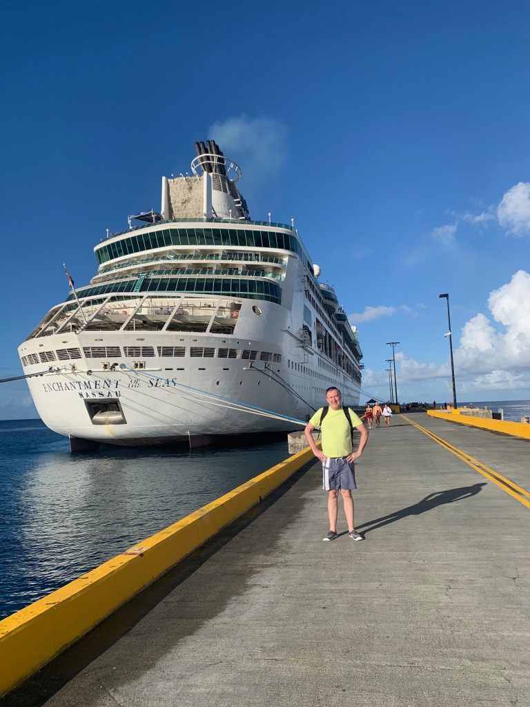
During a stay with family Out West this month, we took a week to visit four national parks and a national monument in Utah and Colorado. The late-fall weather was perfect and the experience reminded me of the wonders we enjoy in this country of God’s handiwork.
Earlier this month, Elizabeth and I embarked from Colorado Springs with our daughter-in-law and grandson to explore Dinosaur National Monument, and Capitol Reef, Arches, Canyonlands, and Mesa Verde national parks. I won’t load up this post with a lot of facts about the parks, which you can find online, but I will share a few personal highlights and favorite photos. If you haven’t seen these places, I hope this will inspire you to make the time to enjoy these special places.
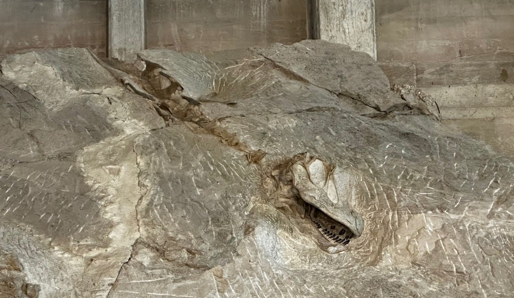
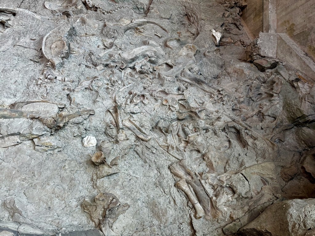
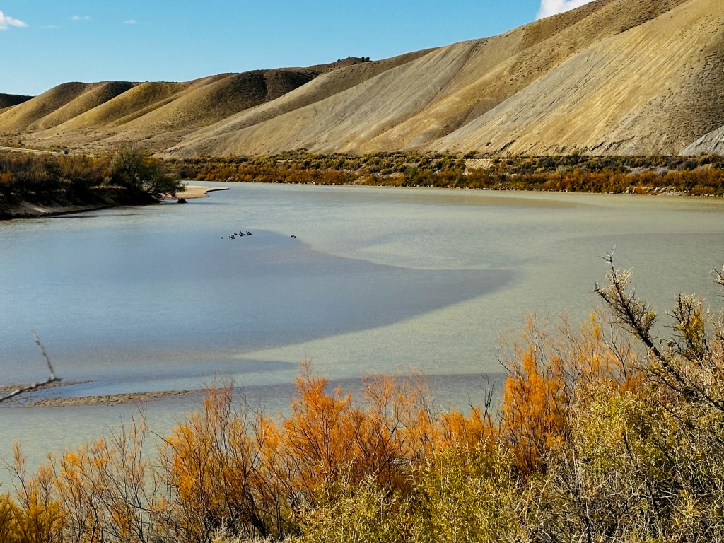
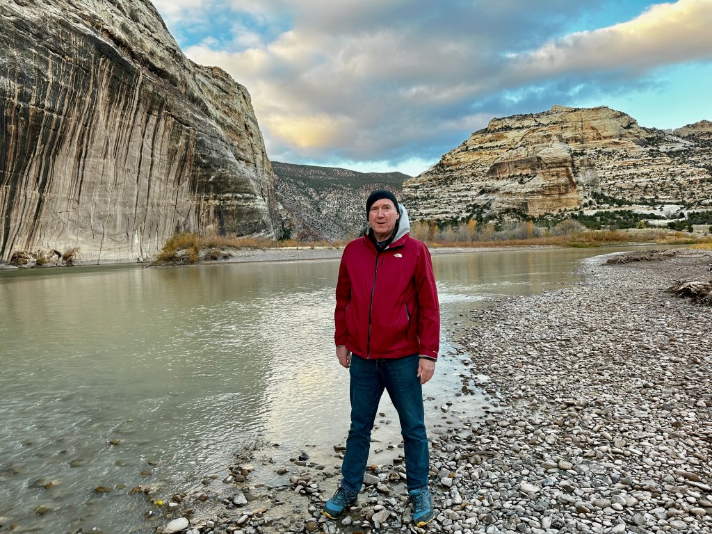
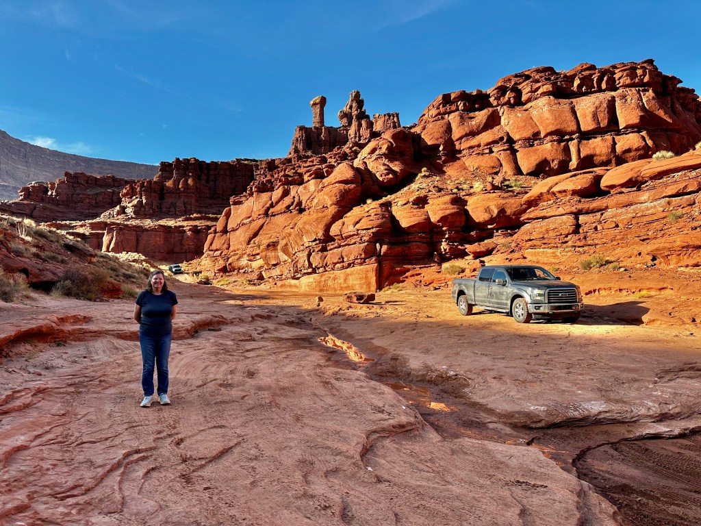
On Wednesday, November 6, we visited Dinosaur National Monument. The monument occupies the far northwest corner of Colorado and a slice of Utah. At the Utah entrance, we saw what is called a “logjam” of dinosaur bones embedded in a hillside. The fossils date back to 149 million years ago. Outside the museum and visitor center, we stopped to view flocks of Canadian geese and sandhill cranes gathering on the Green River, and a large herd of elk feeding in an irrigated field beyond the river. Later that afternoon, on the Colorado side of the monument, we drove our F-150 pickup truck 12 miles and 2,000 feet down an unpaved road to the confluence of the Green and Yampa rivers. It was at this meeting point in 1869 that the explorer John Wesley Powell and his team beached their rafts for a rest after shooting rapids in the upper Green River. We viewed unusual petroglyphs on the Utah side and on our way to the confluence.

The next day we drove from Vernal, Utah, to Torrey, Utah, stopping to spend a couple of hours in the Dinosaur Museum State Park in Vernal. Our grandson enjoyed the exhibits. Later in the afternoon we stopped along Highway 10 to watch the orange-red rays of dusk fall on the Henry Mountains to the east.
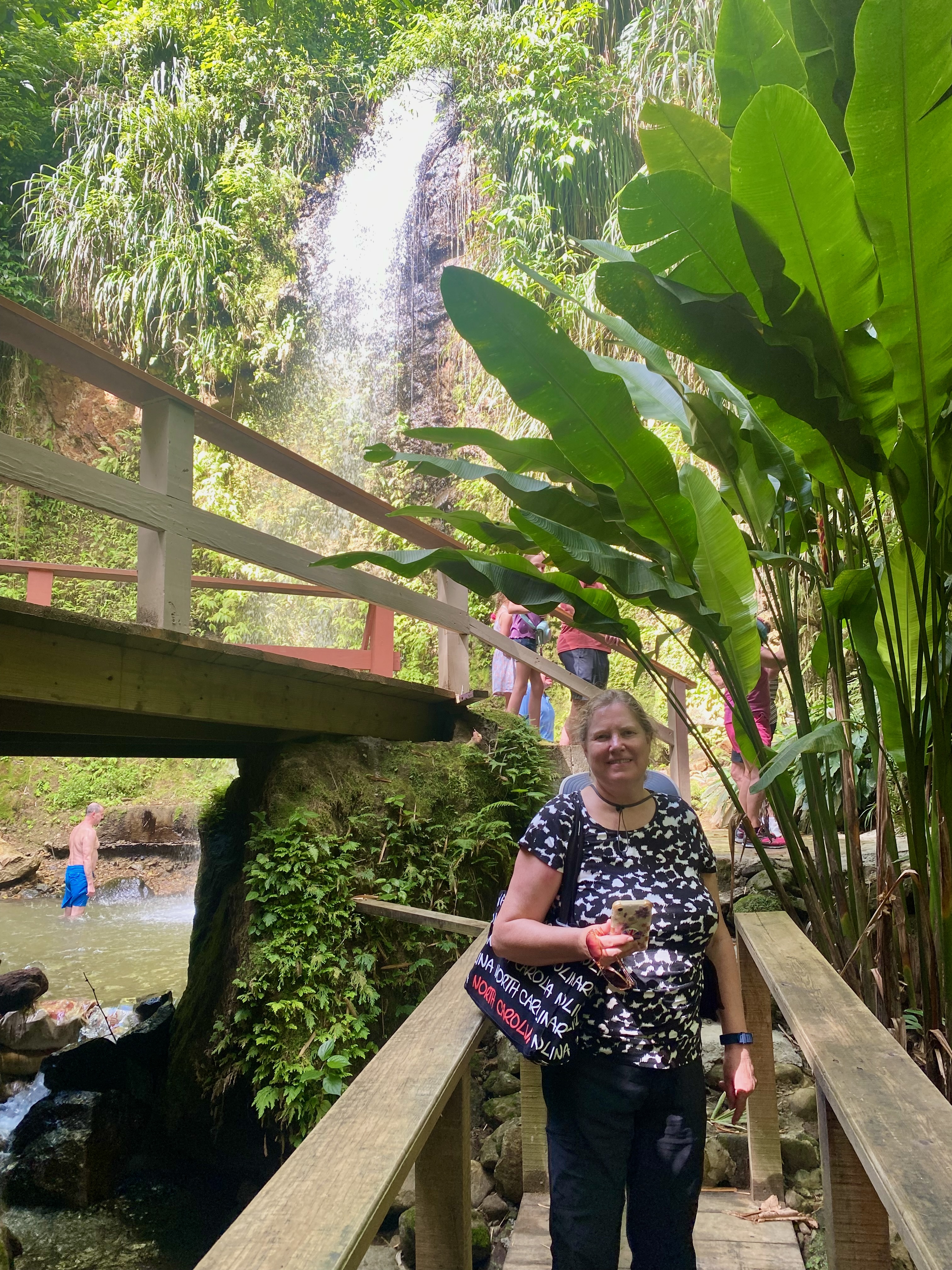
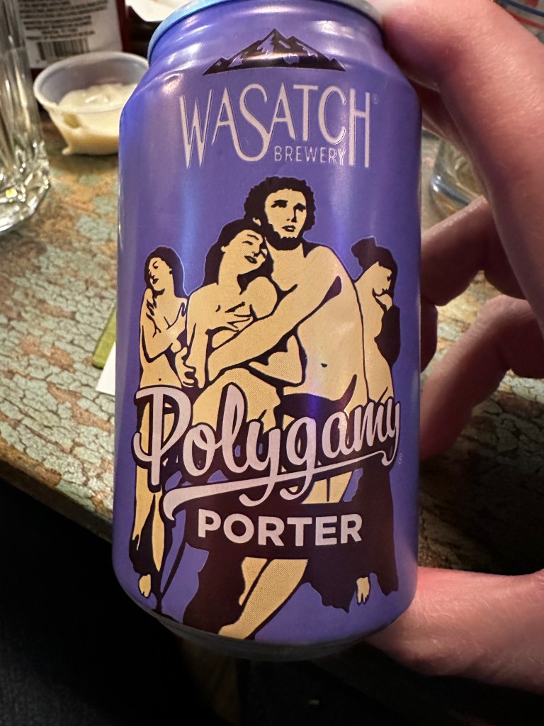
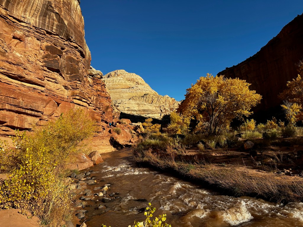
On Friday, we explored a section of Capitol Reef National Park, which encompasses a 100-mile escarpment known as the Waterpocket Fold. We weren’t able to drive the nine-mile scenic road along the fold because of ongoing road improvements that had kept that section closed since May. We spent most of the day near the visitor center and the historic Morman settler community known as Fruita. Using irrigation from the nearby Freeman River, the settlers grew apples, peaches, pears, walnuts, almonds and other produce. The four of us hiked about 2.5 miles roundtrip to Hickman Bridge, a soaring arch up the escarpment and north of the river. For lunch, we enjoyed a small but delicious apple pie sold at the Gifford House and Museum Store. Along a boardwalk, we viewed yet more petroglyphs. We also spotted an orange-breasted bird that my amateur ornithologist friend Bill Evans told us has only recently been spotted in Utah. Later that day we drove on to Moab, Utah, stopping at Green River for dinner, where I enjoyed a local brew called “Polygamy Porter.”


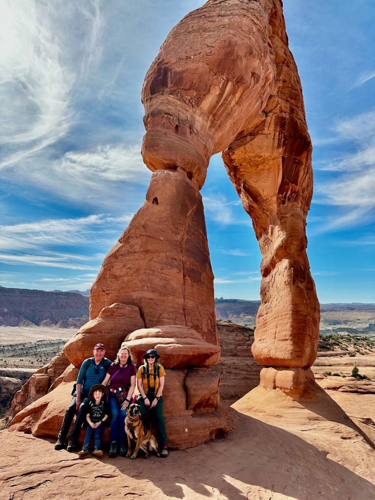
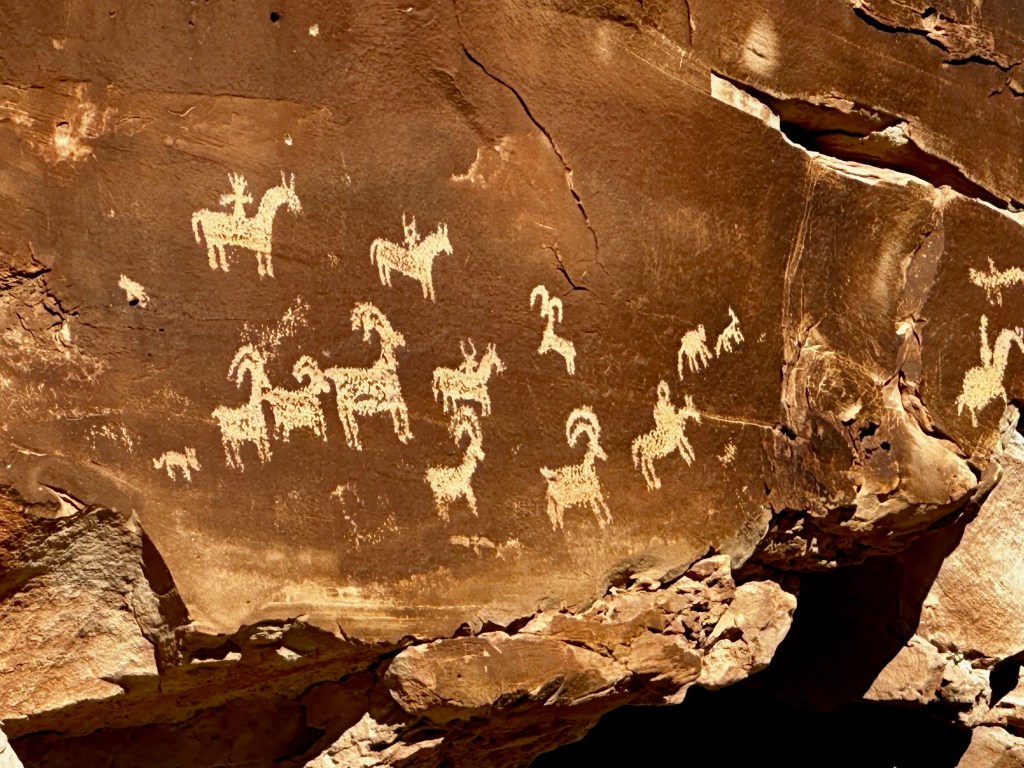
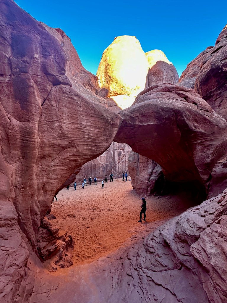
On Saturday, we explored parts of Arches National Park. All of us hiked more than three miles round trip to the famous Delicate Arch, the iconic formation that can be seen on the Utah license plate. We enjoyed our snacks and drinks near the arch and waited our tuns to have our photo taken alongside and underneath it. On the way back from the Delicate Arch hike, we viewed more petroglyphs, including some showing what appears to be Indians on horseback. I was taught growing up that horses only came to America with the European settlers, so these were either post-Columbus petroglyphs or, as some maintain, certain breeds of horses actually existed in America before 1492. (Dear readers, feel free to weigh in with a comment!) Further down the road our grandson enjoyed the cool sand and the shade of Sand Dune Arch. We saw a few of the parks 2,000 other arches from a distance.

In anticipation of our trip, I read Edward Abbey’s book from the 1960s, Desert Solitaire. The book is based around a summer season he spent as a park ranger at Arches N.P. I didn’t agree with his occasional and mercifully brief rants against modernity, cars, cities, and people, but I did relish his descriptions of the Utah desert landscape, flora, and fauna. Here’s what he said about the object of our main hike in the park:
“If Delicate Arch has any significance it lies, I will venture, in the power of the odd and unexpected to startle the senses and surprise the mind out of their ruts of habit, to compel us into a reawakened awareness of the wonderful—that which is full of wonder. A weird, lovely, fantastic object out of nature like Delicate Arch has the curious ability to remind us—like rock and sunlight and wind and wilderness—that out there is a different world, older and greater and deeper by far than ours, a world which surrounds and sustains the little world of men as sea and sky surround and sustain a ship.”
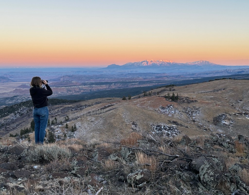
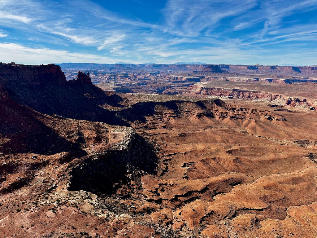
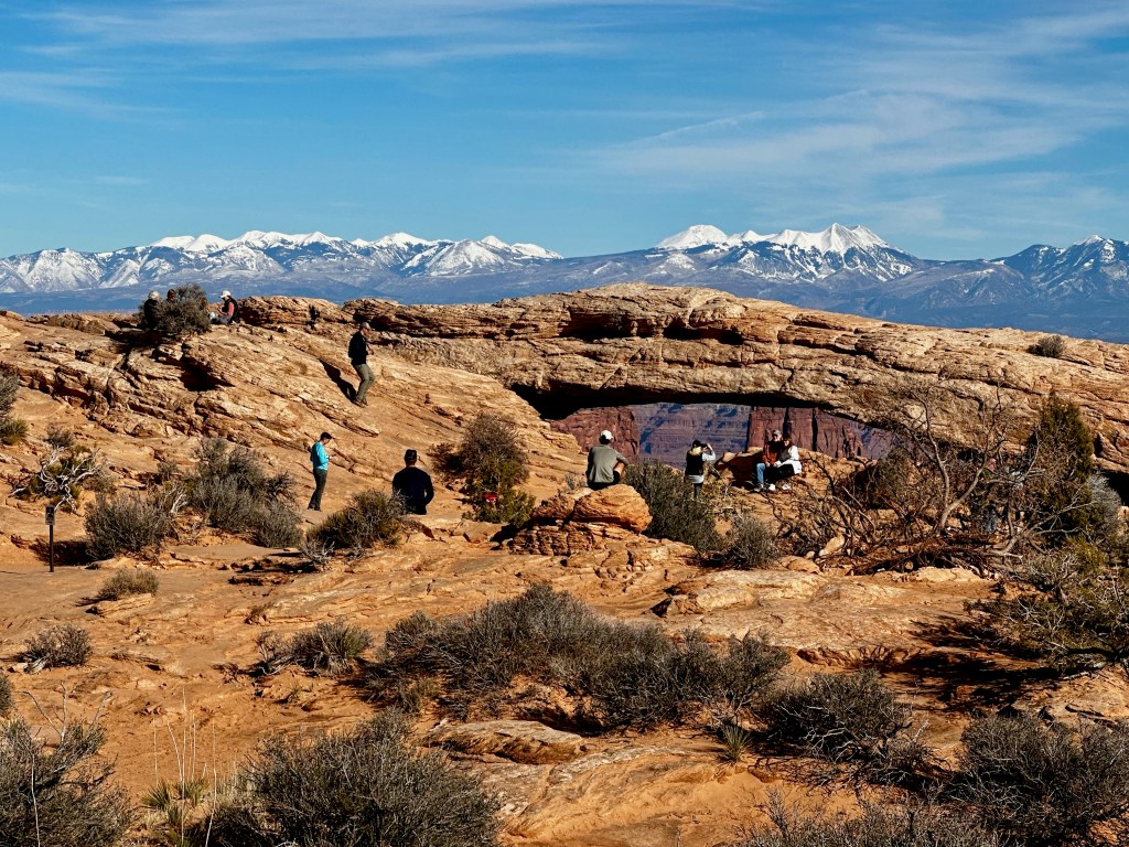
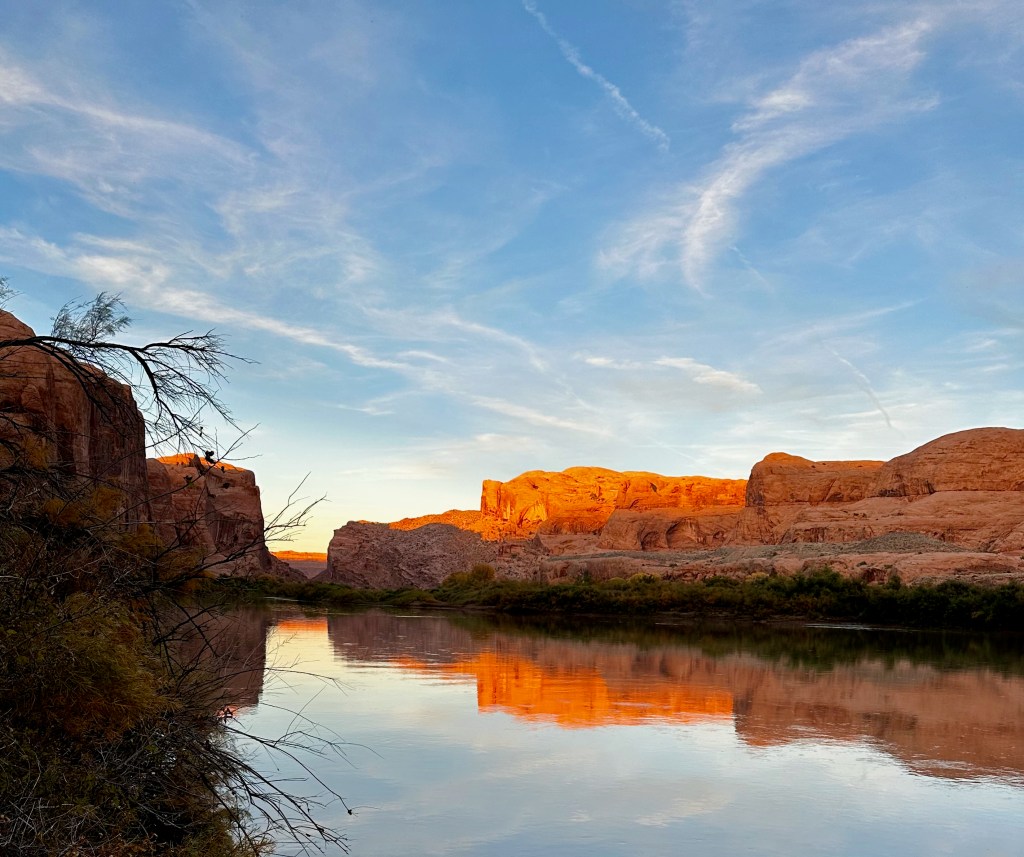
On Sunday, from our base in Moab, we explored Canyonlands National Park. The park surrounds the confluence of the Colorado and Green rivers, which naturally divides it into three districts. On the first day Elizabeth and I drove into the northern Island in the Sky district, driving to the Grand View Overlook. From there we hiked about a mile out and back along a trail that skirts the upper rim of the canyon wall. On the drive back I took a short hike to Mesa Arch, which beautifully framed the snow-capped La Sal Mountains to the east. We ended the day by giving the F-150 another workout, this time on the 4WD, high-clearance Schaefer Canyon Road that snakes down the canyon-side in a series a switchbacks, stalking the Colorado River back to Moab. As we drove along the paved Potash Road on the final stretch, we viewed more petroglyphs on the left side of the road and the rays of the setting sun over the Colorado River on the right.


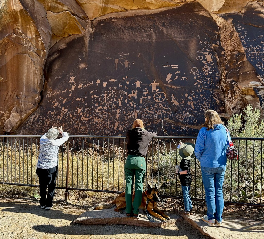
On Monday, we decamped from Moab and stopped to visit the Needles district of the park, which lies to the east of the Colorado River. Along the road to the visitor center, we saw the “Newspaper” petroglyphs. The adorned rock face got its name from the busy mosaic of some 650 images. After stopping at the visitor center, our daughter-in-law drove the truck a few miles down the unpaved Elephant Hill Road. From there we could see in the distance the Needles, a forest of chimney-like rock formations. Our final activity of the day was a short hike on the Cave Spring Trail. The trail follows a series of coves, one containing the remnants of a cowboy camp and another a shallow spring coming out of the rockface. Our grandson enjoyed climbing the two ladders provided by the park service to reach an upper rock ledge, and the series of cairns that directed us back to the trailhead.


On Tuesday, after driving the evening before to Cortez, Colorado, we joined two friends of mine from Durango for a few hours in Mesa Verde National Park. The park was partly closed for the winter season, so there were no guided tours into the cliff dwellings. Instead we experienced the dwellings from a distance, learning more about them at the visitors center and the excellent museum inside the park and viewing them from the overlooks. I only came to appreciate in the past few years that the more elaborate houses built under the cliff overhangs were erected in the 1200s, relatively late in the time period that the Pueblo Indians inhabited Mesa Verde. I had visited this park several times in the past, most recently in 2017 when my son and I took one of the climbing tours into the dwellings.


On Wednesday, our adventure drew to a close when we drove from Durango through the San Luis Valley and up Interstate 25 to Colorado Springs. The highlights of that day were stopping in the valley to buy a couple of fruit pies from the Amish-run “Worth The Drive Bakery” outside Monte Vista and driving slowly by the Chuck Asay Boyhood Home in Alamosa. The National Park Service is awaiting final approval from the incoming Trump administration to install the appropriate plaque on the modest brick home.