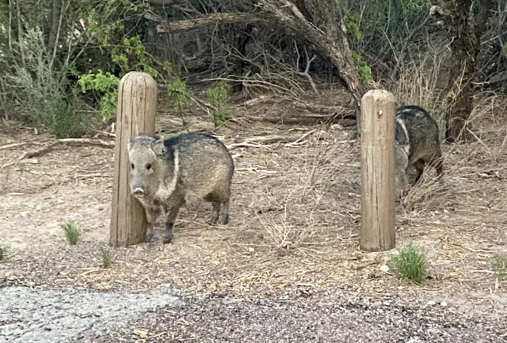
WHITES CITY, NM – This morning we wrapped up four nights in a modest RV park in far southern New Mexico, but our location allowed us to see the wonders of God’s creation from deep underground to high above the surrounding desert.

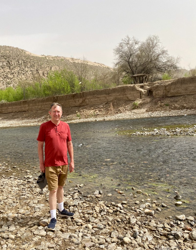
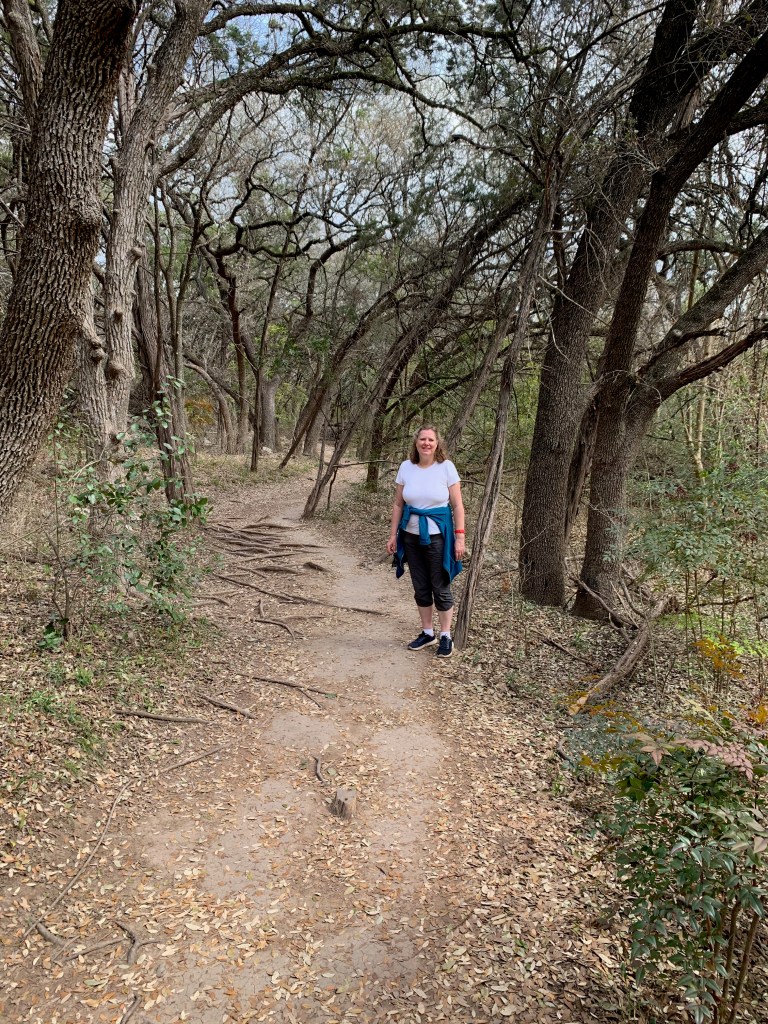
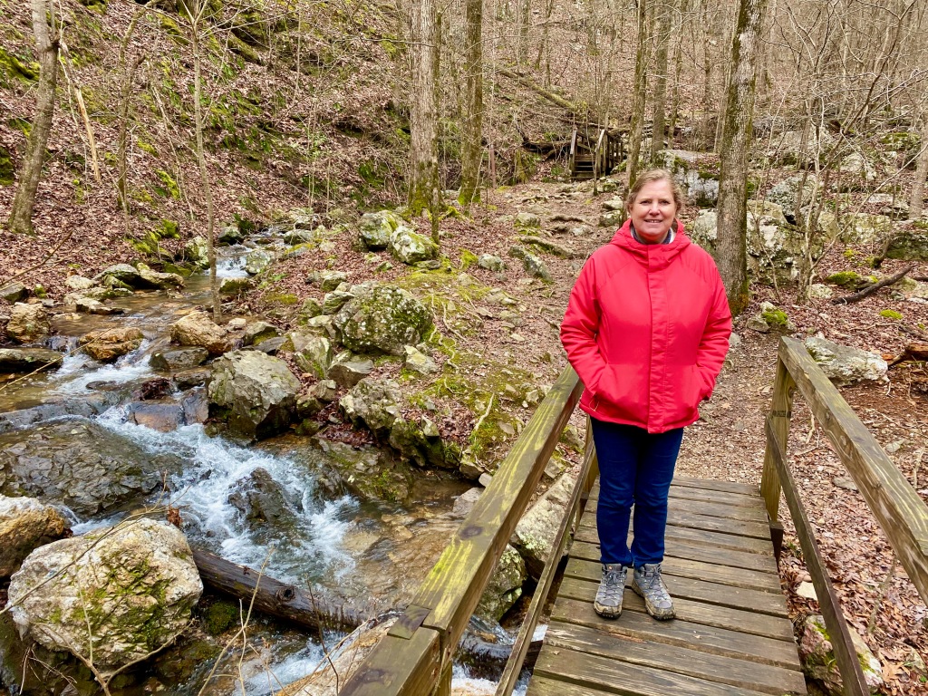
On Wednesday, our first full day here, Elizabeth and I hiked the Devil’s Hall Trail in Guadalupe Mountains National Park. The visitor center and trailhead were about a 30-minute drive back across the Texas border from the RV park.
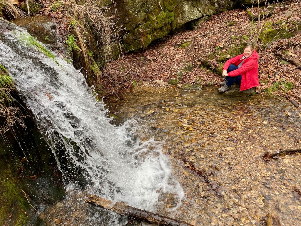
The trail follows a dry stream bed, or wash, for about 1.8 miles to a short and narrow gorge that gives the trail its name. Along the way we looked up at the surrounding peaks, followed a side trail and then the wash, climbed a natural rock staircase, and noted the different kinds of trees and cactus. Our favorite was the Texas madrone tree, which has a smooth reddish bark, sinewy branches, and evergreen broadleaves. In the spring it blooms white flowers and in the fall it yields a red, berry-like fruit that birds like to eat. If I were living in this part of the country, I would plant a Texas madrone or two in the yard.
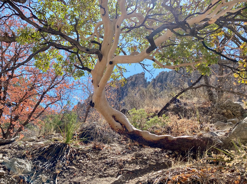
We saw several Texas madrones on the hike. 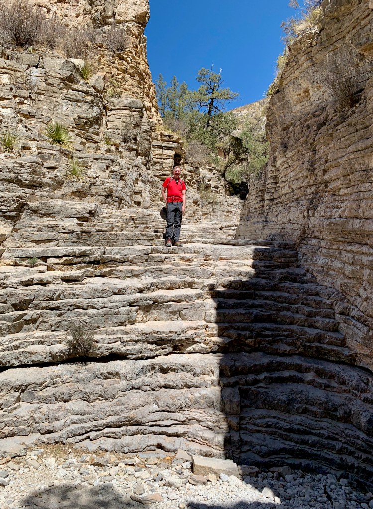
At the top of the natural stone staircase on the way to Devil’s Hall. 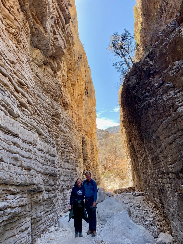
***
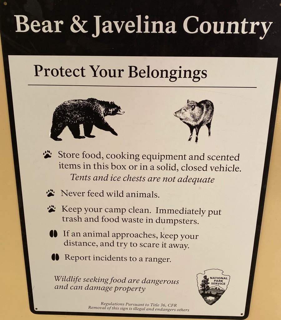
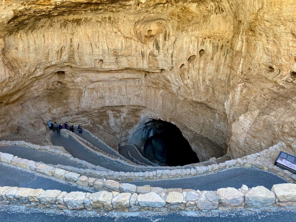
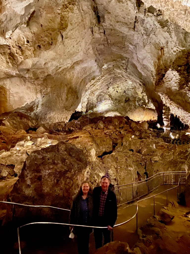
On Thursday we were joined by our dear brother in the Lord Daniel Lauer, who drove down from Roswell, NM, to join us for a tour of the Carlsbad Caverns. The vistors center was only 7 miles from our RV park. The entrance fee is $15 a person, but because of my lifetime senior national park pass, we were all able to enter at no extra charge.
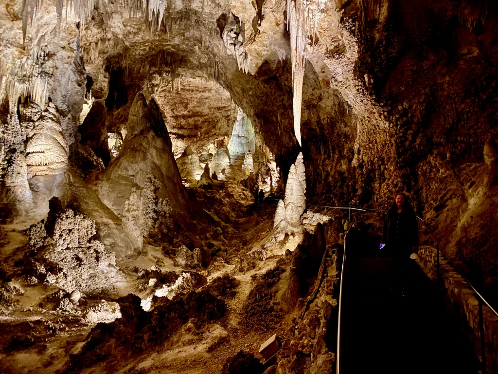
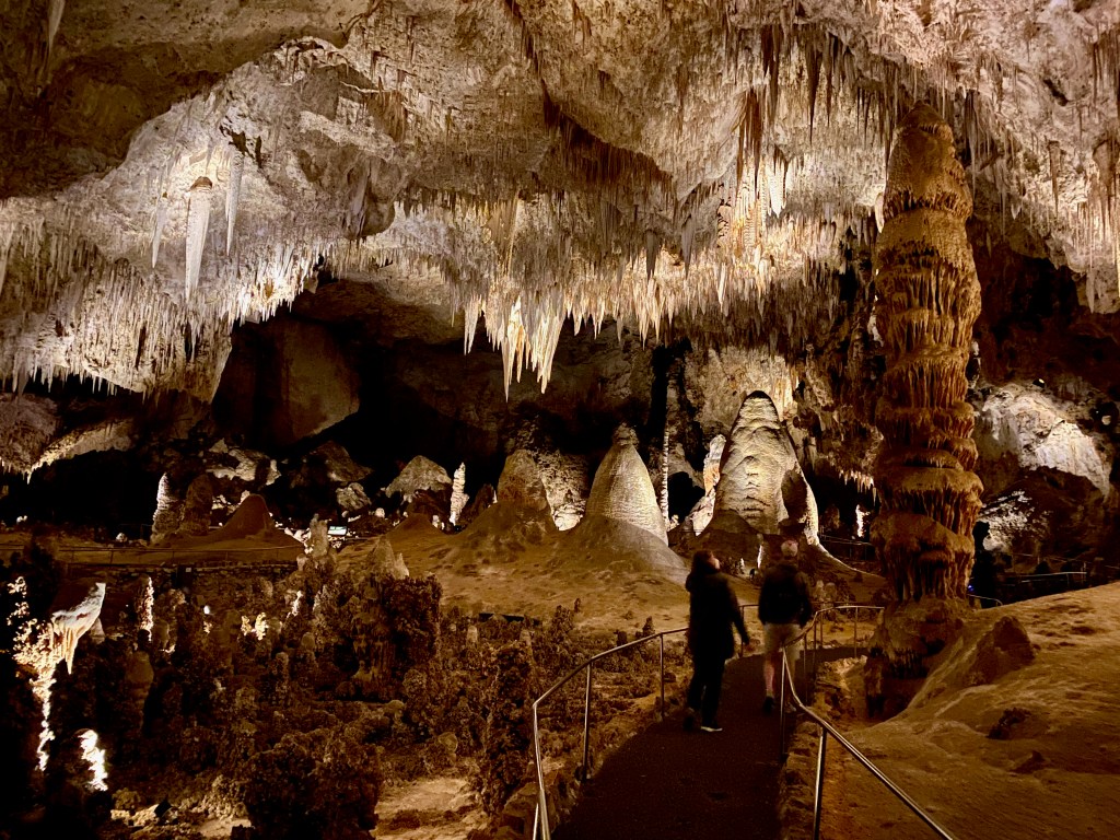
The caverns are awesome, comparable only to the Mammoth Caves in Kentucky as a natural wonder. We descended through the Natural Opening down winding switchbacks to the main rooms of the cavern 750 below the surface. Walking along about 2.5 miles of paved walkways, we saw rock formations that looked like lion’s tails, fairy villages, Star Wars creatures, and layered birthday cakes. The far point of the trail takes you to the Big Room, which is 255 feet high and large enough to cover six football fields. After more than two hours on our feet, we gladly rode the elevator back to the visitors center at the surface.
For those of you into bats (and as a warning for those who are not!) a colony of hundreds of thousands of Brazilian free-tailed bats live and breed about 200 feet into the cave from spring to October. The bats emerge en masse at dusk to feed on tons of insects and then return by dawn to sleep all day in the cave. The timing of our trip didn’t allow us to see any bats, which was a mild disappointment for me but not for Elizabeth.
***
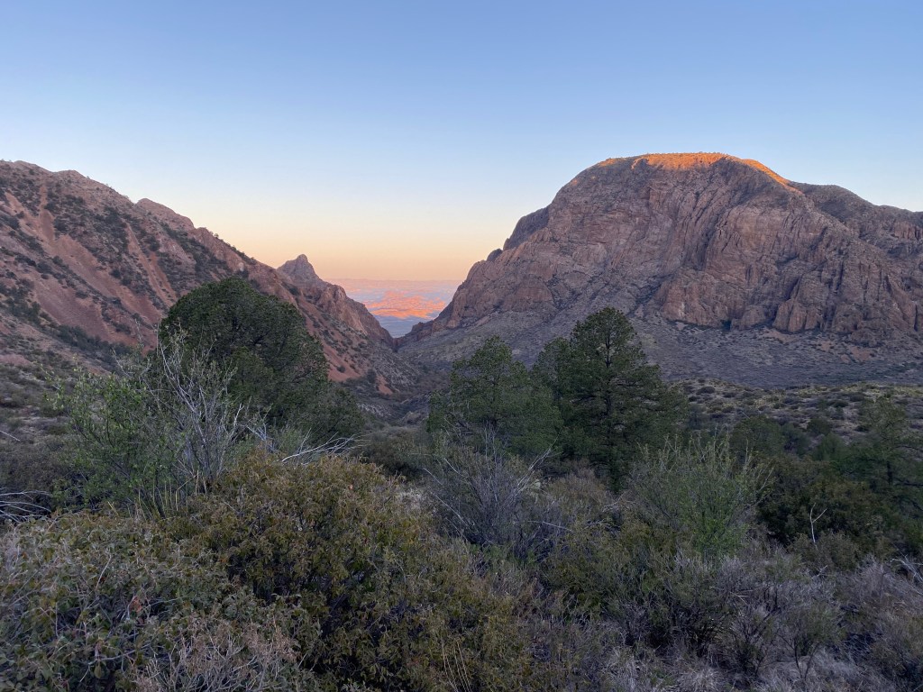
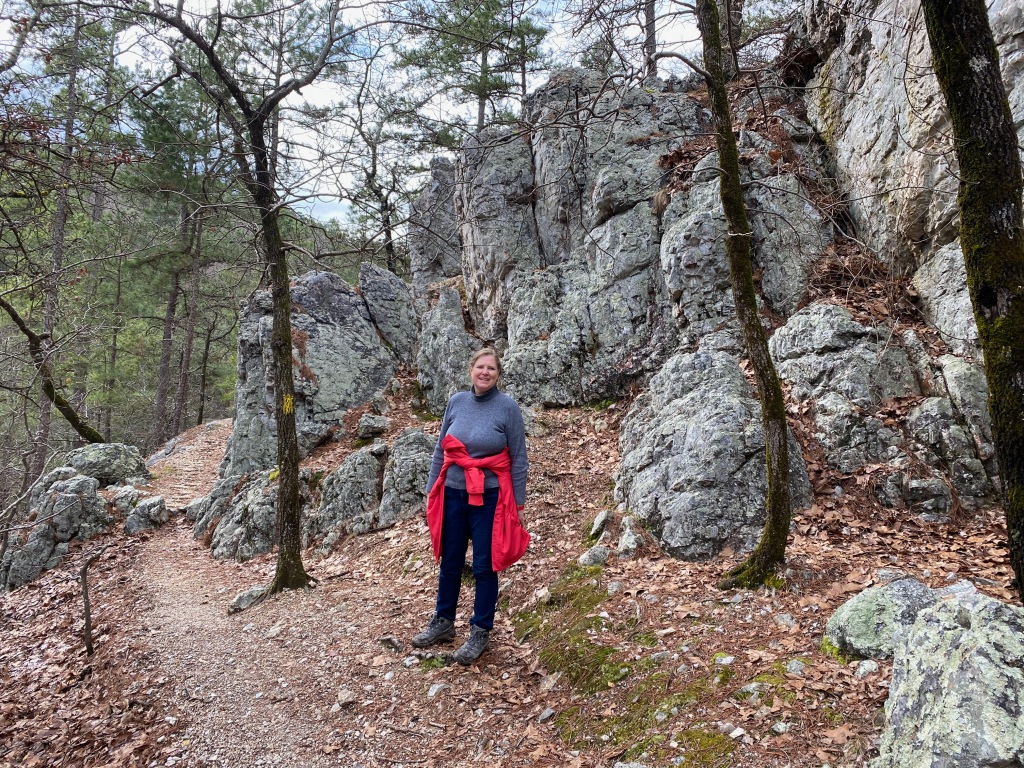
On Friday, Daniel and I set out for Guadalupe Mountains N.P. to climb Guadalupe Peak, the highest point in Texas at 8,751 feet above sea level. It was a perfect day, sunny with temperatures in the 50s and mild breezes. The trail is steep, especially the opening round of switchbacks, but it’s well engineered, signed, and maintained. We covered the 4.1 miles up in about 2 hours, 10 minutes, enjoyed the 360 degree views and lunch from the top for half an hour, and made it back down in about 2 hours flat. I told Daniel, who’s less than half my age, that if he gets any fitter, he may not be content to hike with Mr. Griswold in the future!

Like Big Bend N.P., Guadalupe Mountains N.P. is remote but worth the effort to visit. The geology of the Guadalupe Mountains is distinct from other areas of the Rocky Mountains because geologists say it lies on what was the rim of a large but shallow inland tropical sea 260 million years ago. Geologists say that the mountains are actually an exposed section of the horseshoe shaped Capital Reef that bends through western Texas and southern New Mexico. The reef would explain the large number of marine fossils found in the area.
***
On our drive this morning as we towed the trailer between Carlsbad and Roswell, NM, we observed a number of small oil rigs pumping up and down, a large refinery, and a number of oil-servicing companies. The same Permian Basin that fuels the energy industry in Midland and Odessa, Texas, also lies under this part of New Mexico. We also saw a number of pecan tree orchards, with thousands of bare trees perfectly aligned along shallow irrigation ditches. I had no idea that this part of the country was “an American hub of pecan production.”
Dashboard: Days on the road: 55; miles towing the RV: 2,824; RV parks stayed at: 18;
national parks visited: 5.
The road ahead (Lord willing): Alamogordo, NM, and Tucson, AZ, with a side trip in just the truck to visit son Michael and family in Colorado Springs, CO.