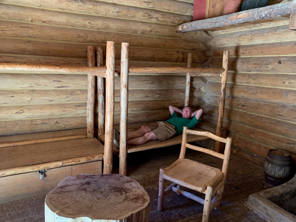
CONCRETE, WA – We hit the road again this morning after three nights at a KOA campground a few miles west of this small town, a stay that included a visit on Monday to North Cascades National Park.
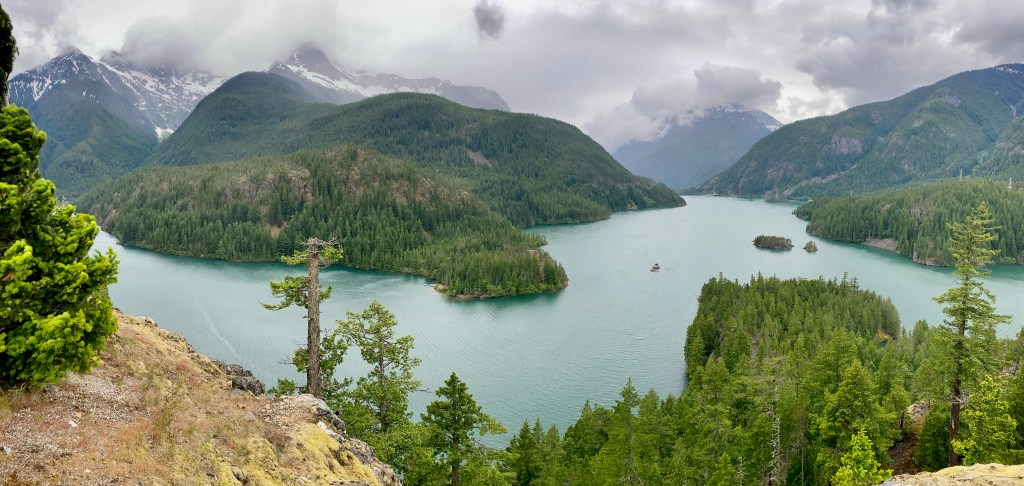
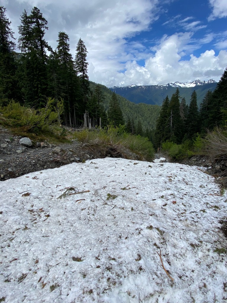
The North Cascades are called “the American Alps,” but we were only able to enjoy a small slice of the park. We hiked 1.8 miles out to a lookout called Thunder Knob above Lake Diablo. Back in the car we drove a few miles along the North Cascades Highway (U.S. 20) to a roadside lookout that offered an even better view of the lake and the surrounding mountains. The overcast day obscured the more distant peaks, but it was still a beautiful vista, as you can see from this pano shot.
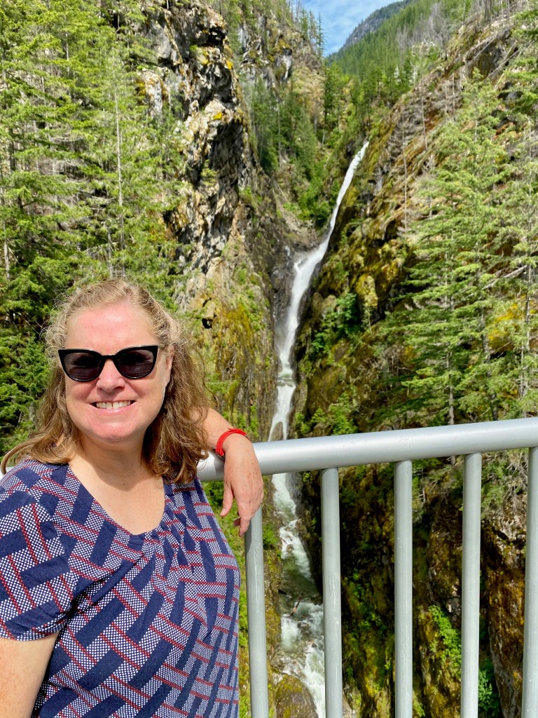
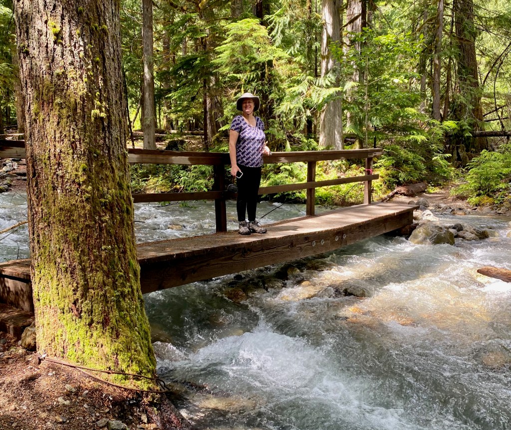
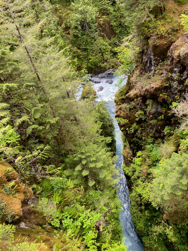
Slideshow below: 1) Looking at the spectacular Gorge Creek Falls on the way to Lake Diablo; 2) Crossing a creek on the way to Thunder Knob; 3) Our view of the Cascades from our lunch spot along the Thunder Knob Trail.
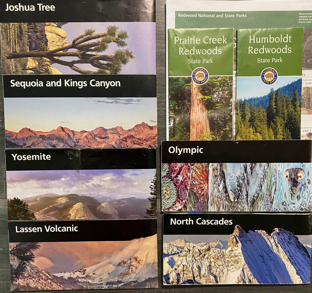
North Cascades marks the 16th national park we’ve visited during our four-month RV trip. Enjoying the parks has been one of the themes of our adventure. Some folks get a stamp in their national park “passport” every time they visit a park. We collect the official maps and brochures, which are typically very informative and useful. Here’s a montage of the official guides we’ve collected since we entered the Pacific Time Zone a couple of months ago.
Alas, we were not able to visit Crater Lake National Park because its rim road was still snowed in when we entered Oregon in late May. We also had to skip Mt. Rainier National Park because of a lack of time–we have campground reservations for Glacier N.P. on June 21 and Yellowstone N.P. on June 30. Perhaps we can return to this part of the country in a future summer to take in the two parks we missed on this trip.
Dashboard:
Days on the road: 128;
Miles towing the RV: 5,604;
RV parks stayed at: 35;
National parks visited: 16.
The road ahead (Lord willing): Coeur d’Alene ID and Glacier National Park.
As we traveled along the Sierra Nevada Mountains and up the Northwest Coast on this RV trip, one man’s name appeared more than any other’s: John Muir. His books are in the national park stores, his quotes on shirts and posters, and his name attached to landmarks, such as Muir Rock and the John Muir Trail. As I’ve learned more about the Scottish-American naturalist, I’ve grown to admire him even if I don’t fully share his philosophy.
Much of what I know about Muir’s life and writings I gleaned from a book that is on display in many a visitor center: The Wisdom of John Muir: 100+ Selections from the Letters, Journals and Essays of the Great Naturalist, compiled by Anne Rowthorn. The book organizes the quotations thematically in 200 pages and 12 chapters, with some context and commentary before each passage and an informative chronology of his life and work in an appendix.
Muir was born in Scotland in 1838 and immigrated to the United States with his family when he was 11. He showed promise as a mechanic and engineer, but after suffering temporary blindness from an industrial accident as a young man in Indiana, he later wrote, “I bade adieu to mechanical inventions, determined to devote the rest of my life to the study of the inventions of God.” He came to the Sierra Nevada Mountains in California 1868 and made his life’s work to study nature and advocate for the protection of wilderness areas and the establishment of national parks. He wrote books, guided presidents on their visits to the West, and traveled the world, co-founding the Sierra Club in 1892. He died in December 1914, age 76.
Of all his quotes, my favorite is, “The mountains are calling, and I must go.” I’ve felt a similar pull to hit the trail, from our years in Colorado to the Appalachians and the high country we’ve passed through on our current RV adventure. What’s usually missing from Muir’s quote, from an 1873 letter to his sister, is the second part, “… & I will work on while I can, studying incessantly.” It shows a practical and disciplined side, reflecting his Scottish Presbyterian upbringing.
Besides our love of mountains, Muir and I have a few other things in common: He spent a part of his childhood in Wisconsin, on the family farm near Portage, and he studied at the University of Wisconsin at Madison. While at the university, he studied botany with a classmate named Milton Griswold (no relation that I know of). And we both see in nature the handiwork of God the Creator.
What I appreciate most about John Muir is his spirit of adventure and wonder. He would head to the mountains with only a small rucksack containing water, bread, and a notebook. He would sleep under the stars and climb trees during a storm to feel its full force. During an expedition along the slopes of Mount Shasta in April 1875, Muir records this harrowing night:
After we had forced our way down the ridge and past the group of hissing fumaroles, the storm became inconceivably violent. The thermometer fell 22 degrees in a few minutes, and soon dropped below zero. The hail gave place to snow, and darkness came on like night. The wind, rising to the highest pitch of violence, boomed and surged amid the desolate crags; lightning flashes in quick succession cut the gloomy darkness; and the thunders, the most tremendously loud and appalling I ever heard, made an almost continuous roar, stroke following stroke in quick, passionate succession, as though the mountain were being rent to its foundations and the fires of the old volcano were breaking forth again.
(p. 108)
Muir also had a gift for describing nature. Recalling a campfire in the forest, he wrote, “Grandly do my logs give back their light, slow gleaned from the suns of a hundred summers …” (p. 96) And in exploring the glaciers of North America, he marveled at the fact that these mighty rivers of ice that carved monumental valleys were formed by the accumulation of the tiniest and most delicate of creations: “Nature chose for a tool not the earthquake or lightning to rend and split asunder, not the stormy torrent or eroding rain, but the tender snowflowers noiselessly falling through unnumbered centuries …” (p. 156)
Muir wasn’t just a poet of nature. He was a practical man who successfully ran his father-in-law’s farm in the Central Valley of California for much of the 1880s, growing grapes, apples, pears, and oranges. His farm was one of the first in California to ship fruit to Hawaii. He knew the names of myriad plants and animals and was up to date on the scientific thinking about geology and how glaciers in particular had shaped Yosemite Valley.
In one of my favorite passages, Muir described in colorful detail the forest heritage of North America, starting from the East through the Midwest and on to
the darkening multitudes of pines that covered the high Rocky ranges and the glorious forests along the coast of the moist and balmy Pacific, where new species of pine, giant cedars and spruces, silver firs and sequoias, kings of their race, growing close together like grass in a meadow, poised their brave domes and spires in the sky three hundred feet above the ferns and the lilies that enameled the ground; towering serene through the long centuries, preaching God’s forestry fresh from heaven.
(p. 49)
While Muir was a founder of the environmental movement, he was also an advocate of what today we would call “intelligent design.” In the words of the editor of the Muir anthology I read, “Muir was overpowered by the beauty and splendor of the natural world. Such grandeur, Muir reasoned, could only have been created by God, and it reflected God’s bounty.” (p. 33)
In the glacier-carved Yosemite Valley, Muir said he saw “a grand congregation of massive heights with the river shining between, each carved into smooth, graceful folds without leaving a single rocky angle exposed, as if the delicate fluting and ridging fashioned out of metamorphic slates had been carefully sandpapered. The whole landscape showed design, like man’s noblest sculptures.” (p. 36) As we’ve traveled from one end of this great country to the other, seeing the deserts and mountains and river valleys, I’ve challenged myself with the same questions that came to Muir in his study of Yosemite: “In particular the great Valley has always kept a place in my mind. How did the Lord make it? What tools did He use? How did He apply them and when?” (p. 153)
Where Muir leaves me behind is his belief that animals are on the same level as man. He often referred to the animals in the wild as “people” and looked down on using animals for food and livestock, writing that “… only human beings have the arrogance to assume that animals were created for them.” (p. 64) I would argue that a Christian can believe just that, and also believe that we should never be cruel to animals and should be good stewards of creation as a gift from God. As beings created in His image, we have a special responsibility to look after His creation while at the same time enjoying its bounty and beauty (Gen. 1:26-28).
Those theological differences aside, I am thankful that John Muir explored, described, and helped to preserve the magnificent wonders of nature he found here in the Western United States. I’m grateful to God that I can gaze up in wonder at the same sights, from Yosemite Falls to the giant sequoias, and see them just as the great naturalist saw them 150 years ago.
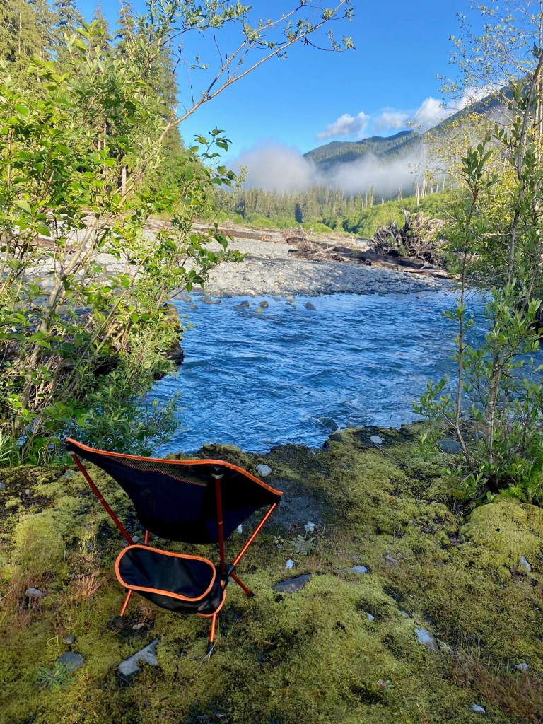
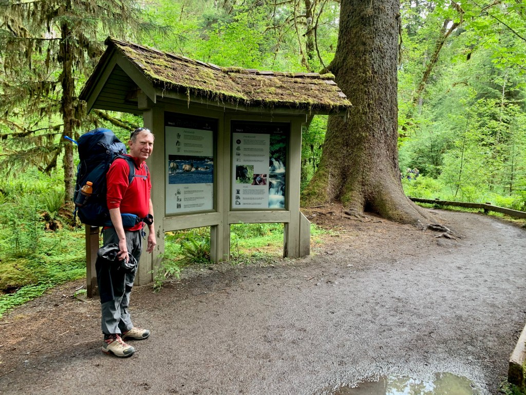
PORT ANGELES, WA – On Monday morning Elizabeth dropped me off at the Hoh River Visitor Center in Olympic National Park, where I began a three-day, 32-mile backpacking trip into the only rainforest in the lower 48 states.
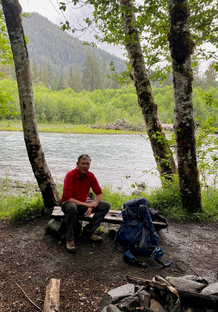
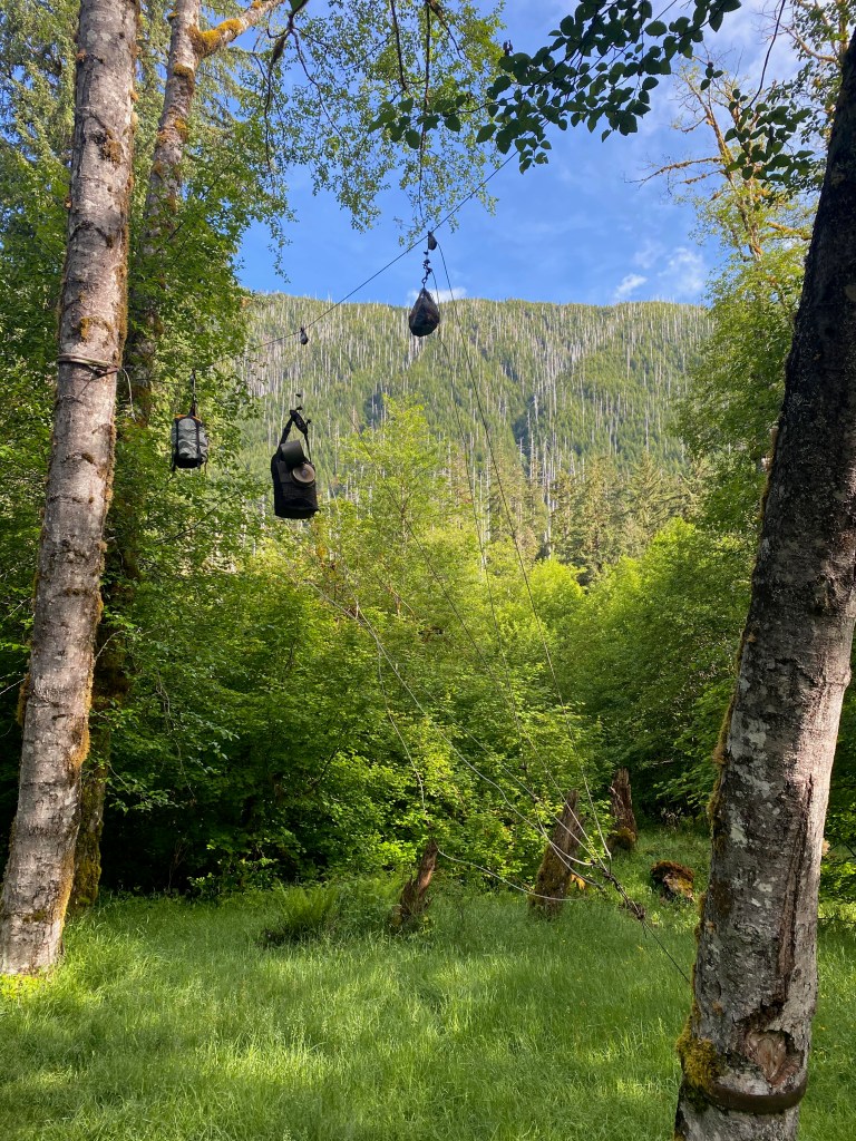
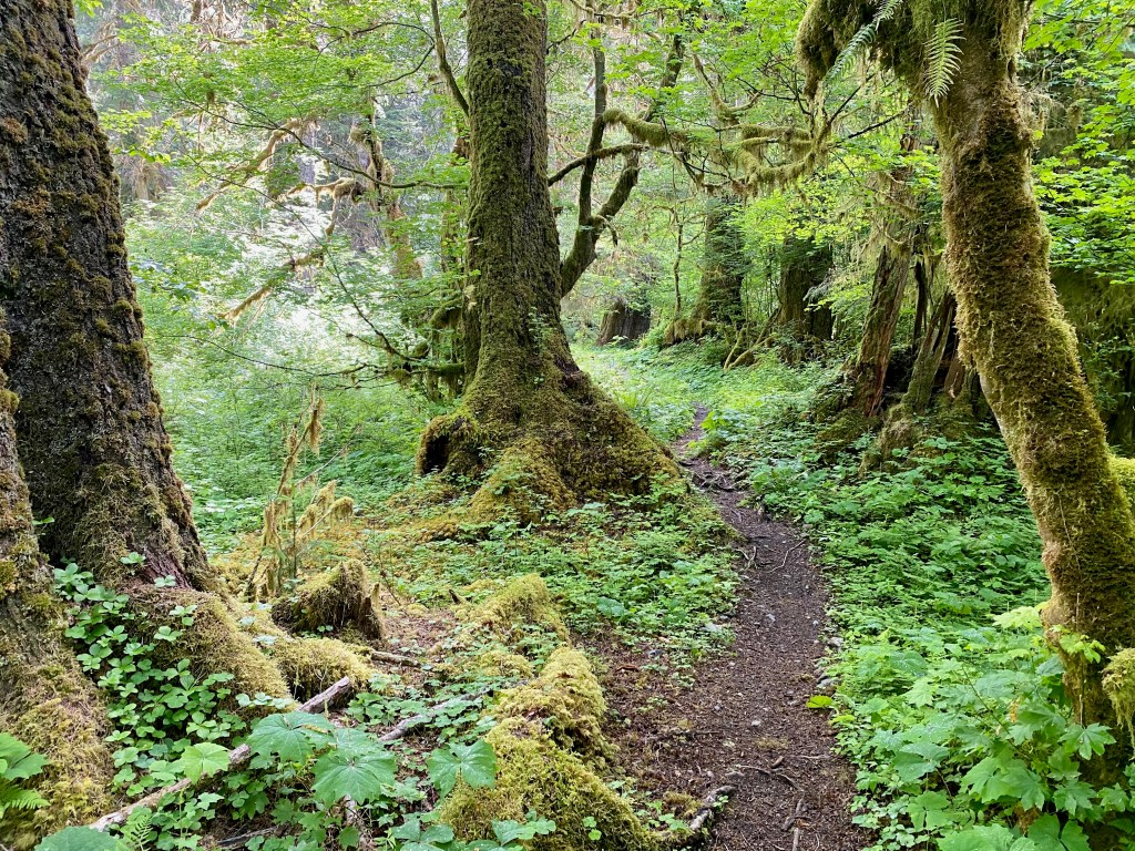
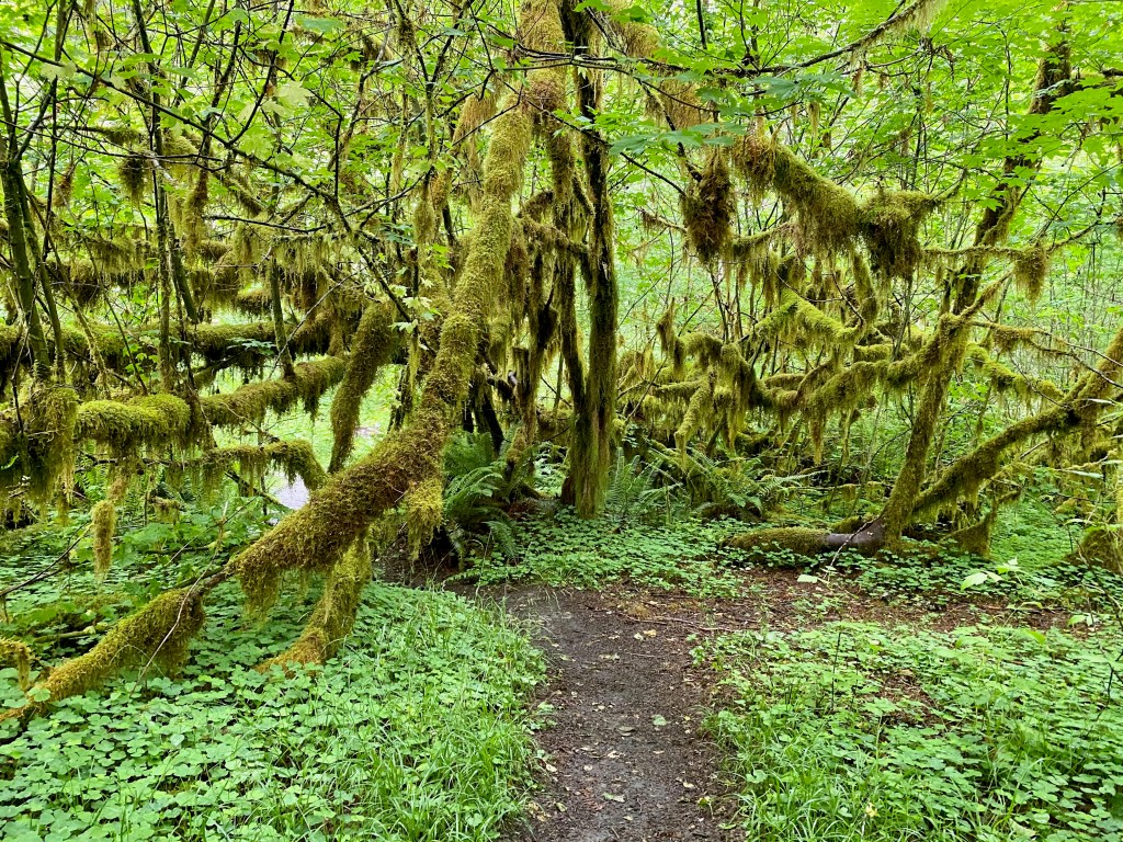
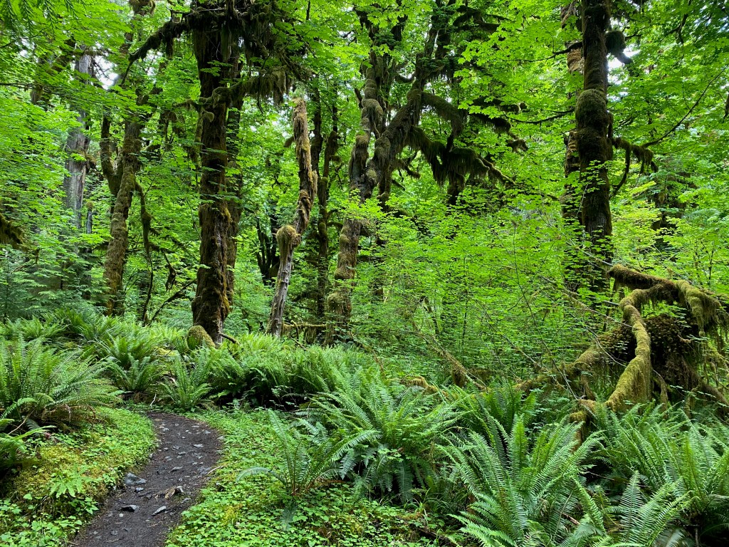
That day I hiked nine miles along the Hoh River, over streams and through the lush forest of ferns and moss-covered trees to the Olympus Ranger Station campground. I pitched my tent near the river and cooked myself a dinner of ramen noodles on my Jetboil stove. Separating the trail from my campsite was a small stream and a lovely grove of alder trees. The only amenities at the campsite were a basic outhouse and a “bear wire,” a contraption to allow campers to hang their food out of reach of animals. (A ranger told me the most likely predators were not bears but cayotes.)
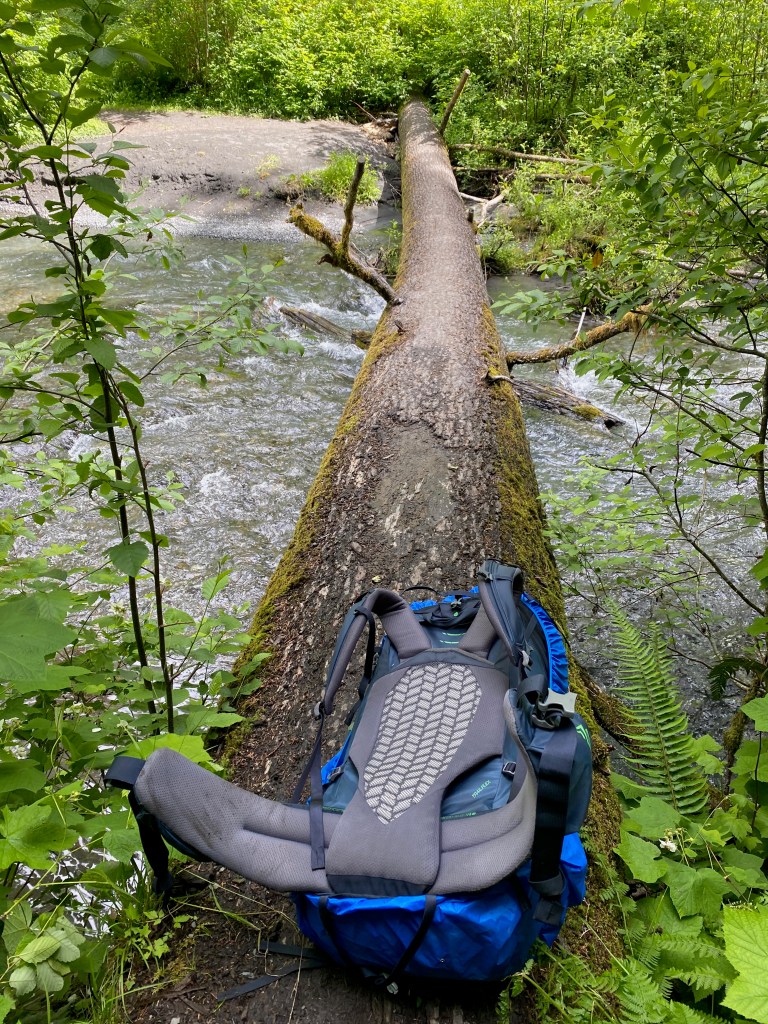
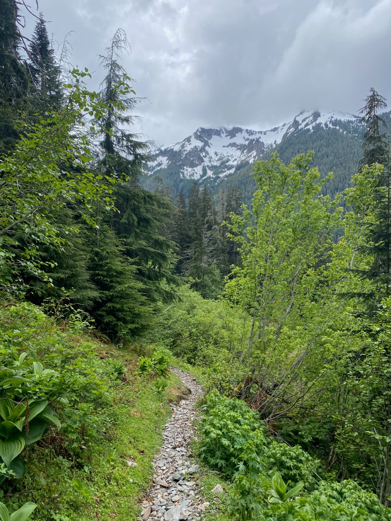
On Tuesday I left my camping stuff behind and headed another seven miles up the trail into the wilderness to Elk Lake. The trail took me over High Hoh Bridge, which crosses about a hundred feet above the Hoh River as it passes down from the Hoh Glacier and through a gorge. Above the bridge the trail climbed for another three miles and more than a thousand feet in elevation past Elk Lake. From there I could glimpse Mount Olympus and the snowfields around it. On Wednesday I packed up my stuff and backpacked the nine miles back to the visitor center.
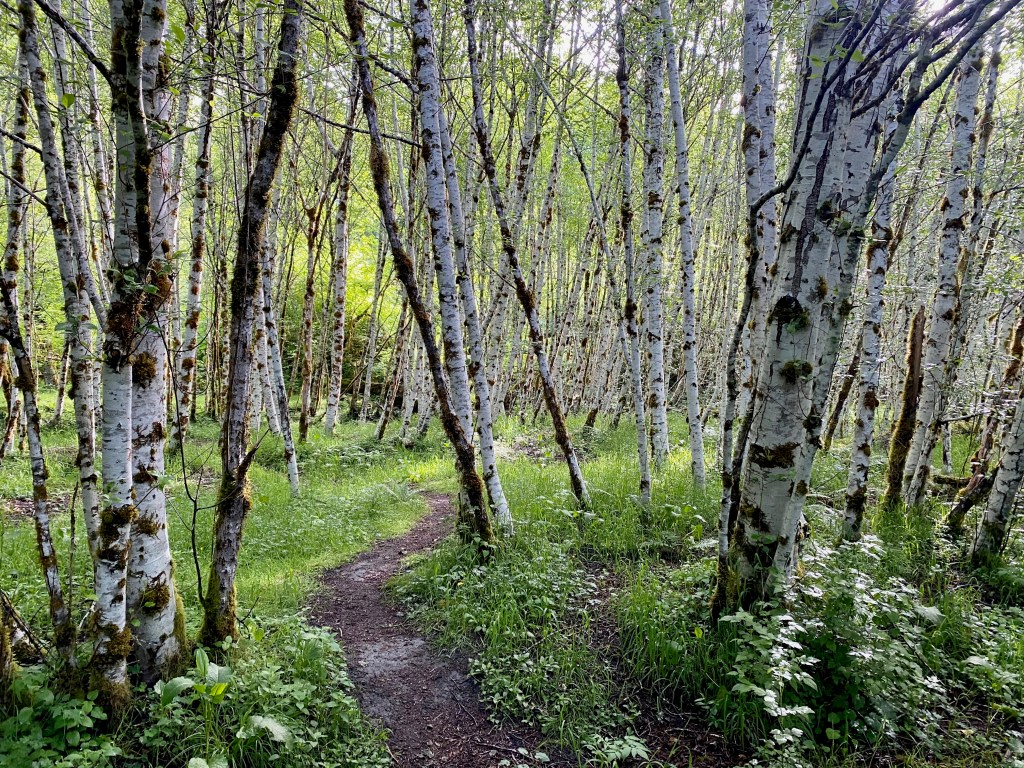
Of all the hikes I’ve enjoyed through God’s creation, this was unique. I had never camped two nights on the trail, and I had never ventured so far (16 miles) into a wilderness area from the trailhead. The Hoh River rain forest was also enchantingly beautiful. This Pacific-facing side of the park receives more than 10 feet of rain a year, creating a true rain forest unlike anything I’d experienced before, certainly not in the United States. The appeal of this hike was not so much the stunning vistas as it was atmosphere. The quiet, deep-green forest felt like the backdrop for a scene from “Jurassic Park” or “Lord of the Rings.” At a number of points on the trail, I just had to stop and soak in the ambiance. I had never felt so far removed from civilization.
Although I was hiking on my own, I wasn’t alone on the journey. People on the trail are invariably friendly, and the comradery grows the further out and the less populated the trail becomes. I crossed paths several times with a young park ranger named Katie, who graduated from Burke High School in Virginia. The first time we met she politely asked me to show my backpacking permit, which I was able to display on my iPhone. Further up the trail toward Elk Lake I talked with a 31-year-old physician’s assistant named Alex who hails from New England but now lives in Washington State. We talked about how much we enjoyed the Stephen Ambrose book on Lewis and Clark, about geology and our shared passion for hiking. When I was thinking of turning around just above Elk Lake, Alex encouraged me to climb a mile or so further across an ice bridge for even better views.
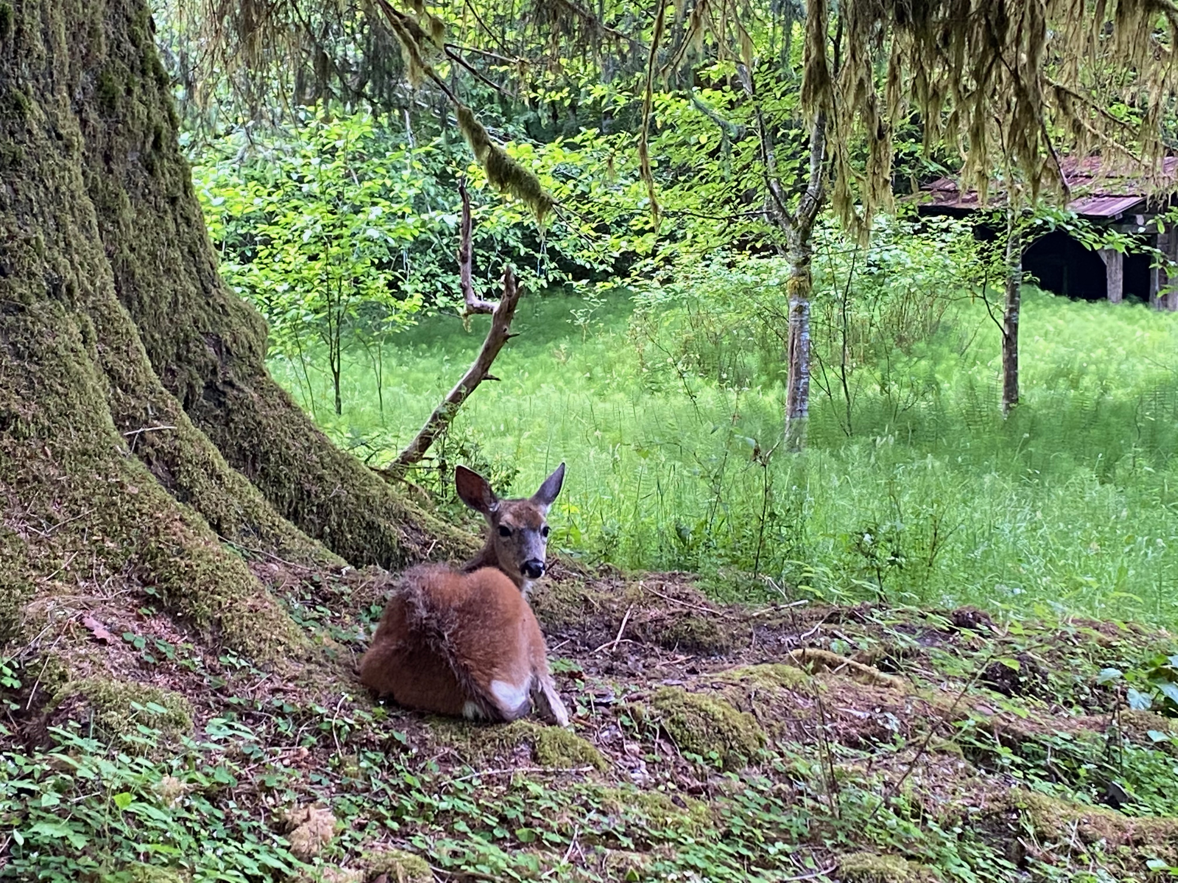
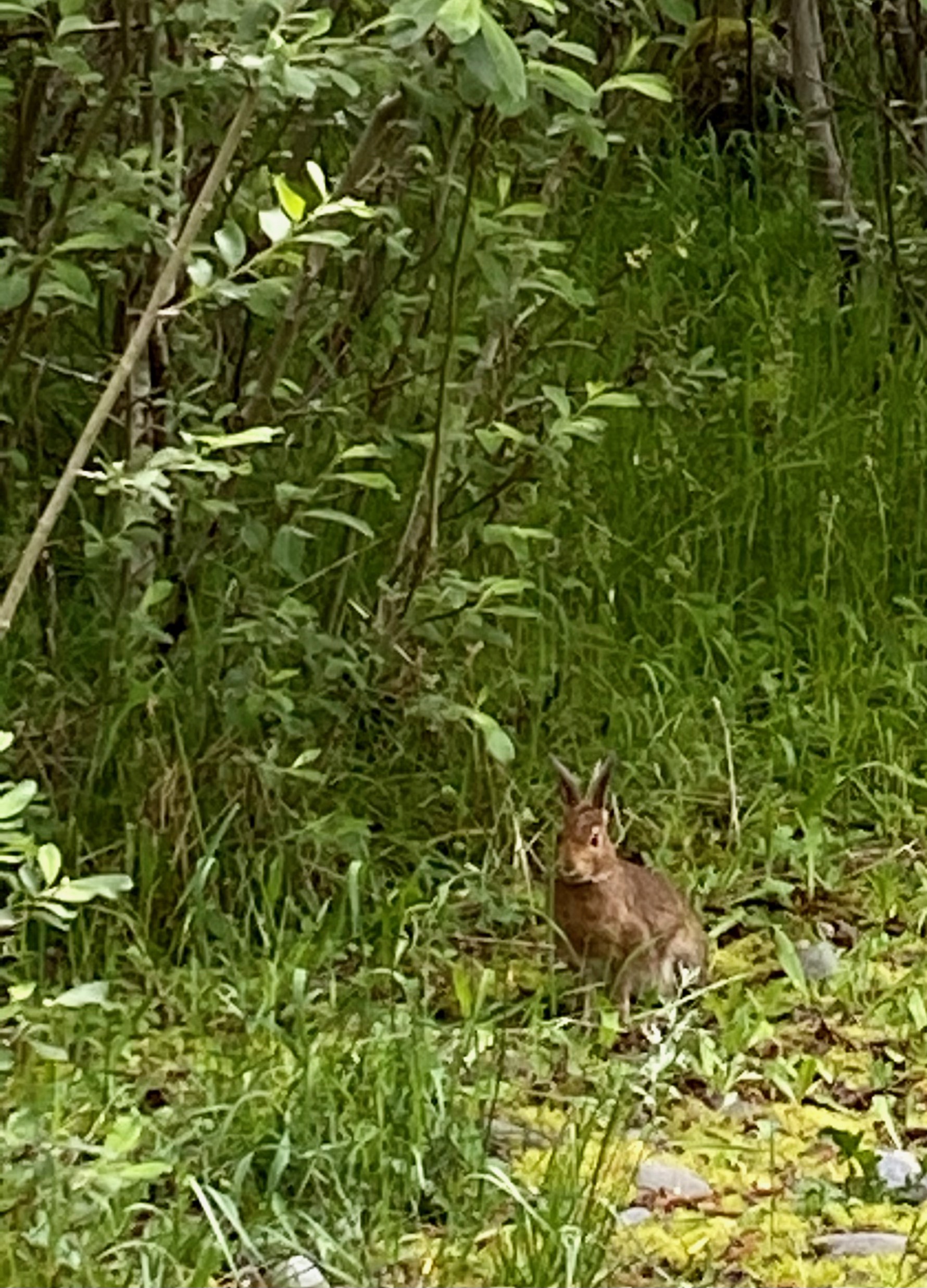
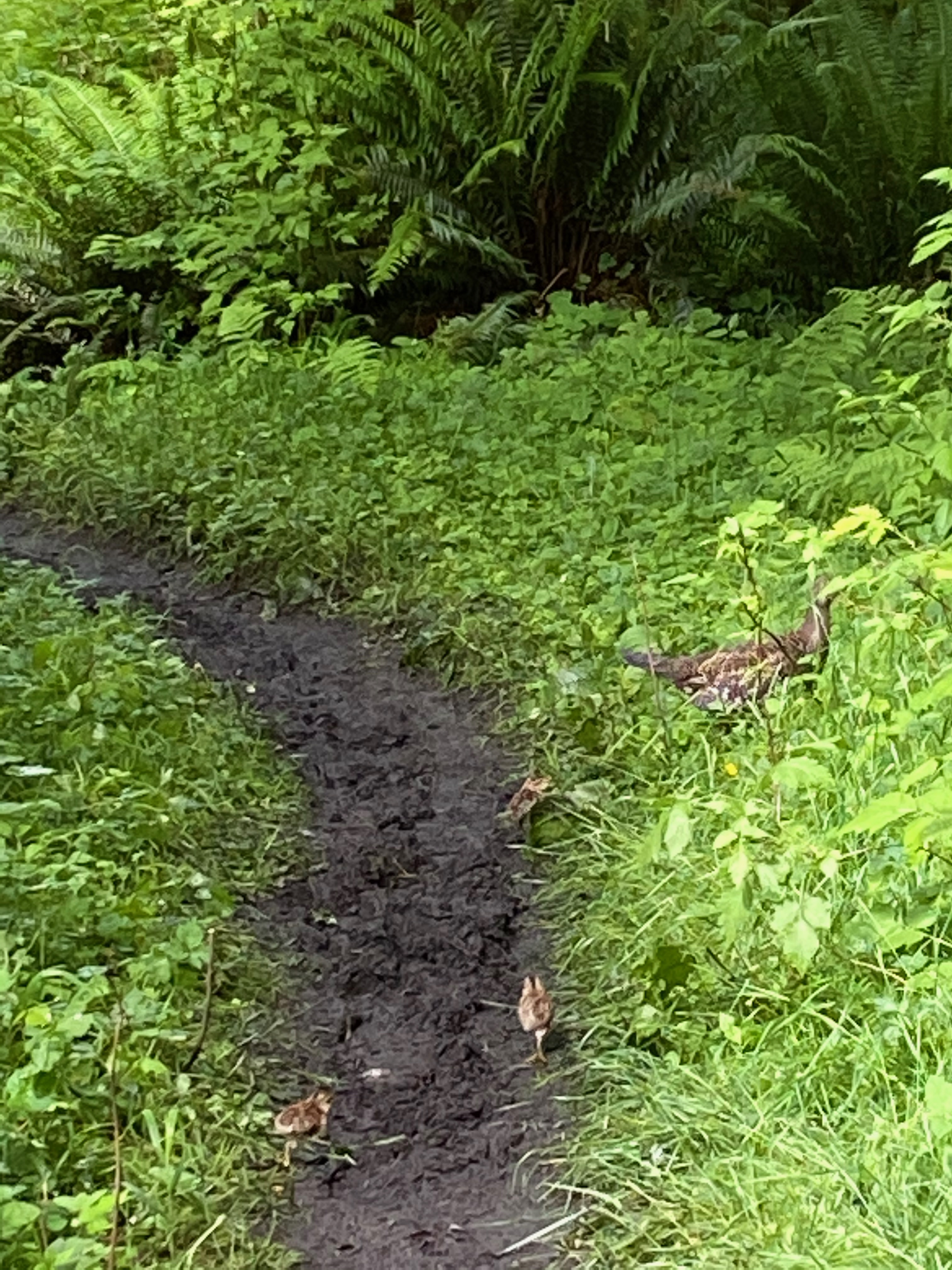
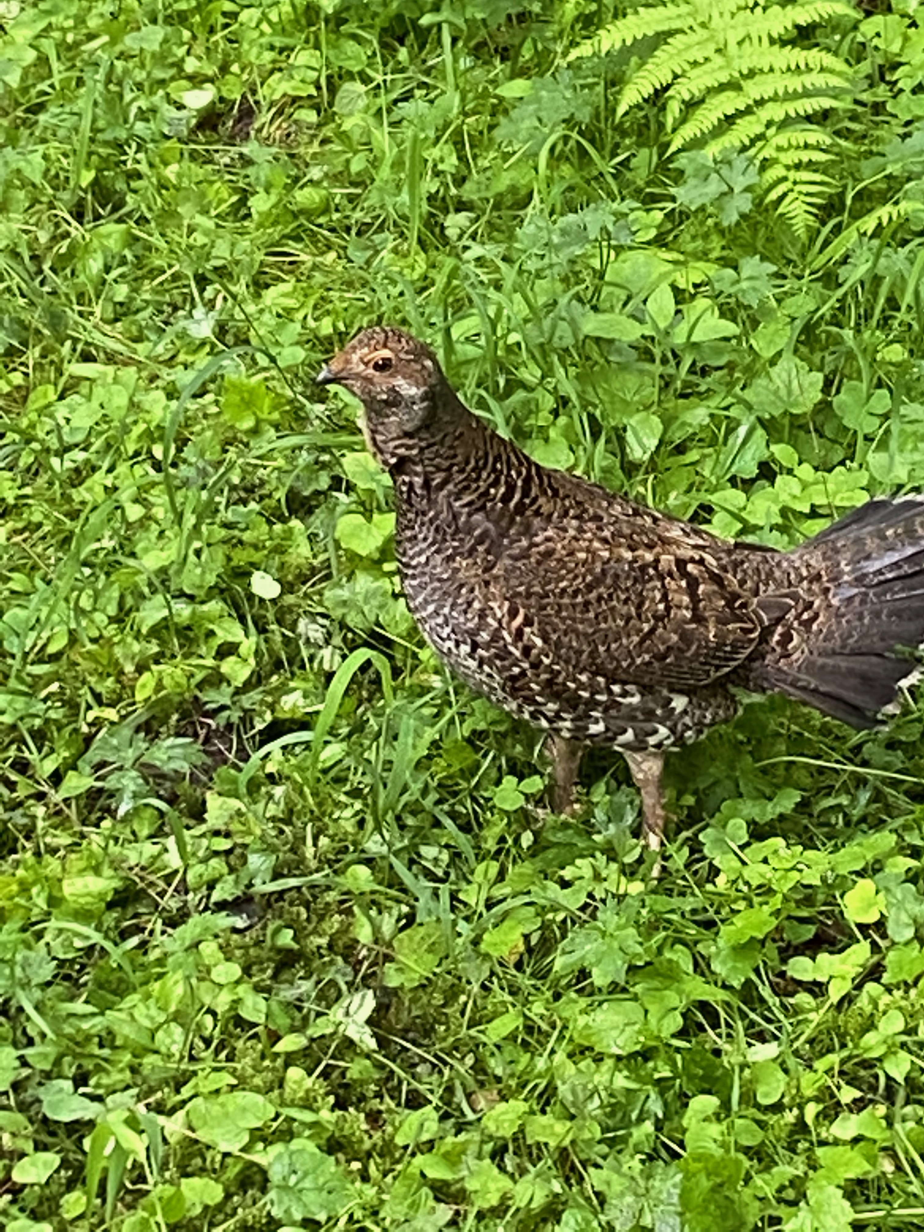
And it wasn’t just people I met on my trek. I also encountered deer and a rabbit at the campground and a mother bird on the trail with four chicks in tow.
Dashboard:
Days on the road: 123;
Miles towing the RV: 5,448;
RV parks stayed at: 34;
National parks visited: 15.
The road ahead (Lord willing): North Cascades National Park
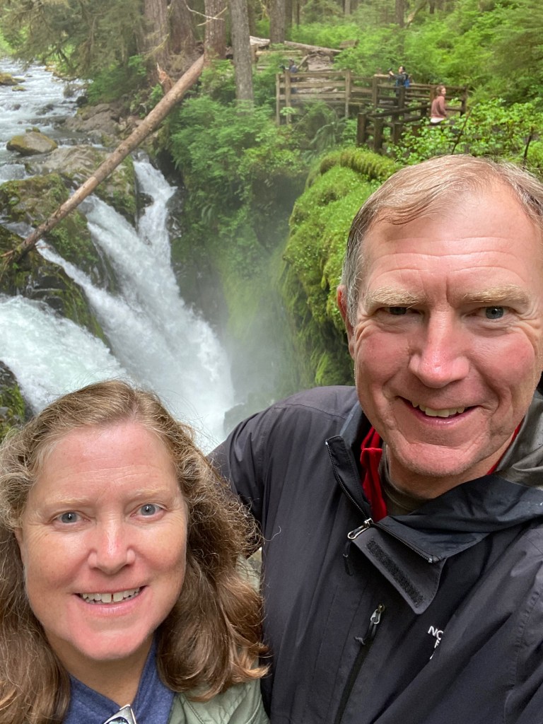
PORT ANGELES, WA – We’re enjoying the beauty of Olympic National Park during our first two full days near this port city along the Strait of Juan del Fuca.
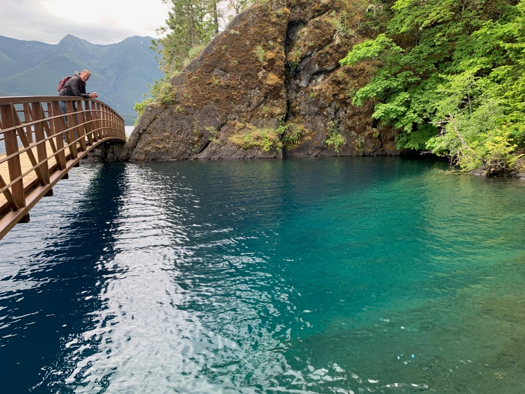
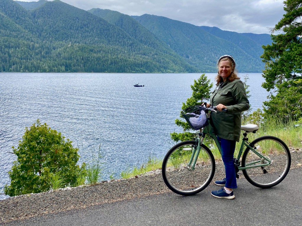
Yesterday we biked for 11 miles round trip along the north side of Lake Crescent, a 13-mile-long natural lake carved by glaciers thousands of years ago. We followed the Spruce Railroad Trail along an old railroad bed, through a couple of tunnels and alongside the green and blue waters of the lake. We stopped for lunch at the Devil’s Punchbowl, a small inlet spanned by a picturesque footbridge. While there, we visited with a friendly group of older Asian Americans from Los Angeles who were walking this part of the trail. One of them brought his fishing pole and almost immediately caught (and released) an eight-inch trout.
From there we drove up the Sol Duc River Valley road to the trailhead for So Duc Falls. It’s described as “a stunning signature falls of Olympic National Park,” and after our 0.8-mile trek through the forest we weren’t disappointed. The falls crash at an angle through three separate channels into a narrow gorge, sending clouds of mist up to the observation area. The falls can be viewed from a bridge downriver or an overlook at the side, but of course I needed to scramble down on the rocks and tree roots below for a closer look!
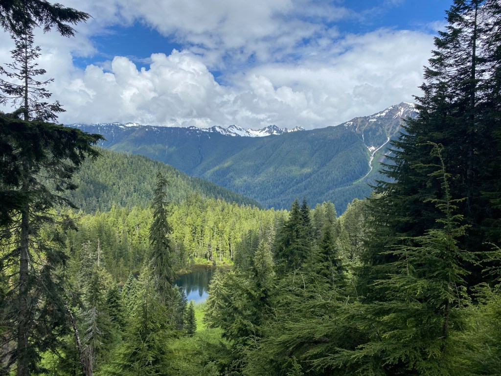
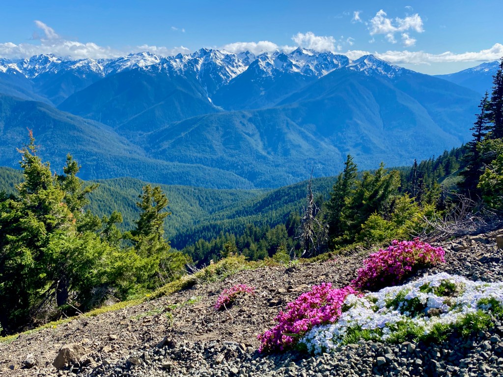
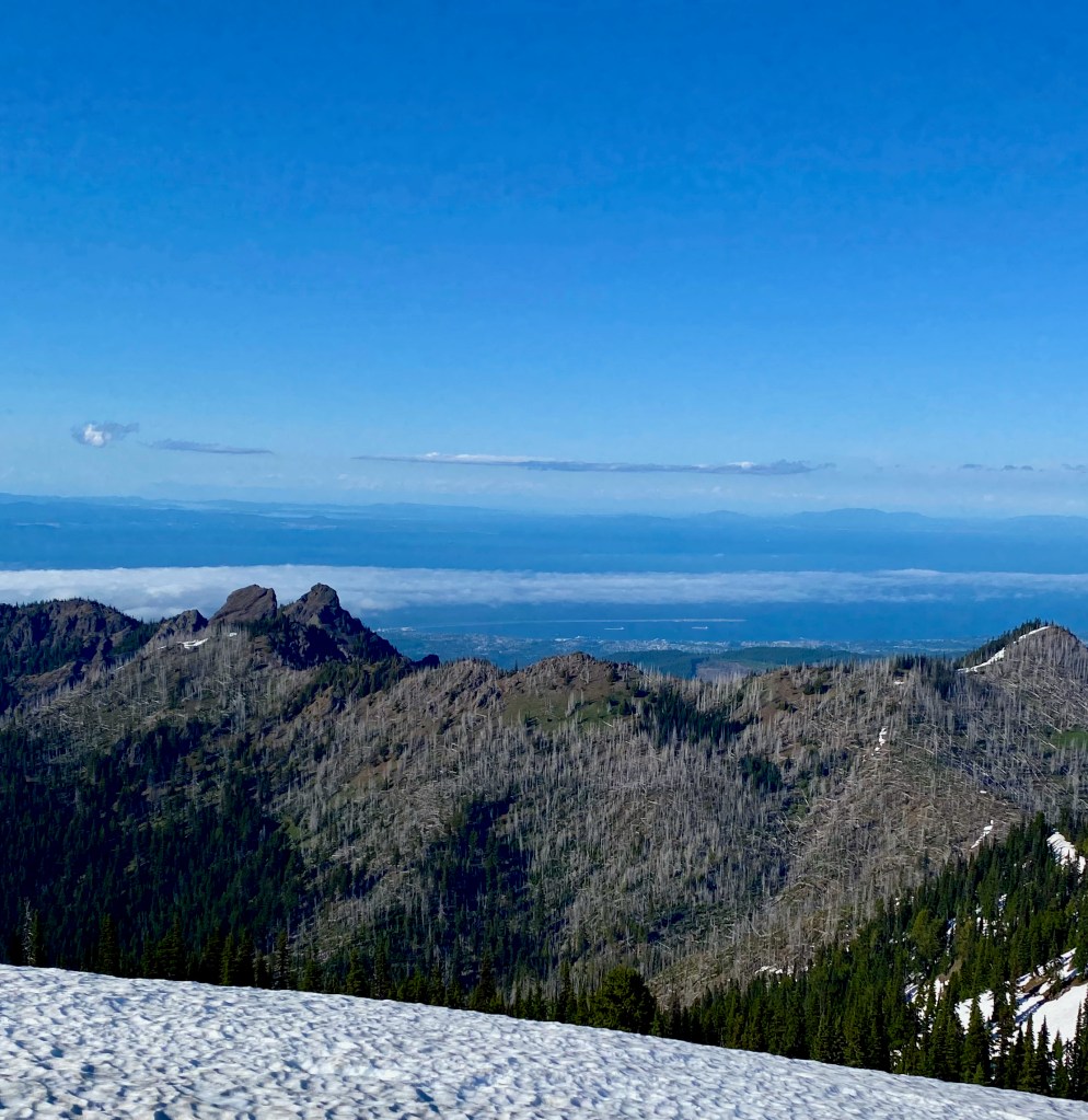
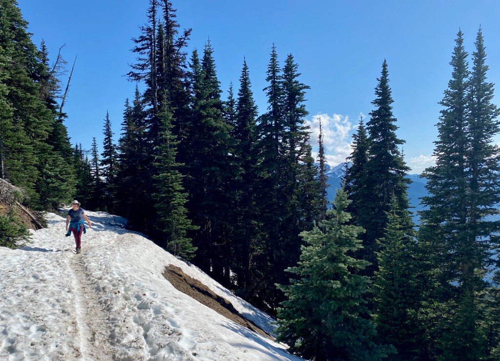
On Thursday, our first full day here, we drove along another entrance to the park to the trailhead for Hurricane Ridge. The 1.6-mile trail to the ridge peaks at Hurricane Hill 5,757 feet above sea level. We were rewarded with 360-degree views of the snow-capped Olympic Mountains to the south and the Strait of Juan de Fuca and Canada’s Vancouver Island beyond to the north. After picking our way over packed snow in the shaded areas, we encountered several tame deer and a couple of very sociable chipmunks.
Lord willing, I’ll be backpacking on my own Monday to Wednesday through the rainforest along the Hoh River Trail on the west side of the park.
LONG BEACH, WA – We’re wrapping up six days in this beach town just north of the Columbia River, exploring the region where the Lewis and Clark expedition spent the winter of 1805-06 after reaching the Pacific Ocean.
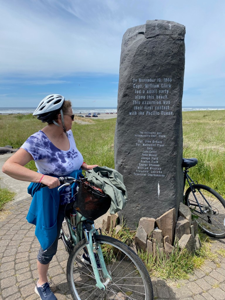
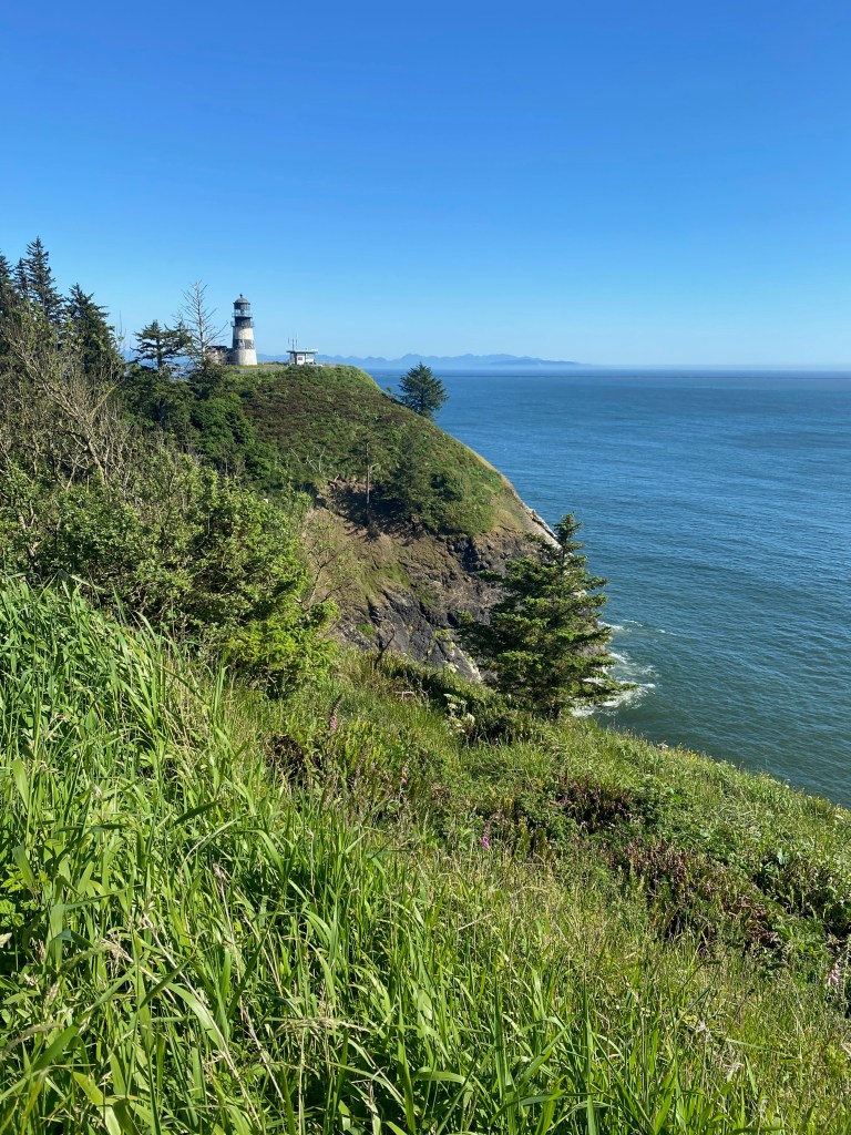
On Friday, we rode our bikes south for six miles along the Discovery Trail, a paved path that parallels the beach and also traces the steps of the Lewis and Clark expedition. A marker on the trail said this was the place in November 1805 where William Clark and a few of the men first reached the Pacific Ocean after their journey across the continent. The trail led us to the North Head Lighthouse built in 1898 to guide ships into the treacherous waters of the Columbia River.
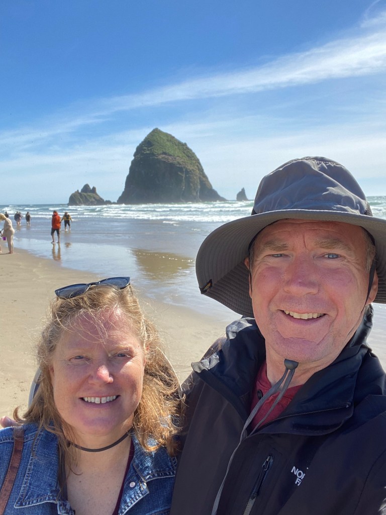
On Saturday, we drove back across the Astoria-Megler Bridge into Oregon to walk on Cannon Beach and see the iconic Haystack Rock just offshore. Clark came to the beach during their time here to investigate reports from Indians of a huge beached whale. We then enjoyed the views from Ecola State Park and the Promenade in Seaside. It was wonderful to see throngs of people on the beach enjoying the sunny start to the Memorial Day weekend.
On Sunday afternoon, we drove the pickup truck for 13 miles up the beach from town. Regulations in Washington allow driving on the beach and even building fires. People were riding motor bikes and one family even brought their RV onto the hard-packed sand. Oregon likes to call their beachfront “the people’s coast” because it’s all publicly owned, but this also seemed to be the people’s coast because it could be enjoyed in lots of different ways by local residents. On a walk on the north end of the peninsula, Elizabeth spotted a bald eagle on a perch on one of the dunes overlooking the beach.
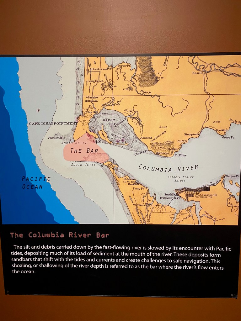
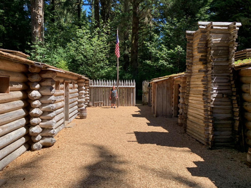
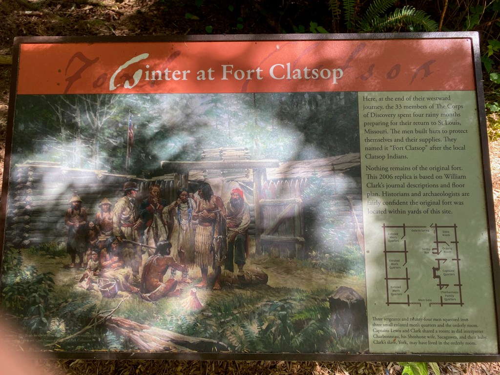
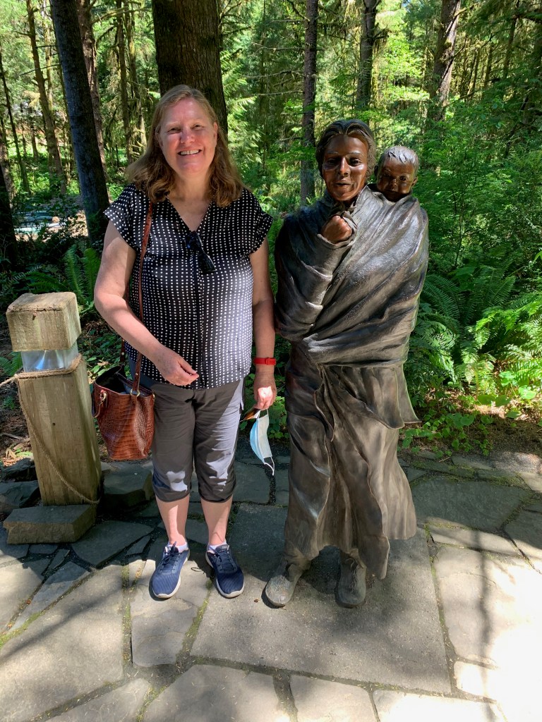
Yesterday we were back across the river in Oregon visiting another Lewis and Clark site, Fort Clatsop. This is a recreated fort on the location where the party spent the winter of 1805-06. I also toured the Columbia River Maritime Museum in Astoria, where I learned about “the Columbia River bar,” the entry point to the river where shifting sand bars and turbulent seas have made this “the Graveyard of the Pacific.” Since the early 1800s, hundreds of ships and 700 lives have been lost. On the way home we stopped at Cape Disappointment to view the lighthouse and look out across the mouth of the river.
LONG BEACH, WA – We towed the RV another 150 miles up Highway 101 on Thursday from Newport OR across the gaping mouth of the Columbia River to this resort town in Washington State. We’ll spend six days here, enjoying the expansive beach and the historical sights marking the western end of the Lewis and Clark expedition in 1805-06.
***
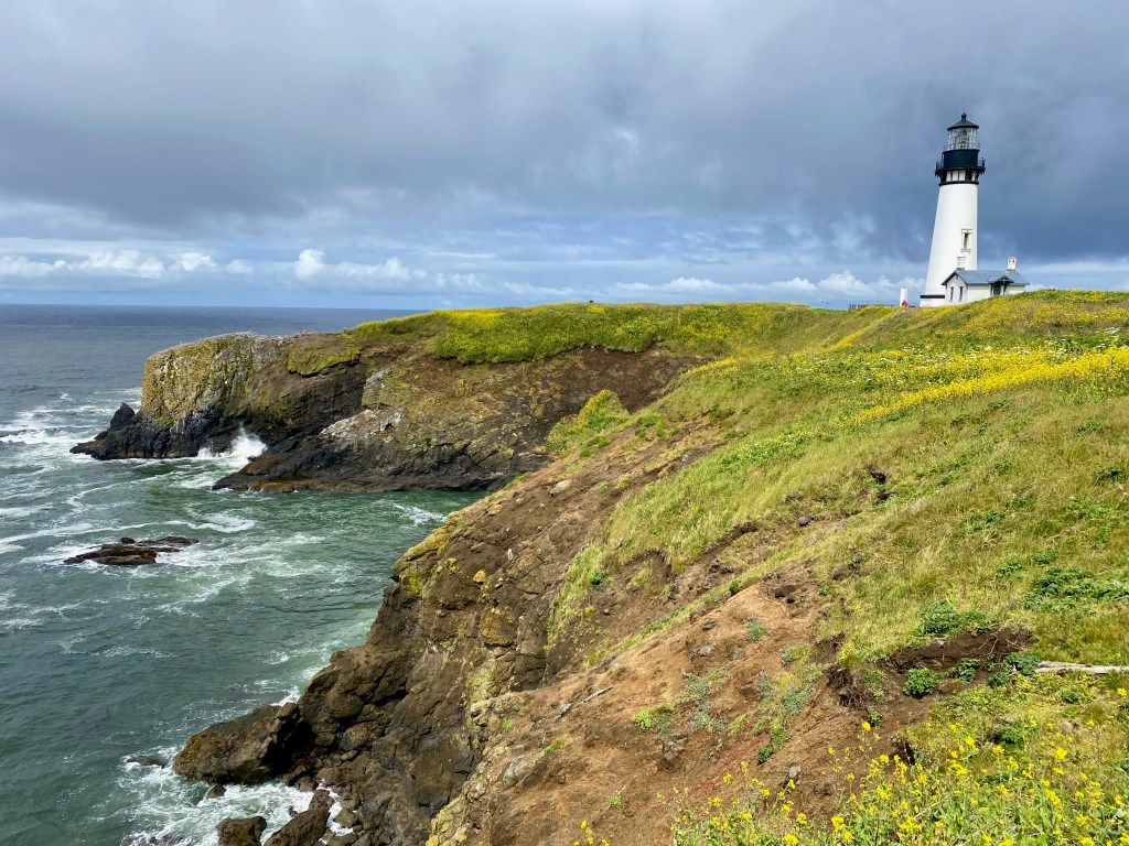
On Tuesday, we visited the Yaquina Head Lighthouse north of Newport. From there we drove to “the world’s smallest harbor” at Depoe. The video shows a tourist boat returning to the narrow inlet, probably from an outing to watch for migrating whales. We had planned to visit the scenic “Three Cape Loop” and the Cape Mears Lighthouse further north that day, but rain, road closures and our own end-of-day tiredness modified our plans.
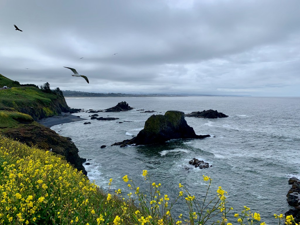
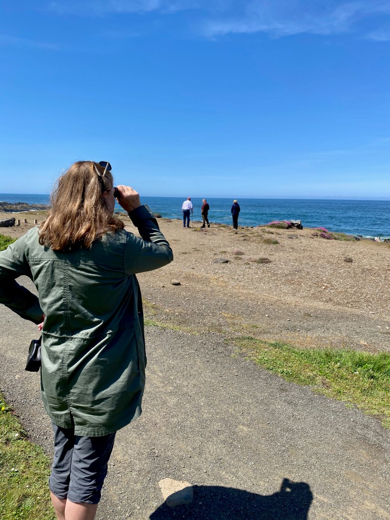
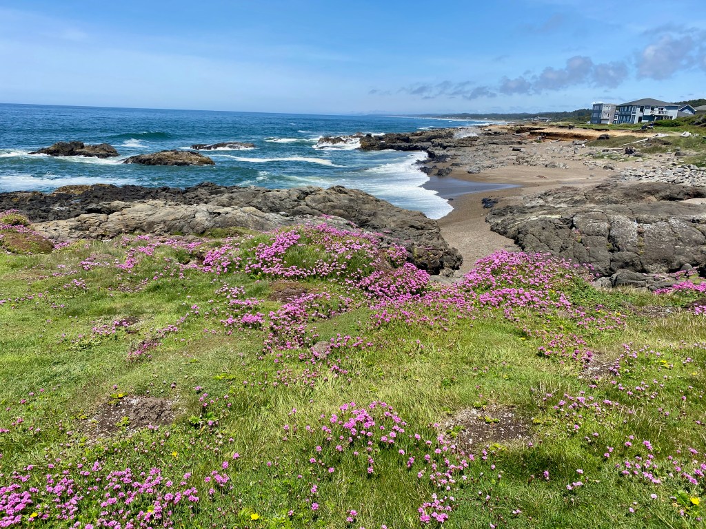
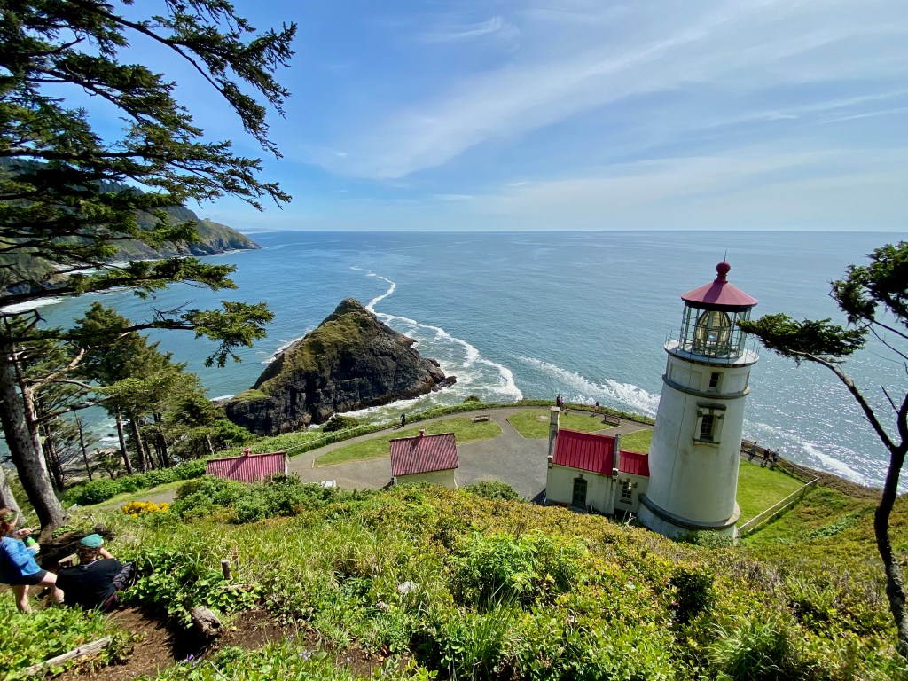
On Wednesday, refreshed and under blue skies, we drove south to enjoy a memorable walk along Oregon Coastal Trail 804 in Yachats. The trail took us along a rocky section of the coast, past homes and between woods and pounding surf. At one spot where we stopped for lunch, we could see a gray whale spouting through its blowhole a few hundred yards offshore before it would descend, only to reemerge in the same spot a few minutes later. We also came across a poignant memorial to two young men from Eugene OR who drowned on a high school outing in 2011 when a “sneaker wave” swept them off the nearby rocks. Further down the coast, we hiked up to Heceta Head Lighthouse.
“Thor’s Well” near Cooks Point, between Yachats and the Haceta lighthouse. Elizabeth thought I was standing a bit too close!
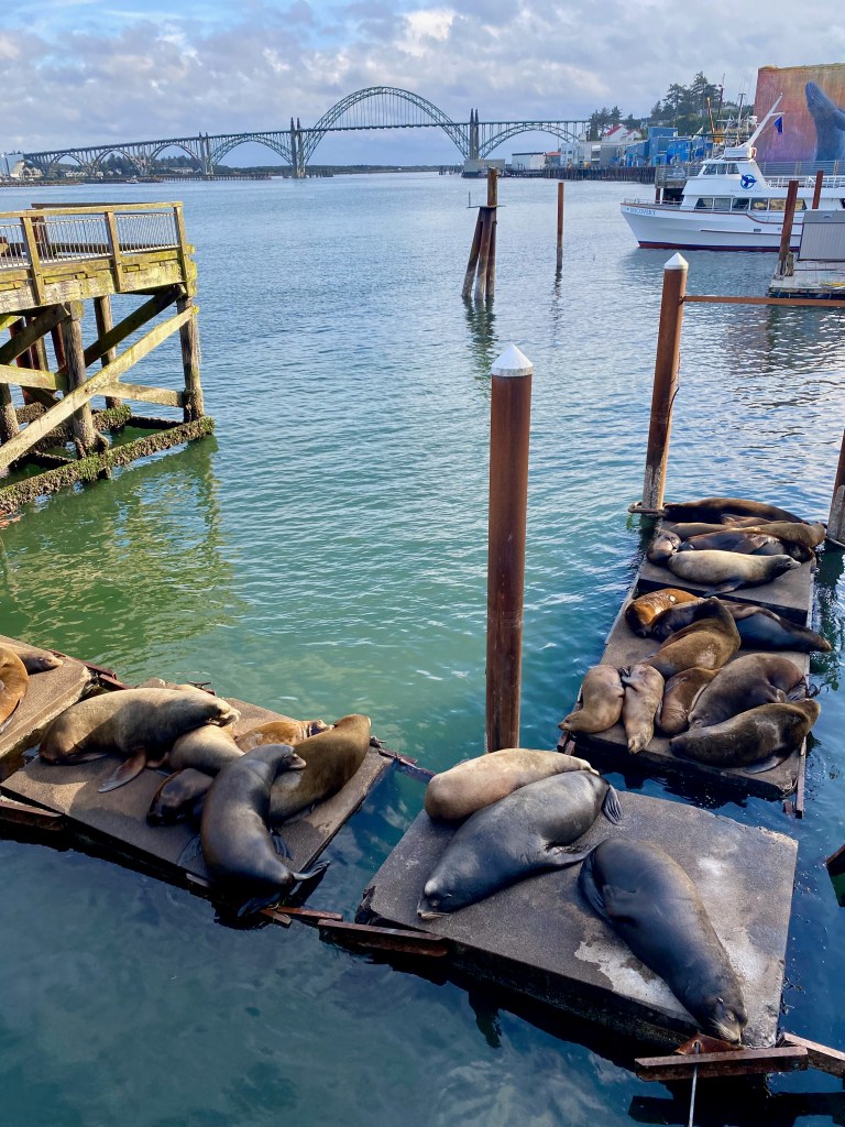
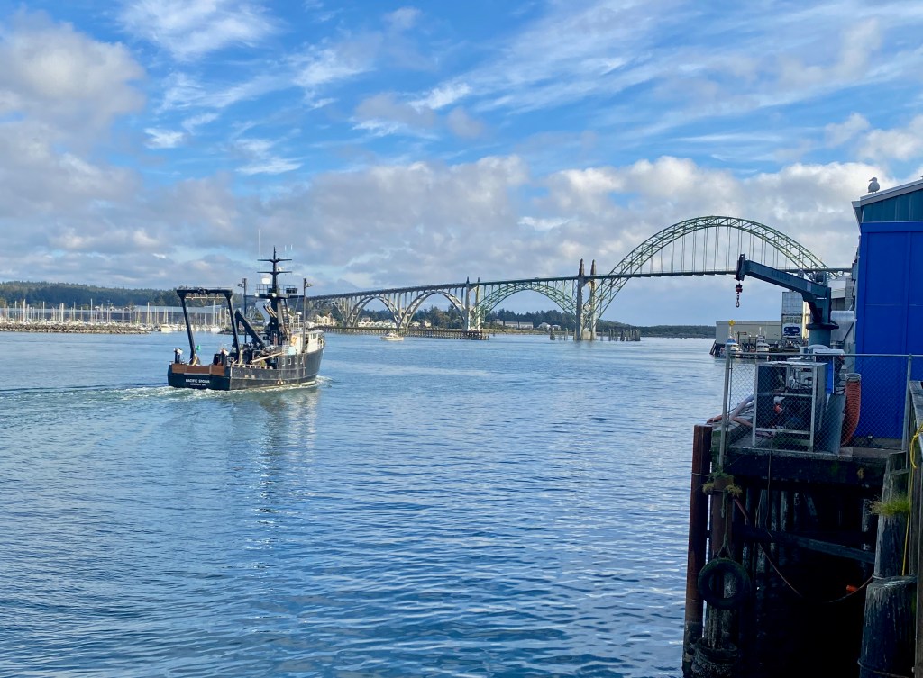
During our time in Newport, we enjoyed the historic bayfront area, where a small colony of California sea lions has taken up residence along the docks. The males come north during the non-summer months, and then head south from mid-June to mid-August to breed in the coves of Baja California. We also watched the boats come and go from the harbor, such as the one aptly named “Pacific Storm.” That’s the Yaquina Bay Bridge in the background. We stayed at the Newport Marina RV Park on the other side of the bay but with an equally good view of the bridge.
***
We’re taking a break from visiting national parks for a short while. I had originally hoped to visit Crater Lake National Park in Oregon, but most of the roads around it are still closed by the winter snows. We’ll plan to come back during the summer months in a future year, Lord willing, when the roads will be open and I can maybe take a jump off a rock into one of America’s grandest swimming holes!
NEWPORT, OR – We’re staying in this scenic Pacific port city for a few days, a bit less than halfway along our 670-mile journey up the West Coast along Highway 101 from Eureka, CA, to Port Angles, WA.
We left Eureka on Wednesday after a weeklong stay. Because of her English blood, Elizabeth has always preferred cooler and more humid weather, so I told her that Eureka might be just the place for her: The cooler Pacific currents cover the city in a “marine layer” of clouds much of the time and keep its daytime temperatures in the 50s and 60s most of the year, and so it was during our stay.
Eureka’s the largest city on the coast north of San Francisco with about 28,000 residents. Its heyday was the late 1800s when it boomed as a lumber and port city, and it’s still home to some lovely Victorian houses and downtown buildings. We drove past a couple of lumber yards in the region that were piled high with huge logs in various stages of processing.
We were less impressed with the large homeless population living along the waterfront and bike trails. It made us feel unsafe as we walked and biked in the city. As a society, we need to have compassion for people living on the margins, but there must be a better way to respond than to allow potentially unsafe and unsanitary encampments in public places. (I flagged the same issue in my post from Austin TX back in March, and I see a majority of the people of that city seem to agree, voting on May 1 by a 57 percent majority to ban camping in the downtown area.)
***
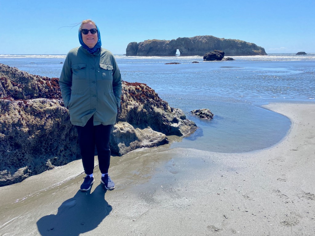
From Eureka, we drove north to Port Orford, a small town about 60 miles from the border with California. From there we explored the coast in both directions, driving back south in the truck to explore the rugged coastline and sea stacks of Myers Creek Beach south of Gold Beach, and north to Bandon and the Face Rock Scenic Viewpoint.
Here are a few photos from our time along the south Oregon Coast last week: 1) At Myers Creek Beach south of Gold Beach; 2) ” Face Rock” near Bandon; 3) My perch after climbing through a passageway at the Face Rock viewpoint: 4) Elizabeth looking out at a small colony of barking male California sea lions at the Simpson Reef overlook south of Coos Bay; 5) A display at the former Coast Guard station that operated at Port Orford Heads from 1934-70 .
Dashboard:
Days on the road: 105;
Miles towing the RV: 5,094;
RV parks stayed at: 33;
National parks visited: 14.
The road ahead (Lord willing): The northern half of the Oregon Coast and over the Columbia River to Long Beach, WA.
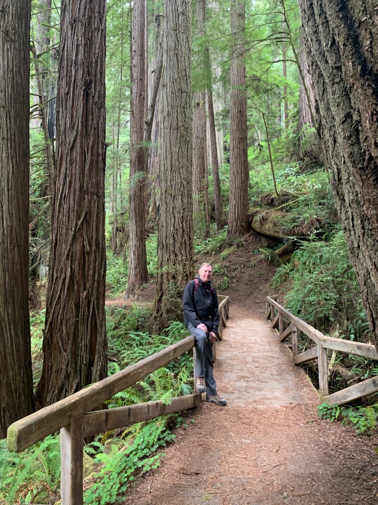
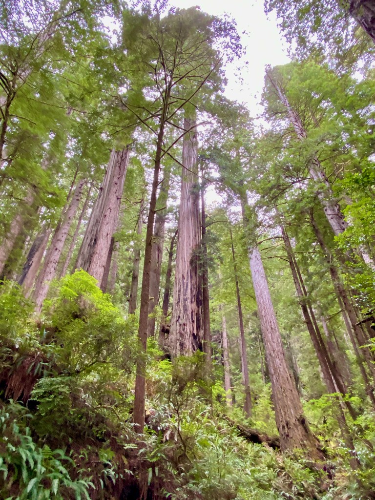
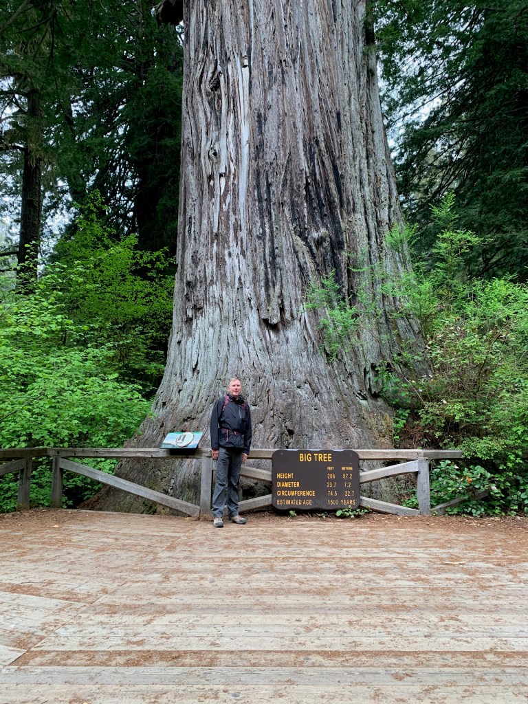
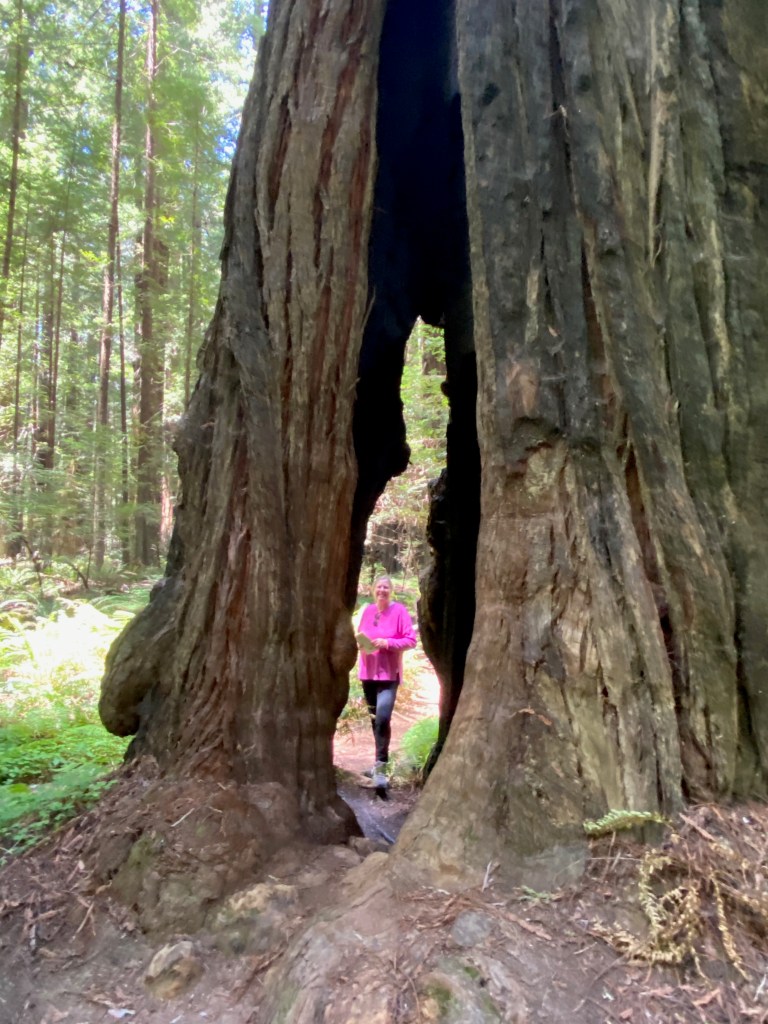
EUREKA, CA – From our base in this Victorian-era logging city on California’s north coast, we’ve launched two forays into the quiet and majestic forests of coastal redwood trees, some of them soaring more than 300 feet high.
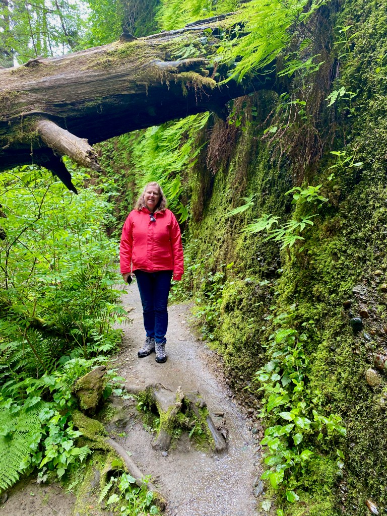
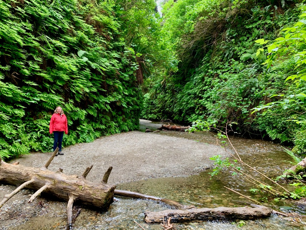
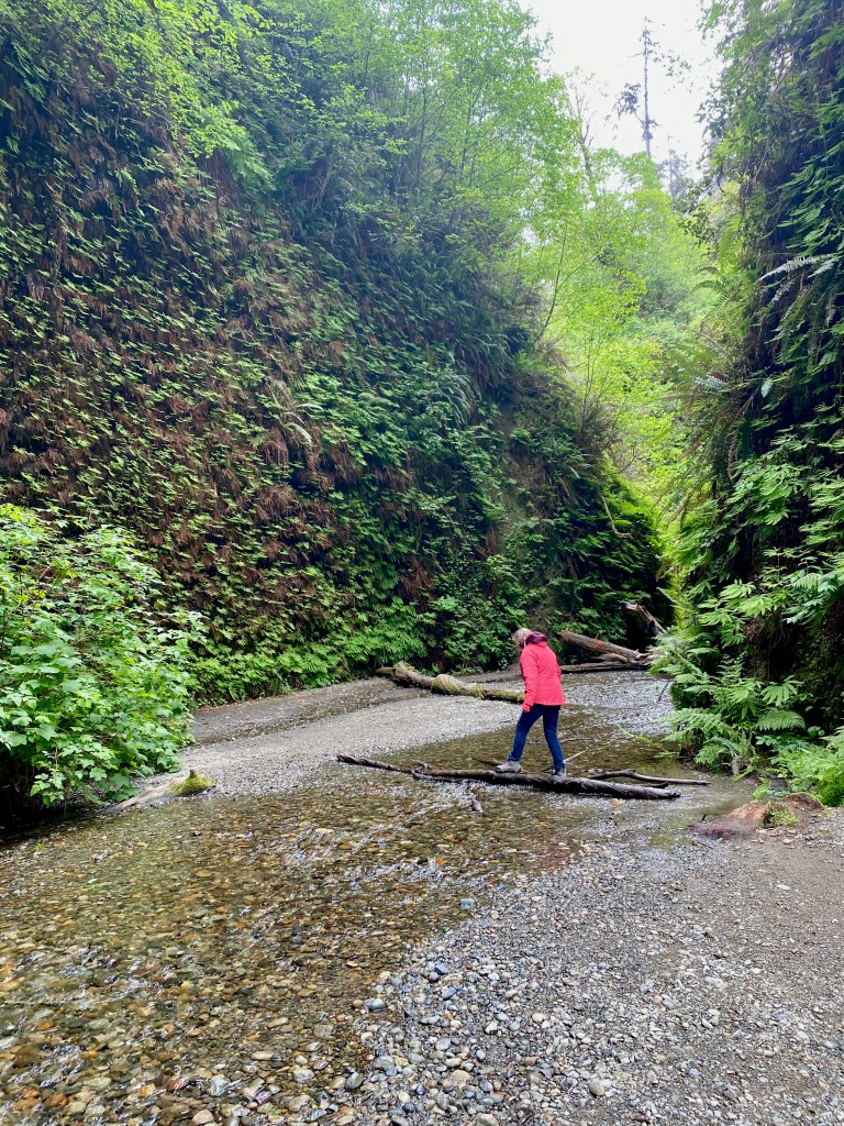
On Friday, we drove north to Prairie Creek Redwoods State Park, where we walked through Fern Canyon and along the 2.5-mile Prairie Creek and Foothills Loop Trail. Fern Canyon is such a strange and wonderful place that Stephen Spielberg filmed this dinosaur attack scene there for “Jurassic Park 2.” On our visit, it was a peaceful place—a narrow gorge with a stream flowing through it and lush ferns covering the sides.
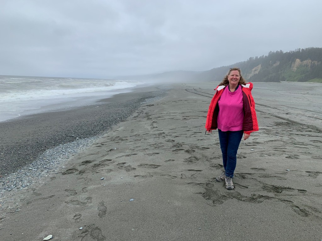
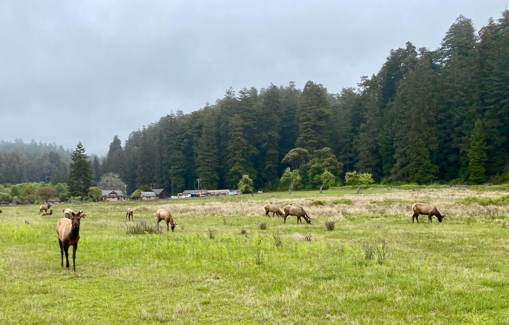
After walking on the nearby beach, we drove to another spot in the park to hike through old-growth redwood trees on the Prairie Creek and Foothills trails. As I’ve complained before, it’s impossible to capture the immensity of these trees on a camera (at least by me on an iPhone 11). The trees are so huge that they exist in three different climate zones—the shaded forest floor, the bare trunk, and the branches and green needles at the forest canopy. The park literature said a tree can give off 500 gallons of water a day, reclaiming it from the moist air from the nearby ocean. A herd of elk greeted us near the visitors center.
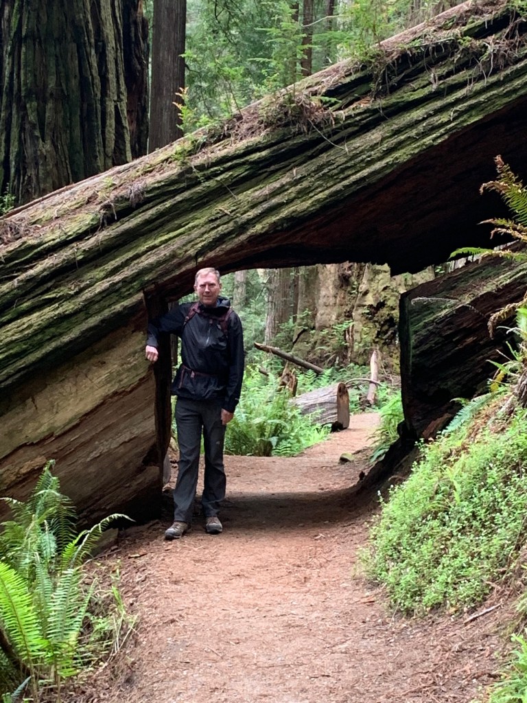
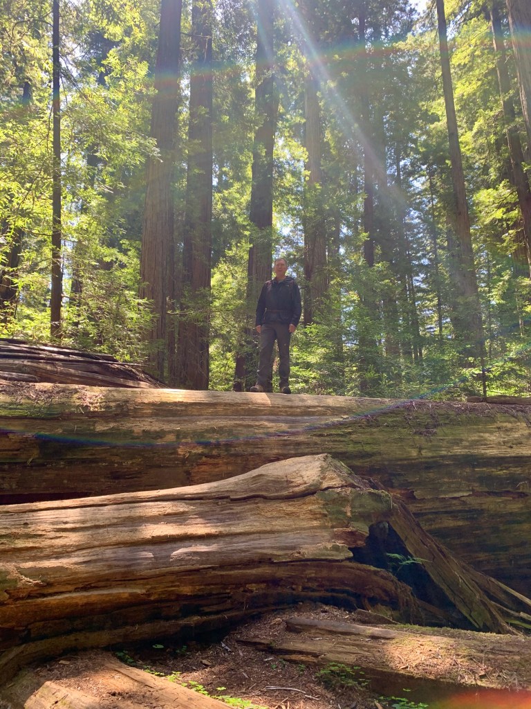
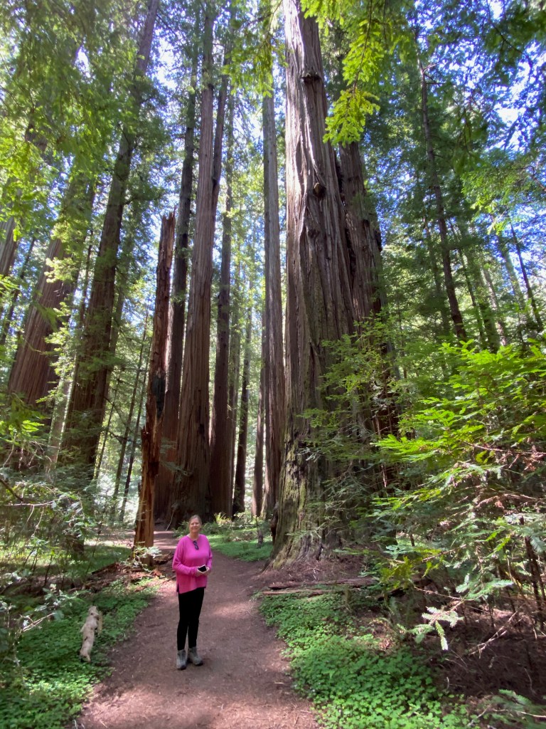
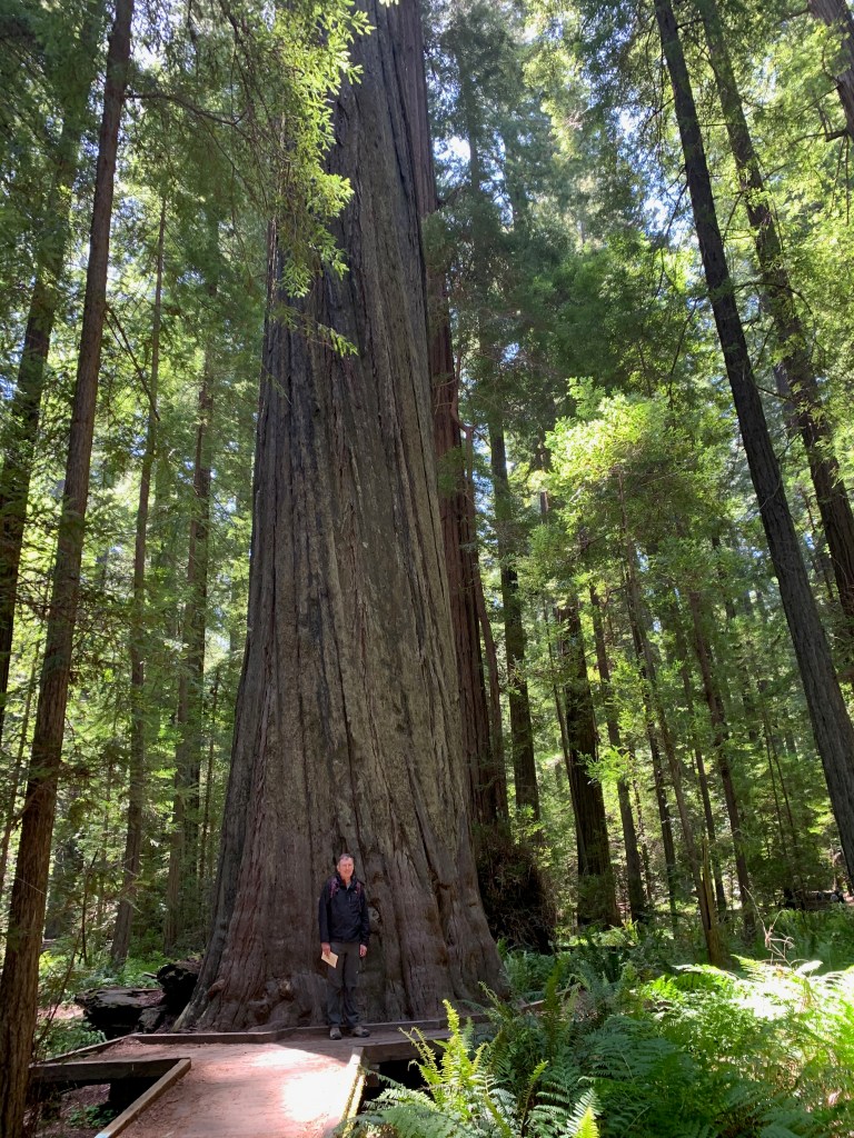
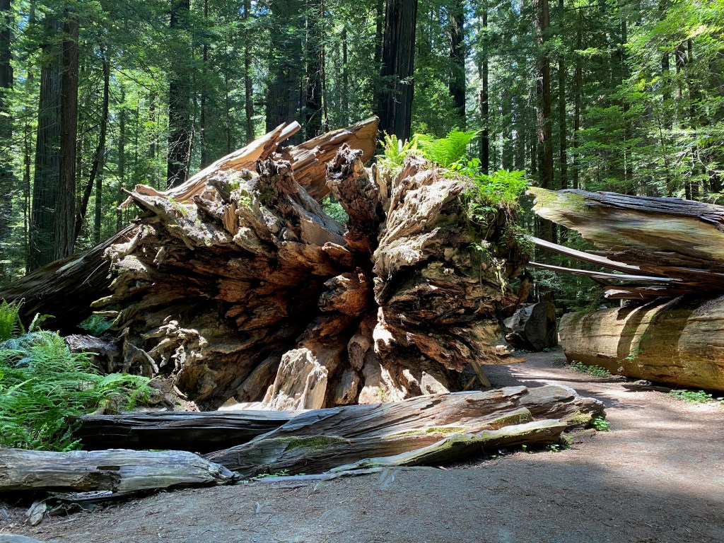
And today we drove south to the Humboldt Redwoods State Forest, where we hiked the Rockefeller Loop and the Founders Loop. We enjoyed walking along the quiet trails, with ferns growing on the forest floor and sunlight filtering through the branches of the redwoods 300 feet above us. When we weren’t looking up, we were gawking at the “fallen giants,” especially the Dyerville Giant, which fell on March 24, 1991. At the time it was at least 362 feet tall–comparable to a 30-story building–52 feet in circumference, and weighed an estimated 1 million pounds! They figure the tree was 1,600 years old, which means it began to grow as a seedling about when Augustine was writing his Confessions and City of God.
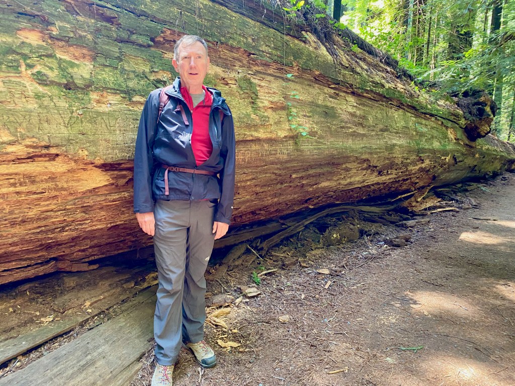
Photos below: 1) Standing athwart one of the fallen giant redwoods; 2) Elizabeth on a trail in Humboldt Redwoods State Park; 3) At the base of Founders Tree, which is 346 feet tall; 4) This tree was damaged by fire, but its top was still green; 5) The exposed roots of the fallen Dyerville Giant; 6) Astride the Dyerville Giant.
EUREKA, CA – Earlier this week we traveled to the north end of California’s Central Valley to visit Lassen Volcanic National Park, the largest area of geothermal activity in the lower 48 states outside of Yellowstone.
During our time in north central California, we parked the RV in the backyard of Ken and Lisa Michaud on their one-acre farm south of Redding. We know the Michaud’s from Lisa’s time at Grace OPC in Vienna about a decade ago. During our stay, we enjoyed meals and family time with this dear Christian couple and their two darling kids.
On Tuesday, our last full day there, Elizabeth and I drove about 60 miles east to Lassen Volcanic N.P. The park is centered on Lassen Peak, the site of a major volcanic eruption in May 1915. The volcano remains active although currently dormant, with steaming fumaroles and boiling mud pots in the south end of the park.
While early May was a great time to visit Yosemite, it was less than optimal for Lassen Volcanic park. Much of it lies at 5,000 feet or more above sea level, so most of its main road and many of its trails were still closed because of snow and boulders.
We were only able to drive about a mile into the park from the southwest entrance, but that was far enough to view the “Sulphur Works.” This area features steam vents and a bubbling caldron of mud exuding the rotten egg smell caused by sulfur dioxide and hydrogen sulfide. Still photos don’t do justice to the geothermal activity, so here’s a video:
And here’s a photo and description from the U.S. Geological Survey of the May 1915 eruption of Lassen Peak, also known as Mount Lassen. Red Bluff, where the photo was taken, is just down the road from where we were staying.
***
On Wednesday we climbed over the mountains to the cloud-shrouded historic lumber port of Eureka, CA, where we plan to stay until the middle of next week. The city is within easy driving distance of California’s Redwood national and state parks.
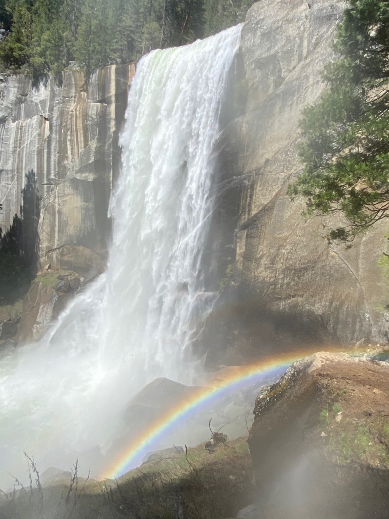
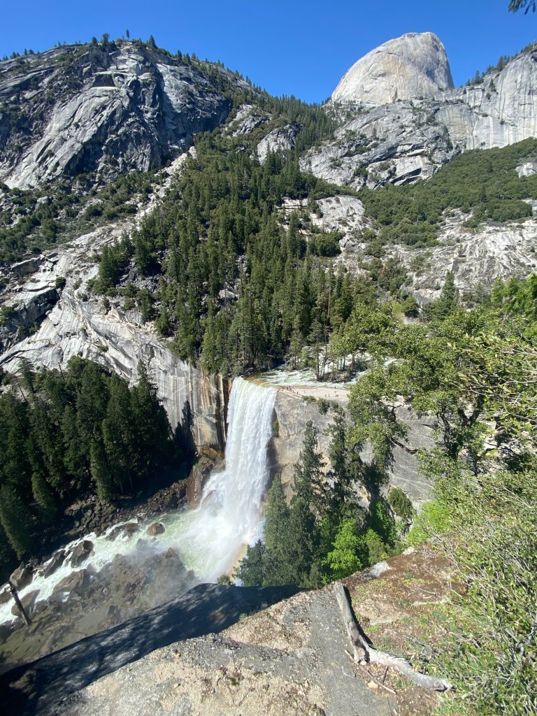
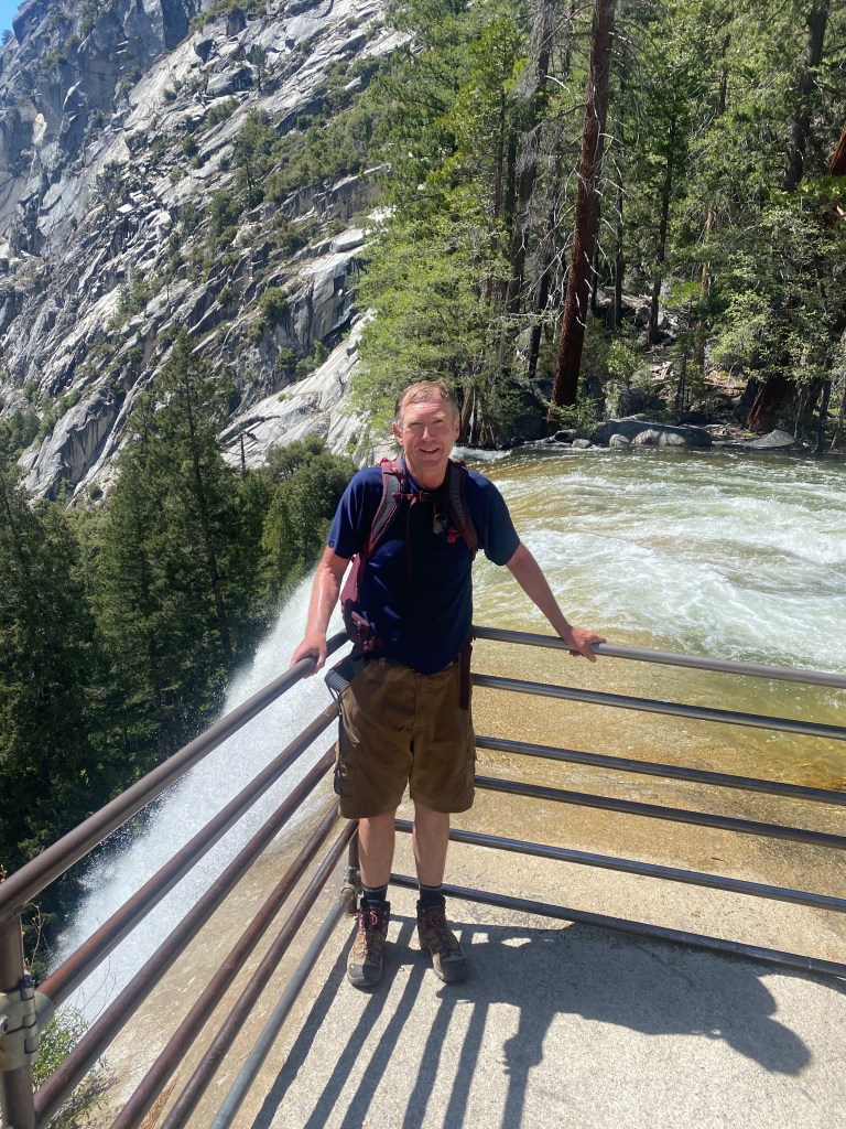
PLACERVILLE, CA – On our last full day in Yosemite National Park on Friday, I hiked to the top of Vernal Fall along what’s called the Mist Trail, which I can confirm is aptly named.
The 3-mile roundtrip trail starts at the Yosemite Valley floor along the Merced River. It rises about 400 feet to a footbridge over the river looking up at the falls, and then another 600 feet to a viewing area above the falls. For the final ascent, I trudged up a granite stairway of more than 600 steps. The stairway and I were both soaked from the spray from the falls but the mist also created a colorful rainbow at its base.
Rather than pick my way back down the slippery stairs, I came back by way of the John Muir Trail. The full Muir Trail runs 211 miles from Yosemite to the top of Mt. Whitney. I only hiked about 1.5 miles of it, but I can say “I hiked the John Muir Trail!” (In his book, A Walk in the Woods, author Bill Bryson said the same about the Appalachian Trail, even though he and his friend only hiked portions of it. Hint: Read the book, skip the movie.)
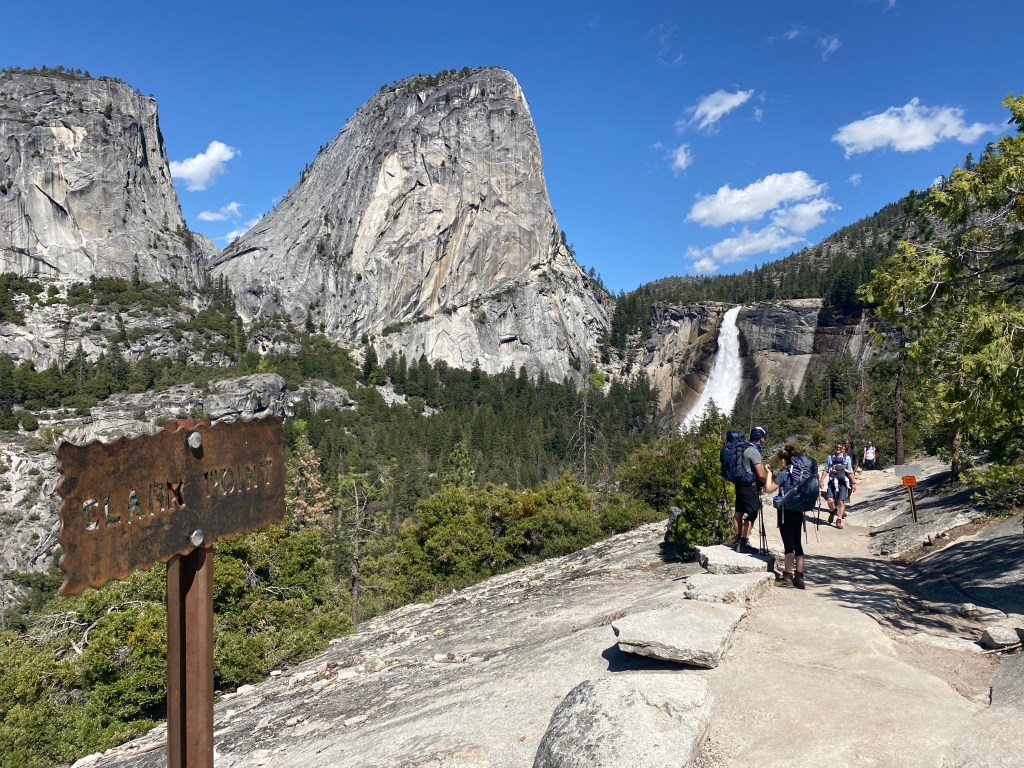
Photo slideshow: 1) Nevada Fall from Clark Point; 2) Above Vernal Fall; 3) At the viewing area at the top of Vernal Fall.
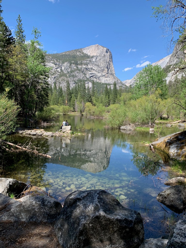
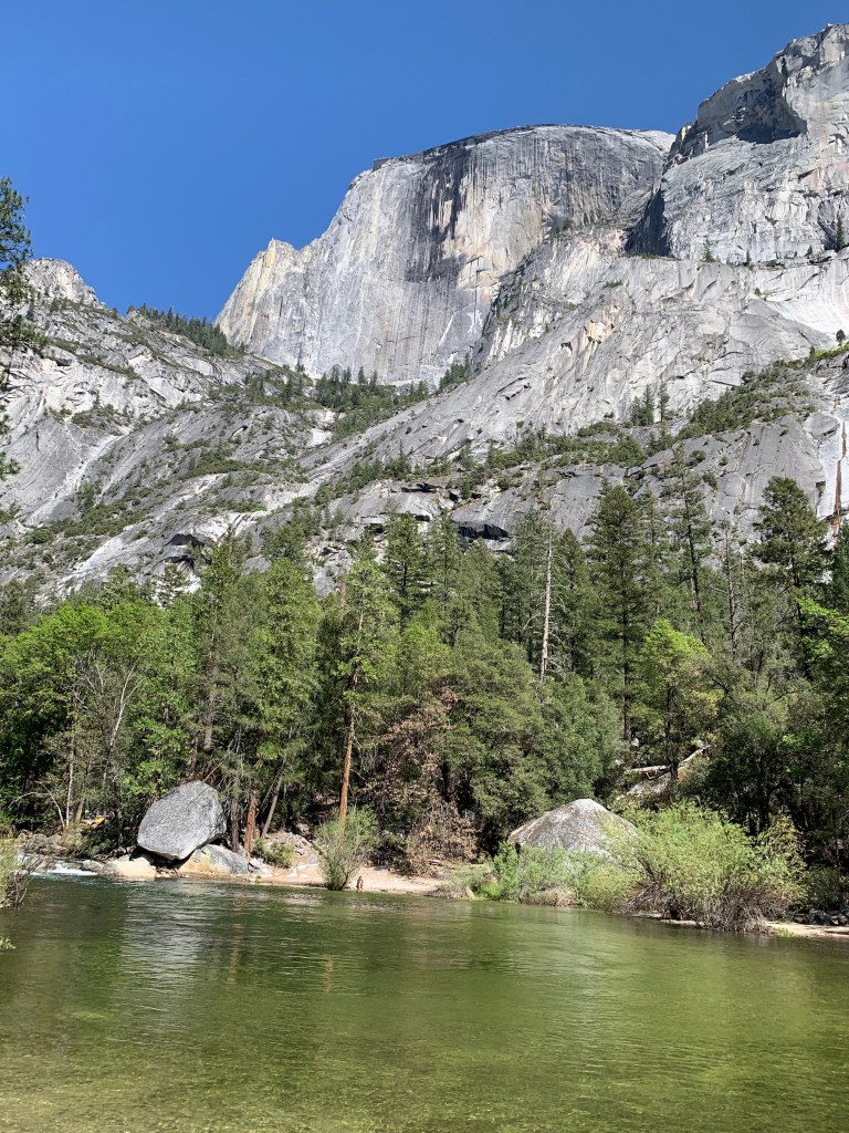
While I was getting a shower on the Mist Trail, Elizabeth was walking to Mirror Lake at the base of Half Dome. It’s not really a lake, but a wide and slow-moving portion of Tenaya Creek. It’s a great place for kids to wade in the creek and for reflective photos of Half Dome. Here are a couple of Elizabeth’s photos.
***
Today we’re wrapping up a two-night stay at a KOA RV park in what was once gold rush country in west central California.
Yesterday we drove 70 miles to South Lake Tahoe to admire the lake and to enjoy lunch with Bill and Jill Schilling, a couple we first met during our time in London in the 1990s. The Schillings live in Reno, so we agreed to meet at a favorite restaurant of theirs just over the California line and near the lake. After lunch we walked along the beach and looked out on the blue-green waters of the lake and the mountains that surround it.
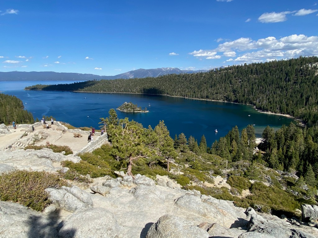
After we said goodbye to our friends, Elizabeth and I drove to the southwest corner of the lake to admire the views above Emerald Bay State Park. The bay is a mile wide and three miles long. It’s home to the only island in the lake, which features the remains of a tea house built at the top of the island by a wealthy land owner in the 1920s.
Dashboard:
Days on the road: 91;
Miles towing the RV: 4,429;
RV parks stayed at: 29;
National parks visited: 12.
The road ahead (Lord willing): Redding and Eureka, CA