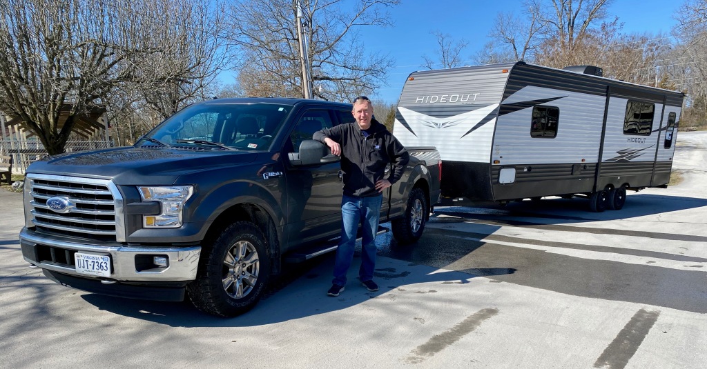
DOUGLAS, WY – We spent three nights earlier this week in this southeastern Wyoming city, attending the state fair and rodeo, exploring a natural bridge, and taking in some local history about trains and World War II POWs.
Douglas is a city of about 6,000 on the banks of the North Platte River 50 miles east of Casper. It was a convenient first stop after we left Colorado Springs last Monday, and it just happened to be hosting the Wyoming State Fair and a Professional Rodeo Cowboys Association event during our stay.
Presenting the flag for the national anthem at the PRCA rodeo in Douglas, WY on August 18.
Our favorite events at the rodeo Wednesday night were the saddle bronc and the bull riding. (Here’s a video clip I posted on FaceBook.) We admired the skill of the down roping and team roping competitors and the pluck of the steer wrestlers. And it was thrilling to see the young women riding their horses at full gallop in the arena for the barrel racing and the flag presentations (see above and below). I felt a bit out of place in the crowd without a cowboy hat or boots, but we felt right at home with the heartfelt opening prayer from the announcer Garrison Panzer and the national anthem from the Rock Bottom Boys. The night was pure Americana.
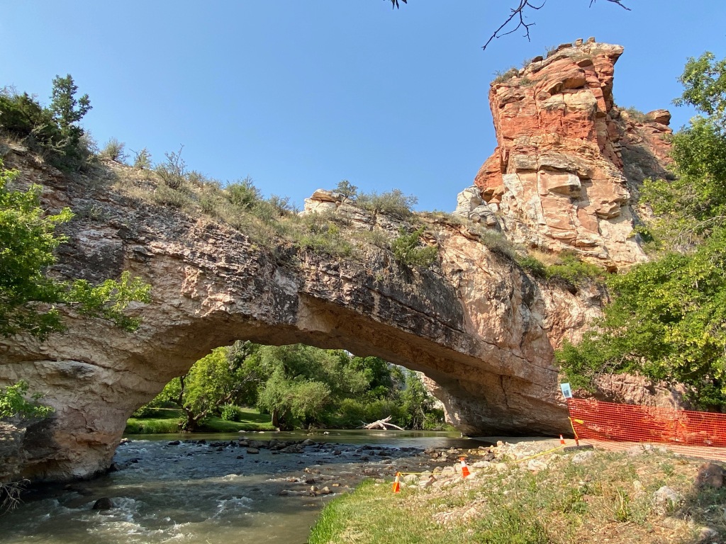
On our first morning in Douglas, we drove a few miles from town to see Ayres Natural Bridge. This is a beautiful spot, with the La Prele Creek flowing under the bridge and through a small canyon. It’s a county park with shaded picnic tables and benches near the creek. If you’re driving through Wyoming on I-25, it’s a refreshing spot just a few miles south of Exit 151. The bridge is supposed to be one of only three in the United States with water flowing beneath it. My fellow Virginians should know one of the others, but I’m not sure of the third. If you know what bridge that might be, feel free to post it in the comment section below.
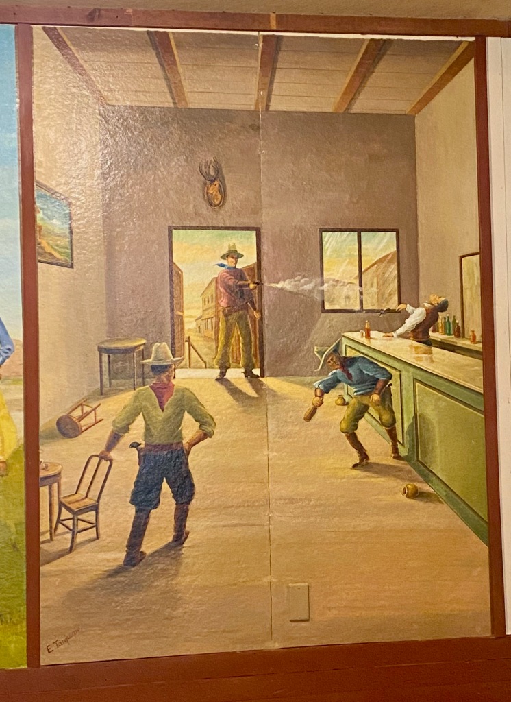
That afternoon we toured the officers club at Camp Douglas, the only remaining building from a POW camp that housed thousands of captured Italian and then German soldiers during World War II. A striking feature of the club are the murals of Western scenes painted by three of the Italian prisoners. They are based partly on what they saw from the trains as they were transported to the camp from the docks at New York City beginning in 1943, but mostly from the Western paintings they saw by American artists. In a film and exhibits, we also heard the testimony from the prisoners about how well they were treated. One said, “I never had it so good.” Another wrote, “I never knew what it meant to be a free man until I was a prisoner in your country.”
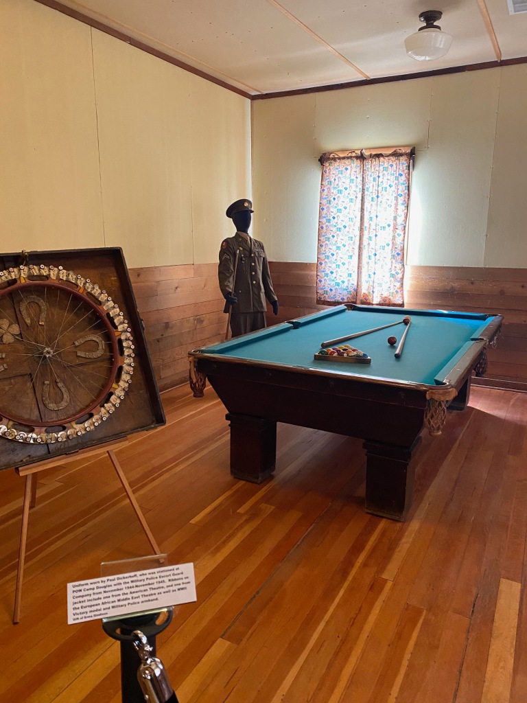
My favorite room!
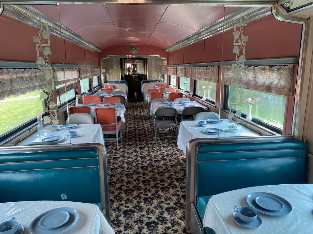
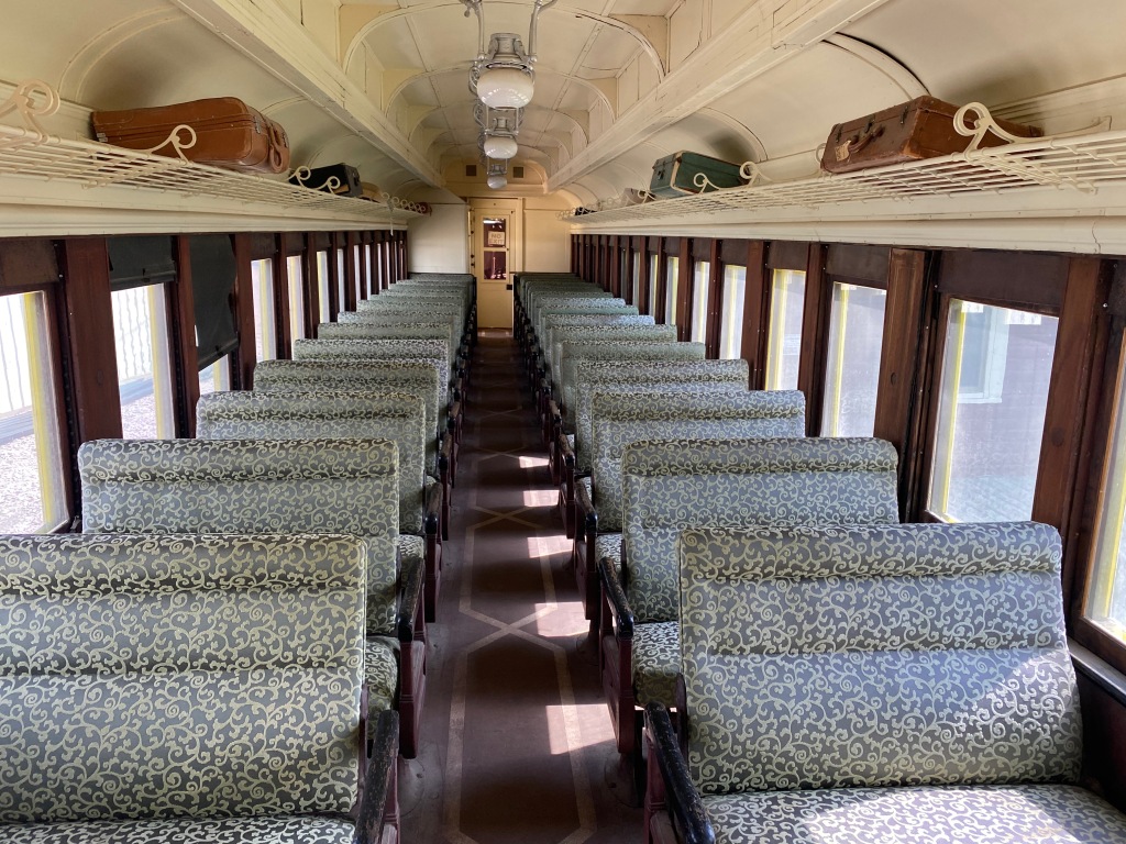
Another attraction was the Douglas Railroad Museum near downtown. If you’re into trains, this park features cars and engines from the 1880s to the 1950s. Many of them passed through Douglas during their years of service. What I especially loved is that you can walk through the cars and in some even sit on the chairs. It gave a real sense of traveling on those “magic carpets made of steel” back when it was the most economical way to travel across this vast country. (Note the giant “jackalope” outside the museum. The town has adopted the fictitious animal as a tourist attraction).
COLORADO SPRINGS, CO – We broke camp on Monday morning in this city at the base of Pikes Peak after a relaxing five-week stay. We enjoyed seeing family and long-time friends and taking a break from our cross-country travels.
Our stay here has reminded us of one of the many advantages of touring the country in an RV. When we stop at a location where we know people, we don’t need to ask anybody for a place to stay. After socializing, we can say goodnight and head off to our own familiar abode. We can also entertain people with a home-cooked meal and a campfire. We’re temporary neighbors rather than houseguests.
Home for us during our time in the Springs was the Golden Eagle Campground, a few miles south of the city. The RV park is home to the May Natural History Museum (more on that below) and lies across CO 115 from the Army’s Fort Carson. Every night at 10 we could hear the strains of “Taps” and every morning at 6:30 the sound of “Reveille.” In between we sometimes heard and felt the distant thunder of artillery practice. The sounds of freedom.
We lived in Colorado Springs from 1983 to 1995, so we can attest first-hand that the city is a great place to live and a great place to visit. The more well-known tourist attractions include the Garden of the Gods, the Air Force Academy Chapel, the Broadmoor Hotel, and the Pikes Peak Highway and Cog Railway. During our recent stay there, we visited three other attractions that are worth checking out:
Glen Eyrie— This is an English-style castle home built in 1904 by the city’s founder, Gen. William Jackson Palmer, in a secluded valley near the Garden of the Gods. The property has been owned since the 1950s by the Navigators, a Christian organization that provides tours. It’s a beautiful spot, with rising cliffs and rock formations. The castle contains 19th century English woodwork and lots of history connected to Gen. Palmer and the founding of the city in 1871. Gen. Palmer is “the man on the iron horse,” the title of a short, readable biography and a reference to a statue of him at the downtown intersection of Nevada and Platte avenues.
Olympic Museum— Colorado Springs is home to the US Olympic Committee, Olympic Training Center, and the new U.S. Olympic & Paralympic Museum. The museum is located in a futuristic building in the downtown area and opened in July 2020. The entry fee is a bit steep at $25 per adult and $15 for kids 3-12, which would add up quickly for a family. I went on my own and enjoyed many of the high-tech interactive exhibits. As someone who has been watching the Olympics since the 1970s, I did find myself wanting to see more archival footage of classic Olympic moments. The highlight of the tour was the film at the end on the Olympic spirit, with the testimony of athletes accompanied by video clips of their performances. In the darkened theater, I found myself coughing repeatedly to disguise the fact that I was getting choked up with emotion. (Here’s a more extended review from Springs Magazine.)
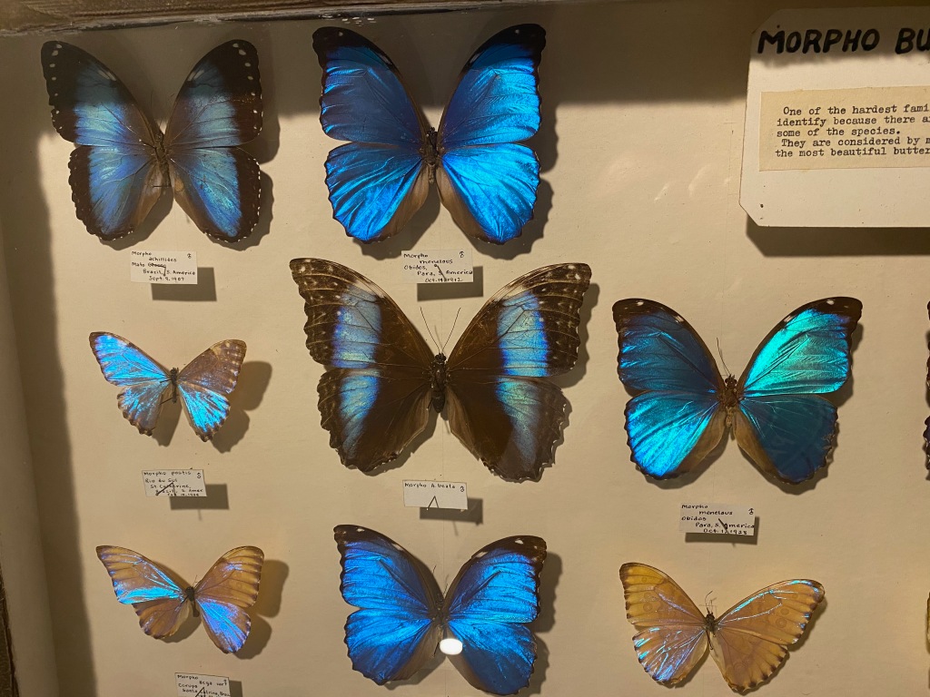
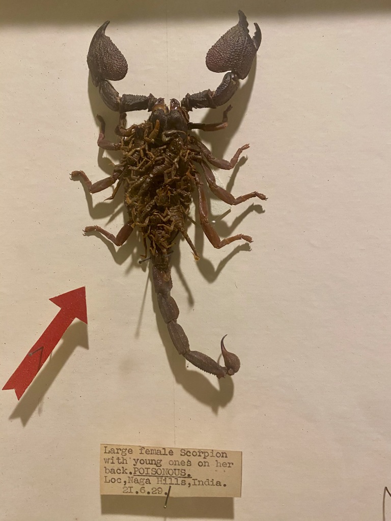
May Natural History Museum— This fantastic collection of insect specimens is connected to the Golden Eagle campground where we stayed. The collection was started more than a century ago by James May and popularized by his son John May, who relocated the collection to its current venue just south of the city in the 1950s. Today his descendants manage the museum and campground. If you’re into bugs, you’ll be amazed by this collection. (Entry is a reasonable $8.) On display are more than 8,000 specimens of beautiful butterflies, giant beetles and stick bugs, and lots of big, hairy spiders! The collection has been valued at $5-6 million, and Walt Disney even offered to buy it when he was in town in the 1950s, but the family turned him down. The story of the museum was featured in this 2015 segment of the Fox Business channel’s “Strange Inheritance with Jamie Colby.” Further below are some of the more memorable bugs I saw.
Note the baby scorpions on its back.
***
On Monday we towed the RV more than 300 miles to Douglas, WY, where we plan to visit the Wyoming State Fair and attend a rodeo Wednesday night. Then it’s on to the Dakotas and Minnesota later this month.
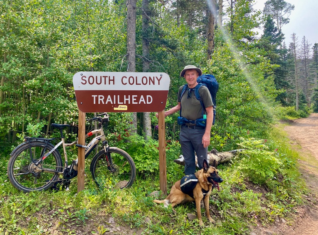
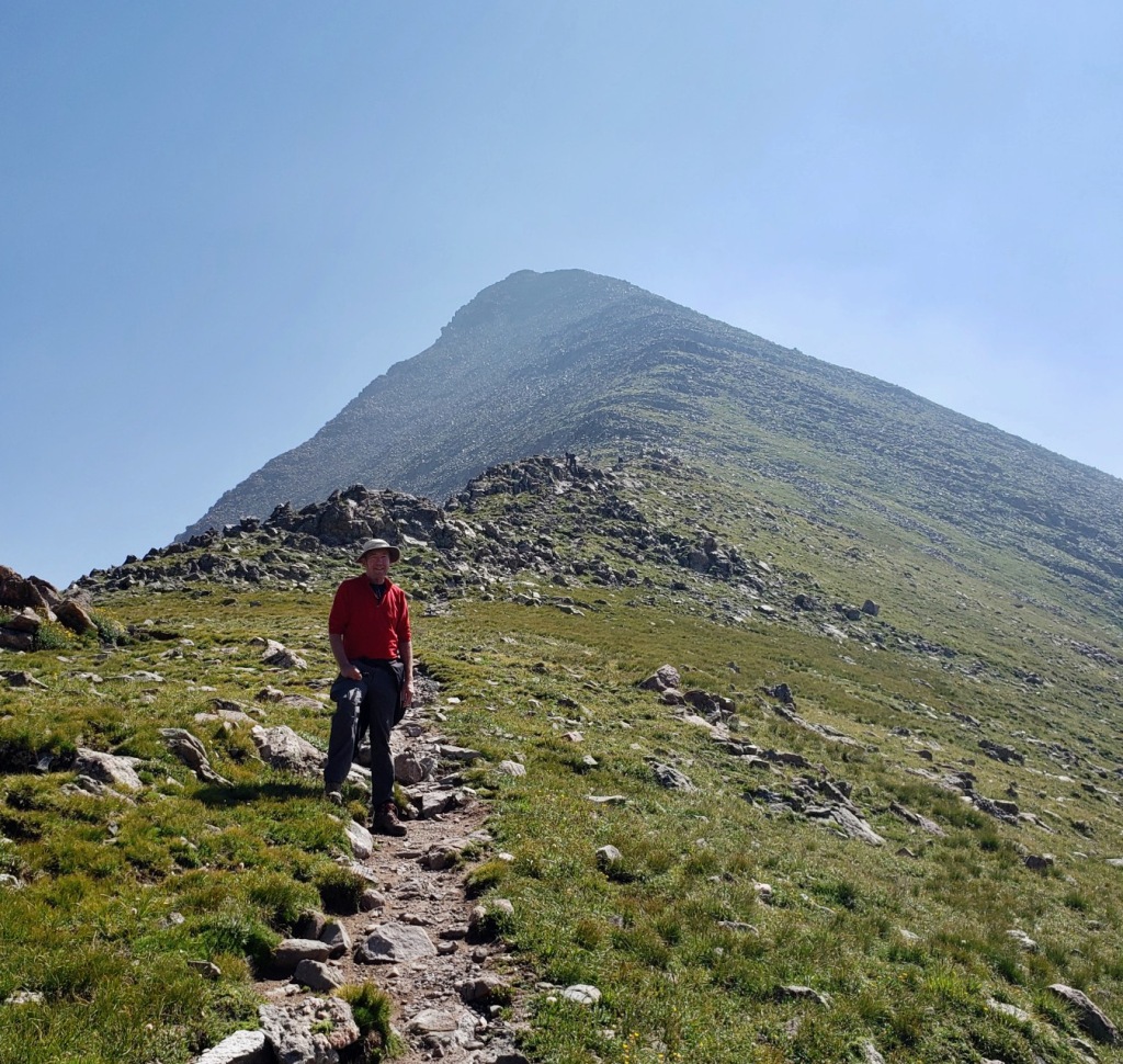
COLORADO SPRINGS, CO – This weekend I teamed up with Michael and Lizzy and their dog Juniper to backpack into the Sangre de Christo Wilderness and conquer one of Colorado’s “fourteeners,” Humboldt Peak. We were worn out at the end, but the scenery rewarded our effort.
The upper South Colony Lake and Crestone Needle from the trail up Humboldt Peak
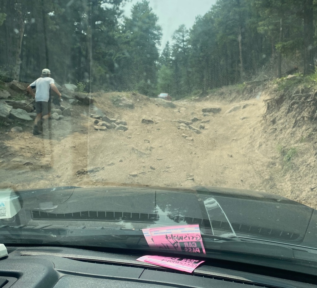
The trailhead is 93 miles southwest of Colorado Springs. When we arrived Saturday morning, we were planning to drive my Ford F-150 another two miles up a forest service road to an upper parking lot. About a half mile up, we encountered what four-wheel drivers call a “crux” in the road—a challenging spot that’s difficult to pass. After assessing the degree of difficulty, we decided to turn back and begin our hike at the lower, “low-clearance” lot.
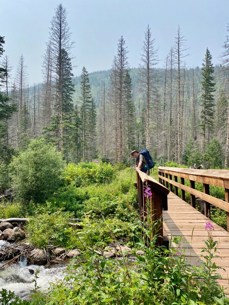
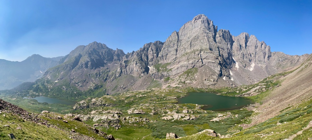
From there, we hiked 5.5 miles with our backpacks to a camping spot near the lower of the two main South Colony Lakes. The lake is 11,666 feet above sea level, a 2,600-foot elevation gain from where we parked the truck. The area was popular with weekend backpackers and we could see why. The views were spectacular of the surrounding fourteeners—Crestone Needle (14,197 feet), Crestone Peak (14,294 feet), and Humboldt Peak (14,064 feet)—and water was plentiful.
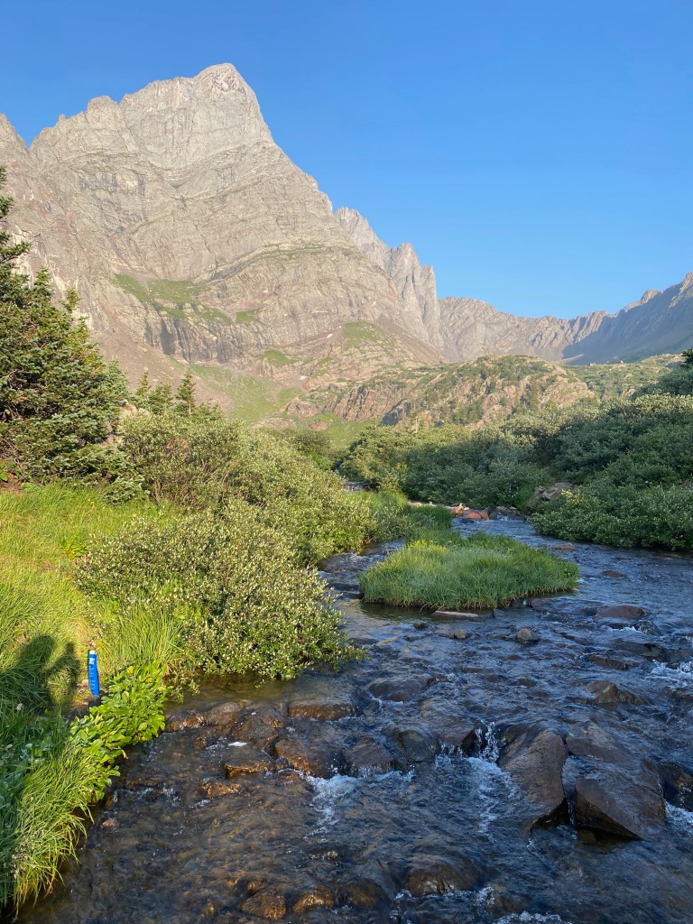
The crux of the matter. This is where we turned back to the lower parking lot. At the upper parking area.A bridge over South Colony Creek.Where we filled our water bottles at camp. That’s Crestone Needle above and my shadow and water pounch on the lower left.
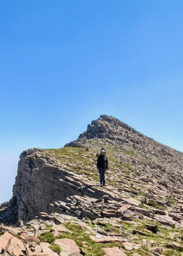
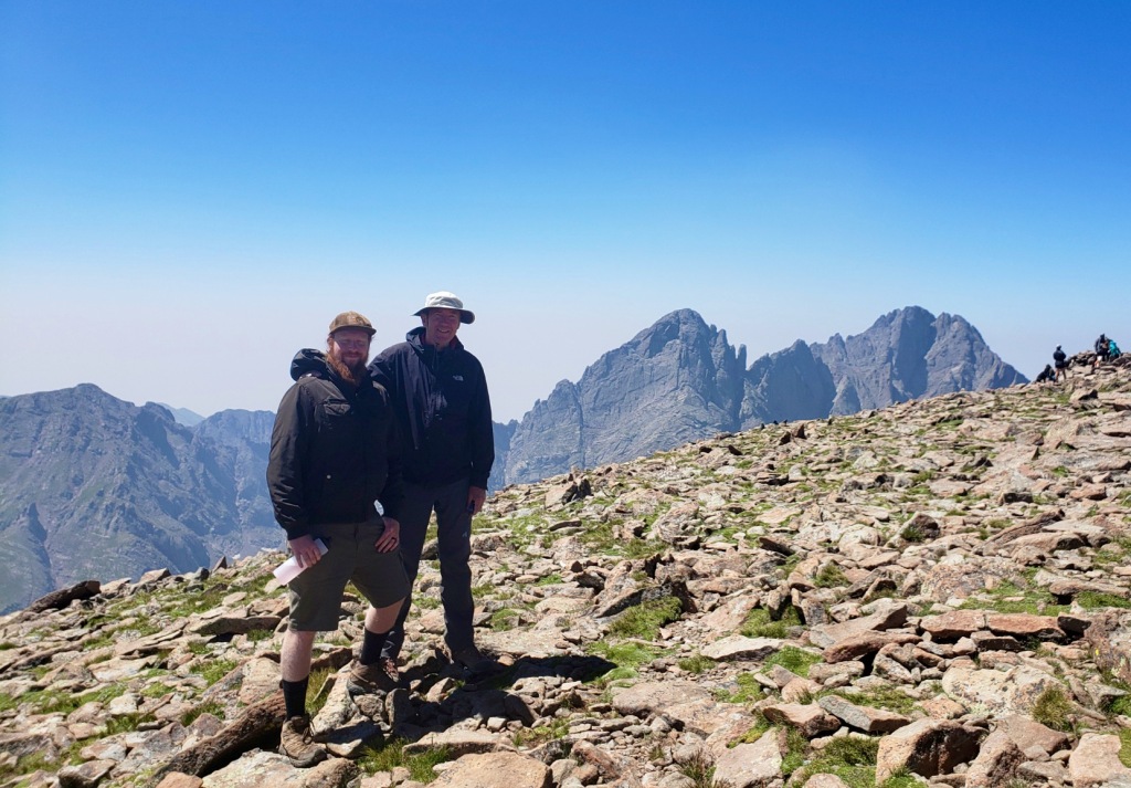
On Sunday, we set off at 9 a.m. to hike Humboldt Peak. The trail took us 1.9 miles and 2,400 feet in elevation gain past the upper South Colony Lake, then up a series of switchbacks to the ridge of the mountain, then up the increasingly rocky ridge to a false summit. (At times we could only find our way through the boulder fields by the cairns, or stacks of rocks, left by previous hikers.) From there it was just a short distance along a ridge to the real summit. At the top, we enjoyed a half-hour rest, some lunch, conversation with a few fellow climbers, and wonderful views of the nearby peaks and the adjoining valley.
Here’s the view from the trail up Humboldt Peak looking back on the South Colony Lakes. Our campground was over the creek at the bottom of the lower lake. That’s Crestone Needle towering over the valley.
Photos below clockwise from upper left: 1) on the ridge of Humboldt Peak; 2) along the upper ridge near the false summit; 3) Juniper, “the best dog,” at the summit. (This was Junie’s first fourteener!); 4) Michael and me at the summit of Humboldt Peak.
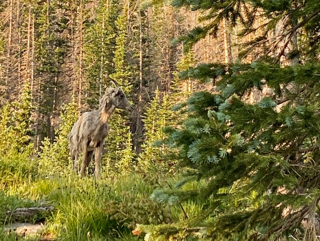
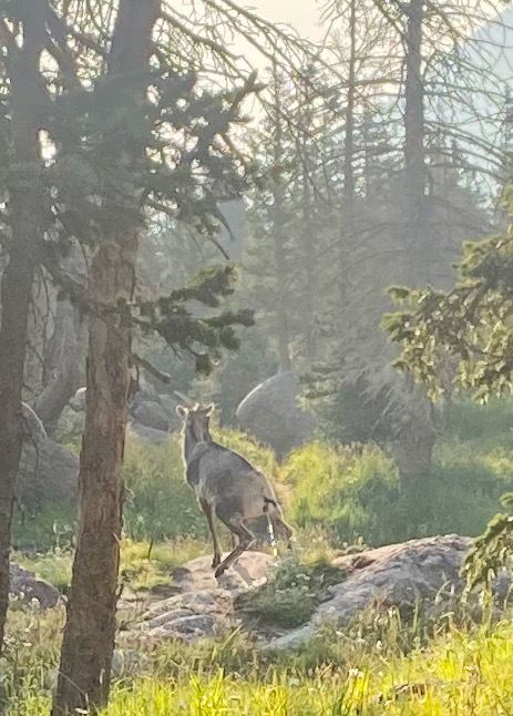
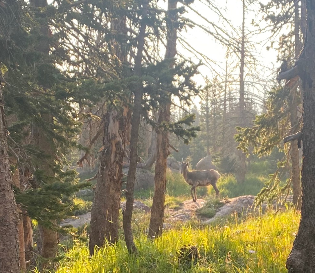
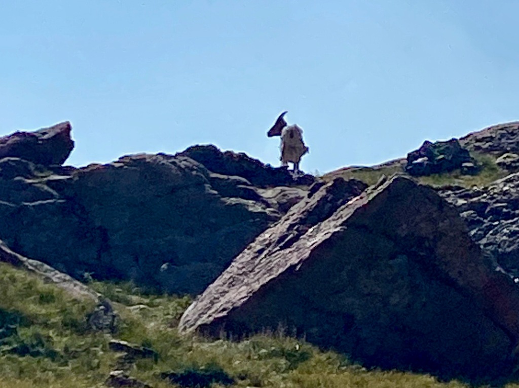
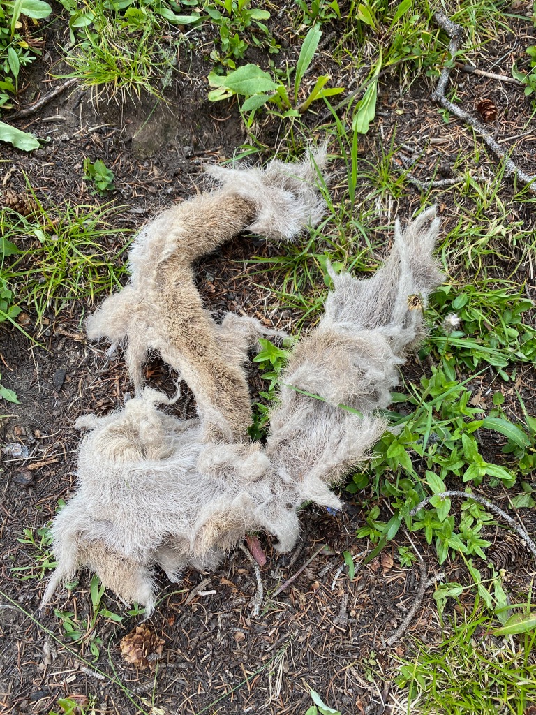
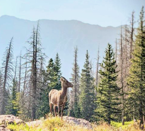
Our camping area was home to a flock of (not so) big horn sheep. Lizzy said they were mostly females with one or two younger males. They would surprise us by bolting past the trail near our tents. They were shedding their fur. One left a big clump near my tent and another a calling card of a different sort, which complicated my packing up when we were ready to leave. (If you look closely at the second photo, you can see one of the sheep taking care of business on a nearby rock.)
During our stay near Red Lodge MT earlier this summer, we witnessed the misfortune of a motorhome driver who cut a corner too sharply and ended up with his powertrain wheels suspended over a ditch. It took several hours and an extra-large tow truck from Billings (not the one pictured) to free the beached whale later that afternoon.
As someone who’s been towing an RV around the country for the past six months, I could only think, “There but for the grace of God go I.” Many of you following our journey have remarked at what a wonderful trip Elizabeth and I are having, and it’s certainly been a great adventure so far, in many ways exceeding expectations. But we’ve also encountered our share of trying moments, self-inflicted setbacks, and close calls that could have turned out much worse.
Some of these situations I’ve shared, but most of them I haven’t—either out of pride or the idea that they weren’t that big a deal. But in the spirt of full disclosure, not only of the good, but the bad and the messy, here are what Elizabeth and I consider the worst moments of our time on the road (in chronological order):
Lost hitching tool
In mid-February, after we’d been on the road for about a week, we were hitching up the RV in Sneads Ferry NC for our next destination. I went looking for a specialized tool that came with the RV that we use to lift the stabilizer bars onto the trailer hitch, but I couldn’t find it anywhere. Without the tool, I couldn’t hitch the bars or tow the RV. We were stuck. It soon occurred to me that I had probably left it on the bumper of the truck as were unhitching six days earlier, and that it had fallen off somewhere as we were driving the unhitched truck around town. After scanning the nearby roadside and asking around for advice, somebody suggested we go to the local hardware store and see if they had a usable substitute. We came back with a $13 standard-issue crowbar and, with a few modifications in our routine, we’ve been using it successfully ever since.
Damaged cable
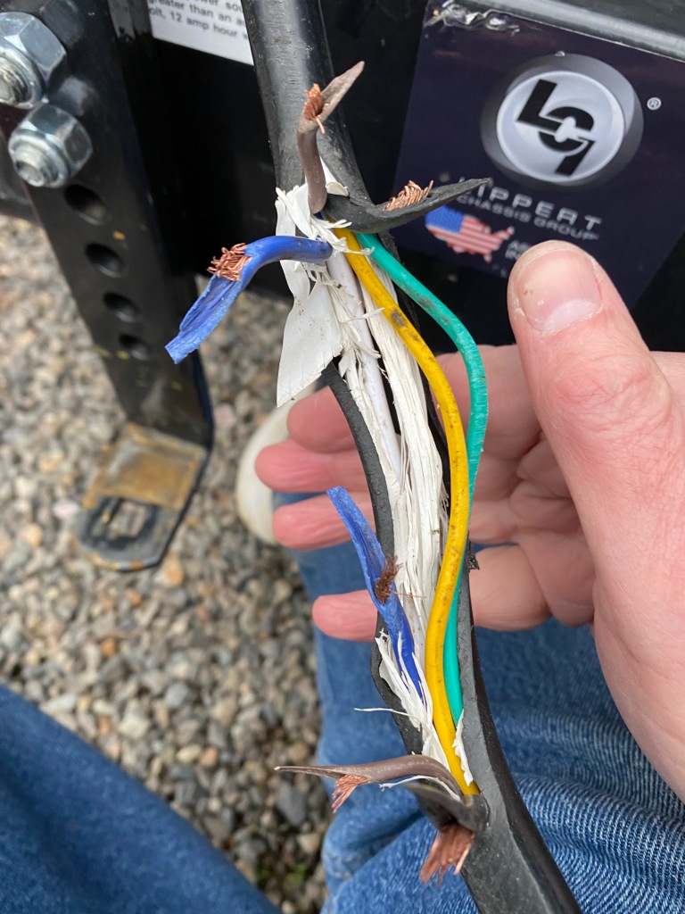
Our most serious misstep occurred later that month when the signal cable connecting the truck to the RV was almost severed on our way from Memphis TN to Hot Springs AK. The cable controls the rear lights on the RV as well as its brakes. As we were hitching up to leave the RV park near Graceland, I loosened the signal cable to get it out of my way as I was attaching the chains. My mistake was to loosen it so much that once we hit the road, it was dragging on the pavement. As we approached Hot Springs a few hours later, in the rain and descending through the hills, warning lights began flashing on the dashboard that told me the trailer signals weren’t working. One even flashed, “Trailer Disconnected.” Since I could see the trailer fully attached in my rear-view mirror, I told myself the problem must be with the signal light. When we were unhitching at the RV park, Elizabeth noticed the cable covering had been worn away and three of the six wires inside it were severed.
In a blog post at the time (“Hanging by a Wire,” March 2), I did recount much of this story and how a local RV repairman reconnected the wires and secured the cable for us. What I didn’t share then was how serious it could have been. One of the wires connects the truck brakes to the trailer brakes, so that when I step on the truck brakes, the RV brakes at the same time. This prevents the trailer from pushing up against the back of the truck and potentially even jack-knifing if you brake suddenly at high speeds or going down a steep incline. As I was admiring the repairman’s skill, I said to him that I was sure glad that the brake wire—which I assumed was the white one that was the thickest of the bunch—hadn’t been severed. The repairman pointed to a thin blue wire, which as you can see in the photo was completely severed, and said, “That’s your brake wire.”
A dead battery and beeping alarm at 1 a.m.
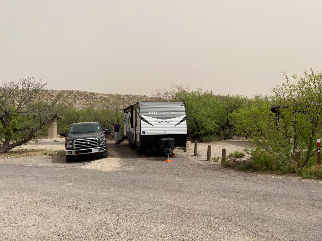
Our first campground in Big Bend National Park in Texas was inside the park at Rio Grande Village on its eastern end. The campground is well located near a scenic stretch of the Rio Grande River, but the downside is that our site had no hookups—no water, electricity, or sewer. We would be “boondocking,” or dry camping, for four nights. Elizabeth and I saw it as a new adventure and an acceptable tradeoff for a great location. Even without hookups, the RV can draw on a 30-gallon freshwater tank and its 12-volt battery can power the LED lights, water pump, and refrigerator. Clean public toilets were nearby. For reasons we still don’t fully understand, our battery soon began running out of power. It may have been the water pump working too hard. (I did blog about the first hint of trouble in “‘Boondocking’ in Big Bend,” March 23.)
Whatever the cause, by the middle of our second night, the battery had died. At 1 a.m., the small carbon monoxide and propane gas alarm began to beep to warn us that it was disconnected from the main power source and could no longer perform its vital duty. The alarm was loud enough and regular enough to make sleep impossible. I told Elizabeth I was getting out of bed to disconnect “it” from the wall. She thought I was talking about the refrigerator, which had also stopped working, and to save me the trouble of pulling it out from the wall and disconnecting it, she began reading through our owner’s manuals to find an alternative. In my grumpy, sleep-deprived state, it took me several minutes to figure out that we were not on the same page. Once I clarified that I was talking about the alarm, I went ahead and removed it from the wall and disconnected its internal battery to stop the infernal beeping. When morning arrived, we agreed that for the sake of the food in the fridge–and our collective sanity–we would depart that morning, two days ahead of schedule, for a private RV park we had booked just outside the west end of the park. We also expressed a mutual hope that this would prove to be the low point of our trip.
At our “no hook-up” site in Big Bend.
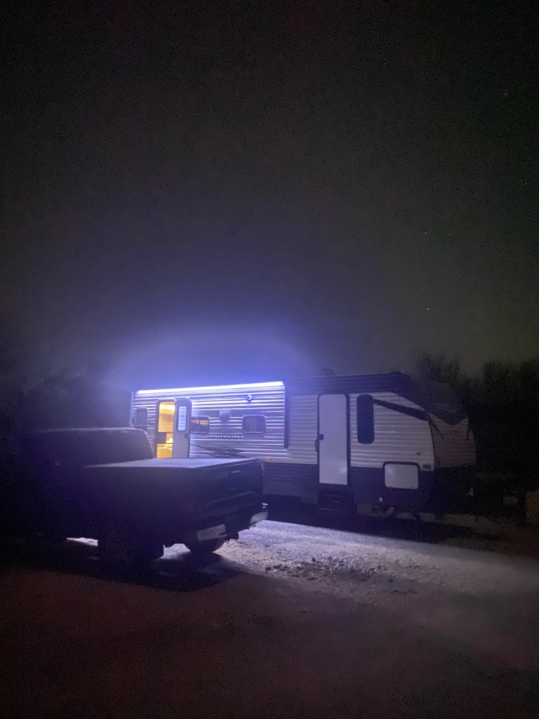
Our first night, when the battery still had power.
The scenic Rio Grande a short walk from our campsite.
Lost skirting board
On April 23, somewhere on the highway between Twentynine Palms and Simi Valley CA, a 12-foot-long piece of skirting fell off the lower left front of the RV. It was blustery that day across south central California, but nothing that caused us alarm. When we arrived at our campground in Simi Valley north of Los Angeles, Elizabeth was the first to notice the missing skirting board. It didn’t compromise the function of the RV, but it looks bad and exposes the press board and pipes behind it. That week I called an authorized Keystone dealer in Redding CA, where we planned to be in a couple of weeks, but the service guy there said replacing it would take 3-4 weeks and cost $7,000! That was a non-starter, so after a trip to Lowes, I covered the exposed area using a roll of aluminum flashing, tin snips, and a few wood screws–at a cost of $37. An authorized dealer in Colorado Springs was equally unenthusiastic about fixing our under-warranty RV, so we’re planning to get it fixed at the end of September when we visit the dealer in West Virginia that sold us the RV.
Earlier in our journey with the skirting still intact.
What we found when we arrived in Simi Valley.
After my trip to Lowes. It may not look brand new, but hey, it saved us $6,963.
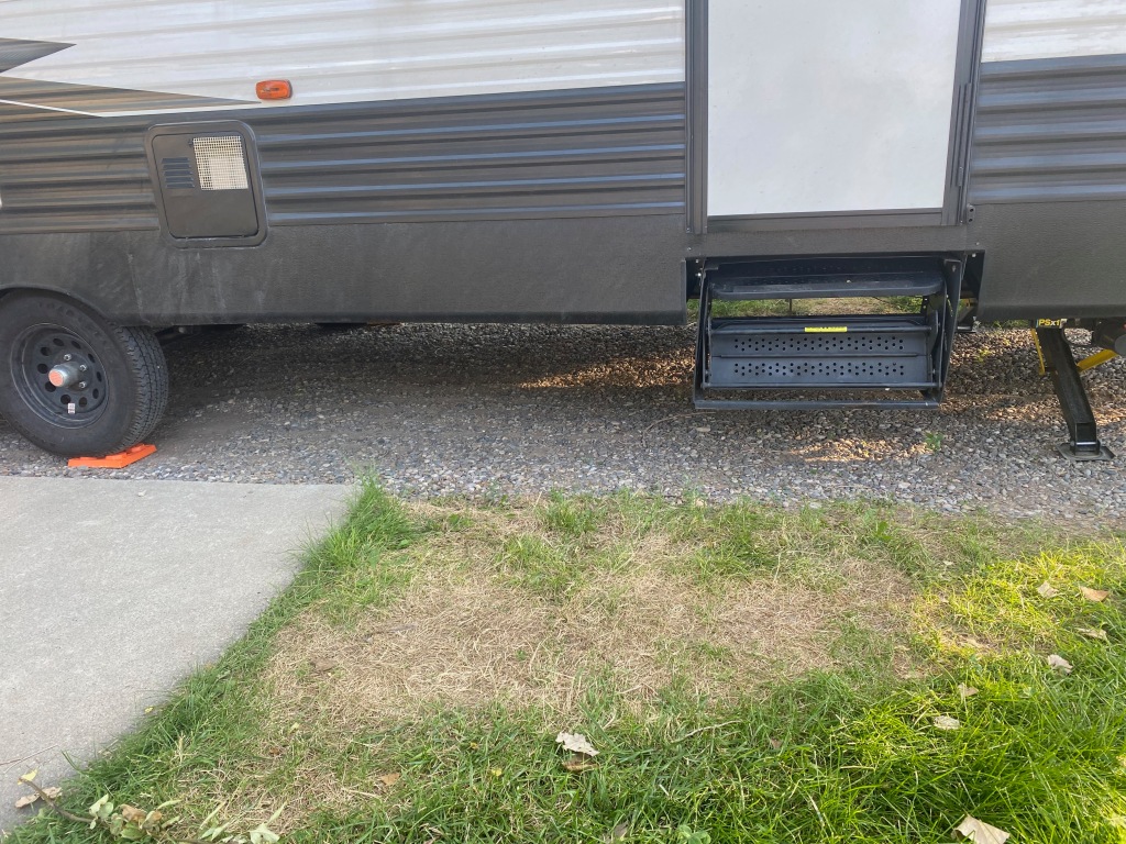
Low-hanging hitch and stairs
Another problem we haven’t quite fixed yet are certain low-hanging parts that can scrape on the ground as we’re towing the RV. If we tow the trailer across uneven ground, the stabilizer bars on the hitch can brush the ground, resulting in mangled hitch pins and bent parts. The bedroom stairs hang low enough that at one campground, as we were pulling out, another driver shouted to me that they were still extended, even though they were fully retracted. At one point earlier in the trip, the steps had caught on a rise in the road, resulting in a slight backward bend to the stairs. We’ve managed the problem by acquiring an extra inventory of hitch pins (they cost about 50 cents at a hardware store) and driving extra carefully on uneven surfaces.
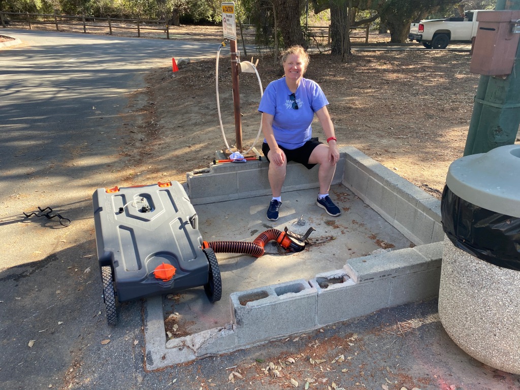
Competing with the beeping alarm in Big Bend for the low point is a backed-up toilet in Lemon Cove CA in early May. As background, in our Hideout the bathroom sink and shower drain into the “gray water” tank and the toilet and kitchen sink drain into the “black water” tank. Both tanks need to be emptied after about two days of normal use at a campground. With full hookups, we drain them into a sewer pipe at our campsite. But with partial hookups (i.e. no sewer)–as we had at Lemon Cove–we need to empty the tanks at a central “dump station.” We can empty them by either stopping by with the trailer as we leave the park or—if we stay longer than two days—by emptying the tanks into a plastic, 28-gallon “tote tank” we store in the truck bed and hauling it to the dump station. This allows us to empty the tanks without the disruption of hitching up and moving the RV itself.
A day-time trip to the dump station in Simi Valley.
Elizabeth overseeing a more routine discharge of the tote tank in Simi Valley.
Things seemed to be going well at the Lemon Cove campground until 10 o’clock one night, when the toilet backed up, spilling several ounces of black water contents on the bathroom floor. The tank was full to overflowing, a day ahead of schedule! Along with the expected smells, an air of panic filled the RV. The regular dump station was locked, the campground office was closed, and the voice-mail message we left went unanswered. Faced with enduring a night with a backed-up sewer system, I heard myself exclaiming, “I didn’t sign up for this!” But as I calmed down, we hit on the idea of using the tote tank to empty the black and gray water into the drain of an empty, full-hookup campsite nearby. After a couple of trips lugging the tank over to the other site, our sewer system and RV were back in order. In the clear light and fresh air of the next morning, I concluded our tanks had filled up prematurely because our uneven campsite had caused the RV to tilt a bit away from the side where the tanks discharge, causing them to reach full capacity earlier than usual. It was another lesson that life can be messy.
Inches from a tree branch
In Northern California, a family we knew from their time out East graciously hosted us at their home in the countryside. We just needed to pull the RV through a driveway and around a tree in their front yard to a spot in their back yard with full hookups. As I was pulling the RV around the tree, I sense I may be getting a bit close. I got out and looked and saw that a sawed-off branch of the tree was about three inches from the aluminum siding of the RV. If they had made contact, I’m sure the three-inch-or-so diameter branch would have prevailed, perhaps even piercing the outer wall! I backed up the RV a few feet to allow a wider turn, and successfully delivered it to the back yard. The close encounter reminded me of a piece of advice from our friend Lyle Brunson—when in doubt, GOAL, as in “get out and look.” An older RVer next door to us in Coeur d’Alene ID, when he pointed out how close they had come to backing into a tree, noted cheerfully, “Missing by an inch is as good as missing by a mile!”
Me and my stuff all over Red Lodge
During our stay outside Yellowstone National Park, Michael and I jumped into the truck to go into Red Lodge for a few items at the store. I had been doing some chores around the RV that morning and didn’t realize that I’d left the truck-bed gate of the F-150 open as we left the campsite. When we arrived at the grocery store five miles down the road, I saw the open gate and noticed that three items were missing—the battery charger, the detachable bike basket, and the truck’s hitch ball receiver. Like the lost hitching tool at the beginning of our journey, this appeared to be another self-inflicted loss from inattention. I closed the gate and resigned myself to replacing the lost items, which I assumed were now scattered somewhere along our route. As we approached the turnoff for the campground on the way back, what should we see but all three items neatly gathered at the side of the road! Some kind and honest citizen had seen them scattered about and collected them for the rightful (if absent-minded) owner to reclaim later.
What a kind stranger left for me outside our campground near Red Lodge, MT.
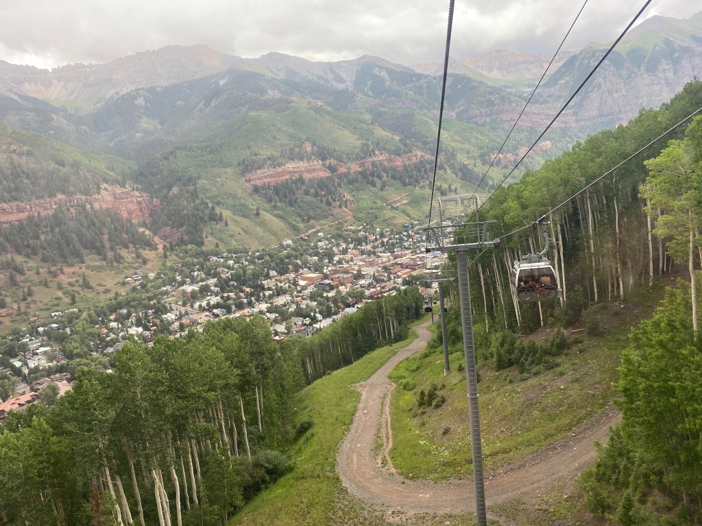
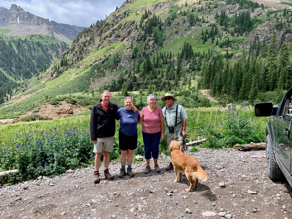
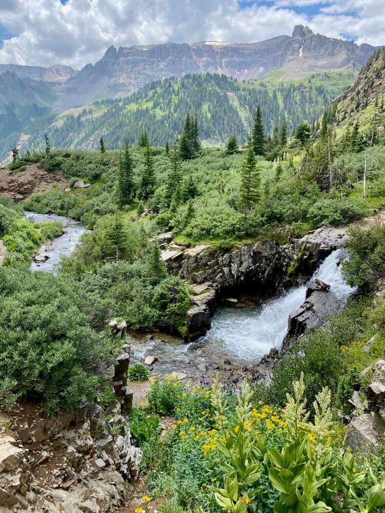
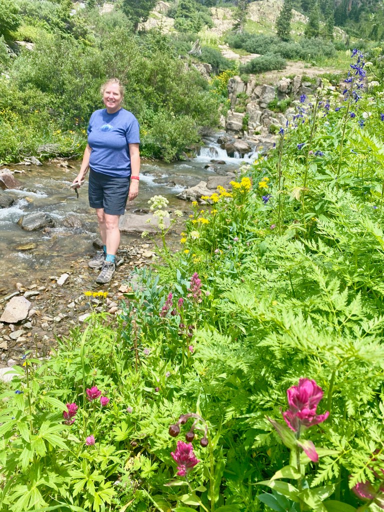
COLORADO SPRINGS, CO – This week we left the RV behind for a short trip over the Continental Divide to see our friends Bill and Sharron Evans in Montrose and to explore the picturesque mountain towns of Telluride and Ouray and the splendor of Yankee Boy Basin.
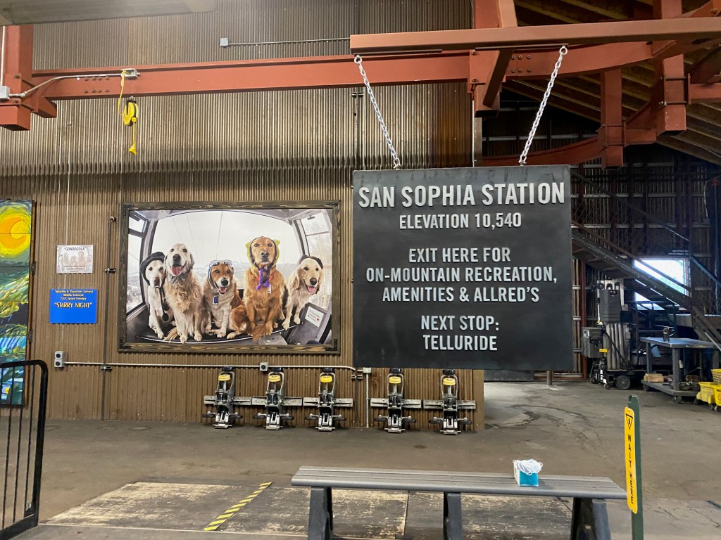
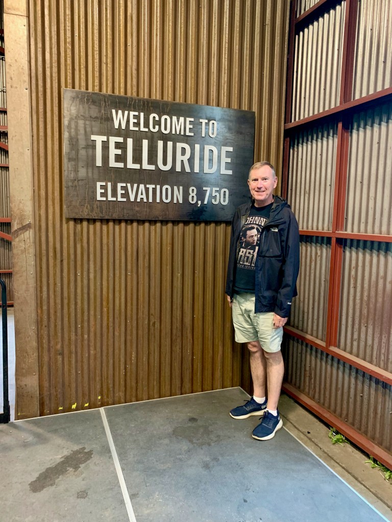
On Monday we spent most of the day in Telluride, eating lunch in town and then riding the free gondola up to the skiing area of Mountain Village. Telluride is a town of 2,000 tucked up in the San Juan Mountains at 8,750 feet above sea level. People there live in charming Victorian homes that are incredibly expensive. We didn’t meet any famous people but we did meet a famous dog! On the gondola ride, we shared our pod with a local lady and her dog, and as we passed through a station at the top of the mountain, she told us that it was her dog pictured on a giant promotional photo on the wall. (Her dog is the one on the far right, if I remember correctly.)
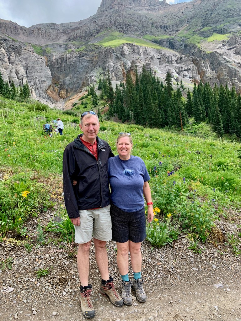
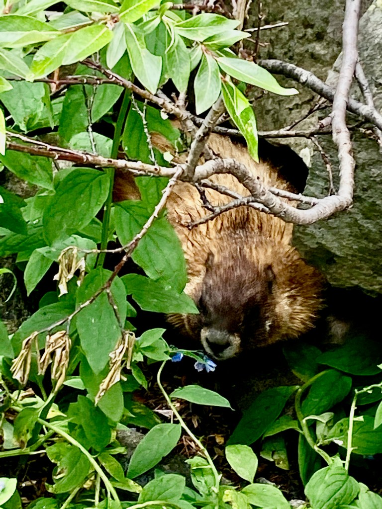
On Tuesday, we drove through Ouray on our way to Yankee Boy Basin. The basin lies above the town in the shadow of Mt. Sneffels and is accessible only by 4WD. We drove up to about 11,200 feet above sea level and enjoyed a lunch by the stream flowing down the basin. While we were eating, Elizabeth exclaimed that she could see something looking up at her from the brush below and that it had teeth. It turned out to be a harmless yellow-bellied marmot, a common animal in the high country.
On Wednesday on the way back, we stopped for three hours in the mountain town of Salida along the Arkansas River. We swam in the Salida Hot Springs and Aquatic Center— “the largest indoor hot springs facility in the country”—and then enjoyed lunch downtown at a rooftop restaurant overlooking the river. The river was busy with kids splashing in the whitewater and rafters making their way downstream.
***
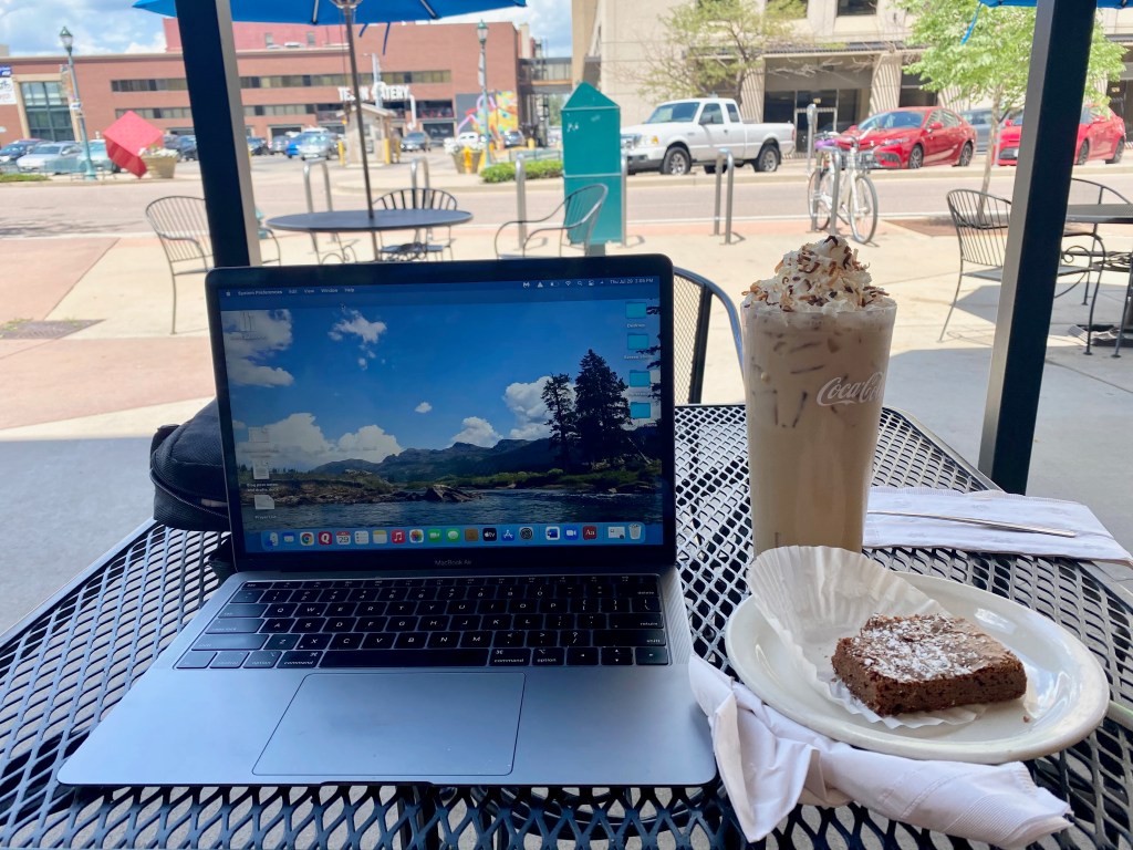
We’re back in Colorado Springs today and we plan to stick around until mid-August. We’ll enjoy our family here and seeing a few more friends we knew from when we lived here three decades ago. Last week Elizabeth and I drove the truck up Rampart Range Road, a 23-mile unpaved road from Colorado Springs to Woodland Park. We stopped along the way for views of the north side of Pikes Peak. We’ve also hosted Michael and his family at the RV for a campfire and smores. And if you’re ever in the Springs, the La Baguette Bakery & Cafe on Pikes Peak Avenue offers free wi-fi, $1.50 brownies, and discounted specialty coffee drinks from 2-4 p.m.!
Elizabeth and I recently watched the Oscar-winning movie “Nomadland” from an appropriate venue—inside our 30-foot travel trailer RV at a campground somewhere out West on our journey across the United States. The movie and the 2017 book of the same title tell the story of people living on the margins of society in aging vans, trailers and motorhomes trying to survive in modern America.
We both read the book beforehand and both agree that this is an unusual case where the movie is superior to the book it’s based on. The movie is not a classic, but well worth watching. Although the book is non-fiction, the movie follows the fictional character Fern as she interacts with the actual people profiled in the book, who are all traveling the American west seeking work and an affordable place each night to park their modest homes on wheels. (Like us, the nomads are “not homeless, just houseless.”)
What resonated from the movie was the beautiful cinematography of the western landscapes and the music that accompanied it. Like the Griswolds, Fern enjoys the California redwoods, the Arizona desert, mountain campgrounds, and even a dip in a mountain spring. People on the road were portrayed as friendly and helpful, just as we’ve experienced during our five months of traveling in an RV. We’ve seen these older RVs parked in campgrounds, on roadsides, under bridges, and on public lands during our travels.
The movie offers a sympathetic and fair view of the “nomads” at work. Fern and her fellow travelers manage to find employment at Wall Drug in South Dakota, in the Red River Valley sugar beet fields, and in seasonal jobs at a giant Amazon fulfillment center. The work can be demanding, but it offers the income and flexibility that seem to fit with their lifestyle. The nomad guru Bob Wells does express his disapproval of the American economic system, but such pronouncements are few in the movie.
Alas, the book is a mixture of good journalism and left-leaning ideology. Author Jessica Bruder faithfully chronicles the daily lives and struggles of the nomads. She even lives herself for a time among the nomads and works at some of the places that hire them. The biggest problem I had with the book was the author’s ideological inclination to generalize the plight of the nomads as a broader indictment of the American capitalist system.
Bruder quotes Bob Wells approvingly as saying the U.S. economy is like the sinking Titanic. The nomads have come to realize that chasing the American dream of a house and kids and career is nothing but a big con. The author cites debatable statistics that the American middle class is disappearing and that real wages haven’t budged in decades for half the American workforce. A central theme of the book is that the 2008-09 recession forced large numbers of people into nomadland by wiping out their retirement savings and forcing their homes into foreclosure.
While the stories the author tells are real and painful for those affected, they are not all that typical. As deep as the recession was, the stock market began recovering in March 2009 and within a few years it had recouped its losses from the recession. Housing prices recovered more slowly, but they too have been rising steadily for the past decade. A veteran financial advisor I know told me in an email that the nomads who lost all their savings in the 2008-09 recession (or the 2001-02 dot-com recession before that) are a special case:
The reality is that only two groups of investors were really wiped out during either of those downturns. The first were folks who had a massive amount of their investment in a single company. … The other group of people who were seriously hurt are the folks who couldn’t stomach the downturn and got out of the market. Inevitably when people panic and get out, it is usually too late to avoid most of the downturn but more importantly people are almost always too slow getting back into the market.
(Please see the excerpt below from his email for more detail.)
The book also paints a harsh picture of Amazon fulfillment centers. The company actively recruits what it calls “CamperForce” workers for seasonal employment in its warehouses, even arranging camping areas nearby for their RVs. The Nomadland author puts a negative spin on the arrangement, describing how many retirement-age nomads work shifts of 10 hours, walking 15 miles on concrete floors, stooping, squatting, and climbing stairs, all to enable the company to meet the holiday rush. She describes the Amazon encampments as “more like microcosms of a national catastrophe.”
The book misses the mutual benefits the arrangement offers to both Amazon and the nomadland workers. The work is hard, but competitively compensated. The workers enjoy comradery in the campground as well as the company lunchroom. The work fits their nomadic lifestyle while supplying needed seasonal labor for the company. The movie shows a much more benign and accurate picture of the Amazon experience than the book.
A big irony of Nomadland is that just about the time the book came out, in 2017, the American labor market was shifting into high gear, with the unemployment rate dropping below 4 percent and wage gains accelerating up and down the income scale. The book is more descriptive of Obama’s America than Trump’s America (pre-COVID). While the left-leaning author would be loathe to admit it, her critique of the American economic system as being rigged against the middle and working classes echoes a major theme of Donald Trump’s campaign in 2016—a theme that I’ve questioned in previous writings.
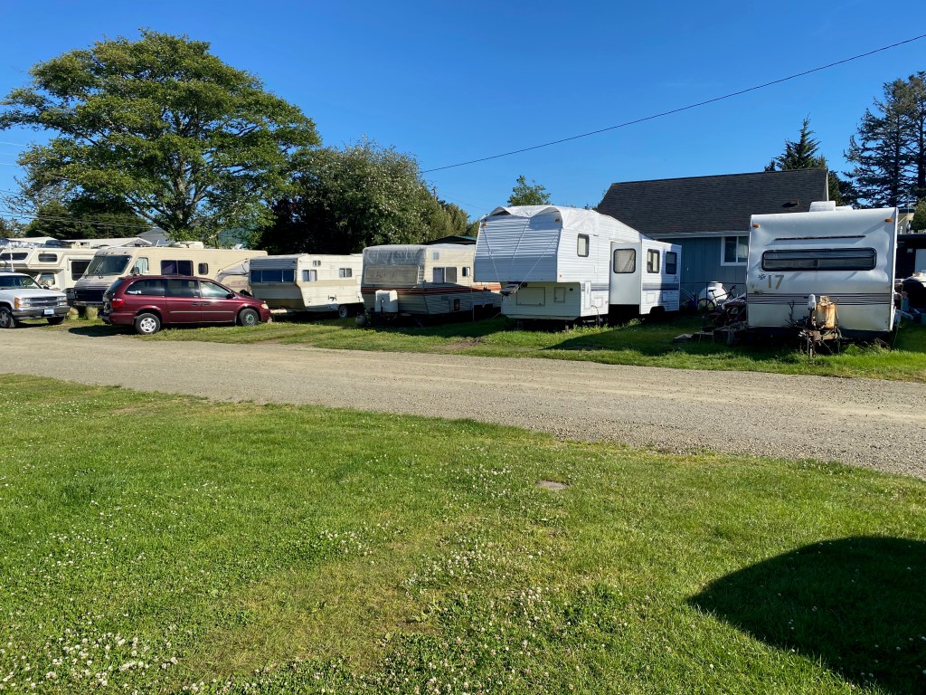
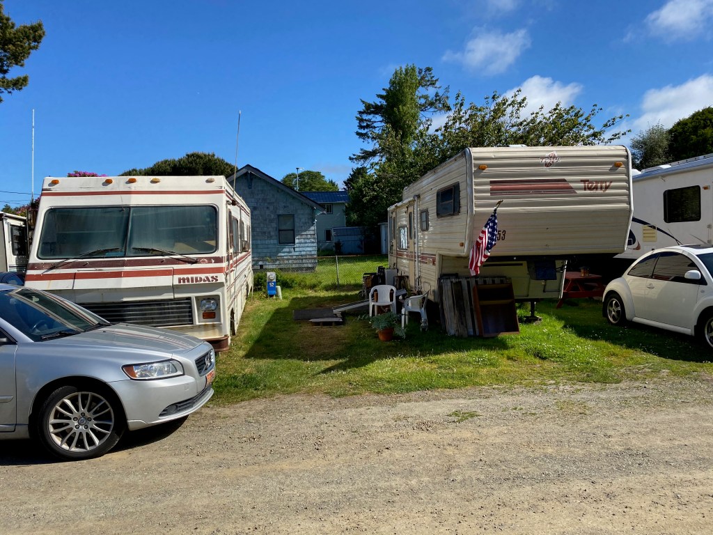
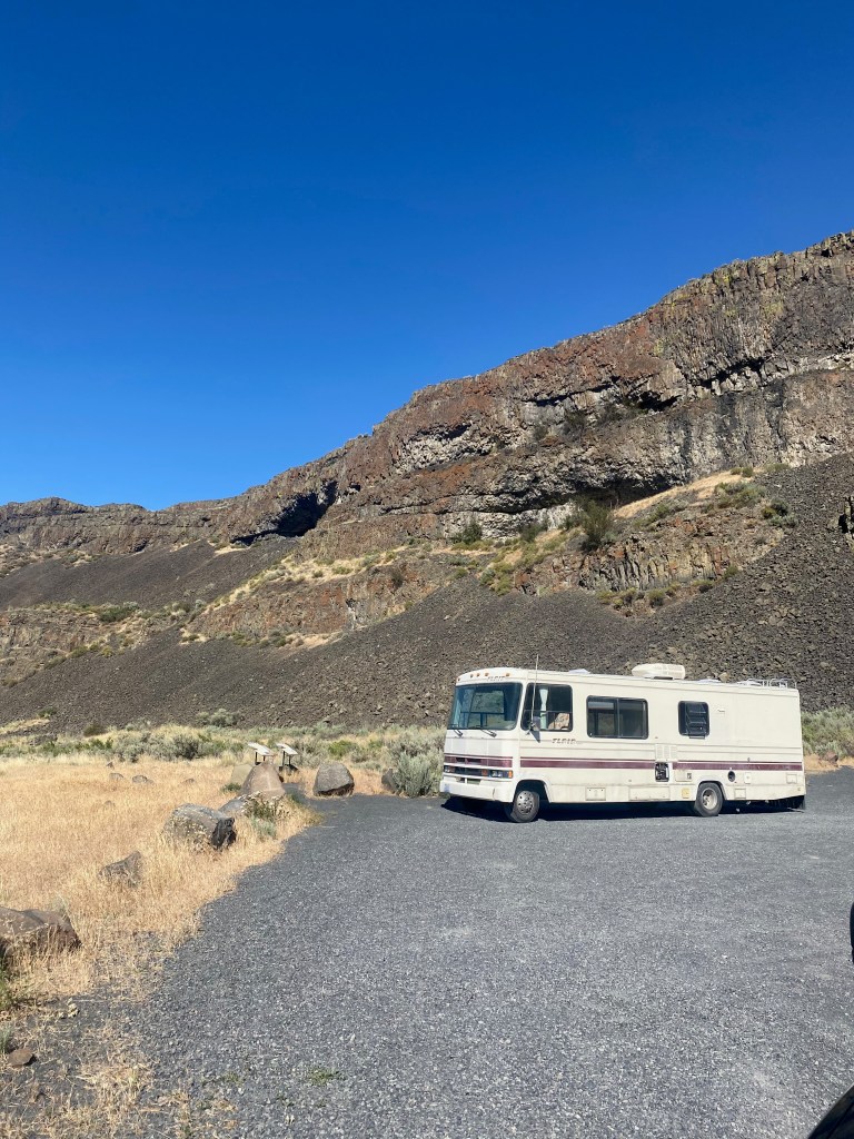
From our current vantage point, Elizabeth and I probably see more of these folks than does the average American. We sometimes meet them casually in the RV parks where we’re staying, or we see their typically beat up RVs parked along the wayside without any hookups for electricity, water, or sewer. (See photos below.) Unlike the nomads, we don’t need to worry about earning income for food and gas. As the Nomadland author writes, we’re among the “… retirees tootling idly around America, sightseeing and enjoying the relaxation they earned after decades of employment. RV, after all, stands for recreational vehicle.”
None of this means we should be unsympathetic to the people living on the margins in their RVs. People fall on hard times for all sorts of reasons, including addiction, mental health issues, bad financial decisions, family breakup, hard upbringings, and simple bad luck. It does mean we should be cautious about reading too much into the phenomenon. No matter what the current economic conditions, the people of nomadland will always be among us.
***
A financial adviser’s view of the impact of the Great Recession of 2008-09 on the personal savings of Americans:
“I haven’t read (or seen the movie) Nomadland but I am generally familiar with the storyline. In general, the 2008-2009 recession/financial crisis did do a lot of damage to many people’s portfolio. The reality though is that being “wiped out” means very different things to different people. For many people having an $800k portfolio cut in half and losing $400k would be considered being wiped out by the downturn and that was very common if someone was invested 100% in stocks (as it was in 2000-2001 during the dot-com crash). Behavioral finance research tells us that folks are much more bothered by losses than they are made happy by gains. You definitely see that in the market where people view a 50% downturn in the market as a once in a lifetime crisis event, but see 15% – 20% annual gains for three years in a row as the normal condition. In fact, both of those are historically normal, but not consistent, events for the stock market.
“The reality is that only two groups of investors were really wiped out during either of those downturns. The first were folks who had a massive amount of their investment in a single company. This happened to a good number of people either through chasing a single hot investment (think Enron or Worldcom or pets.com in the 2000 timeframe or collateralized mortgage obligations in 2008) or by 401k investors who had a significant portion of their portfolio in their own company stock (many companies would provide the entire match in company stock and people were slow to diversify – Wachovia bank comes to mind).
“The other group of people who were seriously hurt are the folks who couldn’t stomach the downturn and got out of the market. Inevitably when people panic and get out it is usually too late to avoid most of the downturn but more importantly people are almost always too slow getting back into the market. For people that bailed out in 2009, if they couldn’t bring themselves to get back into the market until 2012 or 2013 then they missed out on a huge recovery of the market. The same thing happened last year. Really the only folks hurt by the pandemic market downturn were folks who panicked and sold their holdings in March and then waited until July or August to get back in.
“In my mind, what was really extra bad about 2008-2009 was a combination of demographic and emotional factors. With the bulk of the baby-boom generation getting close to (or at least beginning to consider) retirement, much of that temporarily lost wealth had the effect of changing minds about short to medium term plans which resulted in more panic behavior. Also, the slow gradual recovery from that recession didn’t allow people to feel the exuberance that normally comes with a typical more rapid recovery which delayed (or in some cases permanently stopped) the return to investing in the stock market. It isn’t unlike the lifelong frugality that many of our parents adopted as a result of living through the extended Great Depression.”
COLORADO SPRINGS, CO – On our way through Wyoming to Colorado last week, we stopped for a couple of nights in Thermopolis, home to what its Chamber of Commerce calls “the world’s largest mineral hot springs.”
During our time there, we enjoyed thepools and waterslides at the Star Plunge Water Park. It costs $15.50 per person for an all-day admission, but it seemed a good value to us. It offers two big pools, one indoor and one outdoor, both fed by the hot springs and kept at a comfortable 98 degrees. I took two thrilling rides down the big, outdoor waterslide and a jump off the high dive. I spent five minutes in the vapor cave, a natural sauna heated to 114 degrees by a fountain fed by the hot springs. The next morning I soaked for 20 minutes in the pool at the nearby Hot Springs State Park, which is more basic than the commercial water park nearby, but it’s well-maintained and free.
The small town also hosts the Wyoming Dinosaur Center, where I spent an interesting couple of hours exploring the exhibits on earth history and the fossil records and looking up at the impressive dinosaur skeletons in the main hall. If you’re into dinosaurs and paleontology, this is one of the world’s top centers. (You can even sign up to participate in an archeological dig nearby.)
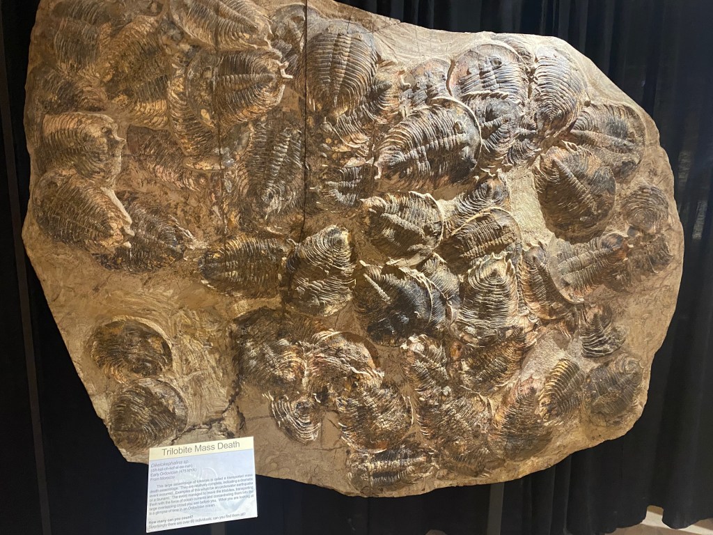
A large fossil from Morocco showing a trilobite mass death.
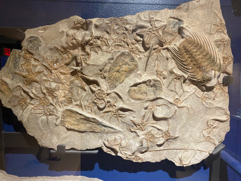
“Trilobite and friends,” a fossil from the same area and around the same time period.
In the main hall.
***
We arrived in Colorado Springs on Saturday afternoon. We’re staying for a few weeks at the Golden Eagle Campground, off State Highway 115 about 10 miles south of downtown. We lived in the city from 1983 to 1985, when I was editorial page editor of the local daily newspaper, the Gazette Telegraph. All three of our kids were born here and our son Michael and his young family live in town. During our stay, we plan to enjoy equal parts hiking and sightseeing in Colorado and also spending time with Michael, Lizzy and our grandson Max and friends we know from our happy years in this place.
RED LODGE, MT – We’re enjoying a week with our son Michael and his family at a KOA campground northeast of Yellowstone National Park, backpacking in the park, marveling at the geysers and hot springs, and spotting a bear, a wolf, and lots of bison.
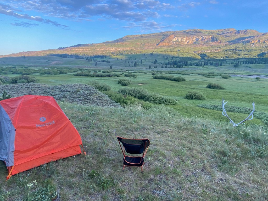
On Thursday, Michael, our daughter-in-law Lizzy and I backpacked 8.3 miles up Slough Creek in the northeast section of Yellowstone Park. We stayed overnight at a campsite on a hill overlooking the valley and the two bison bulls content to graze on the other side of the creek. We walked down to the creek that evening to get a closer look at the bulls, and then on Friday on the way back, we swam in the creek’s swift and cool waters near another campsite about halfway back. (Check out the video of me and Michael riding the current.) Near our campground we found the skull and antlers of a 10-point elk.
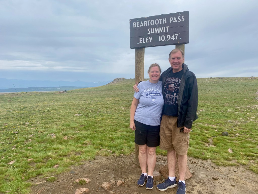
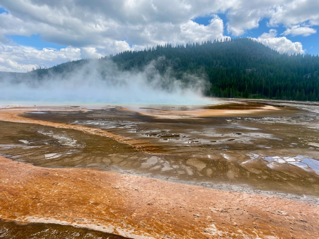
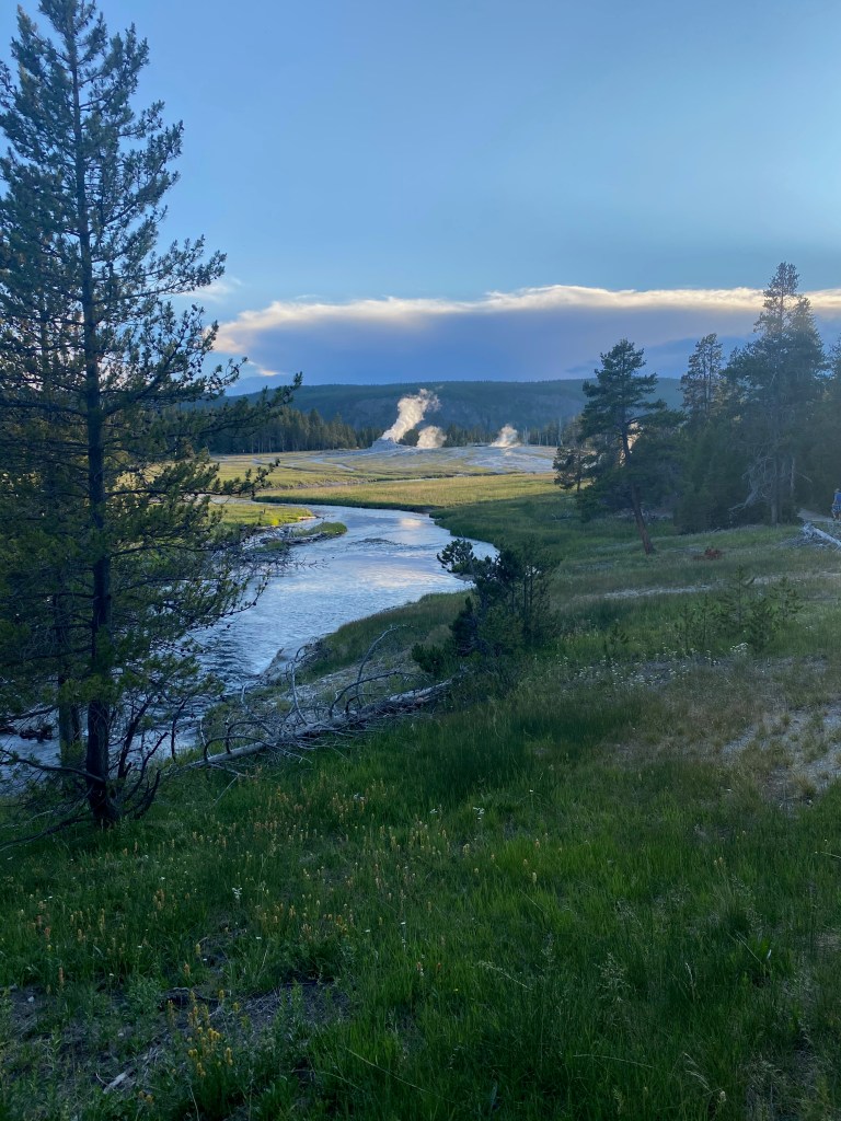
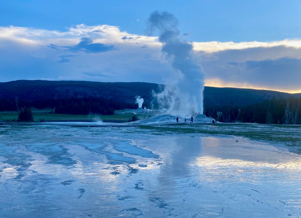
Yesterday, we all drove over 10,947-foot Beartooth Pass and through the Northeast Entrance to spend a full day seeing the more popular geothermal sites of Yellowstone. Highlights were the Mammoth Hot Springs, the Grand Prismatic hot spring, and Old Faithful and other nearby geysers. The roads and parking lots were crowded, but we managed to find a place for the truck at each stop and we didn’t mind the crowds on the trails and boardwalks. They were a wonderful mix of American families and international tourists.
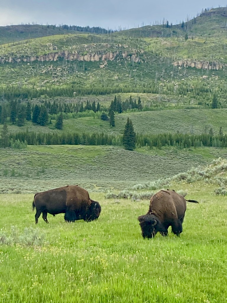
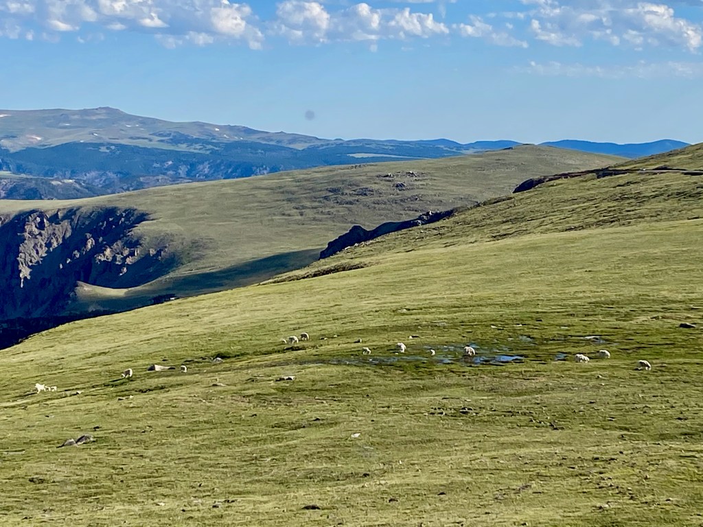
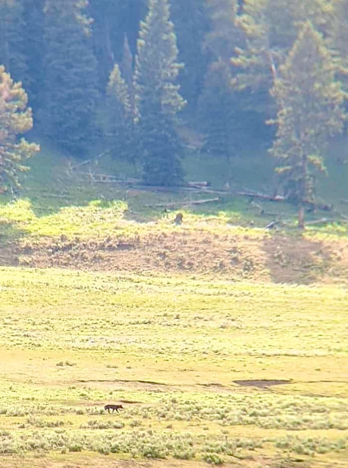
During our two excursions into the park, we also spotted lots of bison and other wildlife. On the way to our backpacking trip, we saw mountain goats near Beartooth Pass and hundreds of bison along the Lamar River and its confluence with Soda Butte Creek . Lizzy also spotted a wolf running along the hillside above the bison and took the photo below through their 10-power binoculars. We also spotted the striped backside of a badger heading into the brush as we were leaving the Slough Creek trailhead after our hike.
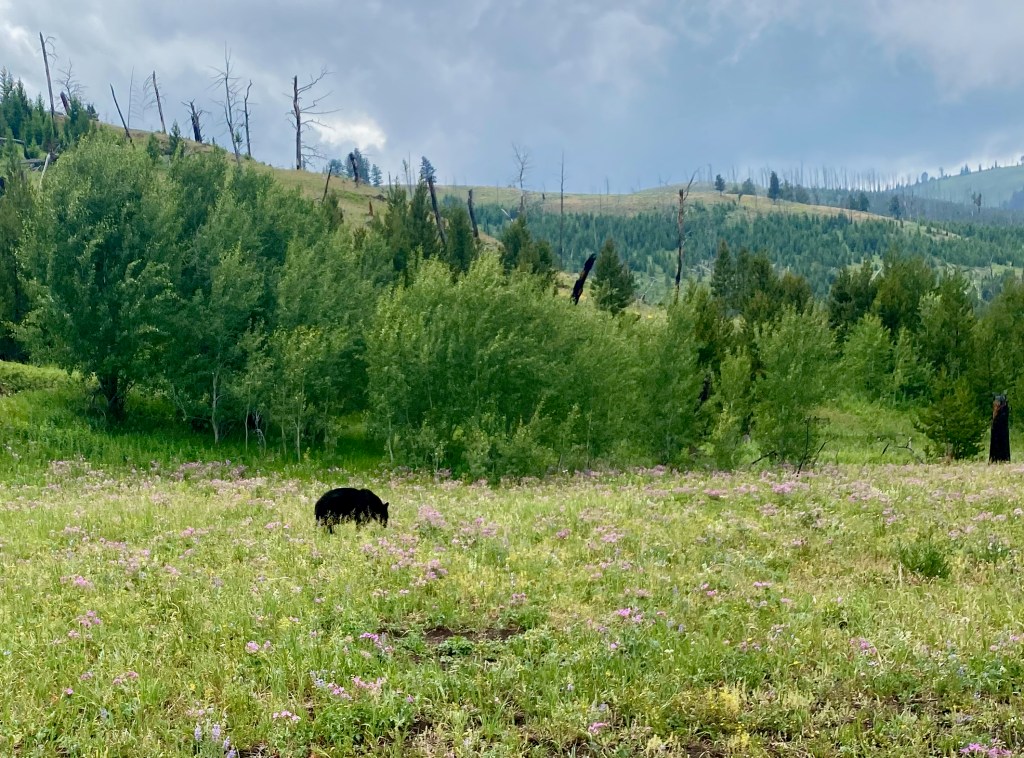
As we entered the park yesterday, we decided the three animals we had yet to spot that we really wanted to see were moose, bear, and elk. The park ranger at the entry station raised our expectations when she said, “The critters are out today!” Sure enough, shortly after entering the park, we spotted a lone moose standing in the woods. Further on, a medium-sized black bear crossed the road in front of us. And later in the day we saw a small group of elk running in the distance through the woods. (I could only get a photo of the bear, and that was from a moving car and at a distance.)
***
Tomorrow (Wednesday) we break camp to head to Colorado Springs for a few weeks to enjoy summer near the mountains and family and friends in the state. After visiting 18 national parks, staying in 42 different campgrounds, and towing the RV 6,627 miles since February, we’re ready to plop down in one place to just call home for a while.
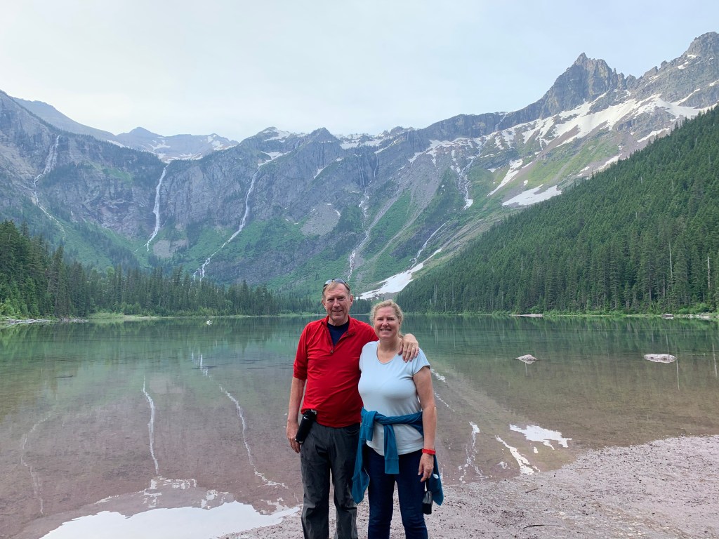
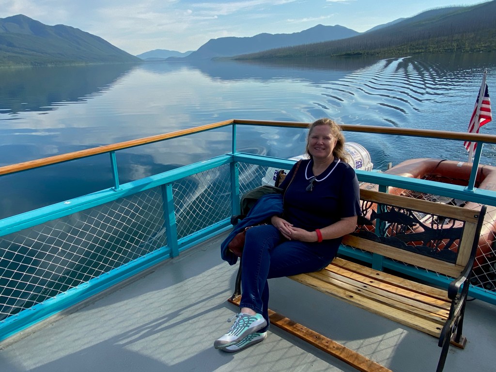
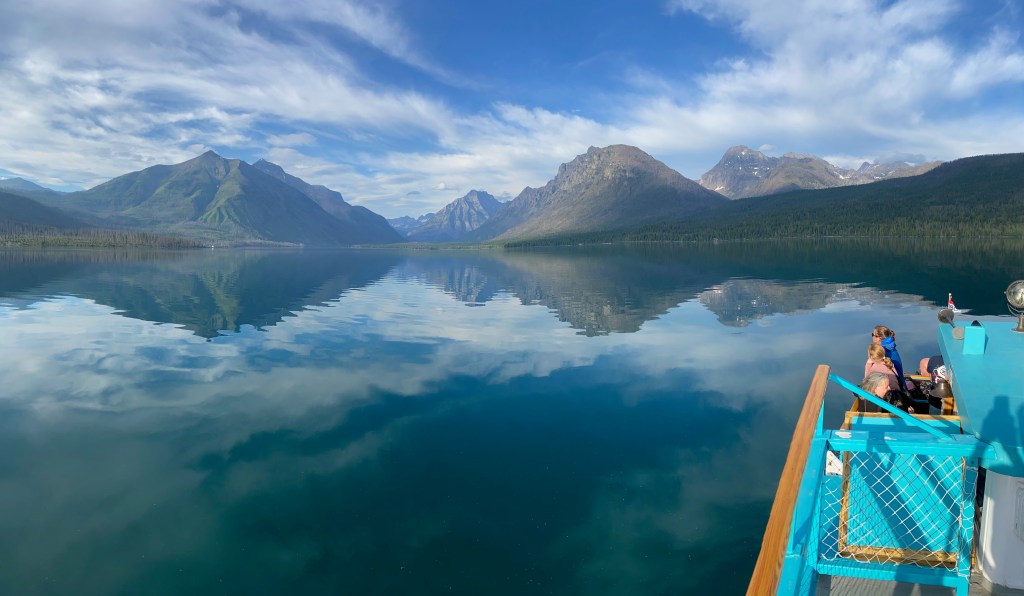
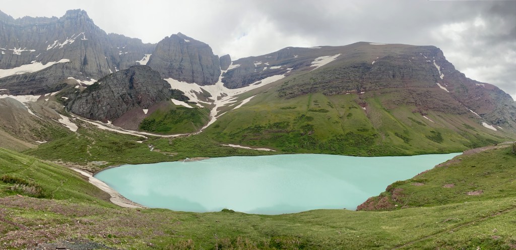
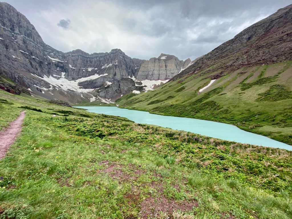
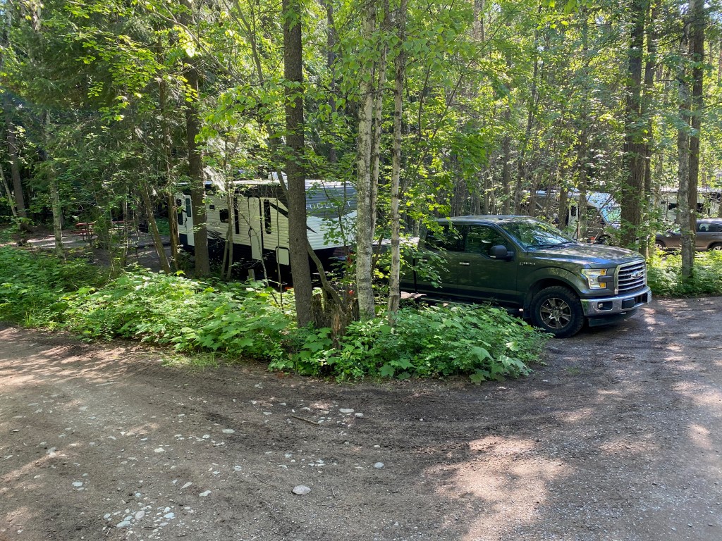
WEST GLACIER, MT – We arrived on Monday at Glacier Campground three miles outside the main west entrance to Glacier National Park. So far we’ve seen a black bear up close, hiked to a couple of glacial lakes, and joined a boat tour for an hour on Lake McDonald. And we’ve enjoyed our wooded RV campsite, even with its extra challenges.
On a boat tour of Lake McDonald in Glacier N.P.
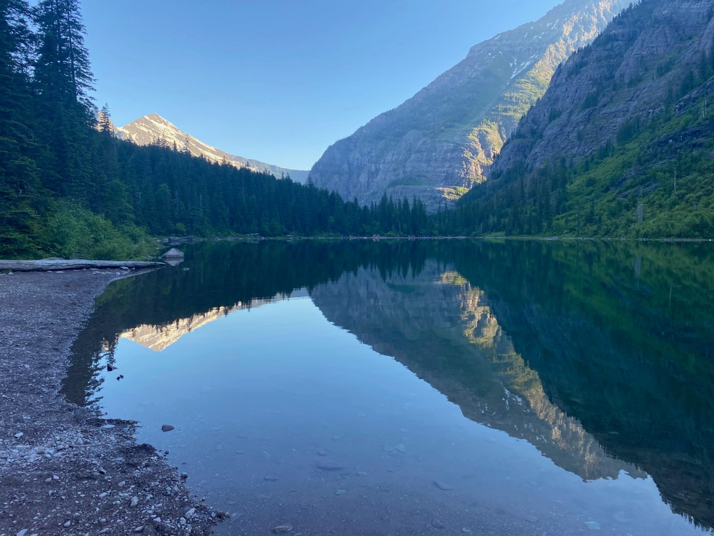
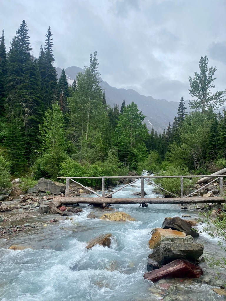
On Wednesday, Elizabeth and I were up early to drive into the park to the trailhead for Avalanche Lake. Because of high demand, Glacier N.P. currently requires a special day permit to enter the park between 6 a.m. and 5 p.m., as well as the normal park pass. Since we weren’t able to get a coveted day pass, we left the RV at 5:15 a.m. and drove into the park before the entry station opened. The trail to Avalanche Lake is about 2.3 miles long each way with 500 feet of elevation gain. The lake lies in a glacier-carved basin with water tumbling down from the glaciers that remain at the top of the rim.
On the way up, we encountered a medium-sized black bear not far from the trail. As you can see from Elizabeth’s video, the bear was ambling in my direction until something made the bear scamper back from the trail. (Here’s my own video that I shared on FaceBook.)
Later that day, we drove to the Lake McDonald Lodge to catch a one-hour boat tour of the 10-mile long, 400-foot deep glacial lake, the largest in the park. The boat held about 40 people and was captained by a young lady who I am sure was no older than about 26. A young man named Ethen provided commentary and answered questions about geology, glaciers, recent fires, and the native Blackfoot Indians.
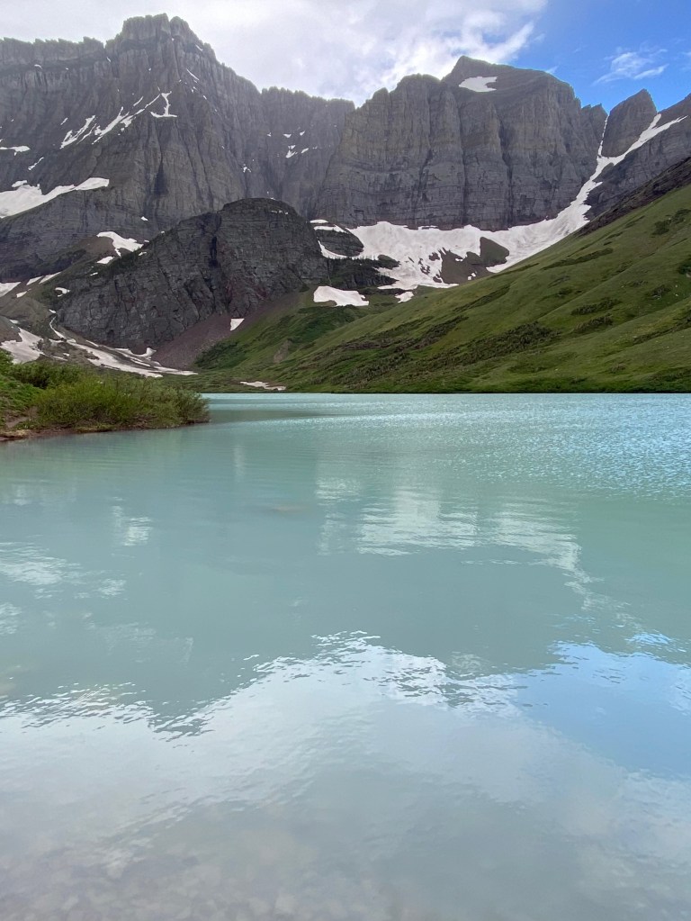
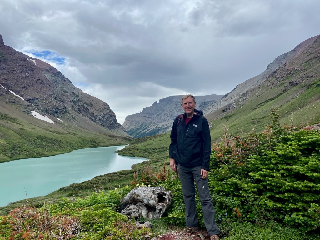
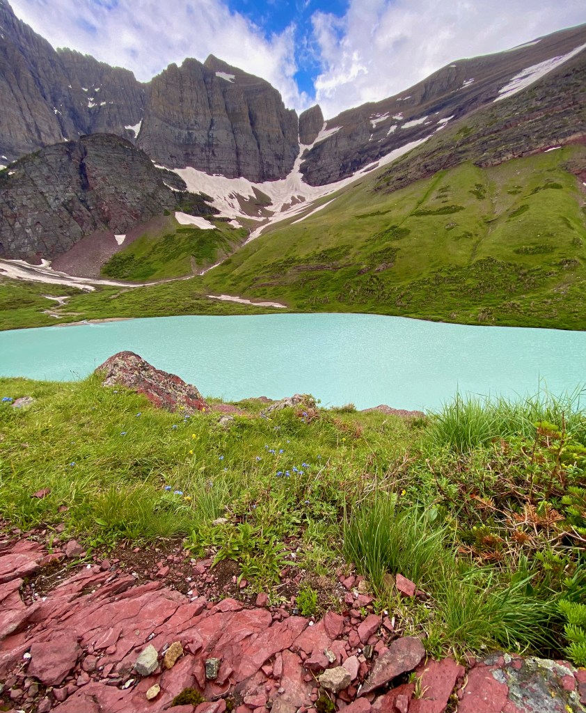
On Thursday I was up even earlier to drive on my own to the east side of the park, where I hiked 6.1 miles one-way through the woods and along the rushing Canyon Creek to the aqua blue Cracker Lake. The lake is nestled in another glacial bowl 6,000 feet above sea level and with about 1,100 feet of elevation gain from the trail head. I crossed a couple of small log bridges and then across several ridges above timberline before coming to the spectacular sight of the lake. I lingered there for almost an hour, looking out on the lake and the peaks 3,000 to 4,000 feet above it. The water draws its color from the small flakes of rock ground by glaciers, known as “glacial flour,” that reflect back blue and green light. I was joined in my time there by several more arriving hikers, and a well-fed yellow-bellied marmot, who didn’t seem to mind us being in his space.
Slideshow: 1) At the shore of Cracker Lake, with rocks visible through the “glacial milk”; 2) the yellow-bellied marmot who joined the hikers at the overlook; 3) looking toward the foot of the lake; 4) blue wildflowers, a blue-green lake, and blue sky; 5) a pano shot from the side of the lake; 6) approaching Cracker Lake; 7) a bridge across Canyon Creek along the lake trail.
On the way down, I was asked by several hikers heading up, “How far is it to the lake?” This can be a tough question, especially when I’ve already come a long way down, because I don’t always know the miles I’ve covered, but I also don’t want to discourage hikers that still have a long way to go. When one couple that was still far from the top asked me the question, I said they still had a ways to go, and then in a Yogi Berra moment I reminded them, “Half the journey is getting there!” (I think I was trying to say that the journey itself is half the experience.)
***
Glacier Campground where we’re staying bills itself as “the way camping used to be.” This is mostly to our benefit. Our camping spot, F5, is a back-in spot, which offers more privacy and woods on three sides, but it also requires that I back our 30-foot trailer into a narrow spot, a skill that I am still developing! And the campground is “partial hook-ups,” which means we’re plugged into water and 30-amp electrical power, but no wastewater hookup. I’ll spare the details for now, but that means every couple of days, we need to empty our gray water tank (which collects drainage from the sink and shower) and our black water tank (which collects from the toilet) into a portable, plastic tote tank and haul it to the campground’s “dump station” to empty. A park employee driving by while we were in the process remarked wryly that this is “the underbelly of camping.”
COULEE CITY, WA – We spent a few days near this town in eastern Washington State last week exploring and enjoying a landscape that geologists came to understand only in the middle of the last century had been shaped by cataclysmic Ice Age floods thousands of years ago.
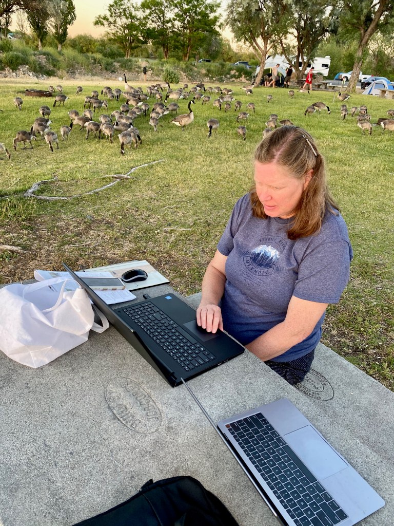
We stayed three nights at the RV campground in Dry Falls/Sun Lakes State Park, about 6 miles from Coulee City and 3 hours east of Seattle. The park was buzzing with families in tents and RVs of all sizes enjoying the waters of Park Lake. The only downside of the park was a weak cellular signal and no wi-fi, which required us to visit a park in the city, where we were joined by a large flock of geese!
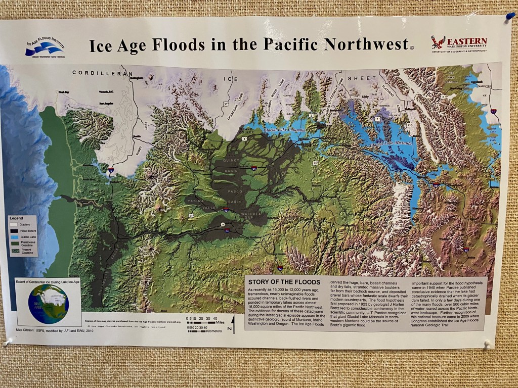
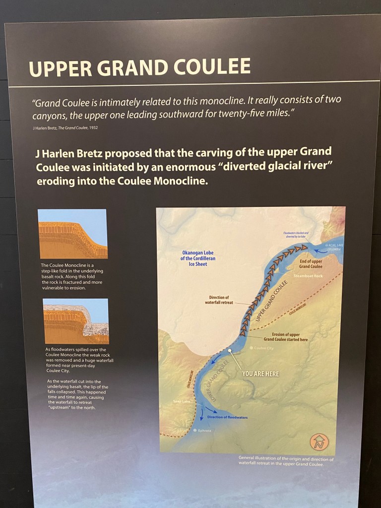
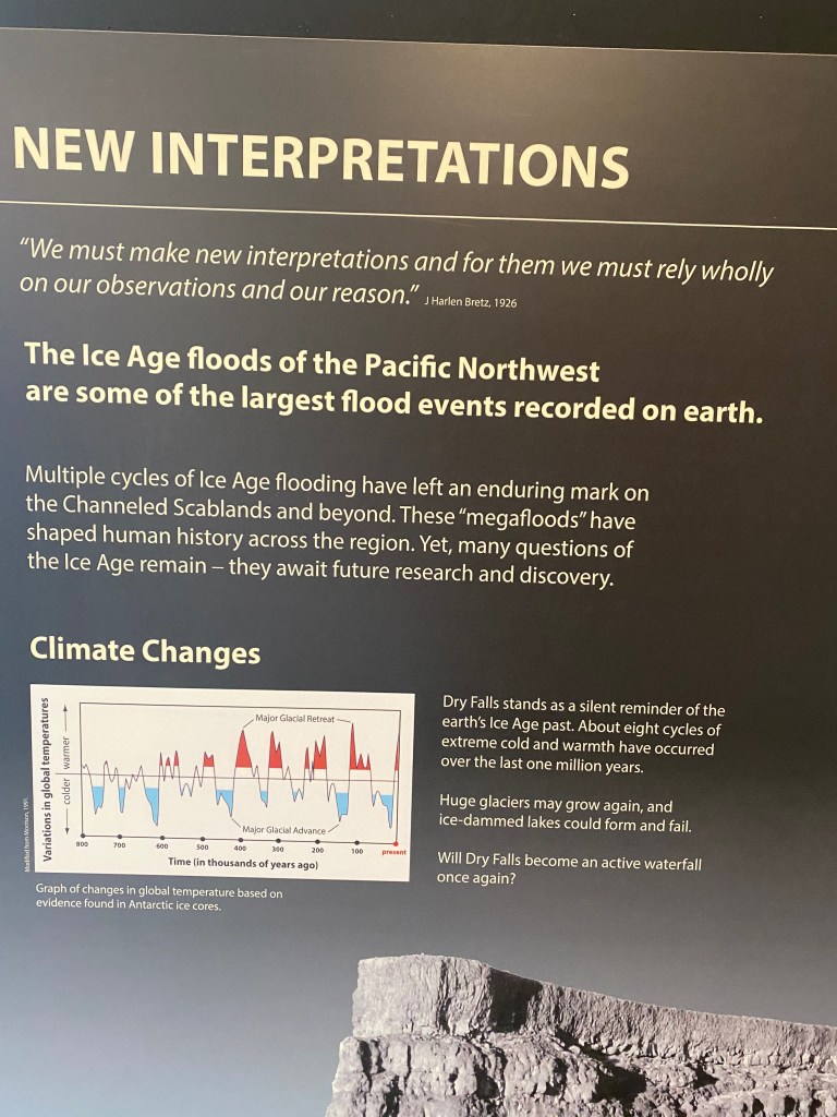
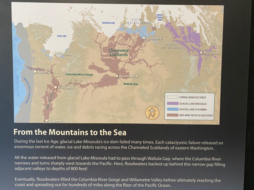
Our travels through eastern Washington have opened my eyes to the story of the massive Ice Age floods. In the early 1920s, a geologist named J. Harlen Bretz (1882-1981) began exploring the region’s strange landscape. He noticed geological features, such as deeply carved coulees, bore holes, and what he called Channeled Scabland that could only be explained by some kind of gigantic, raging flood. When Bretz published his theory, it was met with skepticism and even scorn by his fellow geologists. But he was vindicated when another geologist noted the evidence for a giant Ice Age flood originating in Montana.
During the last big ice age, from roughly 18,000 to 11,000 years ago, the Cordilleran Ice Sheet covered western Canada and the upper northwest United States. An extension of the ice sheet, the Purcell Trench Lobe, extended into northern Idaho, blocking the Clark Fork River and creating a huge reservoir of water behind it, known as Glacial Lake Missoula. The lake was as deep as 2,000 feet and at its maximum build up contained 500 cubic miles of water, half the volume of Lake Michigan.
As pressure from the rising lake would build, the ice dam would give way, releasing the water in a violent torrent that would race at 60 mph across eastern Washington, through the Columbia River Gorge and into the Pacific Ocean. The entire lake would drain in two days, and the process would begin again, repeating the massive flooding 30 or 40 times over the course of the ice age.
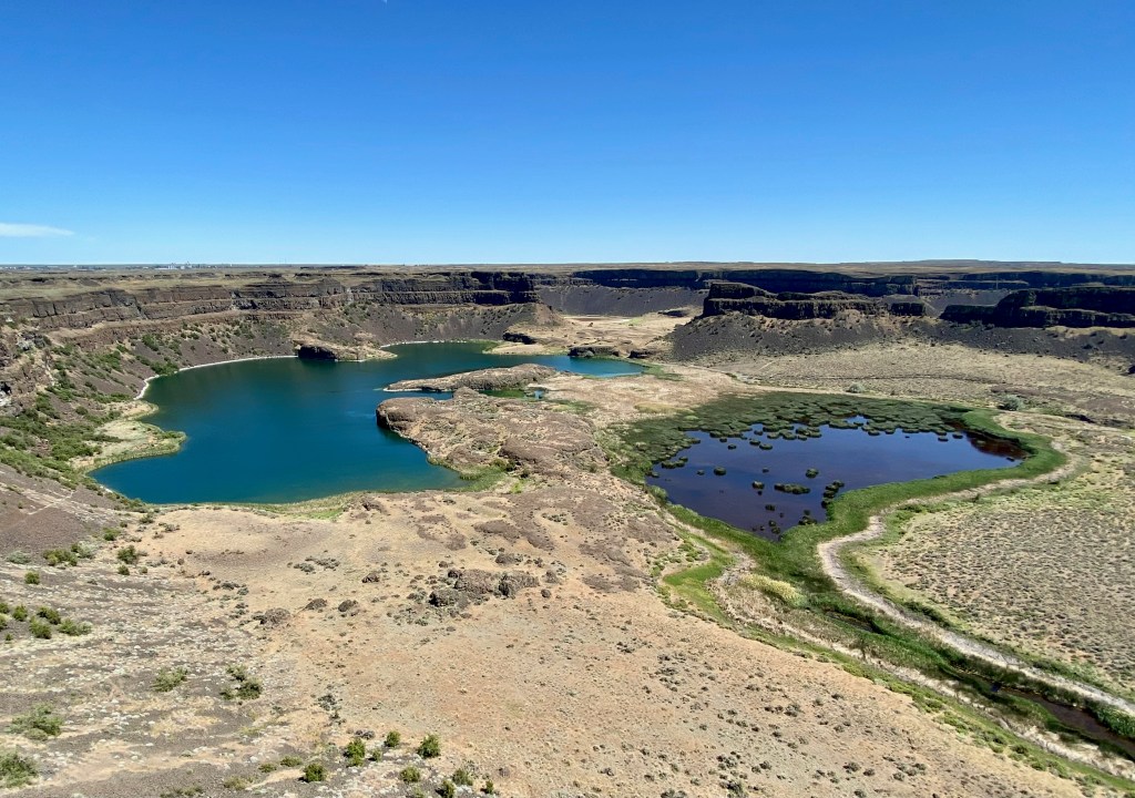
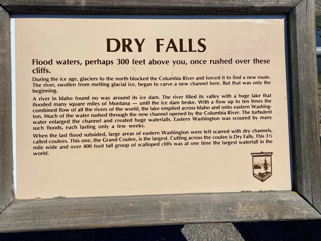
We could see the evidence of the floods first-hand. Our campground was only a short distance from Dry Falls, a 400-foot-high, 3 ½-mile long drop off that at one time was the largest waterfall in the world. Geologists estimate that the volume of water that spilled over the falls during one of the ice age floods was about 10 times the combined discharge of all the rivers in the world! Today all that is left around Coulee City are the dry walls and a string of peaceful lakes fed by the local aquifer.
This is the view from the excellent visitors center looking out at the Dry Falls and the lakes below.
South of our campground are the Lenore Caves, which were carved into the sides of the coulee by the Ice Age floods.
A good source of information for me was the website for the Ice Age Floods Institute. I also learned a lot from the panels at the Dry Falls Visitors Center: