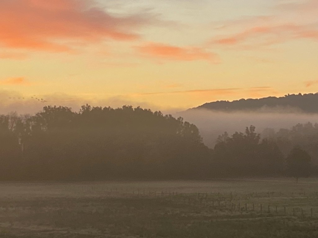
DAWSON, W. Va. — Our campground is located on a ridge in the south central part of this scenic state just off Interstate 64 about 20 miles west of Lewisburg. We’re treated to nice sunrises over the fields to the east and sunsets behind the wooded hills to the west.
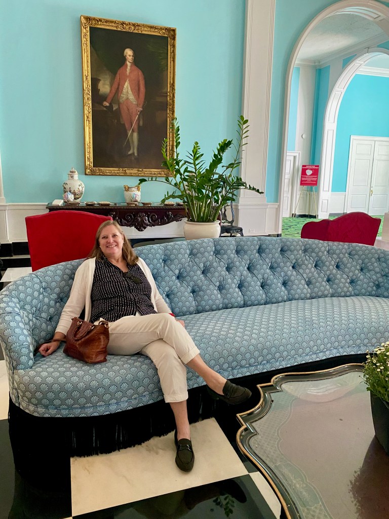
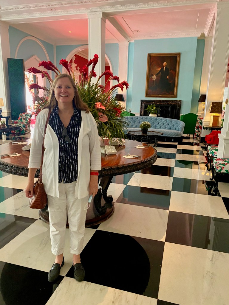
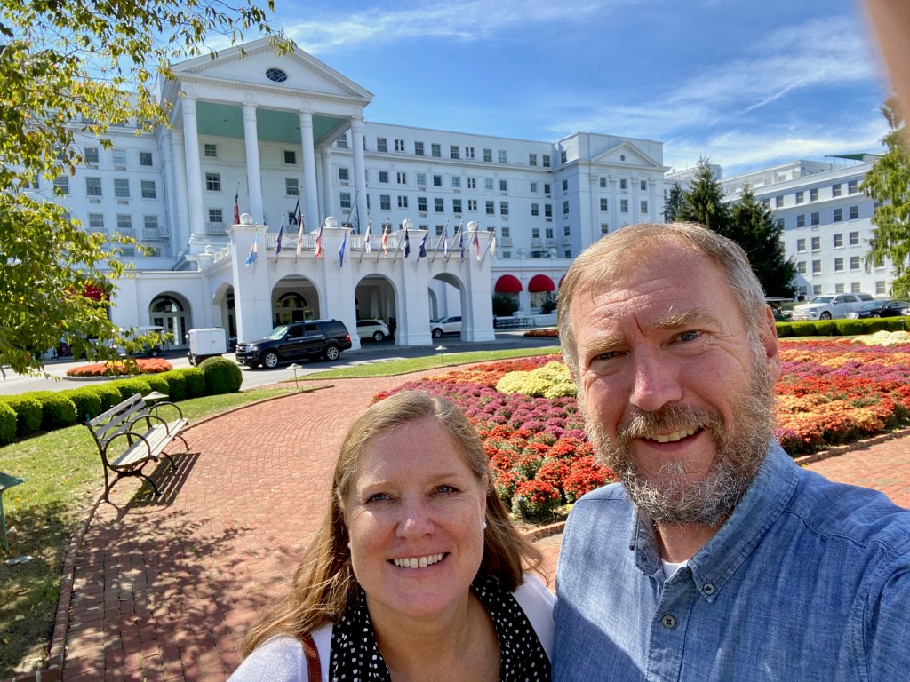
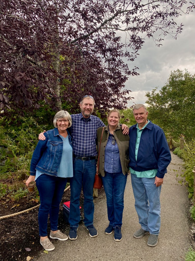
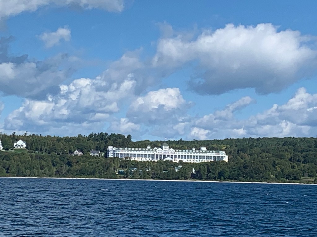
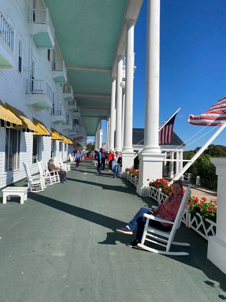
On Sunday afternoon, after attending a local church, we strolled the grounds of the Greenbrier in White Sulphur Springs. We’d never been to this famous resort even though we’ve lived next door in Virginia for more than 20 years. It reminded us of the Broadmoor Hotel in Colorado or the Grand Hotel in Michigan, but with a distinct southern decor and atmosphere. (Elizabeth is looking a bit too much at home in the photos, don’t you think?) When we stopped at the security gate to enter, one of the young men smiled when we said we we’re the Griswolds. This isn’t the first time on our trip that our surname has been a source of amusement!
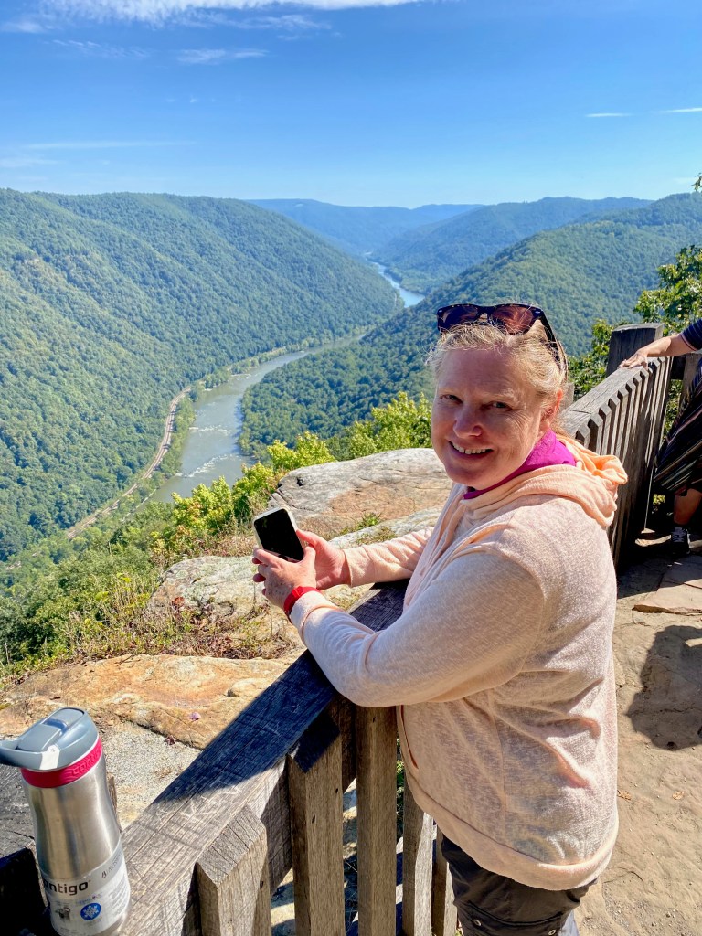
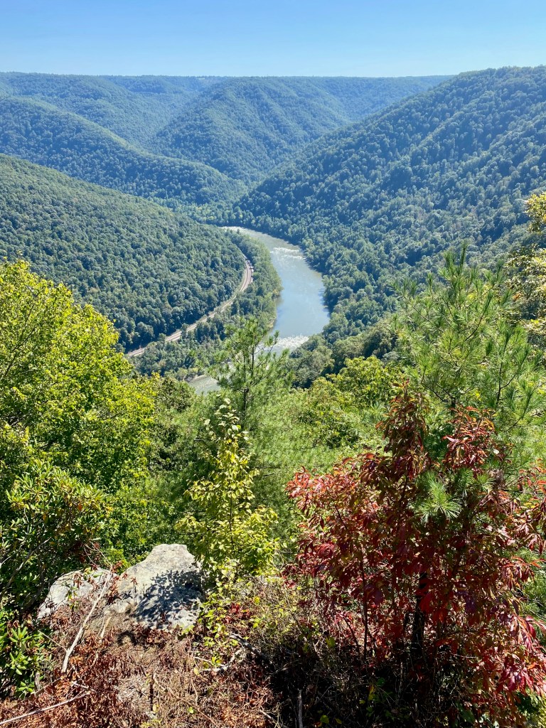
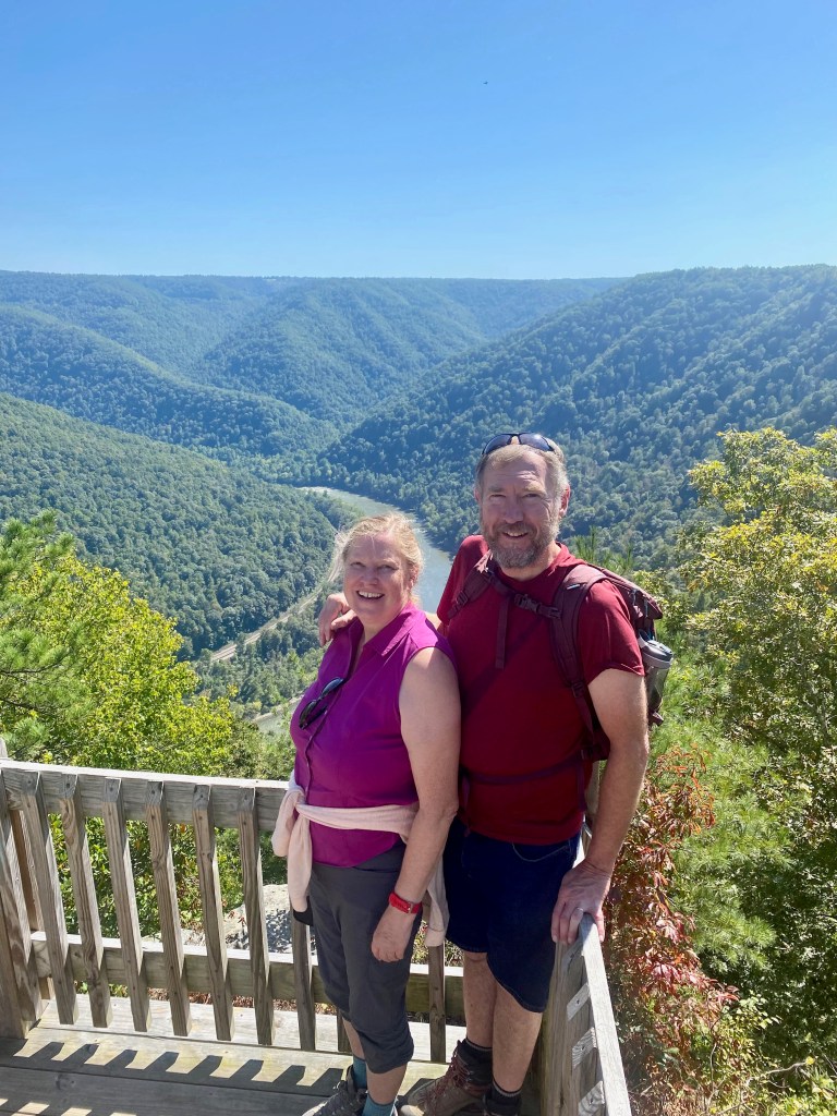
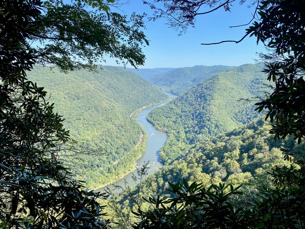
On Monday, we hiked along the rim of the New River Gorge, America’s newest national park. From the Grandview overlook, we gazed down on the river 1,400 feet below. Then we hiked 1.5 miles out and back along the Grandview Rim Trail to the Turkey Spur Overlook, where we could see the river flowing one direction before us and the other direction behind us. The Castle Rock portion of the trail took us alongside steep sandstone cliffs bending out over the trail. The day was clear and in the 70s, but shaded most of the way.
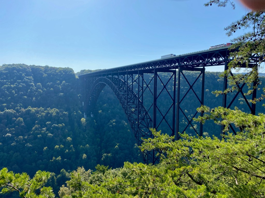
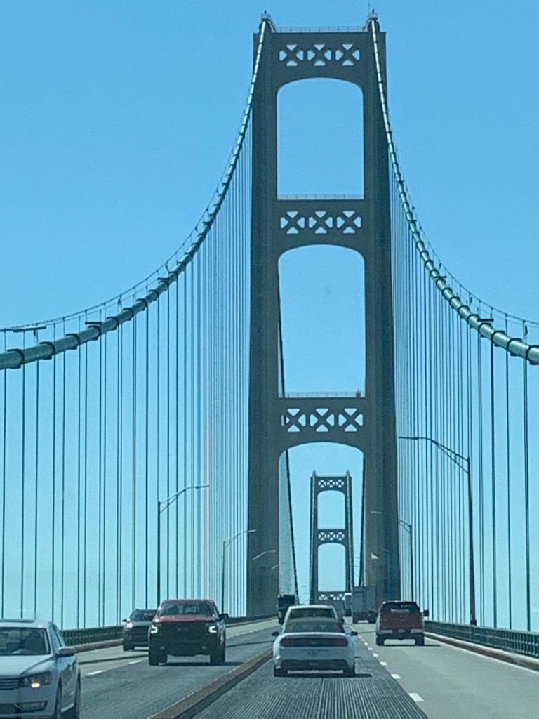
On the north end of the park, near Fayetteville, we crossed the New River Gorge Bridge and then looked up in wonder at its immense arch at the lookout at the Canyon Rim Visitor Center. Opened in 1977, the bridge is billed by the park service as “a work of structural art — the longest steel span in the western hemisphere and the third highest in the United States.” It’s the second time in two weeks that we’ve crossed a bridge billed as “the longest of its type in the hemisphere.” (The Mackinac Bridge is the other.)
Providing background music for this leg of our journey has been “Take Me Home, Country Roads,” by John Denver. West Virginia’s beautiful rivers and wooded mountains give it as good a claim as anywhere we’ve seen to be “almost heaven,” and its country roads are taking us home to the place where we belong.
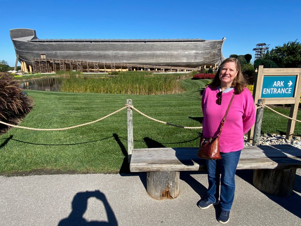
DAWSON, W. Va. – On our way from Michigan to West Virginia last week, we encamped for a few days in the southwest corner of Ohio, where we trekked across the Ohio River for day trips to the Creation Museum and the nearby Ark Encounter in neighboring Kentucky.
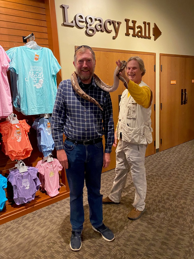
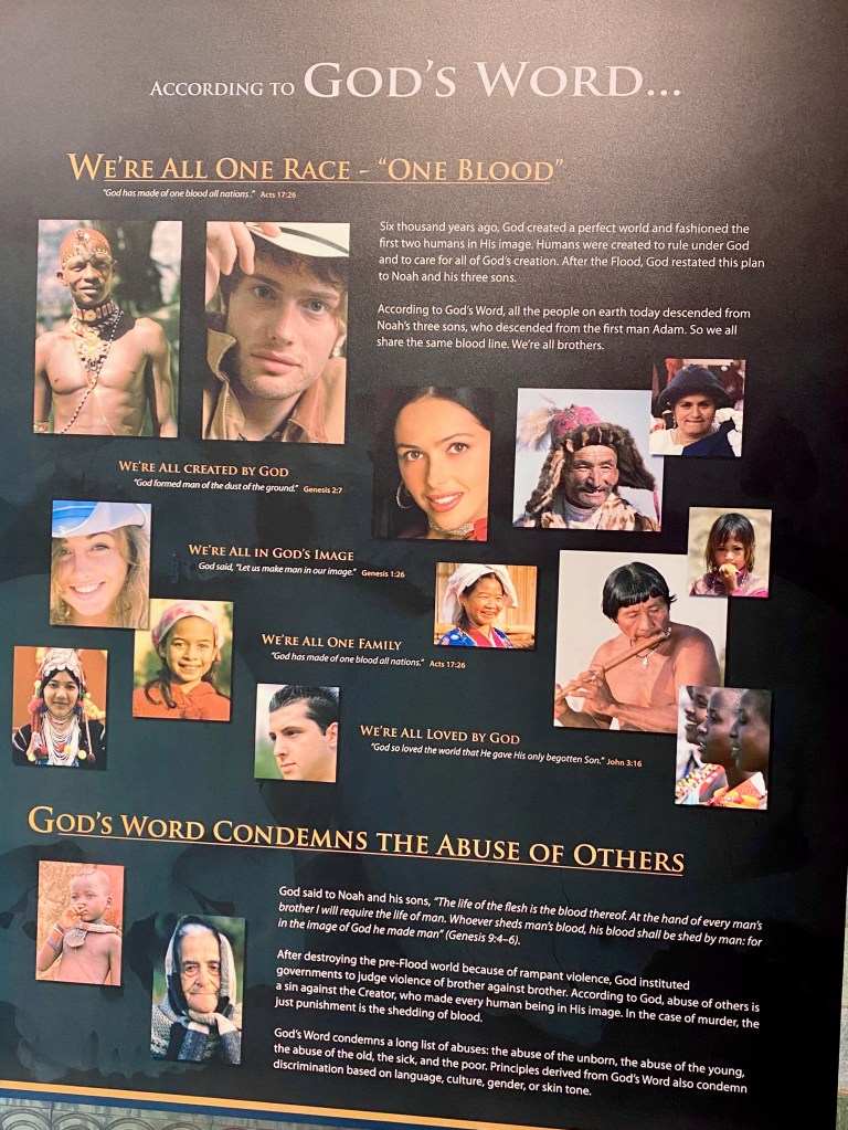
Both attractions are well done and engaging to the mind and the heart. On Thursday, we toured the exhibits and the grounds at the Creation Museum in Petersburg, Ky. The museum is a serious effort to explain the world as we see it today in light of the creation story in the Bible. The museum was busy but not overcrowded on the day we visited. Among the exhibits that impressed us most were those on life in the womb, and on the Bible’s clear message against racism. We missed the presentation on snakes, but as you can see, I did get to hang out with one of the exhibits, a live ball python! And as a wonderful bonus, while we were wandering through the surrounding gardens, we crossed paths with Dale and Linda McLane, a dear couple we knew from our time at Grace PCA in Colorado Springs.
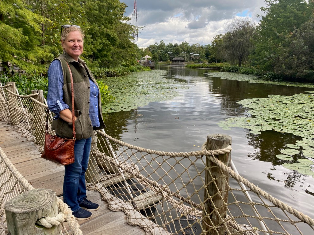
On Friday we drove a few miles further into Kentucky to see the Ark Encounter in Williamstown. The main attraction is a life-sized replica of Noah’s Ark, as described in Genesis 6. More than 500 feet long, it’s an awesome sight to behold! Inside the ark’s three decks, we viewed more exhibits, as well as the human and animal living quarters as the designers of the modern ark thought they might have looked in Noah’s time. Like the Creation Museum (both projects of the Answers in Genesis organization), the Ark Encounter seeks to explain the global flood and how life on earth could have emerged from the ark in its aftermath thousands of years ago. Whatever your views on the subject, both the museum and ark will give you plenty to think about.
***
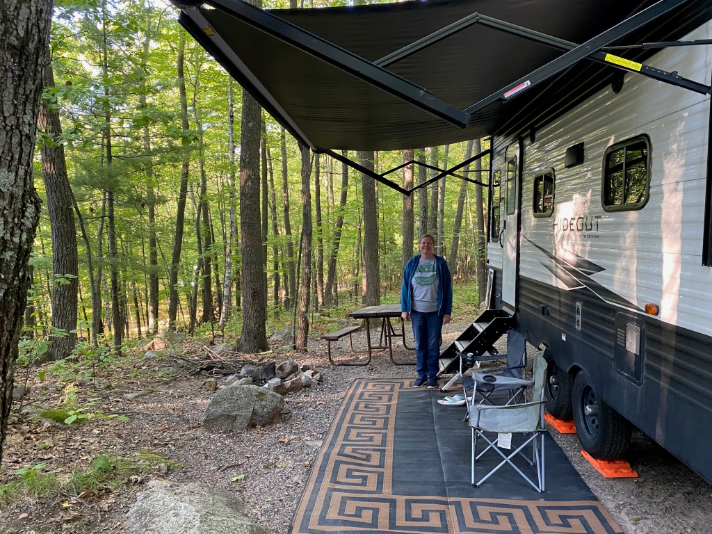
We arrived yesterday at a campground in south central West Virginia, somewhere between Beckley and Lewisburg off Interstate 64. Our plan this week is to spend a day in the nation’s newest national park, the New River Gorge. Then we’ll head north to the RV dealership near Weston that sold us the Hideout for a few repairs, including the left front skirting that we lost in California back in April. At the end of the week we’ll be heading back to Northern Virginia for a few days to see friends and attend our home church next Sunday.
GRAND RAPIDS, Mich. – We left Michigan yesterday after two weeks in the Great Lakes State. Among the highlights of the past week were revisiting Mackinac Island, exploring the towering dunes along Lake Michigan, and enjoying another of the state’s “roadside parks.”
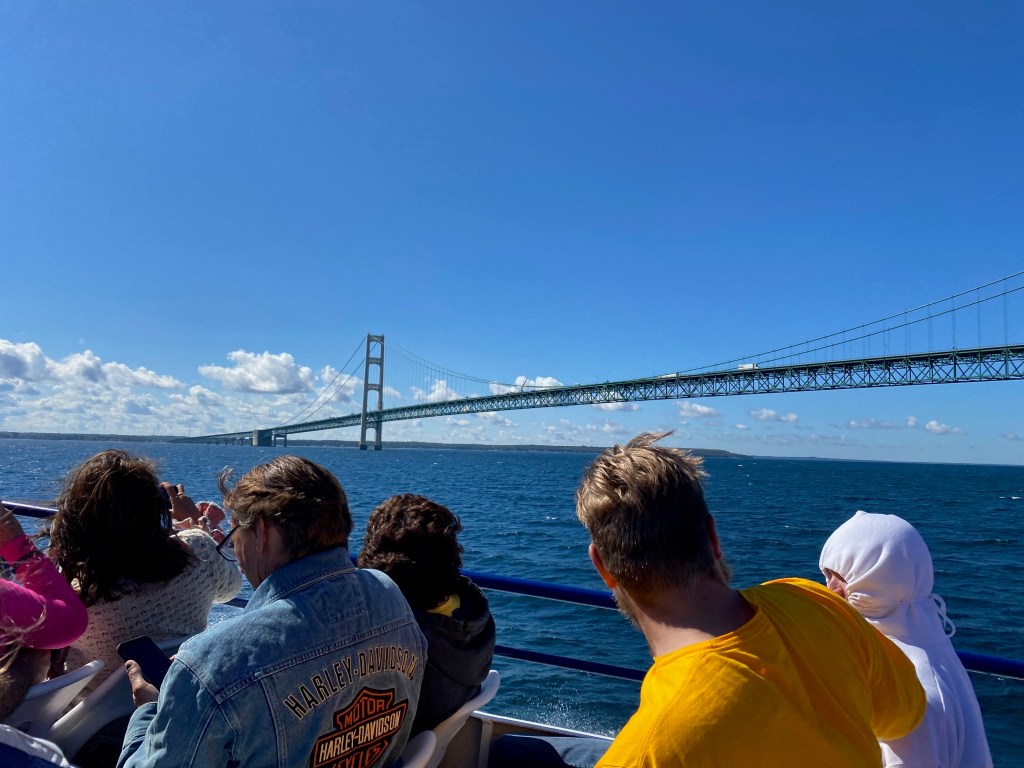
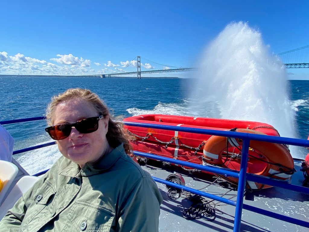
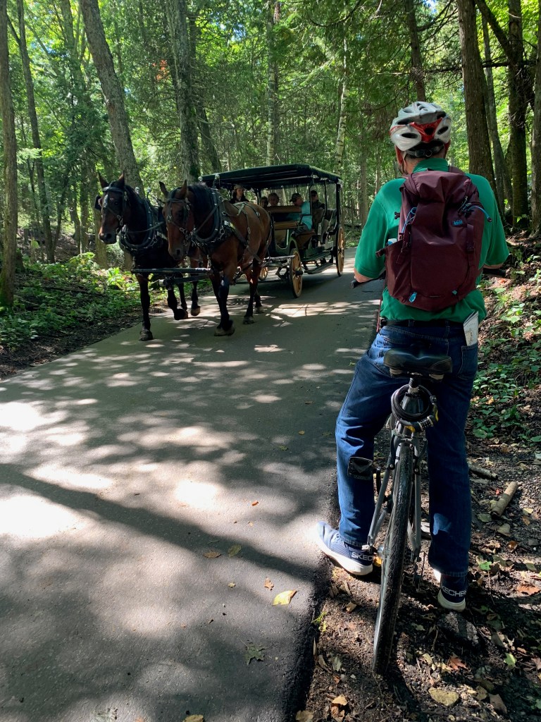
Last week, we caught a ferry from St. Ignace to Mackinac Island, where my family and I had vacationed in the late 1960s. They don’t allow any cars on the island, so we paid a bit extra to take our bikes along with us. Our ferry ride included a side trip to view the Mackinac Bridge, which spans the Straights of Mackinac, connecting the Upper Peninsula with lower Michigan.
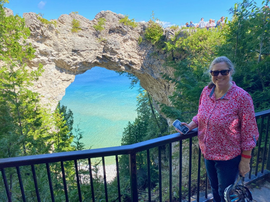
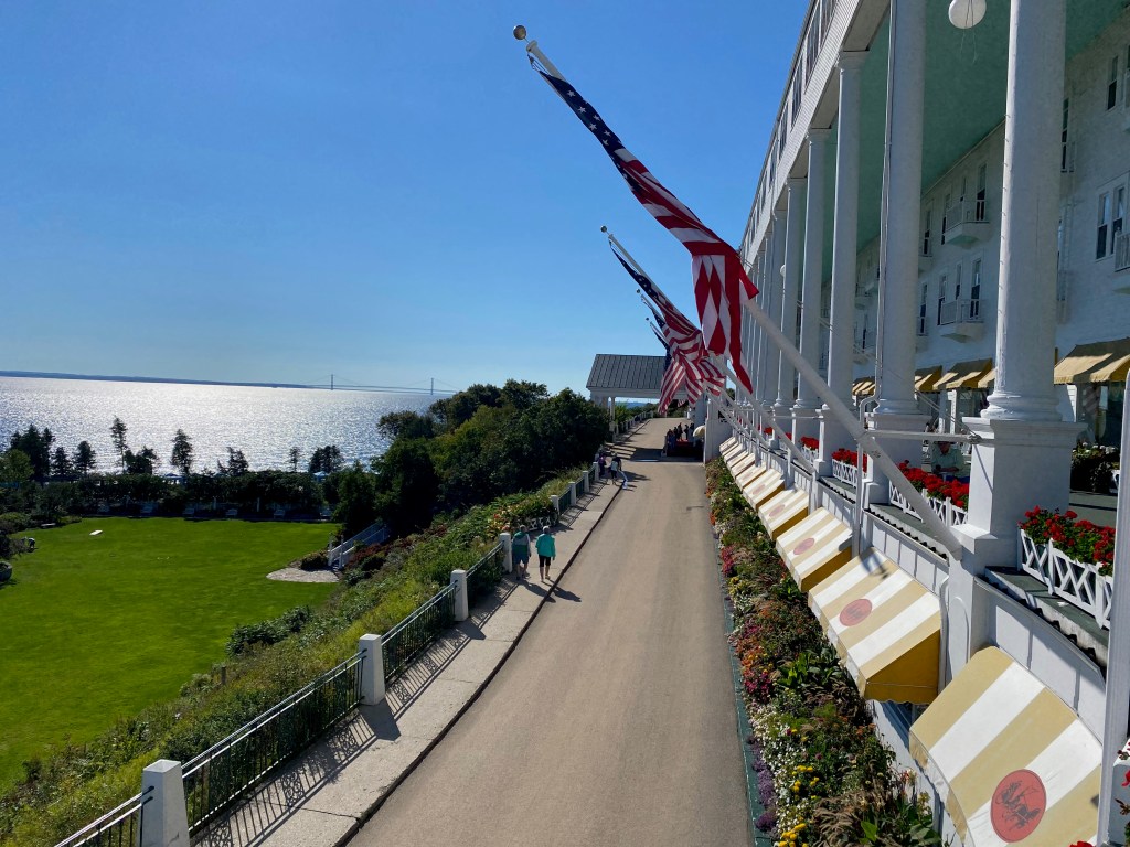
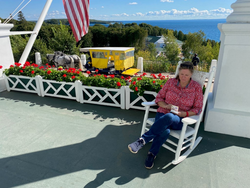
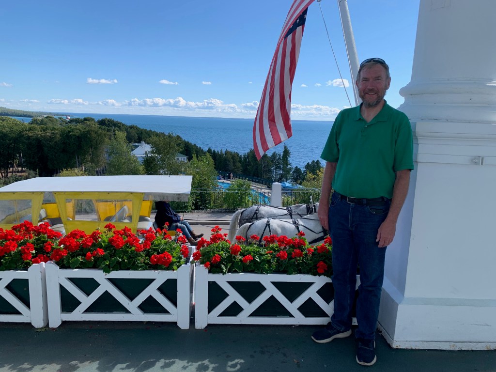
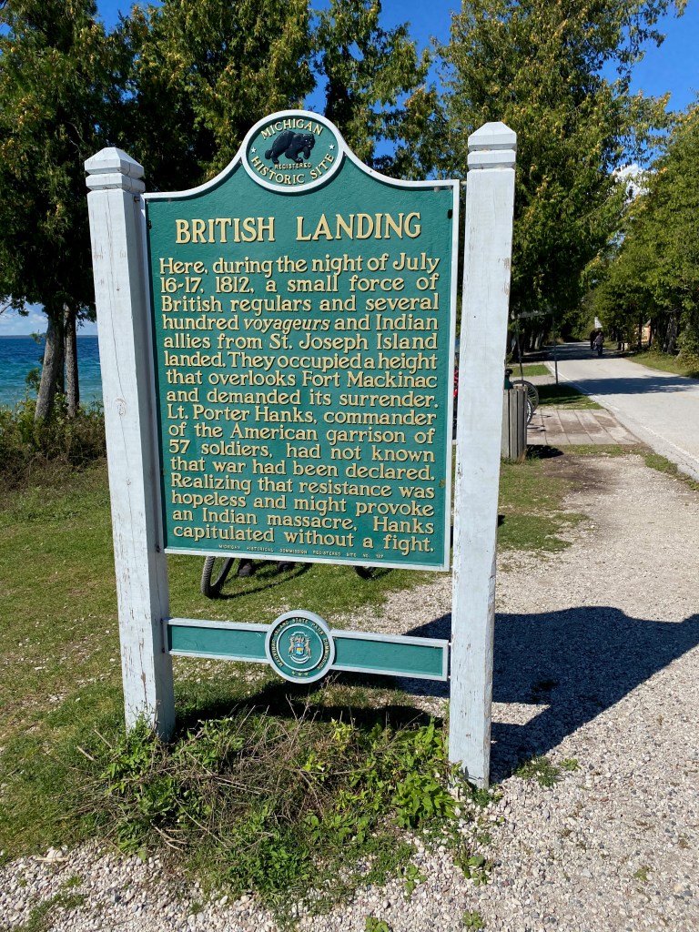
On the island, we rode our bikes to the Arch Rock, past Fort Holmes, down to the British Landing, and then back along the lakefront to the Grand Hotel. We paid $10 each to enter the hotel, where we enjoyed a pear cider on the expansive porch. I have a fleeting memory of staying at the hotel when I was about 10. It was the most exotic vacation my family took when I was a kid. I remember riding a bike on the island, and enjoying the big swimming pool in front of the hotel.
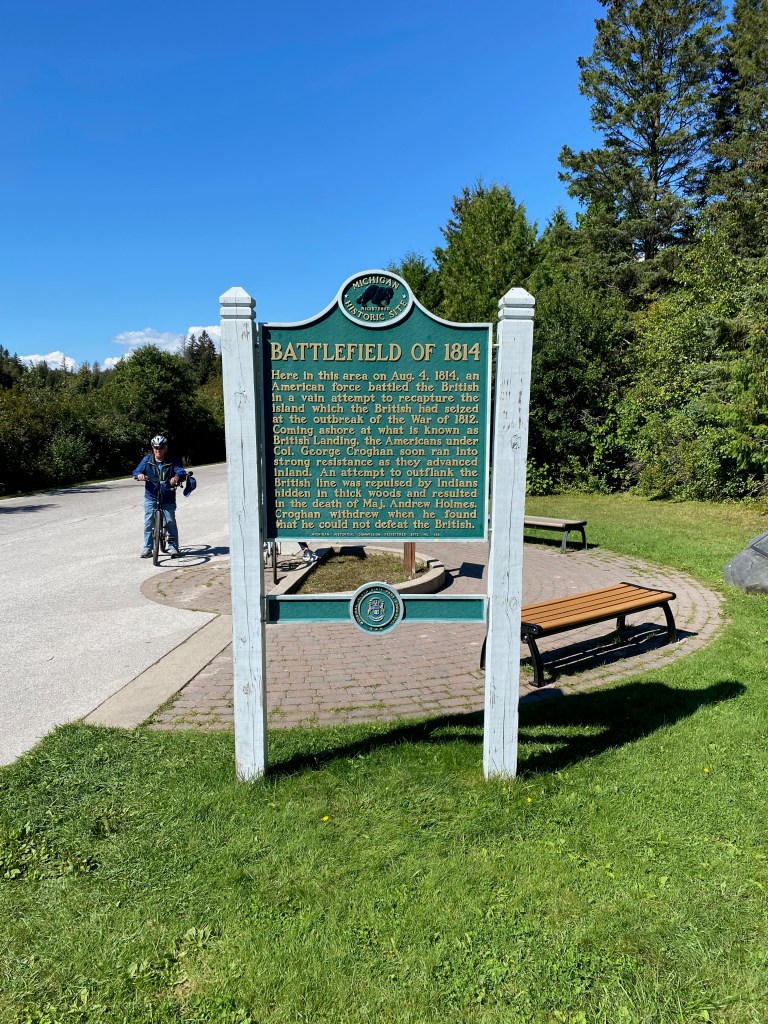
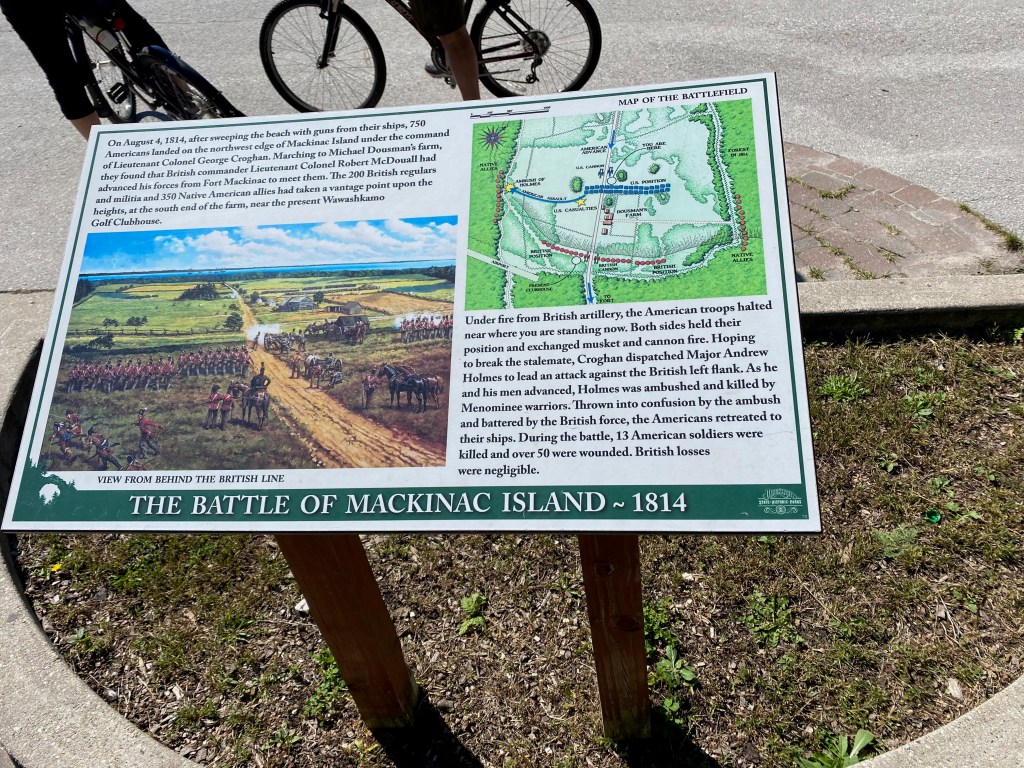
Elizabeth seemed to take special pleasure in viewing the site where the British and their Menominee Indian allies beat back an American force on August 4, 1814. The British had seized the island at the beginning of the War of 1812, and successfully held on to it until the end of the war in 1815. Fort Holmes at the high point of the island is named for an American officer killed in the battle.
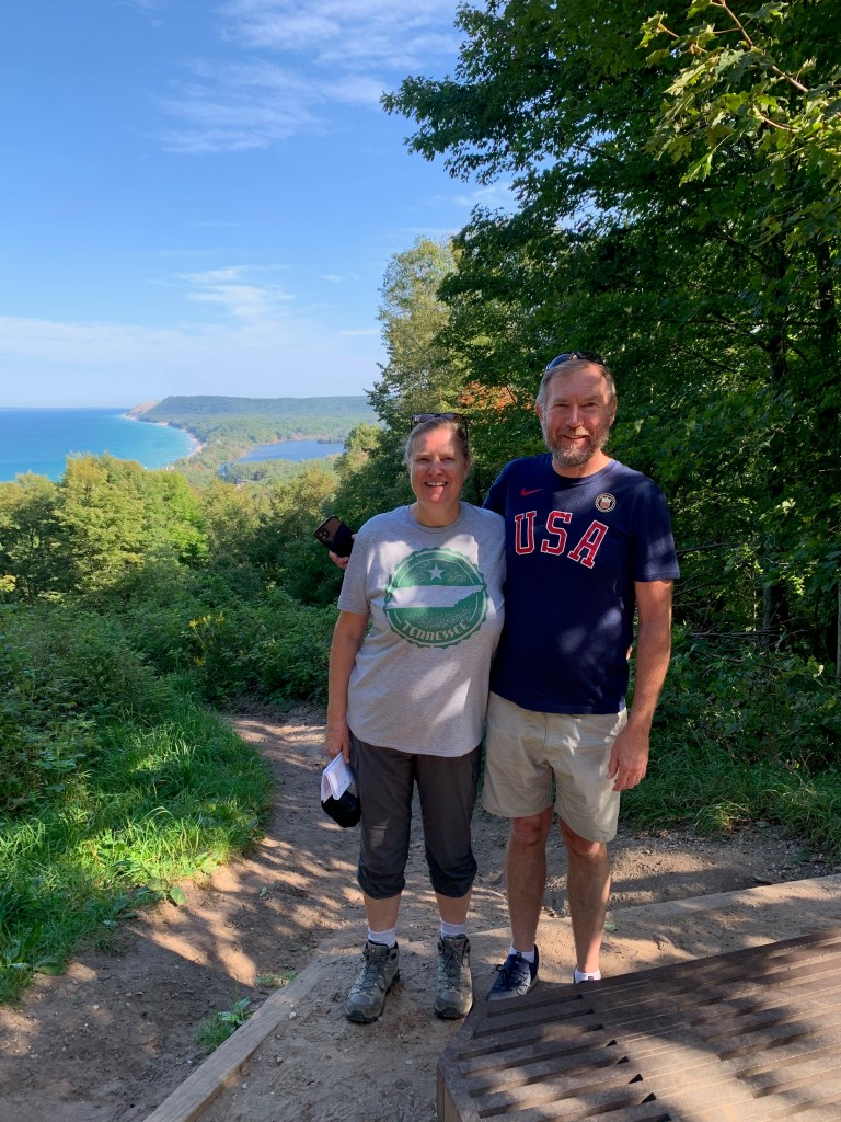
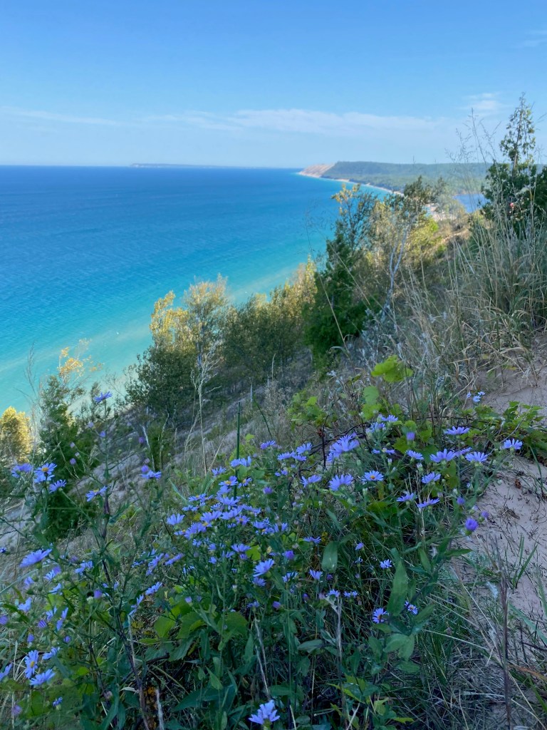
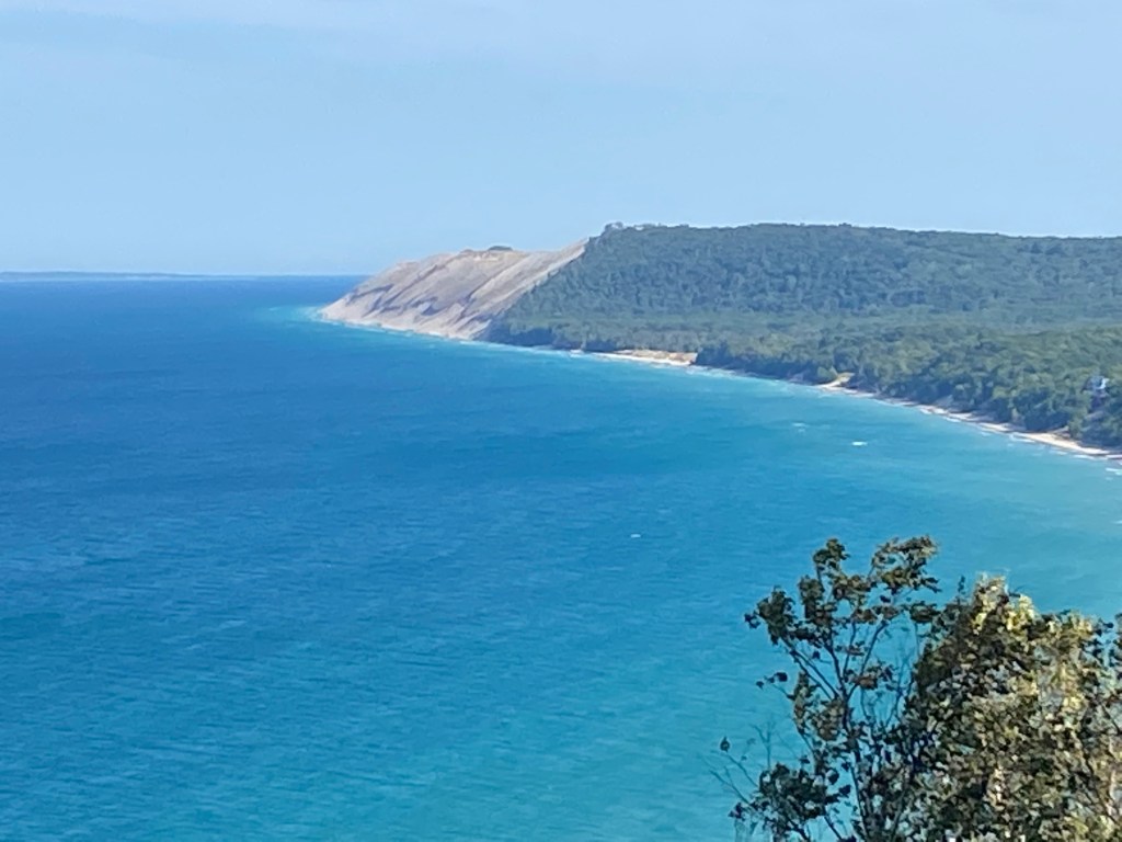
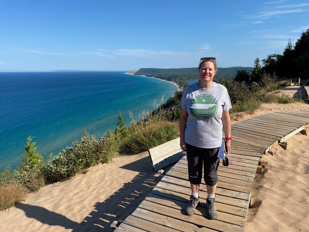
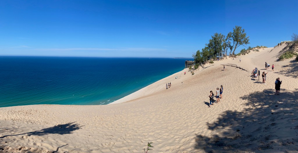
Later in the week, we towed the RV across the Mackinac Bridge to a campground near Traverse City. On Friday we spent a few hours under balmy skies climbing to the top of the Sleeping Bear Dunes that rise hundreds of feet above the shores of Lake Michigan. It was a beautiful sight to look across the blue green waters to see these huge sand bars rising above the surf. We walked together to the top of two overlooks, and then I hiked on my own for about two-thirds of the Dunes Climb Trail before turning back. My nephew Tom Griswold had warned us not to climb down the dunes to the lakeshore because it’s a bear to climb back up. We had no trouble resisting the temptation, but we did see two young women laboring to climb back up a 400-foot dune at one of the overlooks. (You can see them on the lower left photo.
We ended our fortnight in Michigan by spending a few nights at the farmhouse of our long-time friends Jeff and Anita Caspers northeast of Grand Rapids. Looking back on our time in this wonderful state, we’ll remember the beauty of the lakes, especially at sunset. The moderating effect of the lakes on the weather also allows an abundance of wineries and apple, pear, and cherry orchards.
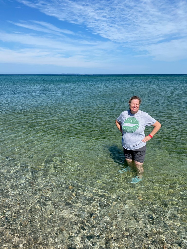
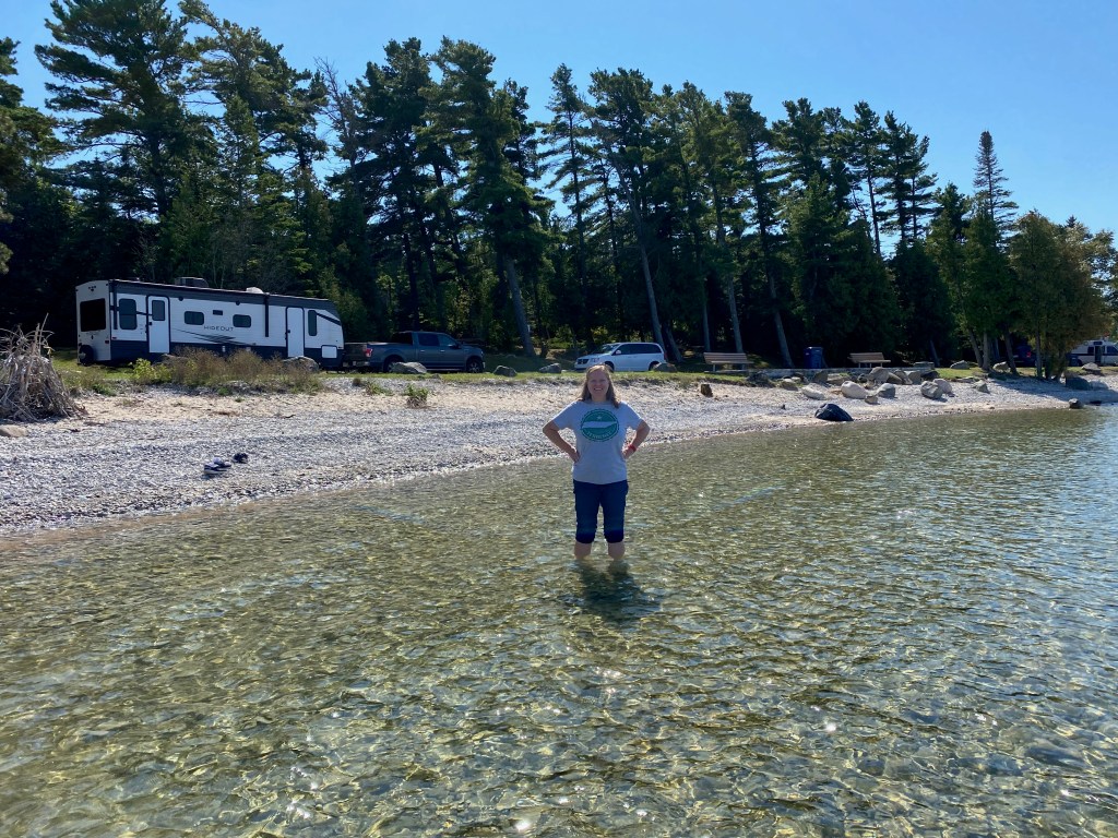
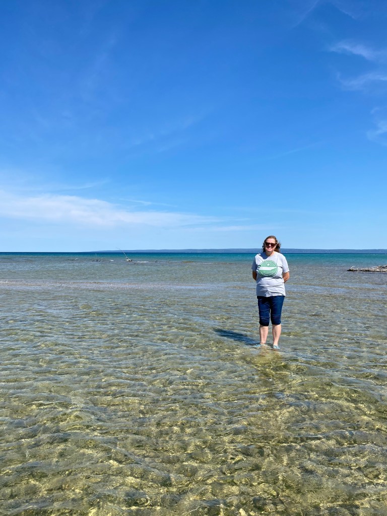
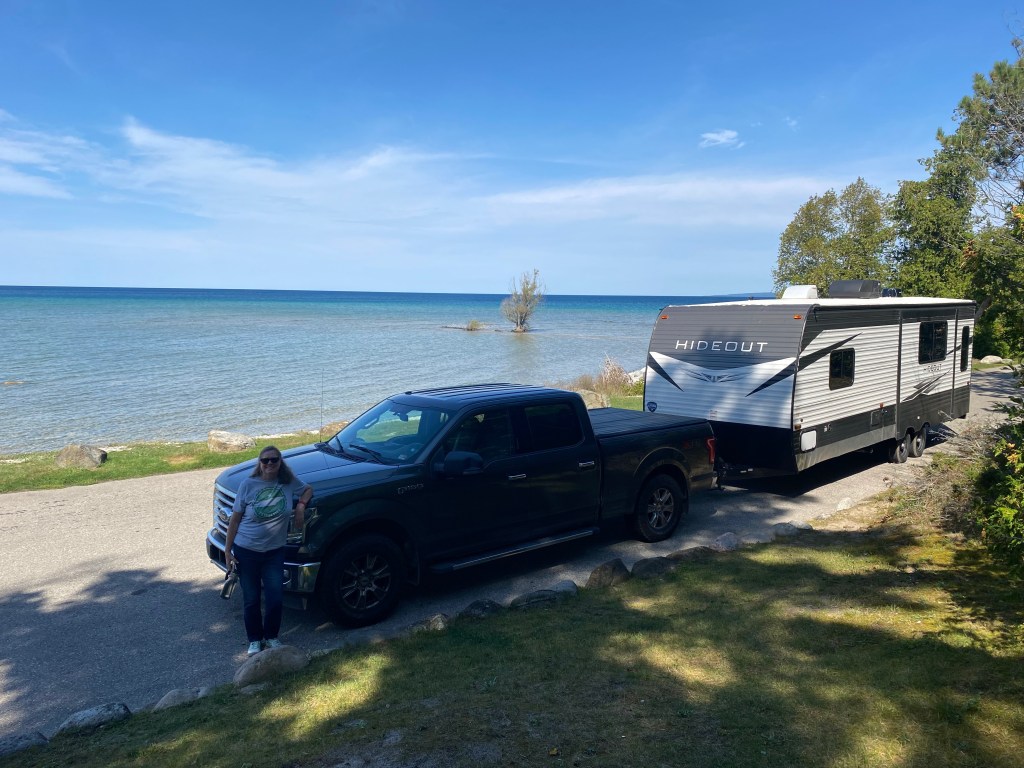
As we drove through the state, we also appreciated the many roundabouts, an English invention that allows a smoother flow of traffic, and the many “Roadside Parks.” The parks are small rest stops along secondary highways that are often located by the lakeshore or other scenic spots. We liked the fact that the parks can accommodate RV parking. We could not only pull over for a bathroom break—a factor of growing importance these days—but we could wade in the water at a picturesque spot. The photos below were taken at a roadside park on our way to Traverse City. You can see how close to the lakeshore we were able to park the Hideout.
Dashboard:
Days on the road: 226;
Miles towing the RV: 10,067;
RV parks stayed at: 61;
National parks visited: 21.
The road ahead (Lord willing): Creation Museum in Petersburg, KY, and the New River Gorge National Park in West Virginia.
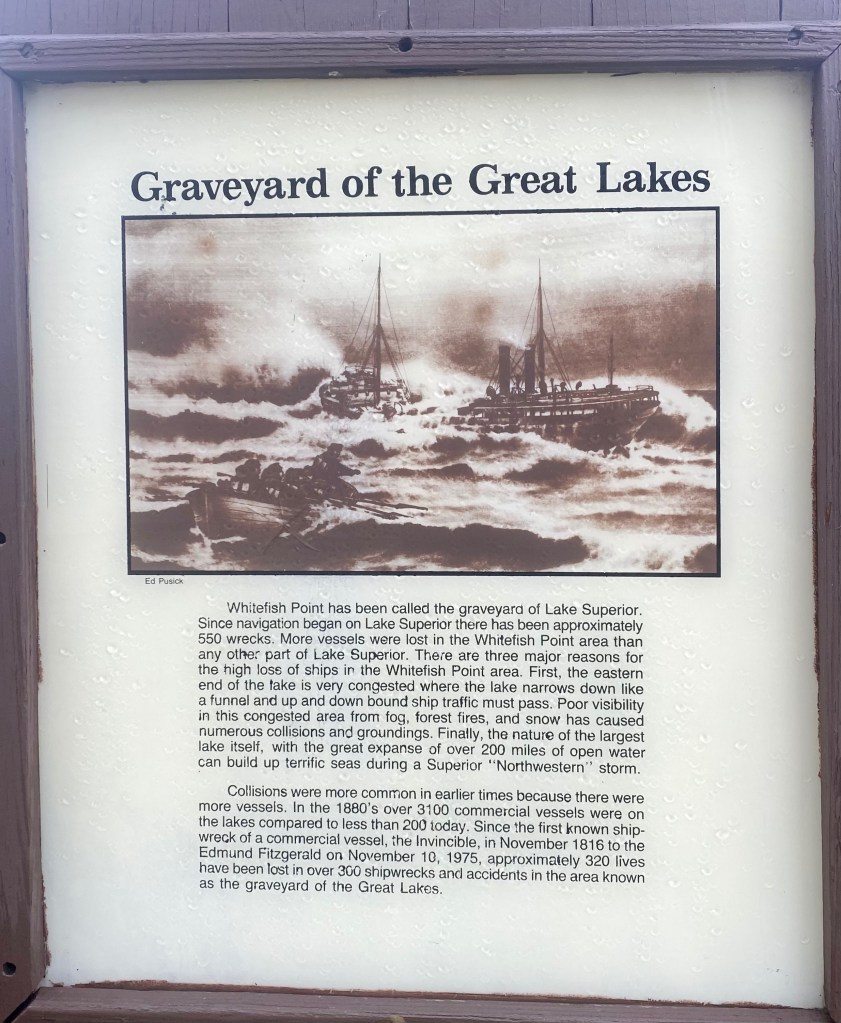
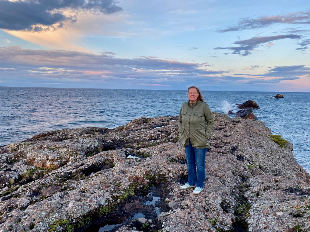
BRIMLEY, Mich. – We’ve been traveling along the southeastern shore of Lake Superior, admiring the beautiful sandstone cliffs while learning more about why this stretch is called “The Shipwreck Coast of Lake Superior.”
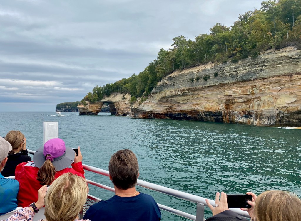
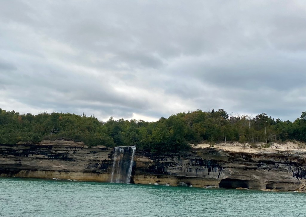
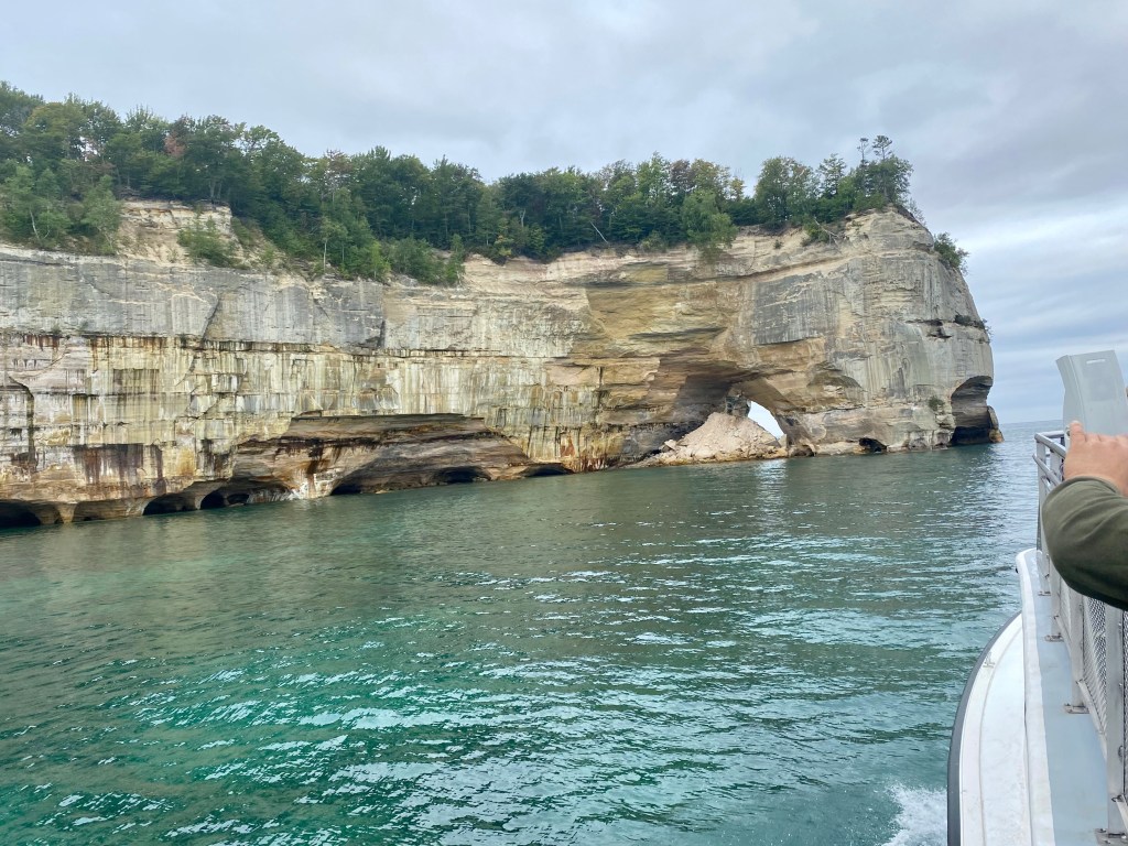
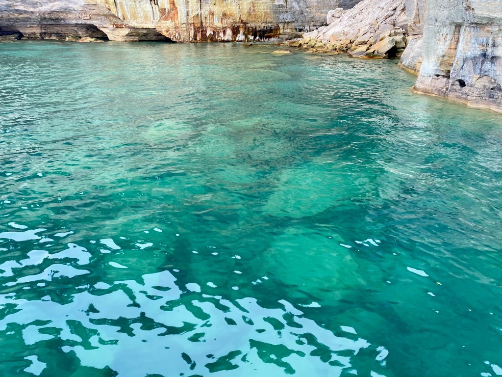
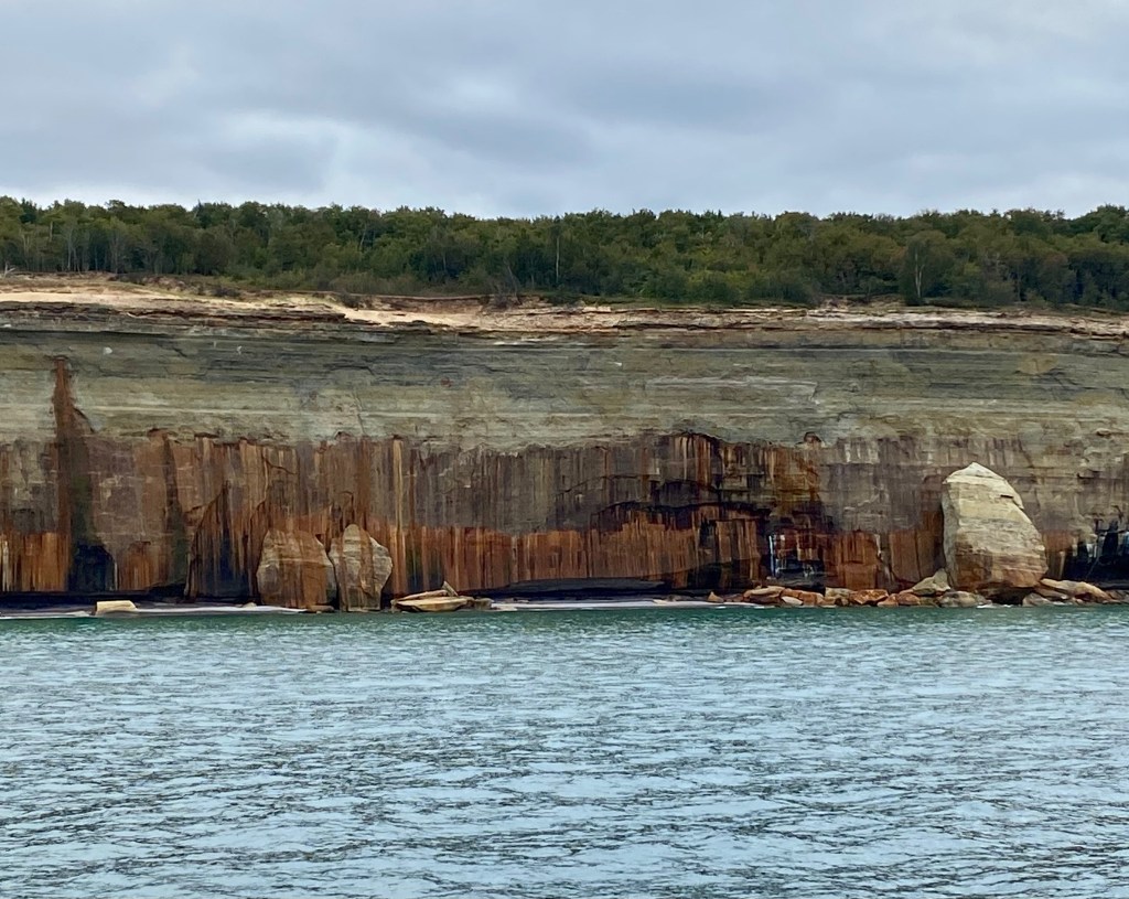
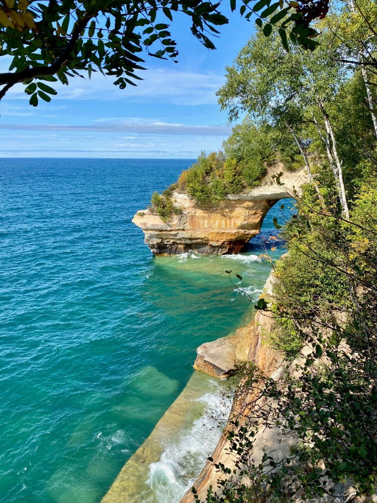
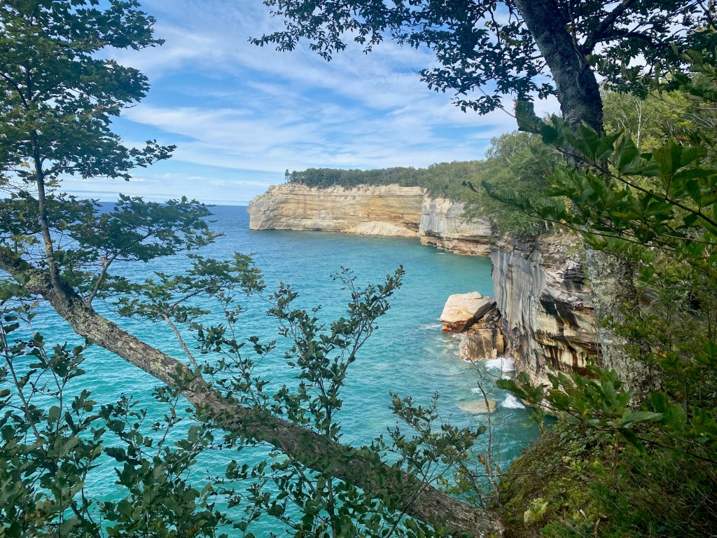
On Saturday, from the marina in Munising, Mich., we joined a two-hour boat cruise along the beautiful Pictured Rocks National Lakeshore. The boat’s captain gave a lively description of the shoreline, including how the seepage of minerals give the rocks their distinctive color. The cliffs soar up to 200 feet above the water. In some places the wind, waves, and rain have carved odd shapes, caves, and even archways in the relatively soft rock. We waved to hikers at the top of the cliffs and saw kayakers plying the waters below.
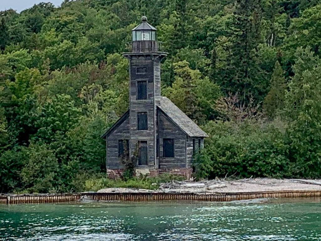
A 19th-century lighthouse on Grand Island near Munising, Mich.
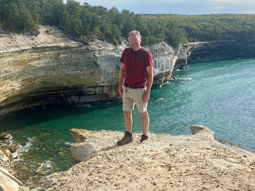
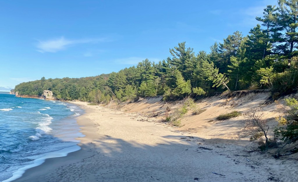
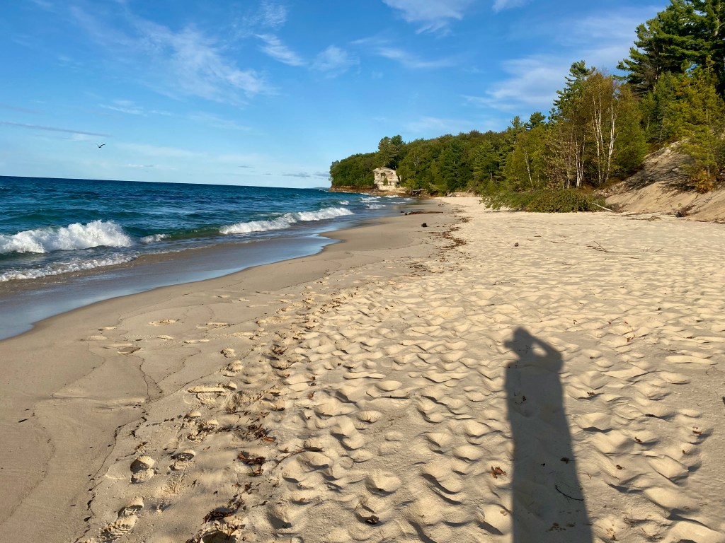
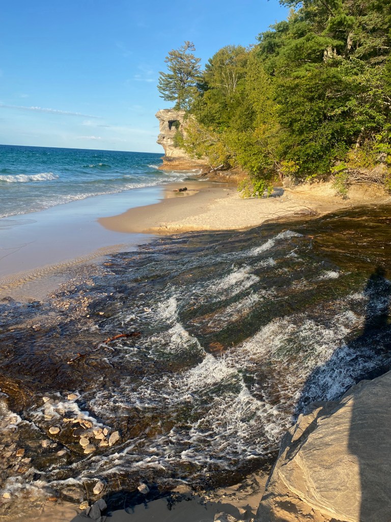
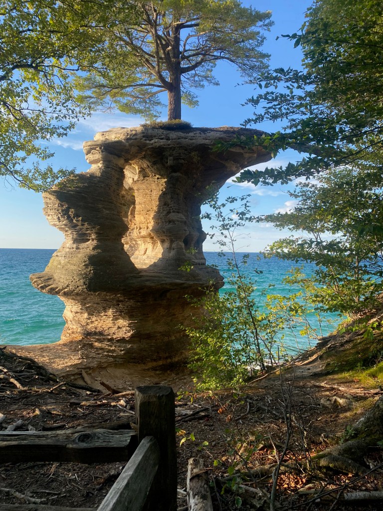
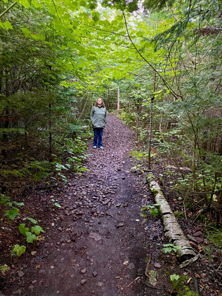
The next afternoon and evening, I returned on my own to the national lakeshore to enjoy one of the best hikes of our entire trip. The trail loop covered about 10 miles–through the woods, past Mosquito Beach, along the cliffs above the lake, to Chapel Beach, and then back through the woods to the trailhead and parking lot. The weather was ideal—sunny, mid-60s, with a mild breeze off the lake. I have a good tolerance for heights, but there were a few spots along the edge of the cliffs, looking down 150 feet to the pounding surf below, that made me wince!
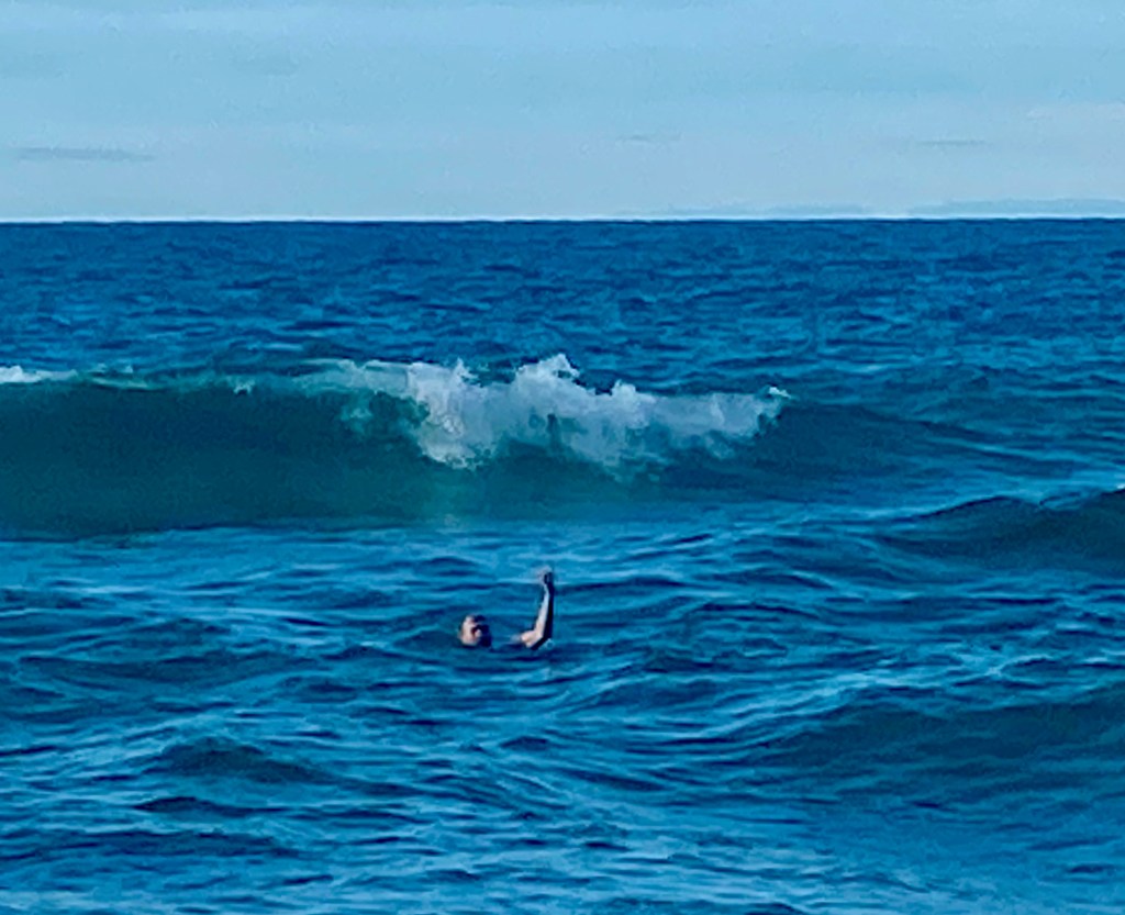
A highlight of the hike was a swim at Chapel Beach. The waves were three to four feet high, just enough to create excitement without any real danger. And the water was just right. The lake’s water can feel very cold in the middle of the summer, but by September it’s absorbed enough heat to offer a comfortable swim. The only other person on the beach was a middle-aged man named Tim who was camping on his own nearby. He lives in the Chicago area with his wife and kids and they are frequent visitors to the area. By mutual agreement, he and his wife occasionally take their own vacations, and Tim chose to hang out for a few days at this wonderful spot. He kindly agreed to take a few photos and a video of me enjoying the surf just so I could share them with all of you!
***
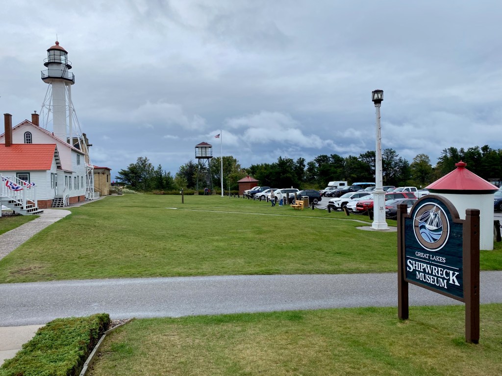
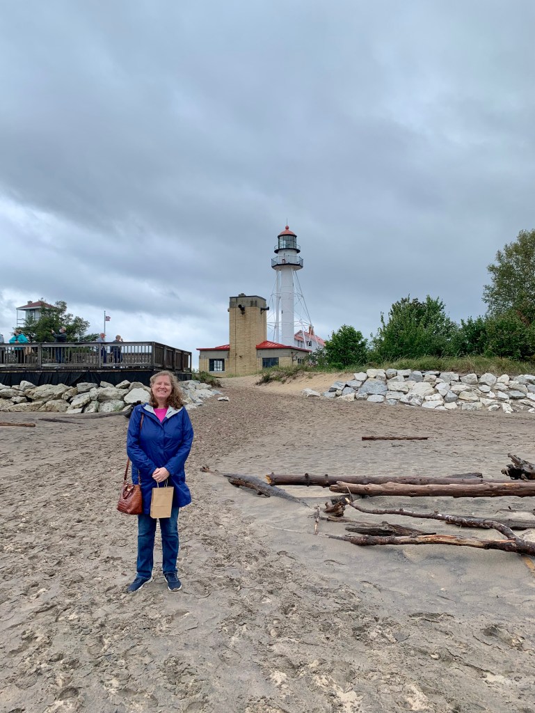
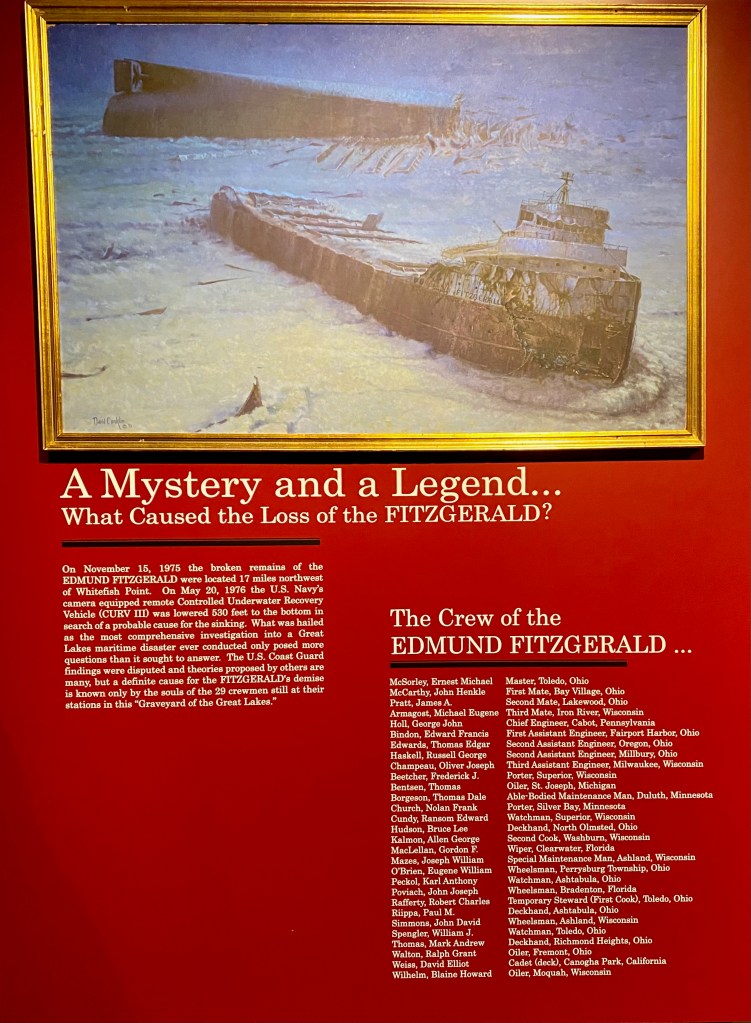
On an appropriately windy and rainy day, Elizabeth and I drove an hour up the coast yesterday from our current campground in Brimley to the Great Lakes Shipwreck Museum at Whitefish Point. The museum is located on a picturesque point separating Whitefish Bay from the main body of the lake. The area has proven dangerous for ships, in part because of the weather but also because it serves as a funnel channeling ships to and from the locks at Sault Ste. Marie that lead to Lake Huron. Many of the shipwrecks described at the museum occurred when ships collided with each other near the point, often at night and in fog.
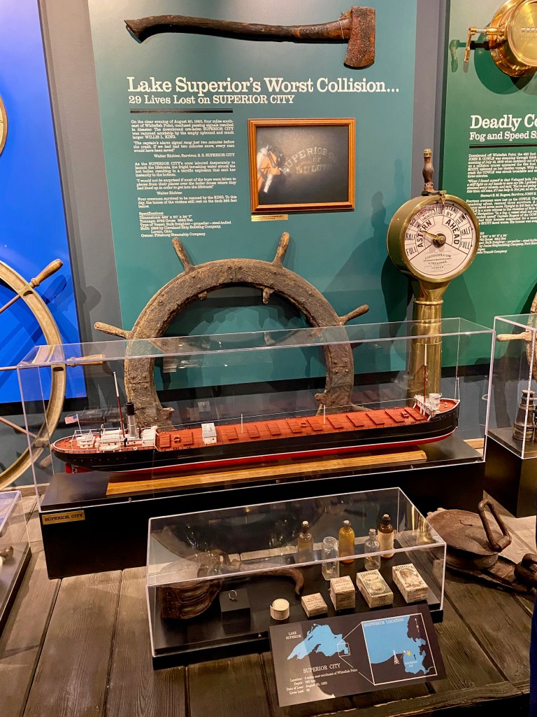
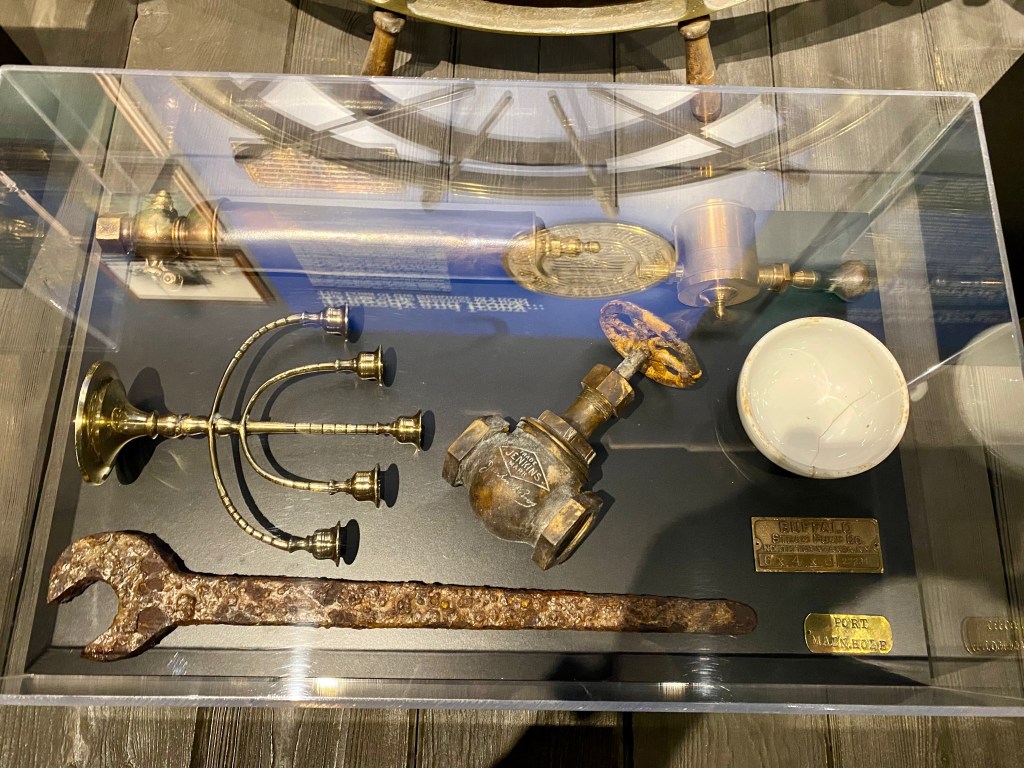
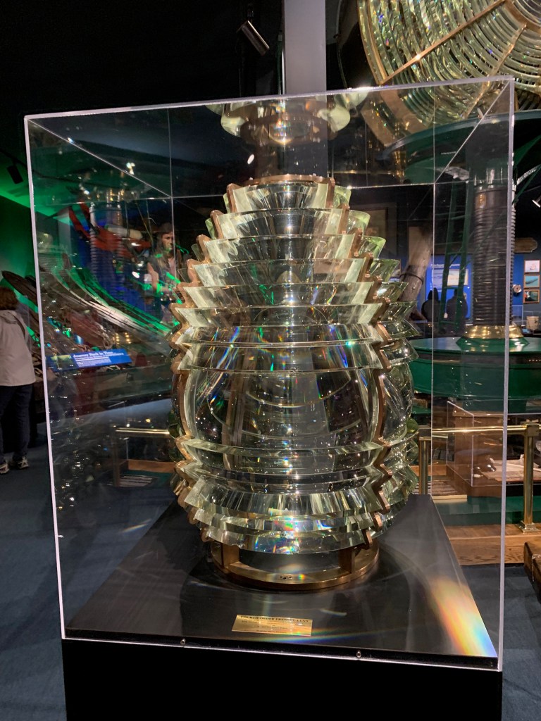
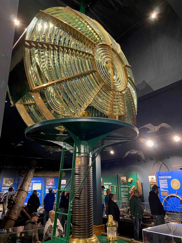
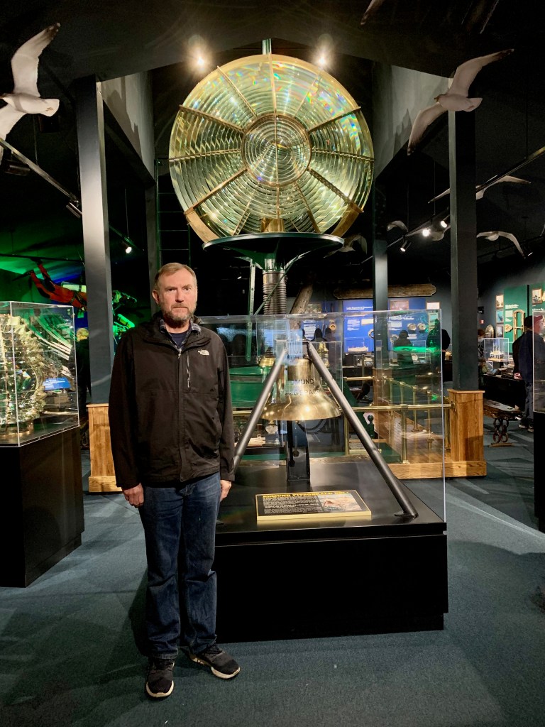
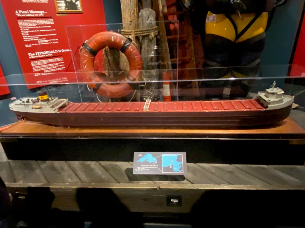
Exhibits at the museum are very well done. About 10 shipwrecks are highlighted, with each exhibit featuring a description of the disaster, a painting that dramatizes the event, a model of the ship, and in many cases artifacts recovered from the ship’s wreckage hundreds of feet below the waves. The museum also displays two Fresnel lenses, developed in the early 1800s, that allowed lighthouse beams to be seen more than 20 miles from shore.
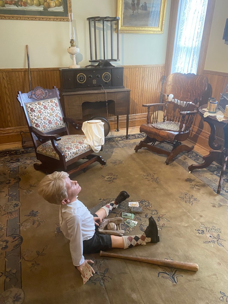
A boy playing cribbage in the lighthouse keeper’s quarters.
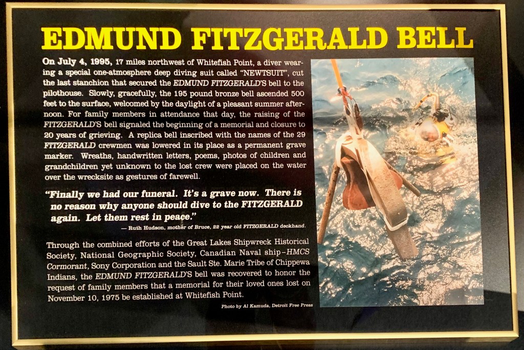
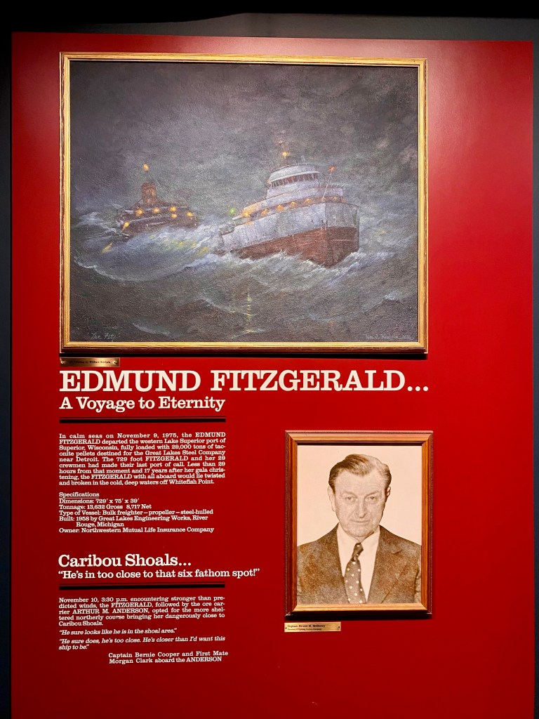
Background music for our time on Lake Superior has been Gordon Lightfoot’s haunting ballad, “The Wreck of the Edmund Fitzgerald.” It’s always been a favorite of mine, and I’ve listened to it a few times as we’ve followed the lake’s shoreline. The museum features a special exhibit on the tragedy and is home to the ship’s 195-pound bell, recovered during a dive to the wreck in 1995. The ship lies 17 miles north of Whitefish Point under more than 500 feet of water. If you want to learn more details of the November 10, 1975, tragedy, here’s the museum’s web page on the Edmund Fitzgerald, and here’s an informative blog post I found annotating the lyrics of Gordon Lightfoot’s ballad. (The song is quite accurate in its details.)
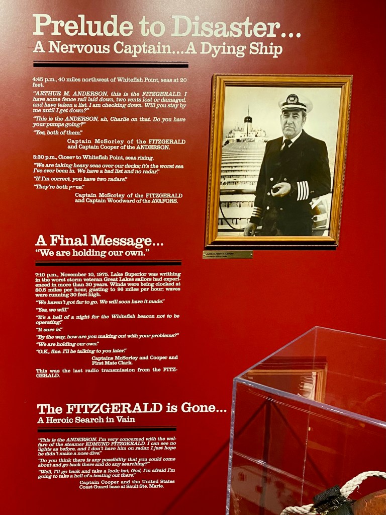
A couple of details about the Edmund Fitzgerald that stuck with me: The captain of the ship, Ernest M. McSorely, had recently turned 63 when the ship met its end, almost exactly my current age. My life seems pretty carefree compared to the responsibilities of a captain of a big ship and crew sailing into freezing rain and 30-foot waves. And minutes before the Edmund Fitzgerald sank, at 7:10 p.m., McSorely had this exchange with the first mate on the freighter Arthur M. Anderson, which was trailing them by about 10 miles.
“By the way, Fitzgerald, how are you making out with your problems?” asked Clark.
McSorely responded: “We are holding our own.”
This was the last radio transmission from the Fitzgerald.
MUNISING, Mich. – We’ve been traveling through the Upper Peninsula of Michigan since Tuesday, hiking through old growth pine woods and viewing the endless expanse and wading in the temperate waters of Lake Superior.
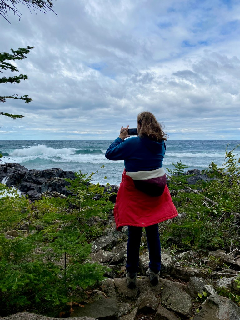
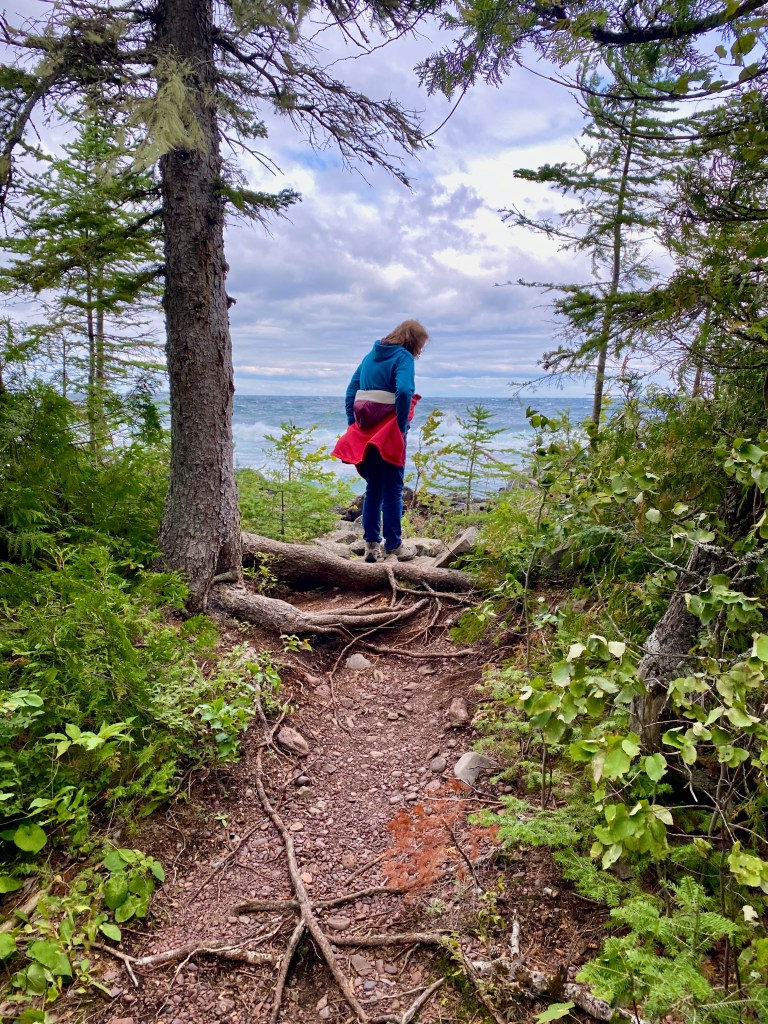
In Copper Harbor, at the top end of the Keweenaw Peninsula, we enjoyed three hikes I would recommend. On our first night there, we drove to the north terminus of US 41 and then along a gravel road to the trailhead for Horseshoe Harbor. The trail led through thick woods to a secluded bay with a rocky ridge along one side. The next day we hiked to Hunter’s Point, along Copper Harbor, with the north segment taking us along the shore of Lake Superior. Strong winds were whipping up waves that one local told us were among the largest he had ever seen. On our last full day, we biked two miles to the Estivant Pines Nature Sanctuary, which preserves an original 600-acre forest of white pines, many more than 100 feet high.
Lots of good skipping stones, but not the right conditions!
Along the Hunter’s Point Trail.
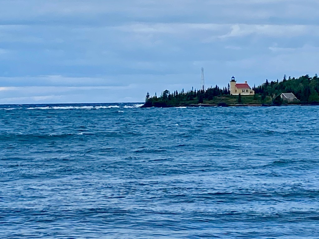
Copper Harbor Lighthouse, 1866
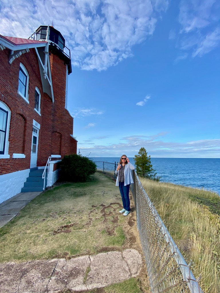
On our last evening in Copper Harbor, we drove along Highway 26 to the town of Eagle Harbor, where we walked the grounds of the lighthouse. Like many lighthouses, it was automated several decades ago. On our agenda that evening was to view the sunset from the top of Brockway Mountain, which lies between the two towns and rises about 700 feet above the lake. Our friend Herb Ford and his family had enjoyed a sunset picnic at the spot on a recent vacation and he highly recommend it. Alas, I miscalculated our timing and we just missed the main event. A friendly fellow saw we had arrived too late and shared his photos of the sunset via iPhone Air Drop.
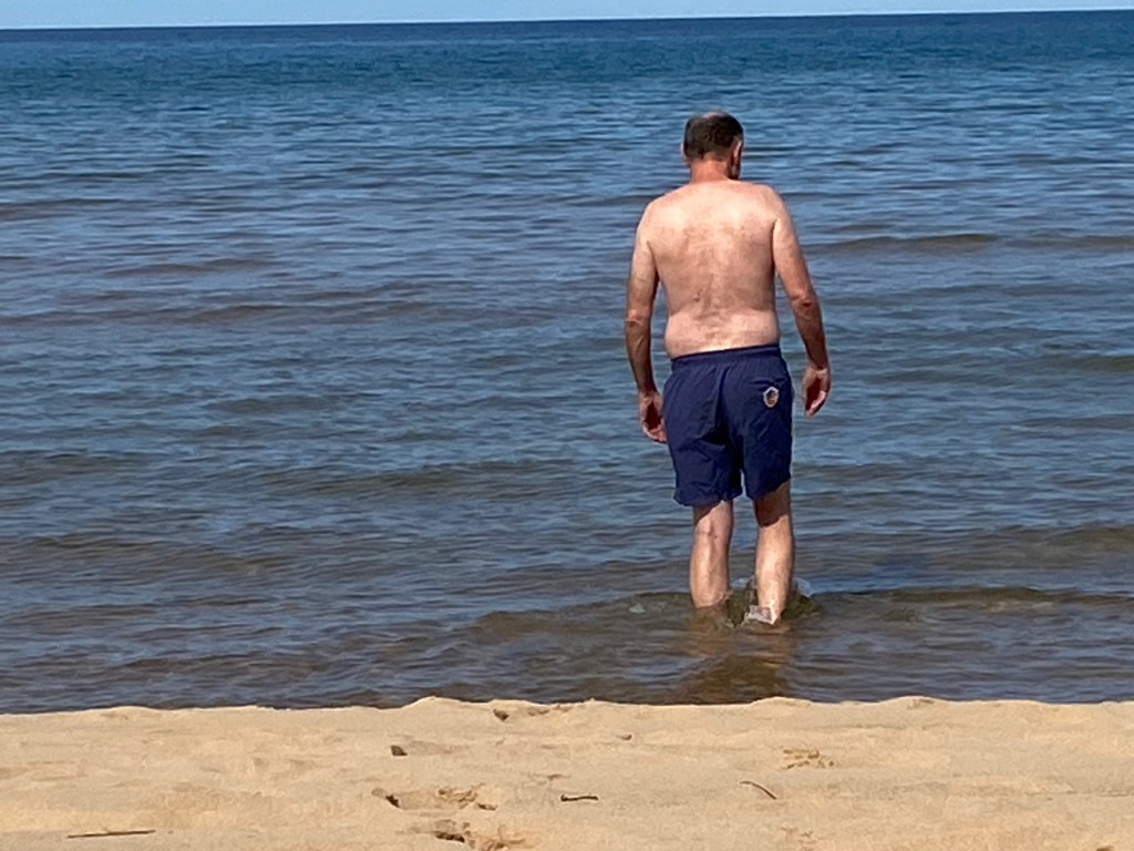
Yesterday we hauled the RV from Copper Harbor about 180 miles east to our current campsite just outside of Munising, Mich. For the next few nights we’ll be staying at the Silent Night Campground on St. Nicholas Road in Christmas, Mich. (I kid you not!) About 8 miles before our destination, we pulled over to a rest stop along a beautiful stretch of sandy beach. Lake Superior is normally cold, but this time of year its waters are relatively warm from the residual heat of summer. I said to Elizabeth, “I need to go swimming!” With the RV parked close by, I disappeared inside for a few minutes and emerged wearing my swimsuit and water shoes. The water was lovely and clear and the sandy bottom stretched out for a hundred feet from shore. Oh sublime joy!
***
Before arriving in the UP, we enjoyed four days in my native state of Wisconsin. During our time in La Crosse County, we visited with my brother, a cousin, and two nephews and their families. I visited the family plot at Hamilton Cemetery outside our hometown of West Salem and placed flowers on my mother’s gravestone. (She passed away in 2017 at age 93.) I also took a bike ride along the Elroy-Sparta Trail that runs through town and rode past the home on Youlon Street where I lived until we moved to Minnesota in 1971.
On the way north to Michigan, we stayed one night in a wooded campground near Rhinelander, Wis. It was a challenge to back the unit into a narrow space, but the reward was a secluded spot surrounded by forest. We built a fire in the pit that evening and shared a s’more.
APPLE VALLEY, Minn. – In our weeklong stay in Minnesota, we’ve visited family and friends while I’ve relived some experiences and places that were significant to me when I lived there during my formative teen years.
In the small town of Sauk Centre, where I graduated from high school in 1976, we walked through the downtown area, and drove past the house where my parents lived for 34 years. Most neighborhoods in the city look much the same, but the town has added a McDonald’s and a Walmart since my high school days. We also walked along the shore of Fairy Lake a few miles north of town, where my family rented a summer cottage during the 1970s and ‘80s, and where I swam and sailed my small boat. (See the photo of me on the boat with my senior-year friend Carlos Medina.)
During our time there, I biked for several miles on the Lake Wobegon Trail, which runs through central Minnesota roughly following Interstate 94. The trail follows an old railroad bed, passing by farms and through groves of birch trees and crossing the Sauk River in several places. While I didn’t reach its fictional namesake, I’ve pieced together from the years I listened to “A Prairie Home Companion” that it lies approximately a dozen miles somewhere southeast from my home town, which has it’s won literary claim to fame as the boyhood home of Main Street author Sinclair Lewis.
Looking down on the Original Main Street along the Lake Wobegon Trail.
In the Twin Cities area where we are now, we spent a few hours yesterday at the Minnesota State Fair, which must be one of the largest in the nation. In one exhibit hall, called “The Miracle of Birth,” we saw new-born piglets feeding at the teats of a big sow. For some reason this made me think of the appropriations process in the U.S. Congress.
And last night, on a beautiful late summer evening, we watched the Minnesota Twins play the Chicago Cubs at the relatively new Target Field in downtown Minneapolis. The outcome of the game wasn’t as important to me (the Cubs won 3-0) as the experience of rejoining 21,000 fans to root for my favorite team. The Twins and I go back 50 summers now, when I was an awkward 13-year-old who had just moved to a new town in central Minnesota with my parents. Before I got to know my new classmates, I would spend hours listening to the Twins games on the radio. Then in high school I would drive down with friends to see them play at the old Metropolitan Stadium in Bloomington. In a corner of the Mall of America, which is built of the site of the old stadium, you can see a brass home plate resting on the same spot where I watched Hall-of-Famer Rod Carew line base hits from my seat in the bleachers back in the mid-1970s.
A statue of Kirby Puckett (left), who led the Twins to World Series glory in 1987 and 1991.
***
From here we’ll travel tomorrow to Wisconsin, and then on to the Upper Peninsula of Michigan and Lake Superior.