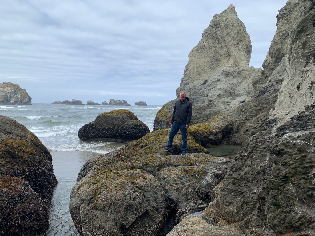
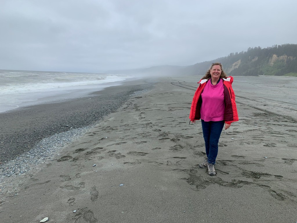
LONG BEACH, WA – We towed the RV another 150 miles up Highway 101 on Thursday from Newport OR across the gaping mouth of the Columbia River to this resort town in Washington State. We’ll spend six days here, enjoying the expansive beach and the historical sights marking the western end of the Lewis and Clark expedition in 1805-06.
***
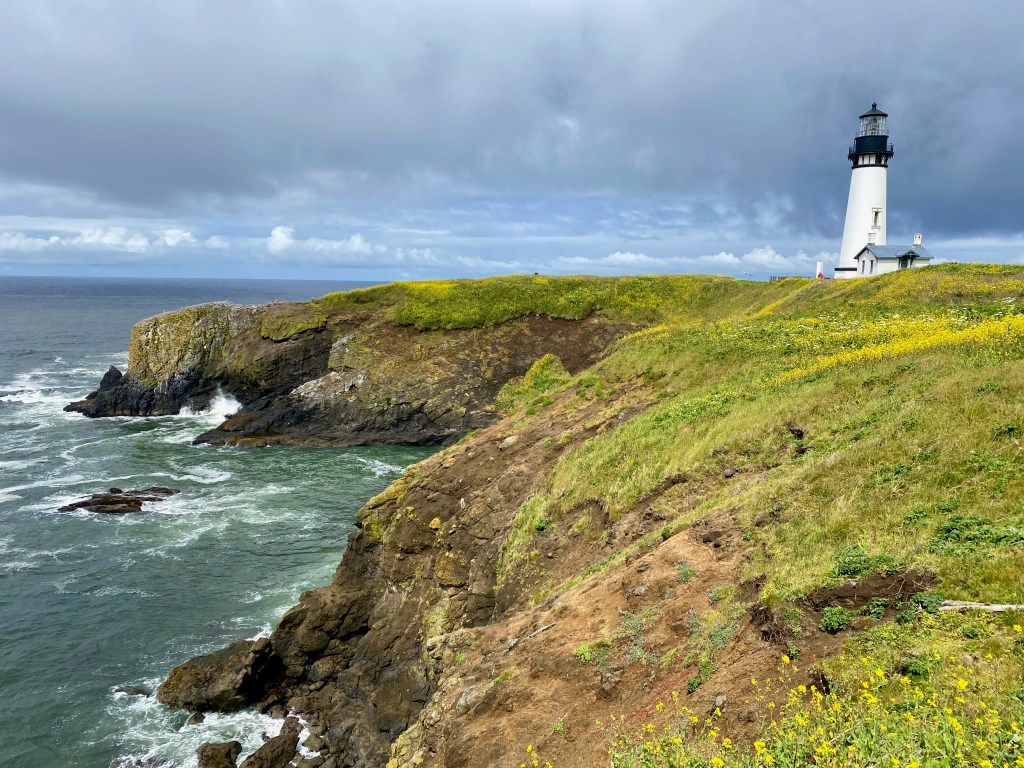
On Tuesday, we visited the Yaquina Head Lighthouse north of Newport. From there we drove to “the world’s smallest harbor” at Depoe. The video shows a tourist boat returning to the narrow inlet, probably from an outing to watch for migrating whales. We had planned to visit the scenic “Three Cape Loop” and the Cape Mears Lighthouse further north that day, but rain, road closures and our own end-of-day tiredness modified our plans.
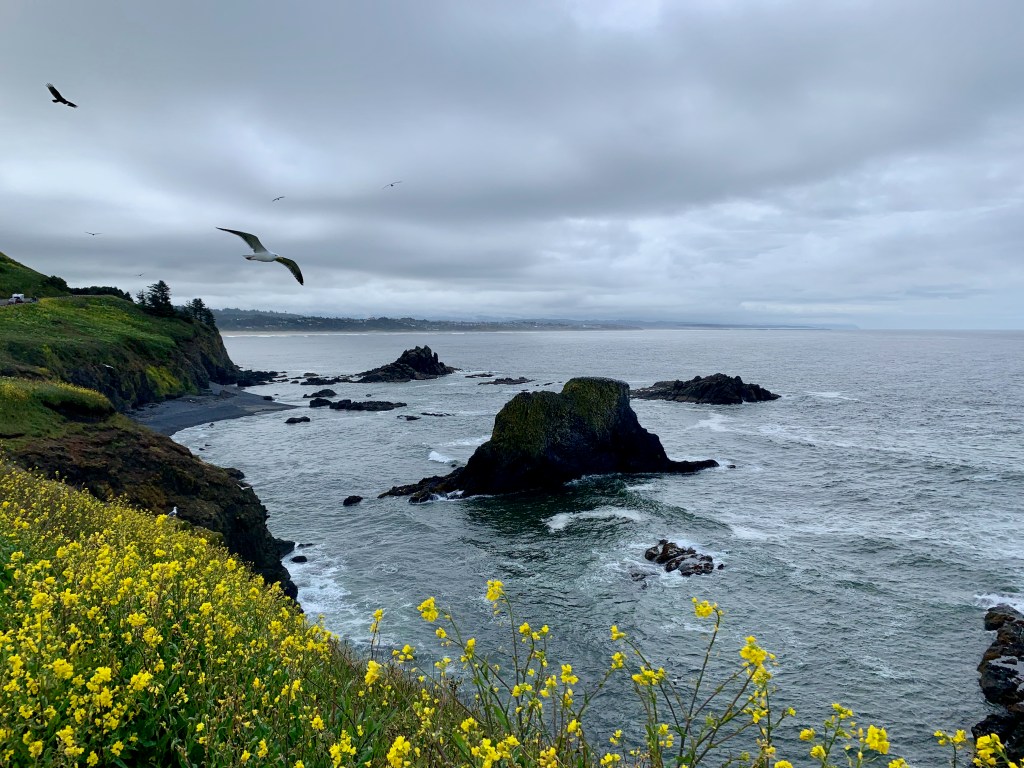
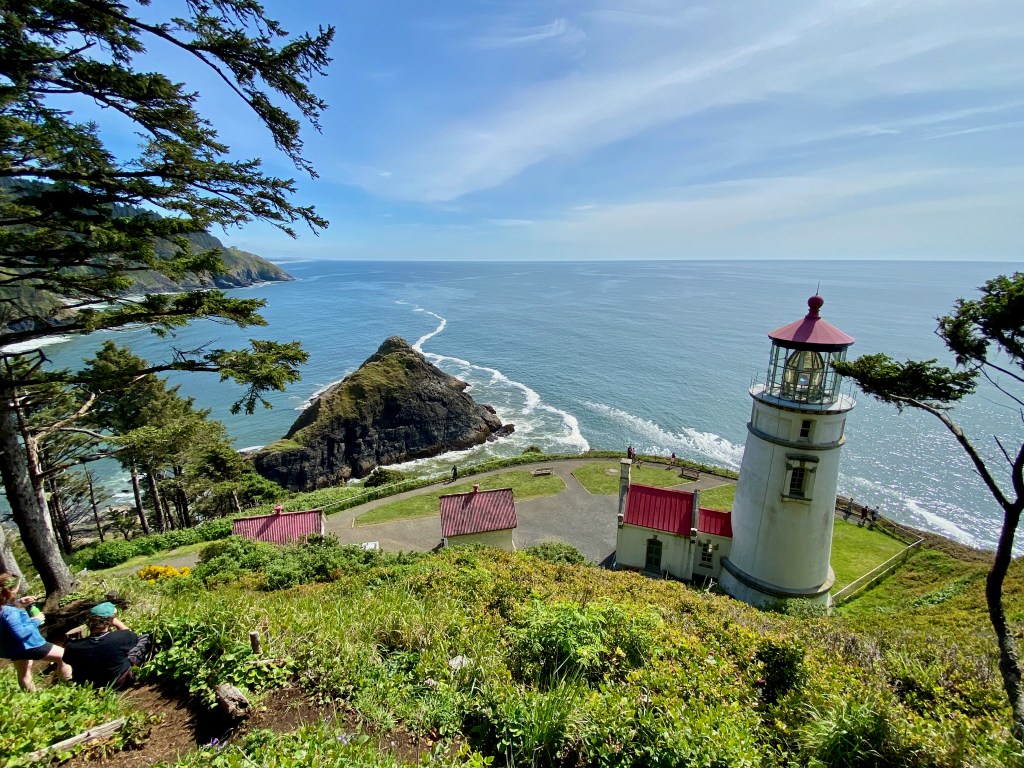
On Wednesday, refreshed and under blue skies, we drove south to enjoy a memorable walk along Oregon Coastal Trail 804 in Yachats. The trail took us along a rocky section of the coast, past homes and between woods and pounding surf. At one spot where we stopped for lunch, we could see a gray whale spouting through its blowhole a few hundred yards offshore before it would descend, only to reemerge in the same spot a few minutes later. We also came across a poignant memorial to two young men from Eugene OR who drowned on a high school outing in 2011 when a “sneaker wave” swept them off the nearby rocks. Further down the coast, we hiked up to Heceta Head Lighthouse.
“Thor’s Well” near Cooks Point, between Yachats and the Haceta lighthouse. Elizabeth thought I was standing a bit too close!
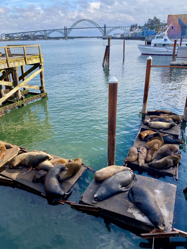
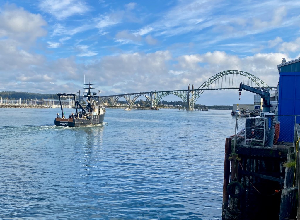
During our time in Newport, we enjoyed the historic bayfront area, where a small colony of California sea lions has taken up residence along the docks. The males come north during the non-summer months, and then head south from mid-June to mid-August to breed in the coves of Baja California. We also watched the boats come and go from the harbor, such as the one aptly named “Pacific Storm.” That’s the Yaquina Bay Bridge in the background. We stayed at the Newport Marina RV Park on the other side of the bay but with an equally good view of the bridge.
***
We’re taking a break from visiting national parks for a short while. I had originally hoped to visit Crater Lake National Park in Oregon, but most of the roads around it are still closed by the winter snows. We’ll plan to come back during the summer months in a future year, Lord willing, when the roads will be open and I can maybe take a jump off a rock into one of America’s grandest swimming holes!
NEWPORT, OR – We’re staying in this scenic Pacific port city for a few days, a bit less than halfway along our 670-mile journey up the West Coast along Highway 101 from Eureka, CA, to Port Angles, WA.
We left Eureka on Wednesday after a weeklong stay. Because of her English blood, Elizabeth has always preferred cooler and more humid weather, so I told her that Eureka might be just the place for her: The cooler Pacific currents cover the city in a “marine layer” of clouds much of the time and keep its daytime temperatures in the 50s and 60s most of the year, and so it was during our stay.
Eureka’s the largest city on the coast north of San Francisco with about 28,000 residents. Its heyday was the late 1800s when it boomed as a lumber and port city, and it’s still home to some lovely Victorian houses and downtown buildings. We drove past a couple of lumber yards in the region that were piled high with huge logs in various stages of processing.
We were less impressed with the large homeless population living along the waterfront and bike trails. It made us feel unsafe as we walked and biked in the city. As a society, we need to have compassion for people living on the margins, but there must be a better way to respond than to allow potentially unsafe and unsanitary encampments in public places. (I flagged the same issue in my post from Austin TX back in March, and I see a majority of the people of that city seem to agree, voting on May 1 by a 57 percent majority to ban camping in the downtown area.)
***
From Eureka, we drove north to Port Orford, a small town about 60 miles from the border with California. From there we explored the coast in both directions, driving back south in the truck to explore the rugged coastline and sea stacks of Myers Creek Beach south of Gold Beach, and north to Bandon and the Face Rock Scenic Viewpoint.
Here are a few photos from our time along the south Oregon Coast last week: 1) At Myers Creek Beach south of Gold Beach; 2) ” Face Rock” near Bandon; 3) My perch after climbing through a passageway at the Face Rock viewpoint: 4) Elizabeth looking out at a small colony of barking male California sea lions at the Simpson Reef overlook south of Coos Bay; 5) A display at the former Coast Guard station that operated at Port Orford Heads from 1934-70 .
Dashboard:
Days on the road: 105;
Miles towing the RV: 5,094;
RV parks stayed at: 33;
National parks visited: 14.
The road ahead (Lord willing): The northern half of the Oregon Coast and over the Columbia River to Long Beach, WA.
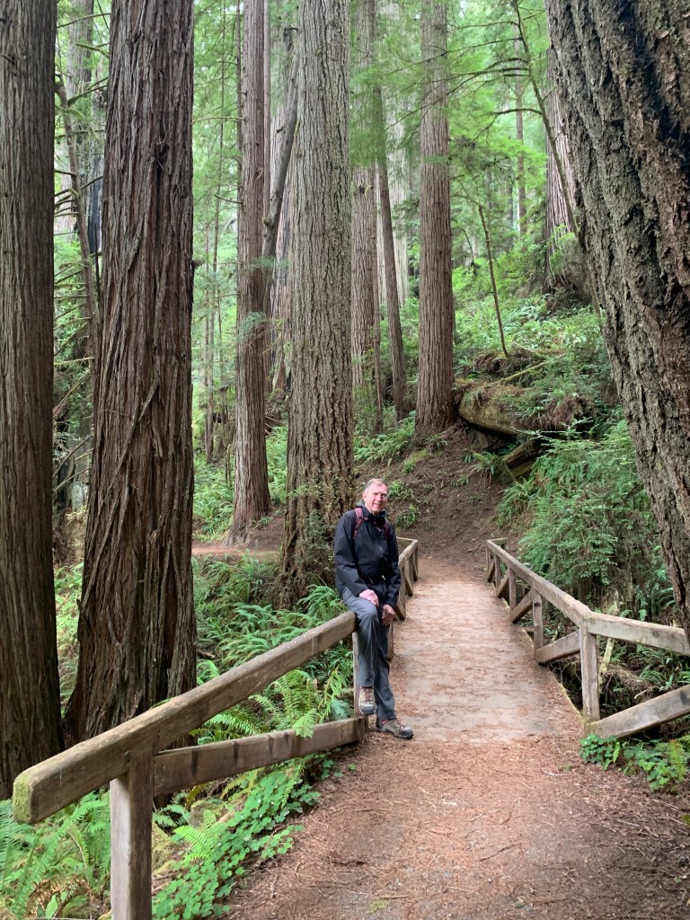
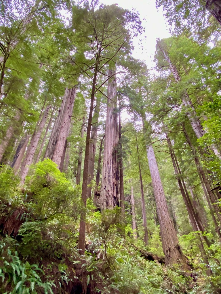
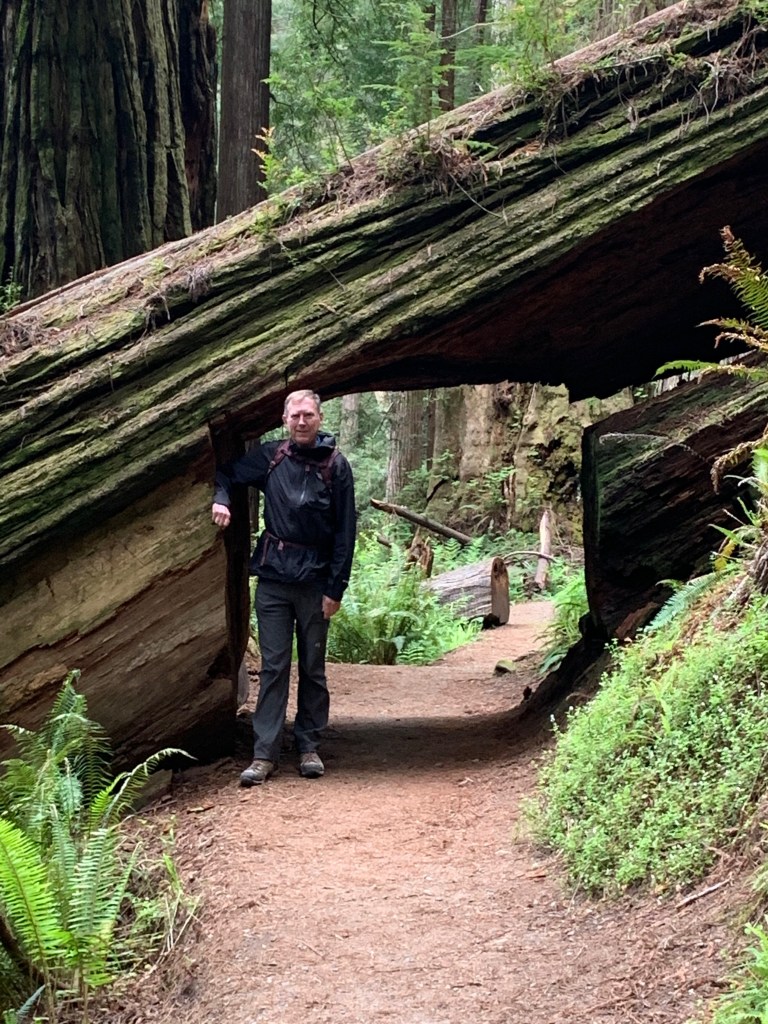
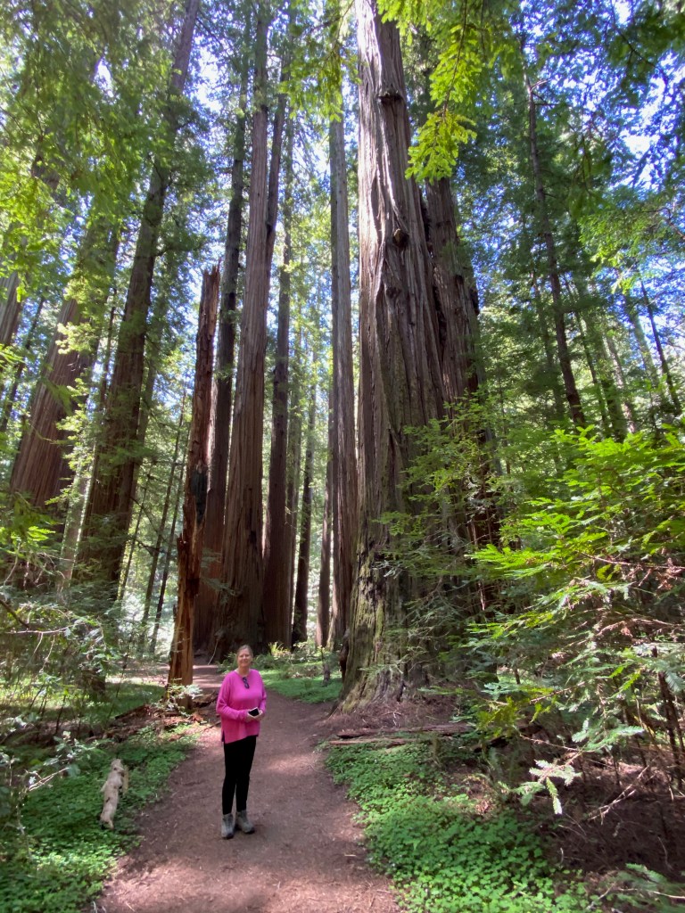
EUREKA, CA – From our base in this Victorian-era logging city on California’s north coast, we’ve launched two forays into the quiet and majestic forests of coastal redwood trees, some of them soaring more than 300 feet high.
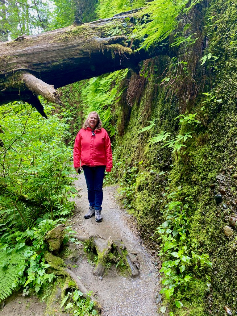
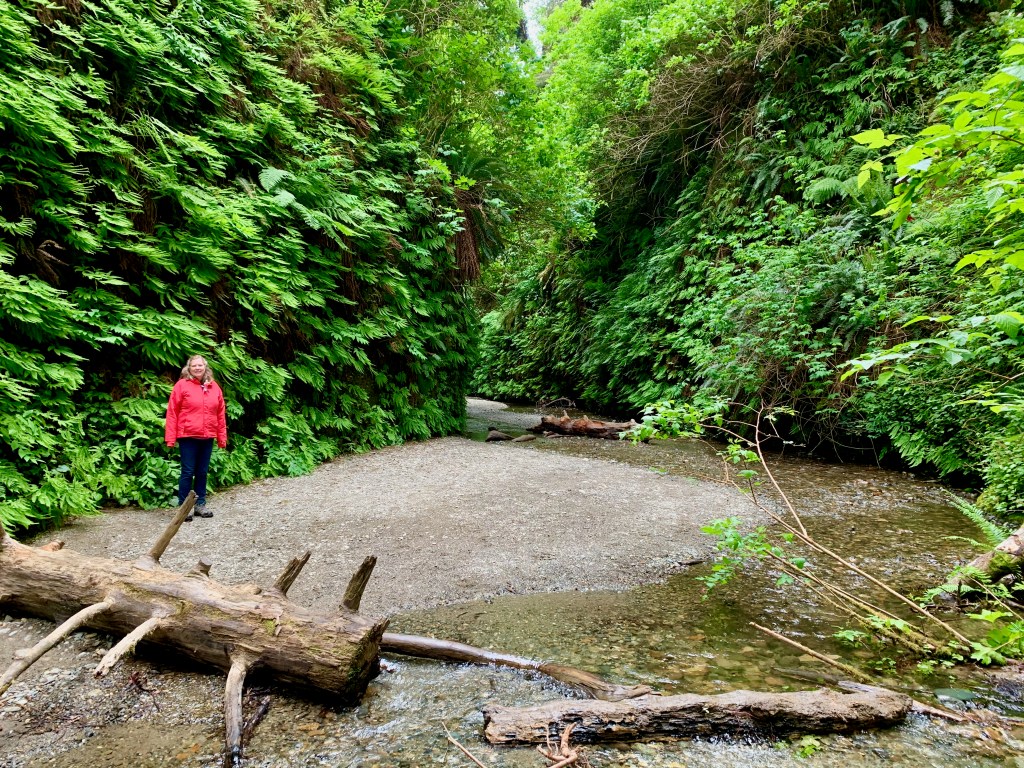
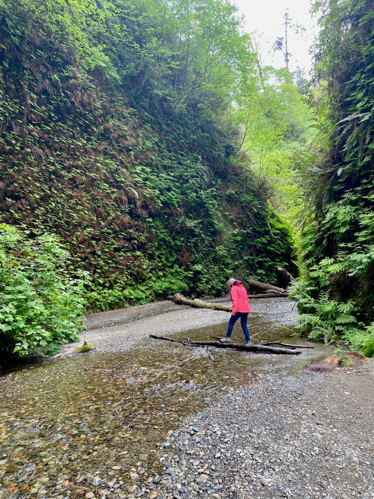
On Friday, we drove north to Prairie Creek Redwoods State Park, where we walked through Fern Canyon and along the 2.5-mile Prairie Creek and Foothills Loop Trail. Fern Canyon is such a strange and wonderful place that Stephen Spielberg filmed this dinosaur attack scene there for “Jurassic Park 2.” On our visit, it was a peaceful place—a narrow gorge with a stream flowing through it and lush ferns covering the sides.
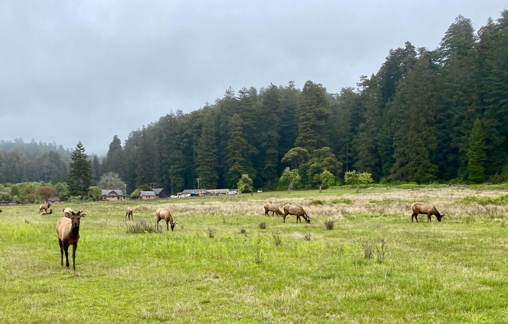
After walking on the nearby beach, we drove to another spot in the park to hike through old-growth redwood trees on the Prairie Creek and Foothills trails. As I’ve complained before, it’s impossible to capture the immensity of these trees on a camera (at least by me on an iPhone 11). The trees are so huge that they exist in three different climate zones—the shaded forest floor, the bare trunk, and the branches and green needles at the forest canopy. The park literature said a tree can give off 500 gallons of water a day, reclaiming it from the moist air from the nearby ocean. A herd of elk greeted us near the visitors center.
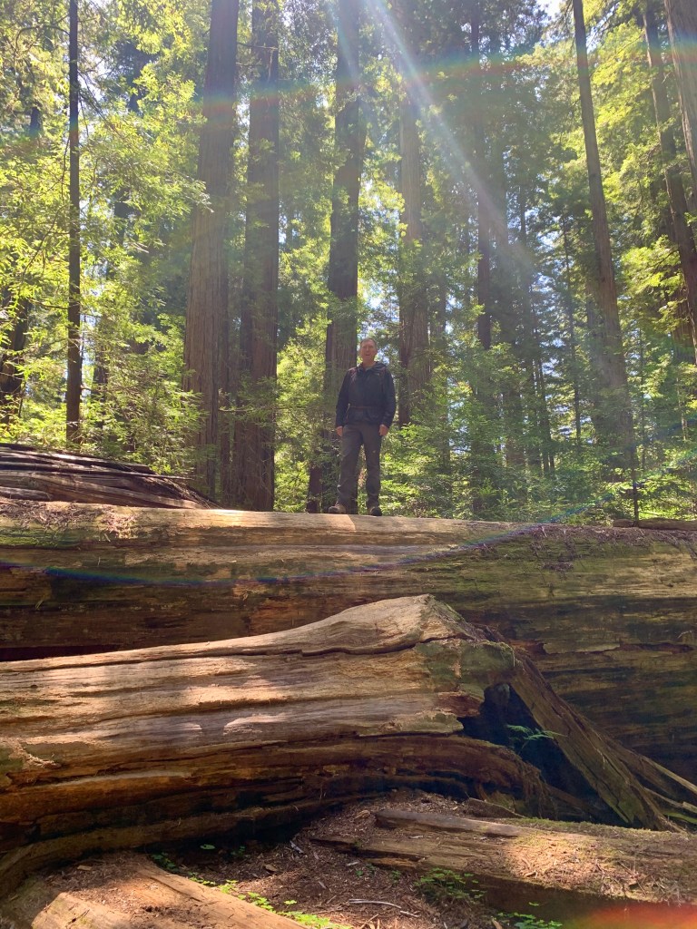
And today we drove south to the Humboldt Redwoods State Forest, where we hiked the Rockefeller Loop and the Founders Loop. We enjoyed walking along the quiet trails, with ferns growing on the forest floor and sunlight filtering through the branches of the redwoods 300 feet above us. When we weren’t looking up, we were gawking at the “fallen giants,” especially the Dyerville Giant, which fell on March 24, 1991. At the time it was at least 362 feet tall–comparable to a 30-story building–52 feet in circumference, and weighed an estimated 1 million pounds! They figure the tree was 1,600 years old, which means it began to grow as a seedling about when Augustine was writing his Confessions and City of God.
Photos below: 1) Standing athwart one of the fallen giant redwoods; 2) Elizabeth on a trail in Humboldt Redwoods State Park; 3) At the base of Founders Tree, which is 346 feet tall; 4) This tree was damaged by fire, but its top was still green; 5) The exposed roots of the fallen Dyerville Giant; 6) Astride the Dyerville Giant.
EUREKA, CA – Earlier this week we traveled to the north end of California’s Central Valley to visit Lassen Volcanic National Park, the largest area of geothermal activity in the lower 48 states outside of Yellowstone.
During our time in north central California, we parked the RV in the backyard of Ken and Lisa Michaud on their one-acre farm south of Redding. We know the Michaud’s from Lisa’s time at Grace OPC in Vienna about a decade ago. During our stay, we enjoyed meals and family time with this dear Christian couple and their two darling kids.
On Tuesday, our last full day there, Elizabeth and I drove about 60 miles east to Lassen Volcanic N.P. The park is centered on Lassen Peak, the site of a major volcanic eruption in May 1915. The volcano remains active although currently dormant, with steaming fumaroles and boiling mud pots in the south end of the park.
While early May was a great time to visit Yosemite, it was less than optimal for Lassen Volcanic park. Much of it lies at 5,000 feet or more above sea level, so most of its main road and many of its trails were still closed because of snow and boulders.
We were only able to drive about a mile into the park from the southwest entrance, but that was far enough to view the “Sulphur Works.” This area features steam vents and a bubbling caldron of mud exuding the rotten egg smell caused by sulfur dioxide and hydrogen sulfide. Still photos don’t do justice to the geothermal activity, so here’s a video:
And here’s a photo and description from the U.S. Geological Survey of the May 1915 eruption of Lassen Peak, also known as Mount Lassen. Red Bluff, where the photo was taken, is just down the road from where we were staying.
***
On Wednesday we climbed over the mountains to the cloud-shrouded historic lumber port of Eureka, CA, where we plan to stay until the middle of next week. The city is within easy driving distance of California’s Redwood national and state parks.
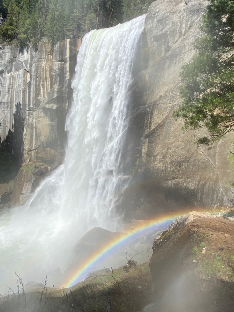
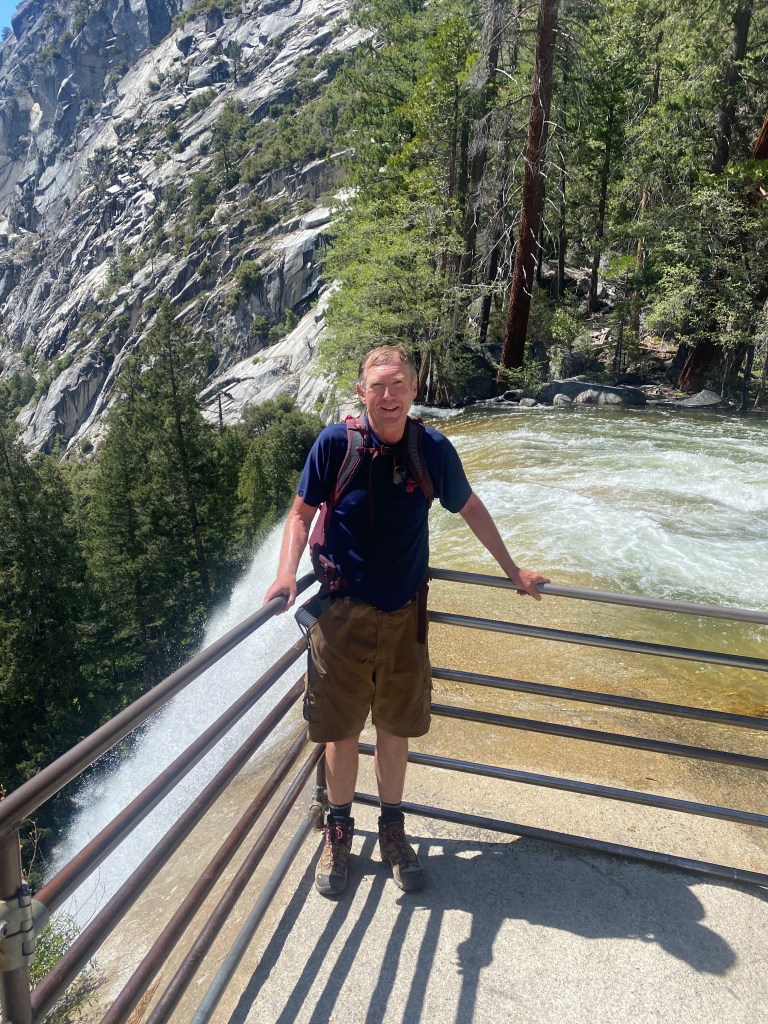
PLACERVILLE, CA – On our last full day in Yosemite National Park on Friday, I hiked to the top of Vernal Fall along what’s called the Mist Trail, which I can confirm is aptly named.
The 3-mile roundtrip trail starts at the Yosemite Valley floor along the Merced River. It rises about 400 feet to a footbridge over the river looking up at the falls, and then another 600 feet to a viewing area above the falls. For the final ascent, I trudged up a granite stairway of more than 600 steps. The stairway and I were both soaked from the spray from the falls but the mist also created a colorful rainbow at its base.
Rather than pick my way back down the slippery stairs, I came back by way of the John Muir Trail. The full Muir Trail runs 211 miles from Yosemite to the top of Mt. Whitney. I only hiked about 1.5 miles of it, but I can say “I hiked the John Muir Trail!” (In his book, A Walk in the Woods, author Bill Bryson said the same about the Appalachian Trail, even though he and his friend only hiked portions of it. Hint: Read the book, skip the movie.)
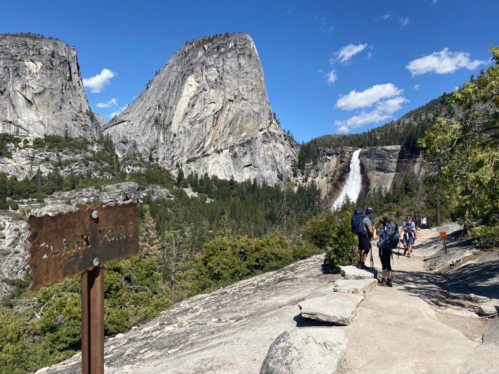
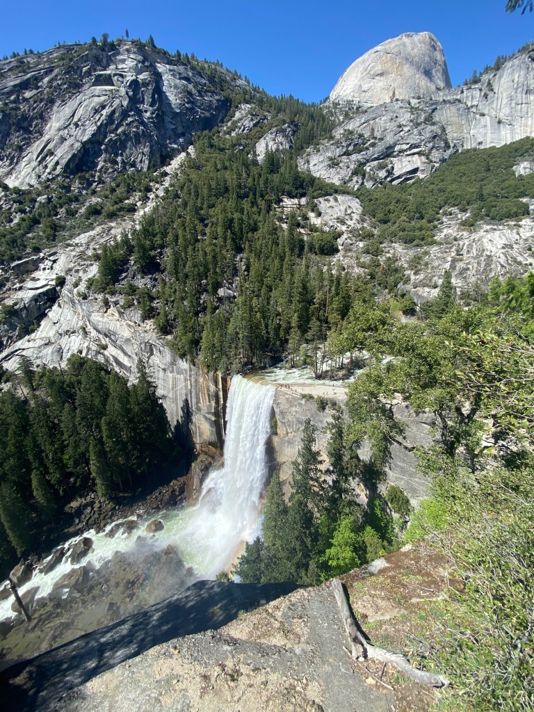
Photo slideshow: 1) Nevada Fall from Clark Point; 2) Above Vernal Fall; 3) At the viewing area at the top of Vernal Fall.
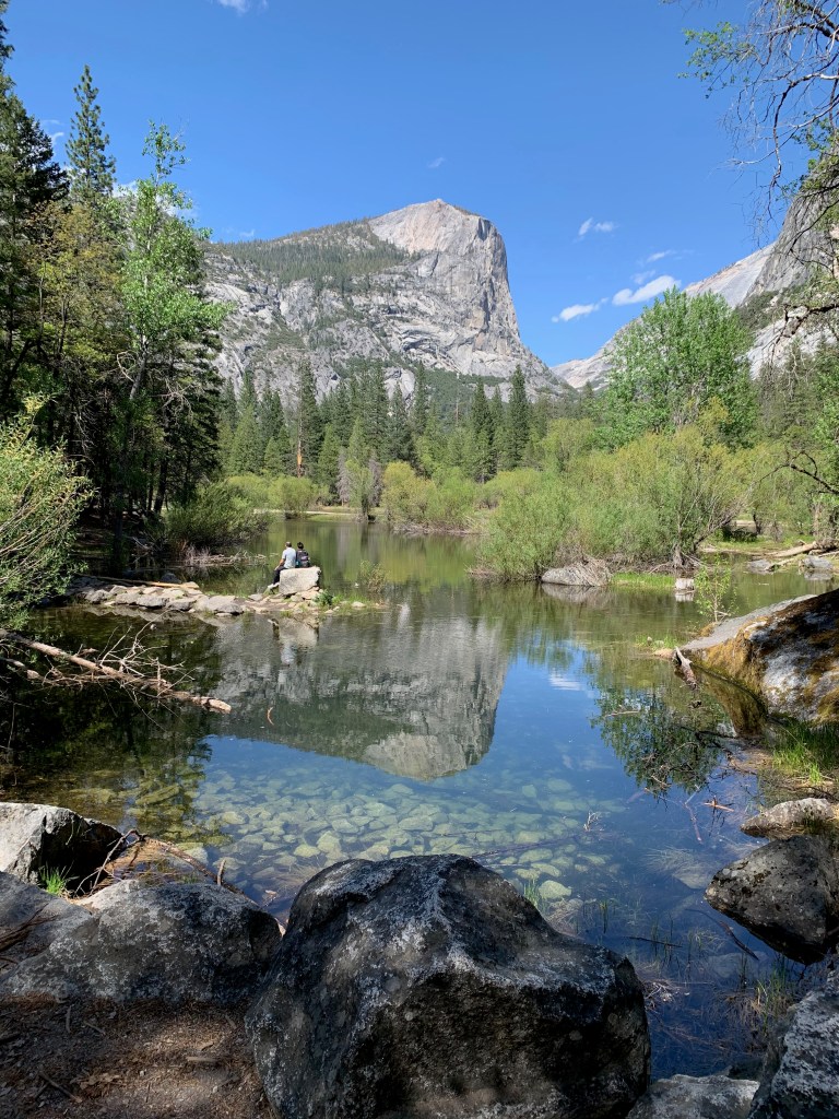
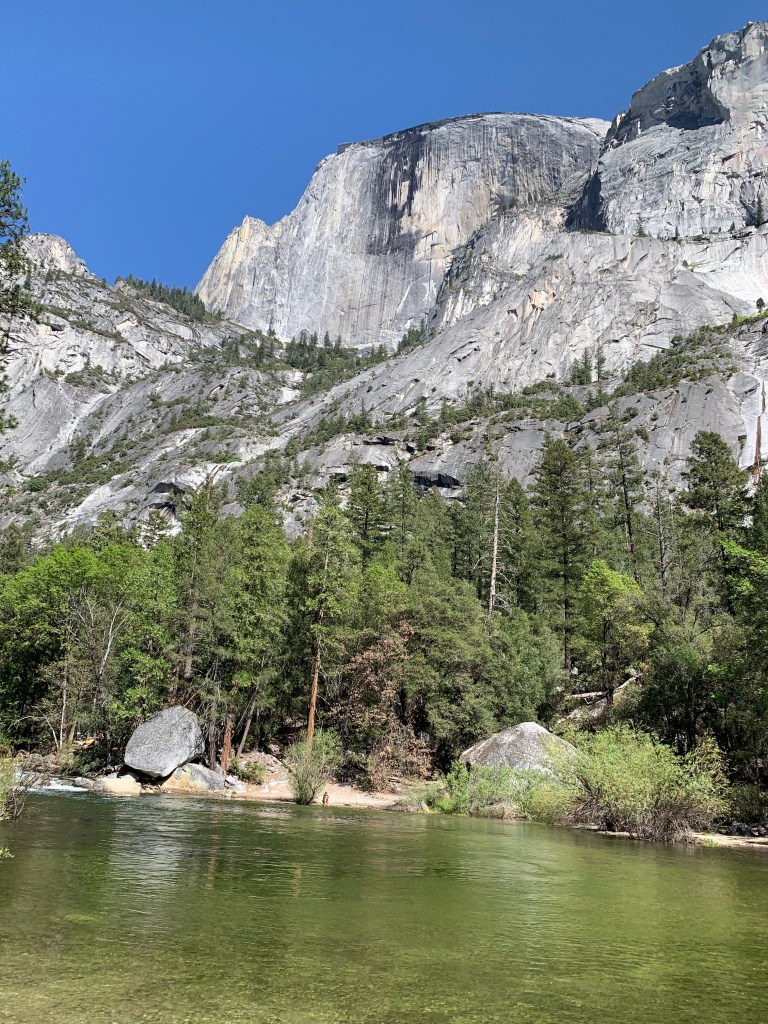
While I was getting a shower on the Mist Trail, Elizabeth was walking to Mirror Lake at the base of Half Dome. It’s not really a lake, but a wide and slow-moving portion of Tenaya Creek. It’s a great place for kids to wade in the creek and for reflective photos of Half Dome. Here are a couple of Elizabeth’s photos.
***
Today we’re wrapping up a two-night stay at a KOA RV park in what was once gold rush country in west central California.
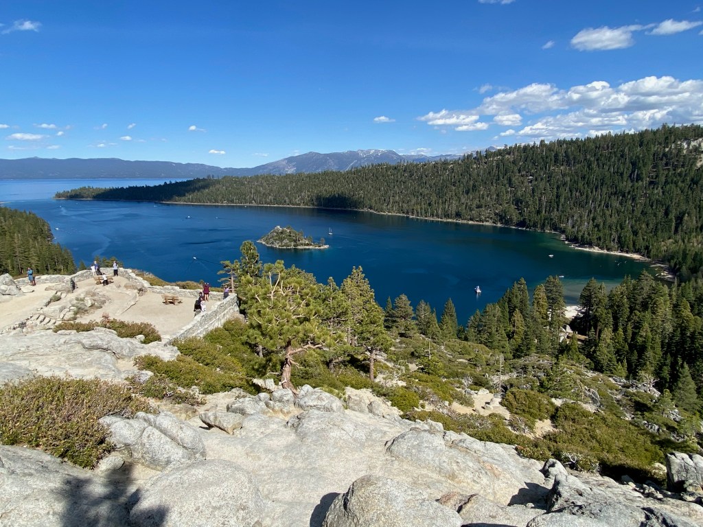
Yesterday we drove 70 miles to South Lake Tahoe to admire the lake and to enjoy lunch with Bill and Jill Schilling, a couple we first met during our time in London in the 1990s. The Schillings live in Reno, so we agreed to meet at a favorite restaurant of theirs just over the California line and near the lake. After lunch we walked along the beach and looked out on the blue-green waters of the lake and the mountains that surround it.
After we said goodbye to our friends, Elizabeth and I drove to the southwest corner of the lake to admire the views above Emerald Bay State Park. The bay is a mile wide and three miles long. It’s home to the only island in the lake, which features the remains of a tea house built at the top of the island by a wealthy land owner in the 1920s.
Dashboard:
Days on the road: 91;
Miles towing the RV: 4,429;
RV parks stayed at: 29;
National parks visited: 12.
The road ahead (Lord willing): Redding and Eureka, CA
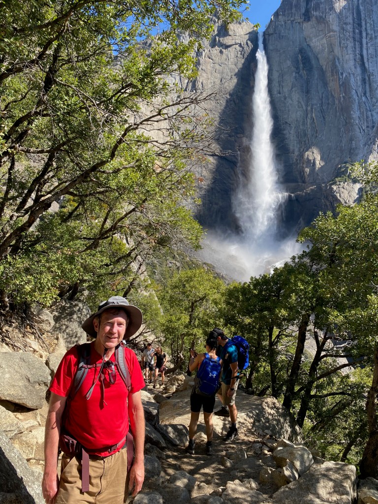
YOSEMITE NATIONAL PARK, CA – Yesterday I hiked to the rim of Yosemite Valley to look down on one of the tallest waterfalls in North America and then on to Yosemite Point for a sweeping view of Half Dome and the valley floor below. It was one of the most demanding and rewarding hikes I’ve ever tackled.
Upper Yosemite Falls plunges 1,430 feet to the rocks below, where the water cascades to the top of Lower Yosemite Falls, to tumble another 320 feet. From the top of the upper falls to the base of the lower falls, the water drops a total of 2,425 feet. The trail to the top of Upper Falls rises 2,700 feet from the trailhead, and Yosemite Point lies a few hundred feet higher, for a total elevation gain of 3,000 feet. Roundtrip, the hike was 8.8 miles.
After climbing steep switchbacks and stone stairs much of the first part of the hike, I was rewarded with a view from the bottom of the upper falls, with Half Dome in the distance. The spray was enough to wet the screen of my iPhone.
From there the trail follows more switchbacks to the rim of the valley and then down a few hundred feet to a viewing rock at the top of the upper falls. Leaning over a sturdy steel guard rail, I was able to snap a few photos of the falls roaring over the precipice. Thanks to the iPhone wide-angle lens feature, I was able to capture not only the falls but also the valley below.
And from there it was on to Yosemite Point. The trail there is about a mile, crossing Yosemite Creek only about a hundred feet upstream from the falls. The view from there rivals that of Glacier Point on the opposite rim, with Half Dome dominating the east end of the valley.
The hike down was easier on my heart and lungs but more challenging for my brain and balance. With all those stone steps, I had to choose my footing carefully. Once I slipped on a sand-covered step and fell back on my bottom, and at least three other times I had to catch myself. My total time on the trail, including breaks, was about 6 hours.
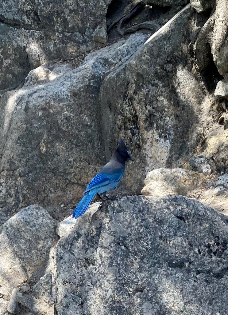
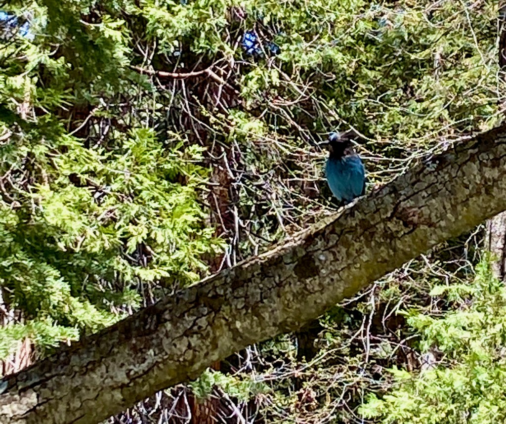
Here are three more photos from the trip down: 1) A look back at Upper Yosemite Falls; 2) Half Dome; 3) A friendly steller’s jay, the same kind of bird that was waiting for a cracker at Muir Rock in Kings Canyon.
***
A few general observations about Yosemite N.P.: It’s an incredibly scenic place, and if you’ve ever thought of visiting, don’t put it off too long. Early May is a great time of year to visit the park. You miss the summer vacation hordes, which means you can enter the park anytime without making a reservation, which will be required this year starting on May 21. Temperatures are warm, in the 70s and low 80s during our visit, but not too hot.
Another benefit of an early spring visit is that the snow melt is still feeding the waterfalls and rivers. When people think of Yosemite, they tend to picture El Capitan and Half Dome, and rightly so, but what brings the park alive is the sound of crashing water. All the major waterfalls—Bridalveil, Yosemite, Vernal, and Nevada—are flowing generously during our time here. That flow can greatly diminish or dry up entirely later in the summer with the last of the snow melt.
Yosemite would be worth visiting even in the drier season, but it would seem to me a diminished experience—like visiting a magnificent concert hall but without the music.
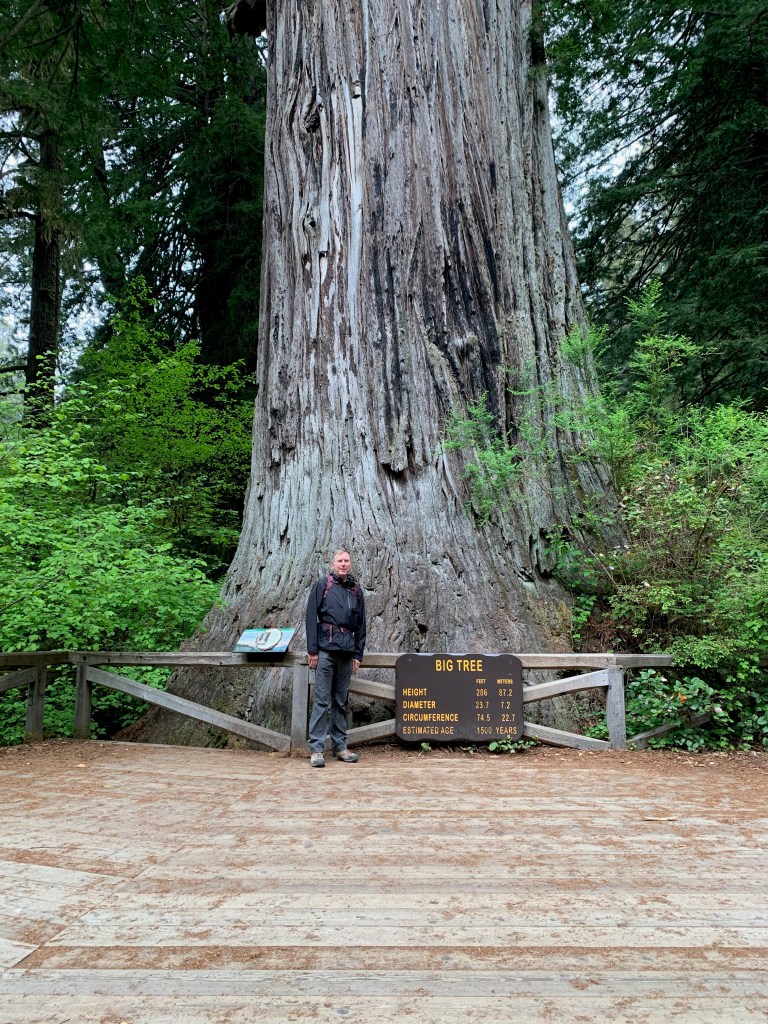
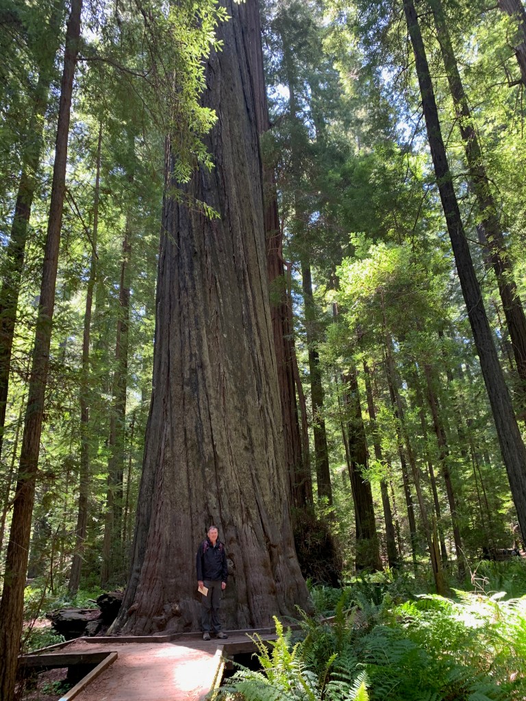
LEMON COVE, CA – On Saturday we spent the day in Sequoia National Park, walking the pine-scented trails and staring up at the biggest trees we’ve ever seen.
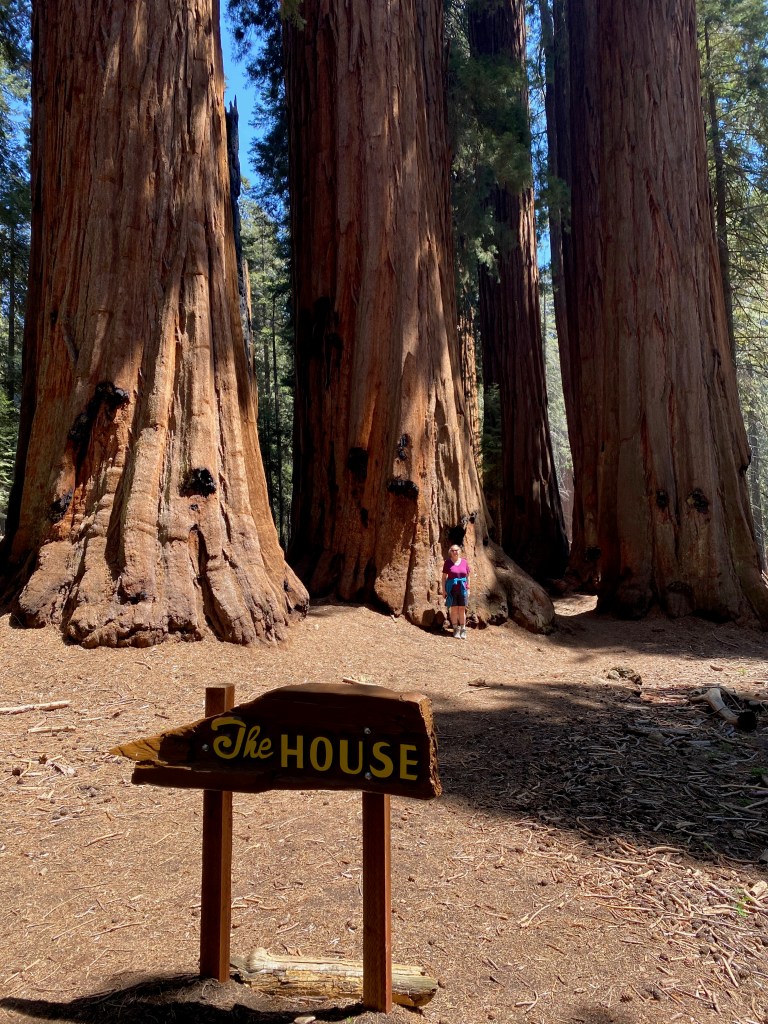
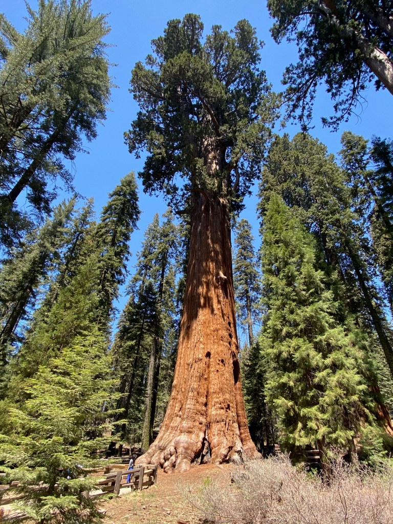
Sequoias grow only in a limited area of California, along mountainsides at about 6,000 feet above sea level. The centerpiece of Sequoia N.P. is the General Sherman Tree, considered the biggest in the world in terms of the volume of wood it contains. From there we walked two miles along the Congress Trail, past groves of sequoias, one called the House and another the Senate.
The General Sherman Tree.
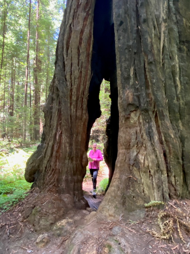
It’s impossible to capture the immensity of these trees with a camera. They can be 250 feet tall with trunks 100 feet in diameter. We enjoyed walking among the trees, ducking into the crevices often created by past forest fires, and looking up the copper-colored trunks to the green pine branches far above the forest floor. It’s a sight we’ll never forget.
***
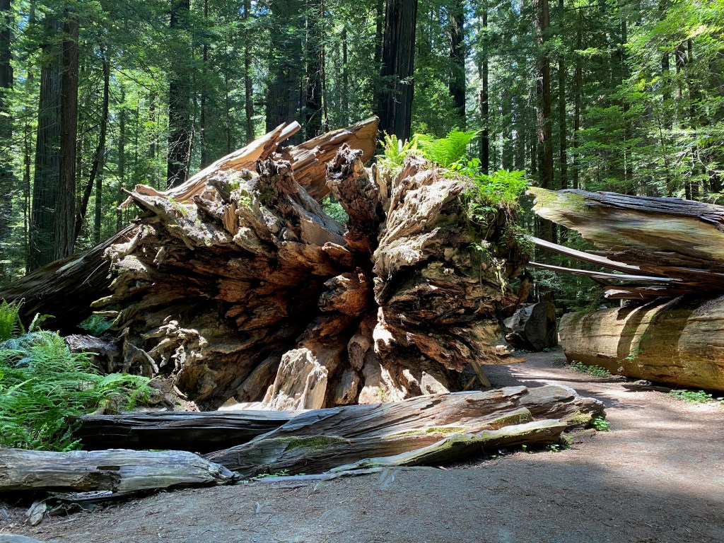
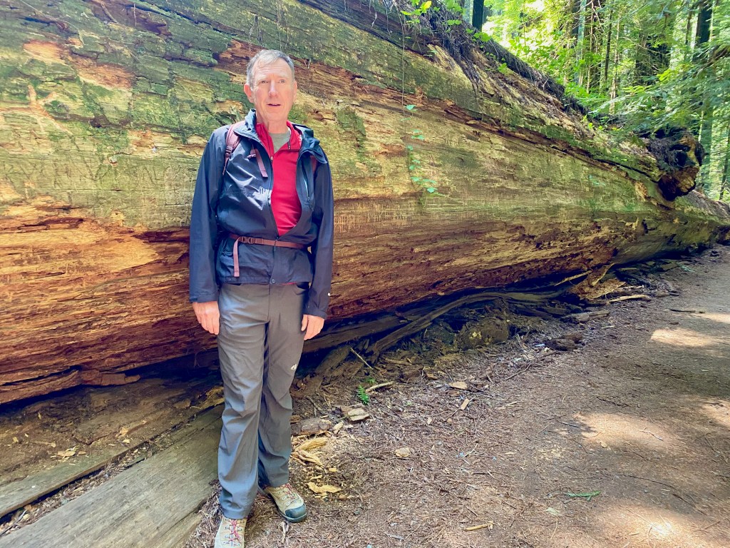
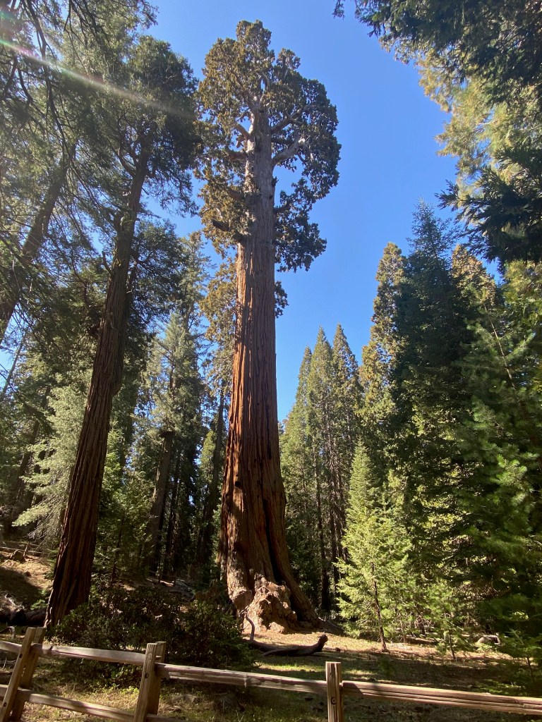
On Monday, we drove a bit further north to the adjacent Kings Canyon National Park, which has its own stand of sequoias as well as the spectacular canyon carved into the mountainside by ice-age glaciers. The main attraction among the sequoias is the General Grant Tree, which is actually a bit wider in circumference than the General Sherman Tree but not as voluminous in wood. Nearby is the Fallen Monarch, a giant sequoia that fell centuries ago but continues to provide a shelter in its hollowed trunk that was used by explorers and even army cavalry.
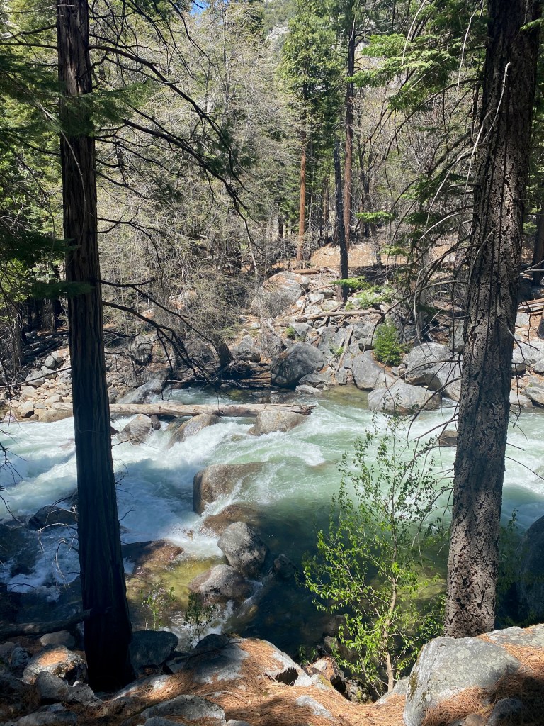
Further up the canyon, we enjoyed the views of the South Fork of the Kings River, with stops at Grizzly Falls and Roaring River Falls. At the end of the 30-mile Kings Canyon Scenic Byway, we enjoyed a restful time along the river on Muir Rock, where the naturalist John Muir would give talks on preserving the surrounding wilderness. Today the rock serves as a swimming hole. I was tempted to jump in, but the spring run-off water was too cold even for me!
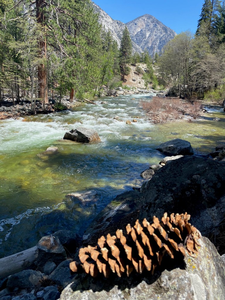
Here are a few photos from Kings Canyon N.P.: 1) The General Grant Tree; 2) Roaring River Falls; 3) along the South Fork of the Kings River; 4) Looking up river–with a huge pine cone I placed on a rock for perspective and color; 5) This bird waited patiently on a limb above Muir Rock, and was rewarded when a couple nearby left a cracker out for the bird to snatch; 6) On Muir Rock looking up river. Right behind me was a popular jumping off point for swimmers.
One book I’ve finished on this RV trip is Alexander Solzhenitsyn’s novel Cancer Ward. A Christian brother recommended it three decades ago, telling me that it was so vivid in its portrayal of patients in a Soviet hospital in the 1950s that he felt like he had cancer himself.
Solzhenitsyn is one of my favorite authors. In his fiction and non-fiction, he portrays ordinary human characters living and dying in an inhuman system. His writings remind me what’s important in life and to never take our blessings and freedoms for granted. It never fails to put my own problems in perspective when I recall the life of a prisoner, or zek, trying to survive in a Soviet prison camp.
Back in my 20s, I read the first two (of three) volumes of Solzhenitsyn’s The Gulag Archipelago, one of the most important literary works of the 20th century. In his detailed account of the Soviet prison camp system and the suffering it afflicted on millions, the Russian dissident exposed to the world the evil at the heart of communism.
More recently, along with Cancer Ward, I’ve read another of his novels, In the First Circle, and an abridged version of The Gulag Archipelago that covers all three volumes and was produced with the author’s input and approval before his death in 2008. Since “the first circle” is a reference to Dante, I’ll briefly review the three works starting from the deepest circle in the man-made hell Solzhenitsyn describes.
In the abridged version of The Gulag Archipelago, Solzhenitsyn chronicles the creation of the vast prison system that began soon after the communist revolution in Russia in 1917. He tells the history of the system as well as hundreds of individual stories of the people raked into its maw.
Among the passages that affected me most were those about what it means to be arrested and to undergo interrogation and torture. He writes that even medieval torturers didn’t “understand how narrow are the limits within which a human being can preserve his personality intact.” After arrest you must put your past firmly behind you and tell yourself that the life you knew is over.
Many of the most heartbreaking stories involved women and children in the prison camps: a 10-year-old girl from a Christian family who defied her captors; a 14-year-old boy who told the truth about life in the camps to the visiting Soviet author Maxim Gorky, and was later shot for his honesty; and the 18-year-old girl forced to stand in freezing water for two hours.
Liquidating the kulaks, or successful farmers, as a class meant that for every communist agent the farmers killed in self-defense, “hundreds of the most industrious, enterprising, and level-headed peasants, those who should keep the Russian nation on an even keel, were eliminated.” At the Great Break of 1929, whole nations were exiled.
Solzhenitsyn blames ideology for the mass killings of the Gulag. He notes that Shakespeare’s evil-doers stopped at a dozen corpses because they had no ideology. He tells the story of the hundreds of thousands of Soviet soldiers who were prisoners of war, only to be sent directly to the Gulag when they were repatriated. He rightly asks, “A Motherland that betrays its soldiers—is that really a Motherland?”
In the chapter, “Ascent,” he writes about spiritual growth in the camps and learning not to judge others. As he wrestled with good and evil in his own heart, Solzhenitsyn writes,
And it was only when I lay there on rotting prison straw that I sensed within myself the first stirrings of good. Gradually it was disclosed to me that the line separating good and evil passes not through states, nor between classes, nor between political parties either—but right through every human heart—and through all human hearts.
Of the Christian believers he encountered in the camps, he says they endured “without wavering, and without spiritual collapse. They were all honest, free from anger, hard-working, quick to help others, devoted to Christ.”
***
In the First Circle is set in a special corner of the Soviet prison system, the sharashka, a research prison for engineers and scientists who work on projects for the Soviet state. It is still within the inferno of the Gulag, but in a less brutal part, hence the “first circle.”
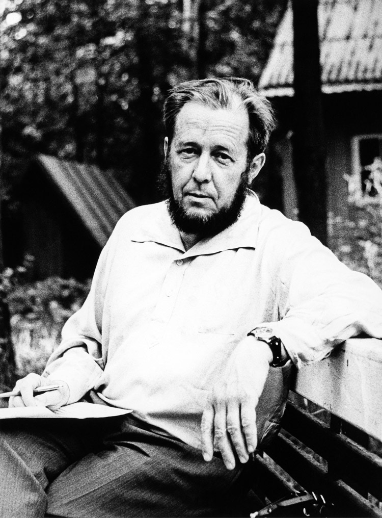
Solzhenitsyn tried to get a self-censored version of this work published in the Soviet Union in the mid-1960s, but the brief thaw that allowed the publication of A Day in the Life of Ivan Denisovich had closed by then. The photo below is Solzhenitsyn in 1967, when he was in his late 40s and still a member of the writer’s union. The version I read is the uncensored original.
Life in the research prison was not as bad as the Gulag camps, but it was bad enough. Prisoners could see their wives for only a half hour a year, their mail was censored, and their family members on the outside were subject to discrimination.
My favorite characters were Innokenty Volodin, the privileged diplomat who came to understand the horrors of the system, and Spiridon, the simple peasant who ached for his teen-age daughter who was prisoner in a lumber camp. Nerzhin was the character most like Solzhenitsyn.
The profile of Stalin was chilling but also kind of funny. In late night hours, he would enjoy listening to his old speeches. He was a prisoner in his own way to his paranoia and self-absorption.
Among the most tragic of the prisoners was the 1945-46 “stream” of former POWs who were lured back with pamphlets that said, “The Motherland forgives. The Motherland calls.” While America was greeting its POWs with the GI bill, “sturdy Russian prisoners of war [were] exchanging a German stalag for their fatherland’s Gulag.”
The translation was beautiful, with memorable lines and passages throughout. Among my favorites:
If we live in a state of constant fear, can we remain human?
Only sick people alone with their illness (and not in a hospital!) could live an untroubled life in the Soviet Union.
They came back [from the front] cleansed by the proximity of death.
Must love for your native land extend to any and every government it may have? Must you go on abetting it in destroying its own people?
Where should you start reforming the world? With other people? Or with yourself?
Two prisoners debating whether mankind has progressed: “Well, we aren’t burning one another at the stake anymore.” “Why bother with firewood when you’ve got gas chambers?”
Yes, [Volodin] had enjoyed so many blessings! But the most precious of blessings had never been his: the freedom to say what you think, the freedom to associate openly with your intellectual equals.
The Gulag is a country in which a grown man working twelve hours a day cannot earn enough to feed himself.
[For a discussion of the book and Solzhenitsyn’s broader significance, I highly recommend this Econtalk podcast with host Russ Roberts and Russian literature professor Kevin McKenna of the University of Vermont. On another episode, Roberts discusses Solzhenitsyn’s work with historian Stephen Kotkin of Princeton University.]
***
Cancer Ward is a story based on Solzhenitsyn’s real-life experience of nearly dying from the disease when he was living in exile in central Asia in 1953-54. By then he had escaped the hell of the Gulag to the relative “freedom” of life as an ordinary Soviet citizen.
After reading the book, I can confirm my friend’s assessment: Some of the most memorable passages are when the author describes the chronic pain of the patients in the ward. One leans his head over the edge of the bed all day, unable to do anything but long for the next round of pain relievers. Another struggles to turn his head because of the size of the tumor growing on his neck.
The main character in the book, Oleg, lives a simple life in the cancer ward, but he can be grateful that he is no longer in the Gulag:
there were other joys, sufficient in themselves, which he had not forgotten how to value: the right to move about without waiting for an order; the right to be alone; the right to gaze at stars that were not blinded by prison-camp searchlights; the right to put the light out at night and sleep in the dark; the right to put letters in a letterbox; the right to rest on Sunday; the right to bathe in the river. Yes, there were many, many more rights like these. And among them was the right to talk to women. His recovery was giving him back all these countless, wonderful rights.
Another theme of Cancer Ward is contentment. As the author writes: “It is not our level of prosperity that makes for happiness but the kinship of heart to heart and the way we look at the world. Both attitudes lie within our power, so that a man is happy so long as he chooses to be happy, and no one can stop him.”
In passing Solzhenitsyn reflects on the Soviet health system compared to a private system where people pay at least something toward their care. When one character exults that it is one of the greatest achievements of the Soviet system that health care is a free service, another responds:
Is this in fact such a great achievement? What does ‘free’ mean? The doctors don’t work for nothing, you know. It only means that they’re paid out of the national budget and the budget is supported by patients. It isn’t free treatment, it’s depersonalized treatment. If a patient kept the money that pays for his treatments, he would have turned the ten roubles he has to spend at the doctor’s over and over in his hands. He could go to the doctor five times over if he really needed to.
Later the character reflects, “Well, out there, out there in the camps, we used to argue that there was a lot of good in private enterprise. It makes life easier, you see. You can always get everything. You know where to find things.”
And finally, even though the book takes place outside the Gulag, the labor camp system casts a shadow over those who suffered under it:
The icy world which had shaped Oleg’s soul had no room for “unpremeditated kindness.” He had simply forgotten that such a thing existed.
The Uzbeks and the Kara-Kalpaks had no difficulty in recognizing their own people in the clinic, nor did those who had once lived in the shadow of barbed wire.
A man dies from a tumor, so how can a country survive with growths like labor camps and exiles?
I hope these passages and my reflections will spur more people to read Solzhenitsyn’s work. We cannot fully understand the world we live in, or our own human hearts, without at least a basic knowledge of the horrors that took place on a grand scale in the 20th century, and those taking place on a smaller scale today.
LEMON COVE, CA – We drove 185 miles north yesterday to this area of citrus groves after a week in the Los Angeles area.
One of the highlights of our time in LA was a ferry ride on Wednesday to Catalina Island, which lies about 29 miles southwest from the Port of Long Beach. We spent a full day on the island with our dear sister-in-law Bernadette, who lives in LA with Elizabeth’s brother Mark.
We spent most of the day walking the streets of Avalon, the main port and only incorporated city on the island. It is full of interesting shops and restaurants, surrounded by homes built on the hillsides. Its population is about 4,000, the same as my boyhood home of Sauk Centre, MN.
While there, we walked up to the Zane Gray Hotel for views of the town and harbor. The hotel was originally the home of the successful author who wrote popular westerns at the turn of the last century.
We also took a city bus to the William Wrigley Memorial a couple of miles in the hills above the city. The chewing gum magnate actually owned the island at one time and the Chicago Cubs used it as their base for spring training from 1921 to 1951. Today 88 percent of the island is a conservancy trust protecting the fauna and flora covering its 76 square miles.
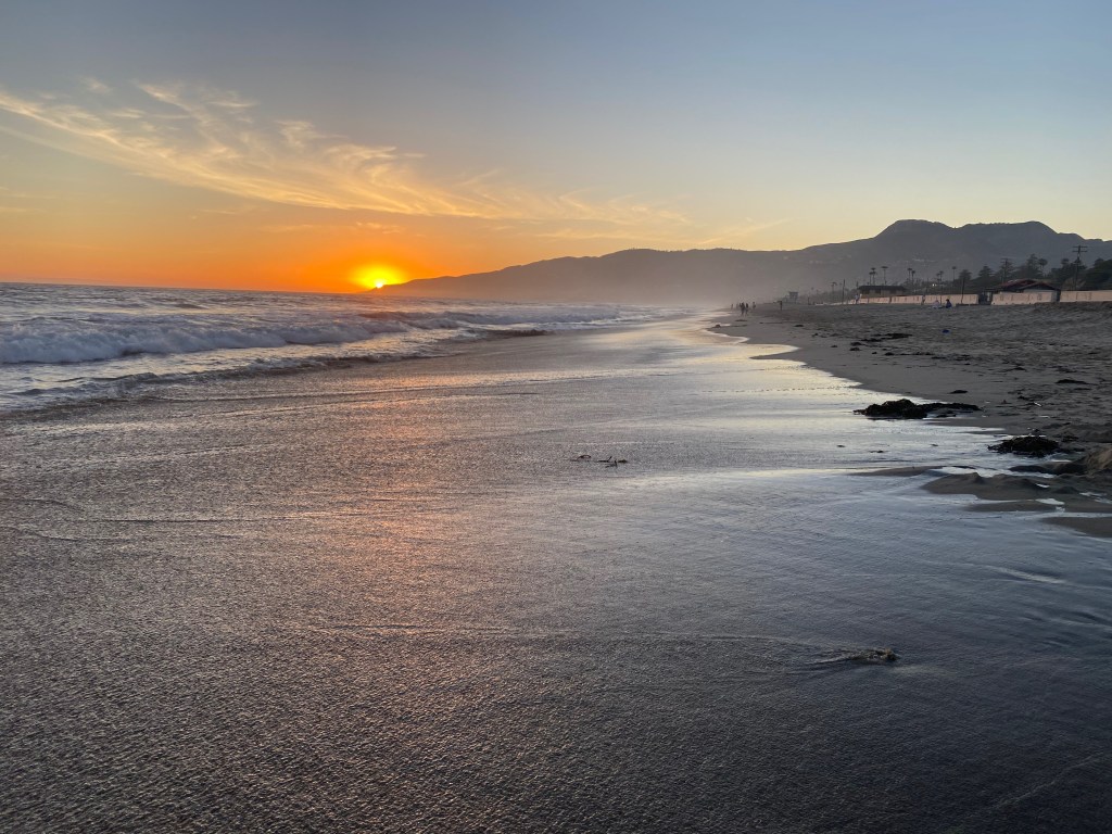
On Thursday Elizabeth and I walked for an hour on Zuma Beach in Malibu as the sun was setting.