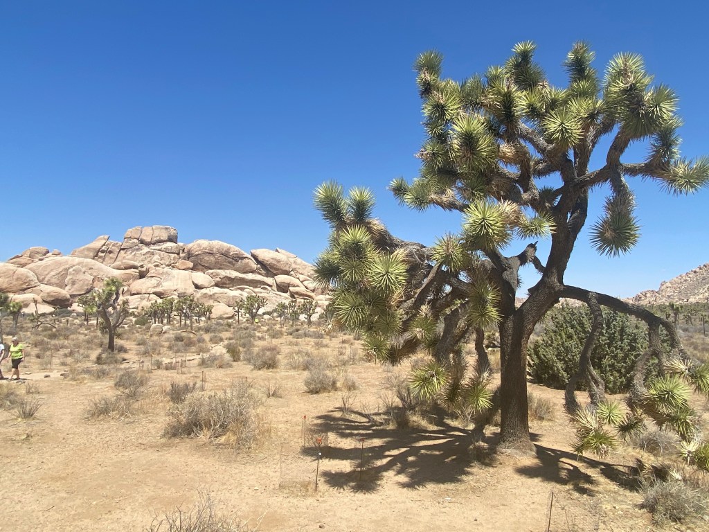
TWENTYNINE PALMS, CA – We drove through Joshua Tree N.P. yesterday, admiring the strangely formed plants that give the park its name and the granite boulders stacked in odd formations throughout the park.
A Joshua Tree near the Keys View lookout point.
The park is located just south of this city where we’ve parked our RV, and about 150 miles east of Los Angeles. The landscape is not spectacular in terms of mountain peaks and canyons, but it is strange and unique, with the twisted Joshua Trees dotting open areas surrounded by boulder fields. It’s worth a visit, although we found we could see it all easily in a day.
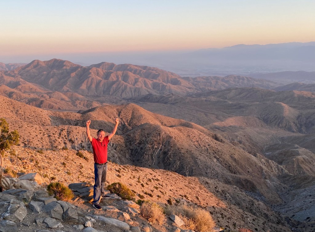
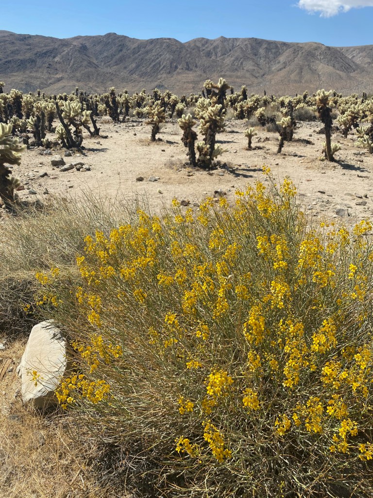
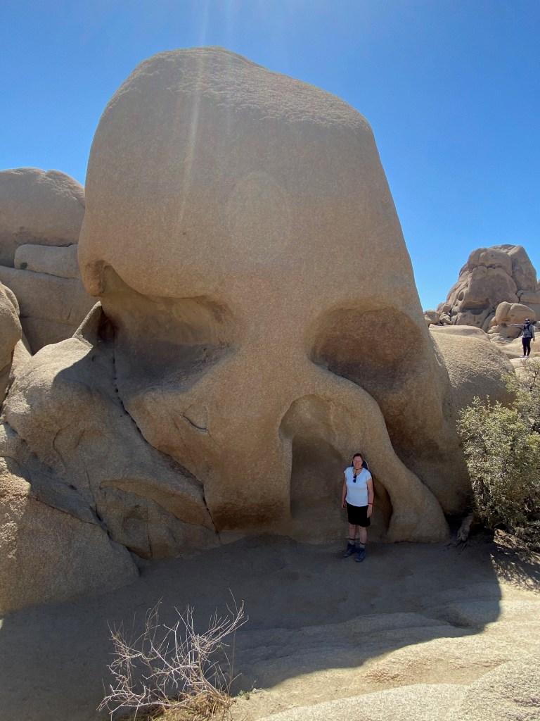
[Captions for the photos below: 1) Atop Keys View at sunset; the San Andreas Fault runs through the valley floor in the distance; 2) An oasis of palms at the Oasis Visitor Center; 3) The Cholla Cactus Garden in the park; 4) “The Skull” rock formation; 5) A frequent vista in the park; 6) A blooming hedgehog cactus along the Hidden Valley trail.]
Joshua Trees are not really trees but a species of yucca plant. They were named by early Morman settlers who thought their limbs resembled the outstretched arms of Moses’ successor leading Israel to victory as it conquered the promised land. Joshua 8:18 tells us:
Then the Lord said to Joshua, “Stretch out the javelin that is in your hand toward Ai, for I will give it into your hand.” And Joshua stretched out the javelin that was in his hand toward the city.
I was tempted to joke that the park was actually named in honor of the mega-selling, 1987 U2 album “The Joshua Tree.” Two of the songs from that album are among my favorites, “Still Haven’t Found What I’m Looking For” and “With or Without You.” They served as a fitting soundtrack as we left the park for home yesterday afternoon.
***
One of the many things I’ve learned during our time in this part of the country is that it’s too sweeping to refer, as I have in previous blogs, to “the desert southwest.” There are actually four desert systems: the Chihuahuan Desert, which we crossed in west Texas and southern New Mexico; the Sonoran Desert, home to the saguaro cactus; the Mohave Desert; and the Great Basin Desert that covers most of Nevada. Joshua Tree N.P. straddles the Mojave and Sonora deserts, adding to its diversity of plant and animal life.
We’ll be spending the next four weeks traveling through California, Lord willing. If anyone has suggestions about what we should see or people we can visit, please send the suggestions my way!
Dashboard:
Days on the road: 75;
Miles towing the RV: 3,756;
RV parks stayed at: 24;
National parks visited: 9.
The road ahead (Lord willing): Los Angeles and the West Coast
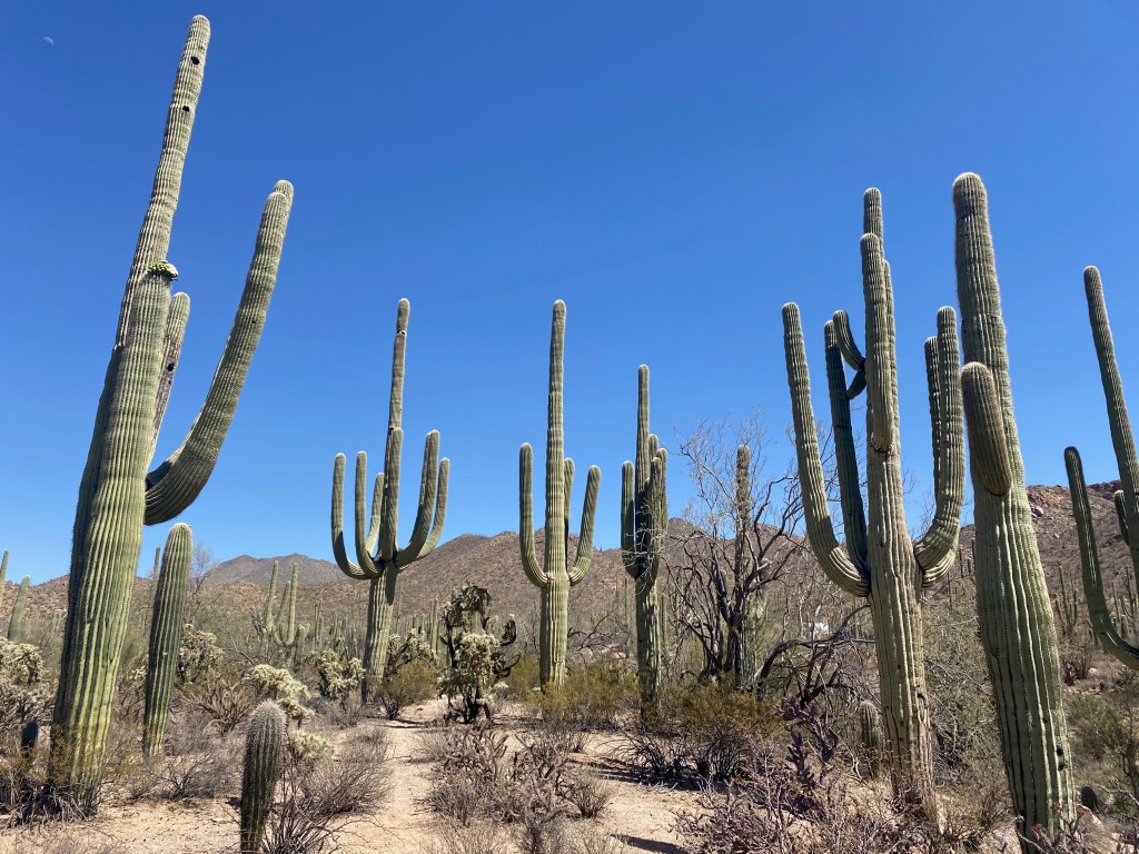
TUCSON, AZ – Who knew the desert Southwest could be so colorful? In our last full day in the Tucson area yesterday, we toured the Arizona-Sonora Desert Museum and the West section of the Saguaro National Park—getting up close to tall saguaro cacti and other blooming desert plants covering the rolling hills of the park.
On the Wild Dog Trail in Saguaro N.P.
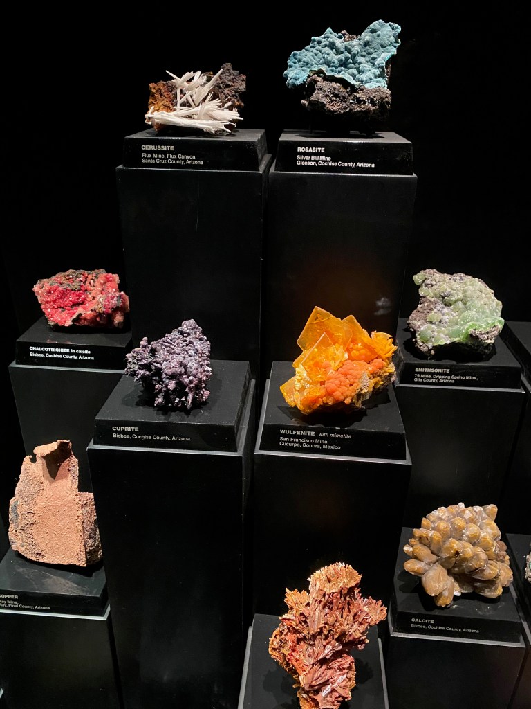
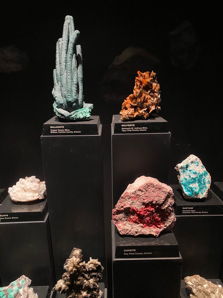
The Desert Museum is located in the Tucson Mountain Park just south of the Visitor Center in the West section of the national park. Admission was not cheap–$23 per person–but it was a reasonable charge for the three hours we spent there viewing desert plants, wildlife and mineral riches mined in Arizona.
Among the highlights that you shouldn’t miss at the museum is the hummingbird aviary, where we were able to watch three of the little birds flit around us. I was especially impressed with the mineral collection, which I thought rivaled that of the Smithsonian’s Natural History Museum in Washington. The museum’s display was all the more impressive because almost all the colorful rocks were mined in Arizona or in nearby Mexico. (See photos below.)
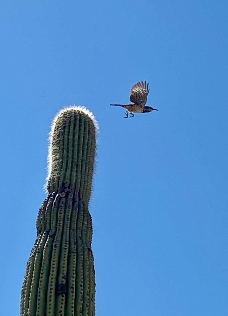
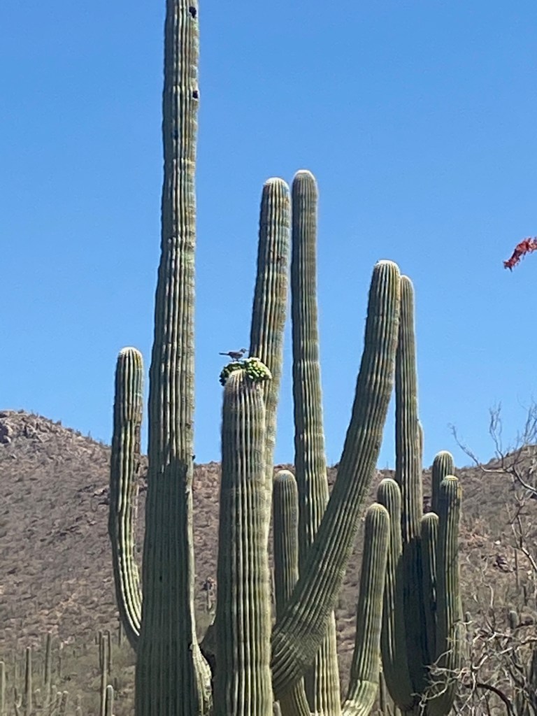
At the museum you can also see wildlife that would be much more rare to see in the park. We saw javalinas sleeping under a pedestrian bridge, a black bear, lots of rattlesnakes safely behind glass, a beaver, a large lizard sunning itself on a rock, and Mexican gray wolves. Elizabeth took the photo of the bird taking off from atop a saguaro cactus, and the coyote was on the road just outside the museum as we were leaving.
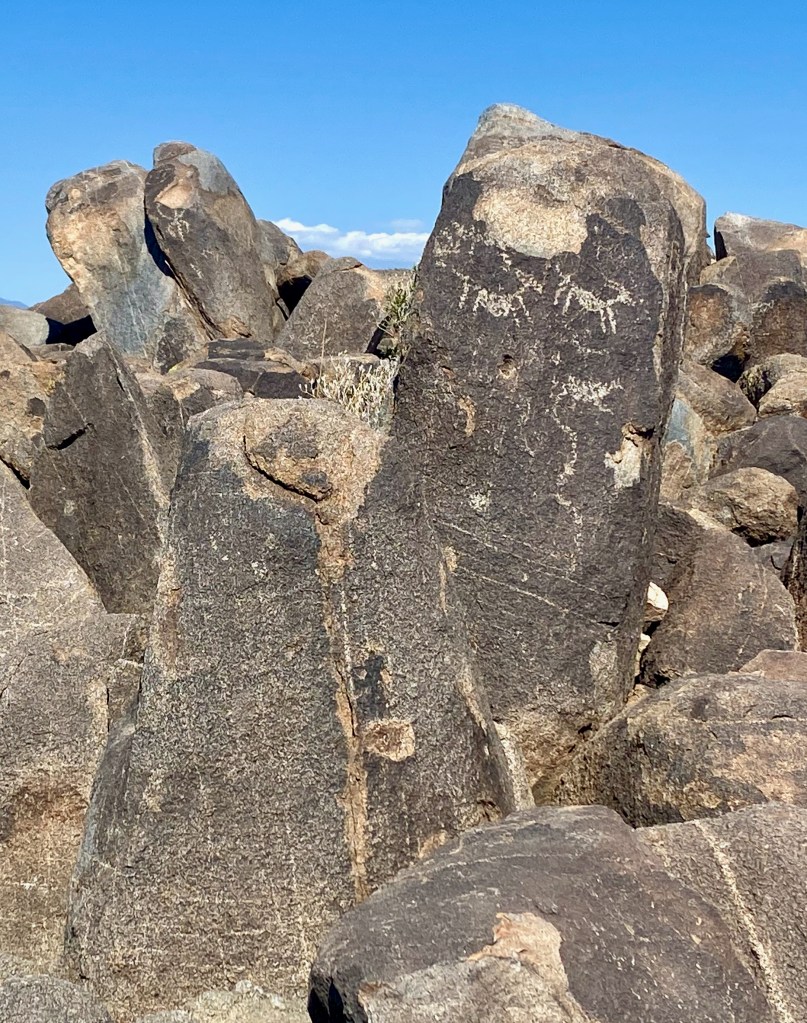
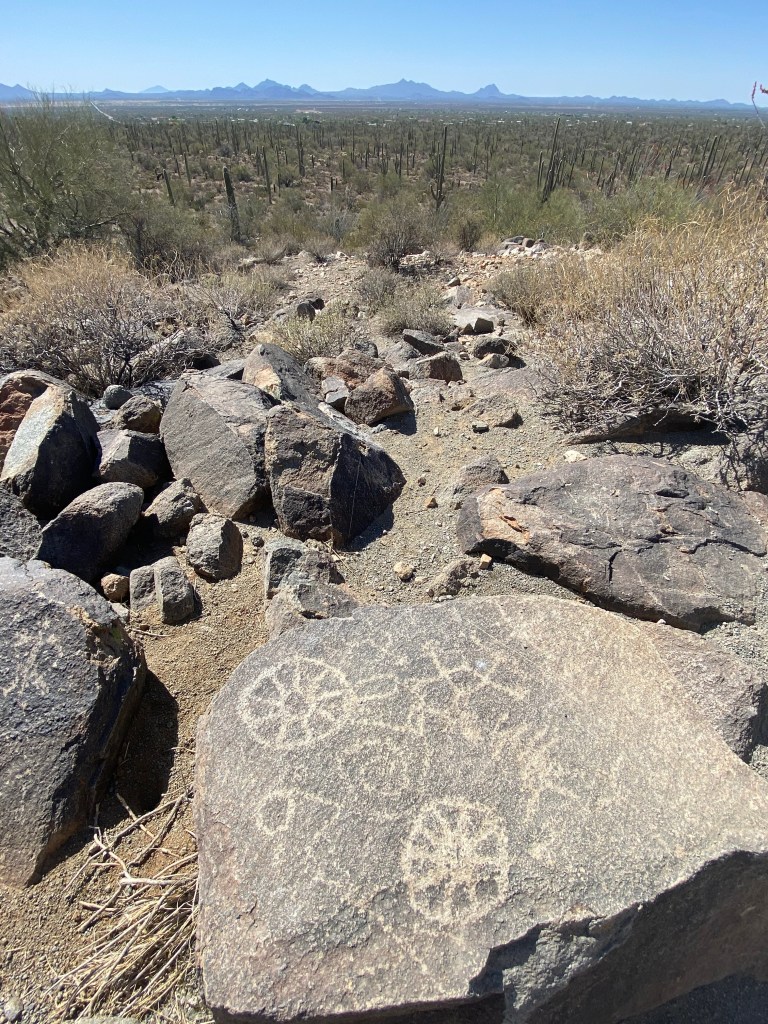
In Saguaro National Park, time limited us to the West section. We drove the 5-mile Bajada Loop through a forest of saguaro (pronounced suh-WAH-row) cacti. We hiked for a mile or so on the Cactus Wren and Wild Dog trails, surrounded by the towering stick figures known as the “sentinels of the desert.” At the visitor center we learned that the saguaro can grow to 40 feet or higher and only start sprouting arms at age 70. They are found in large numbers only in this part of the Sonora Desert. Toward the end of the loop we climbed a third of a mile to the top of Signal Hill to view petroglyphs created by the Hohokam Indians who lived in the area between 450 and 1450 AD.
This was an ideal time of year to visit this verdant desert park. Many of the plants are blooming with colorful flowers. The temperatures were in the 60s at the beginning of the day, peaking in the low 80s by afternoon, compared to highs near 100 that are normal during the summer months.
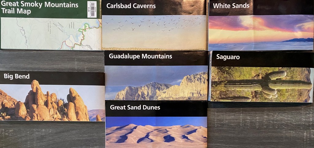
Saguaro marks the eighth national park we’ve enjoyed since we began our trip in early February. Seeing as many national parks as we can has been a kind of organizing principle of our itinerary. Lord willing, by the time we see Yellowstone N.P. in early July, we will have visited 20 national parks! (Here’s a montage of my trophies, minus the brochure for Hot Springs N.P. in Arkansas, which I must have absent-mindedly discarded along the way.)
***
On Sunday we worshiped at Covenant Orthodox Presbyterian Church in Tucson. We heard an excellent sermon from 1 Peter 2:11-17 from a guest preacher on how we should live as “resident aliens” in an unbelieving world. We also enjoyed renewing our connection with Pastor Christopher Chelpka, who was a pastoral intern at Grace OPC in Vienna more than a decade ago. If you are ever in the Tucson area and looking for a place to worship on Sunday, we highly recommend Covenant OPC.
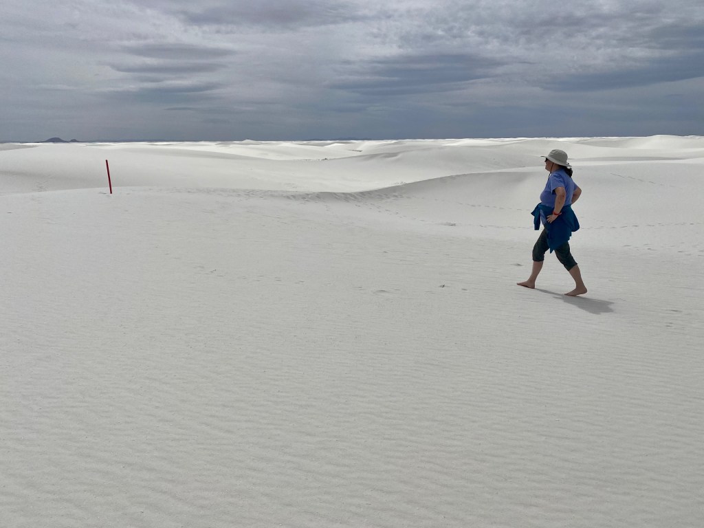
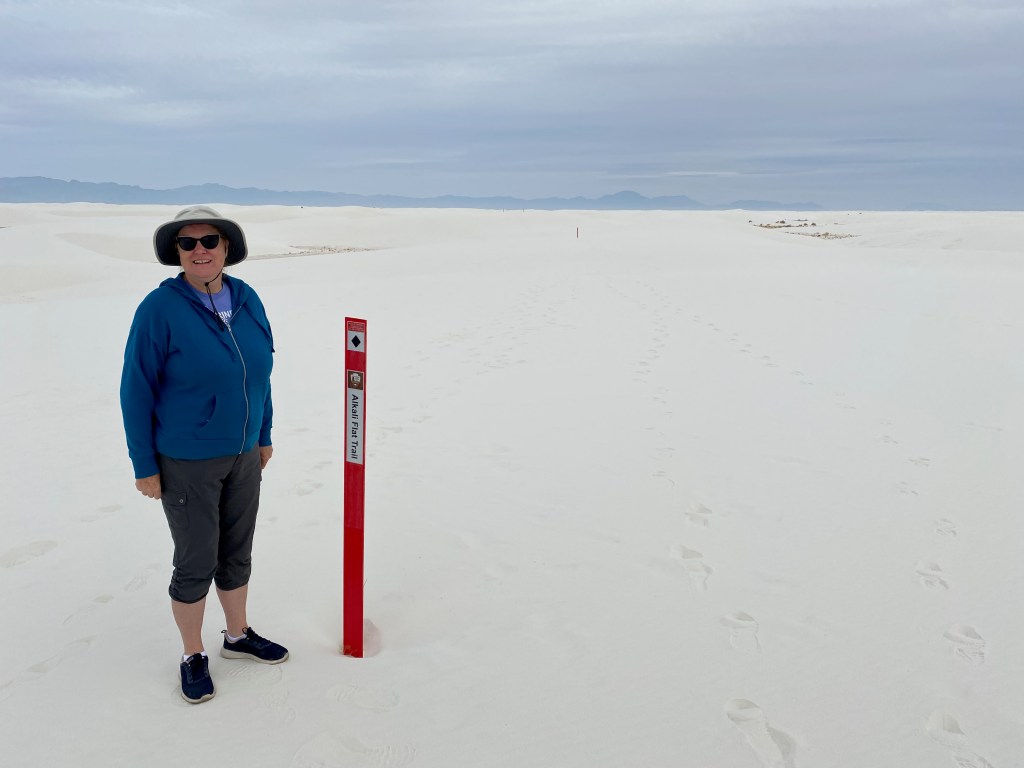
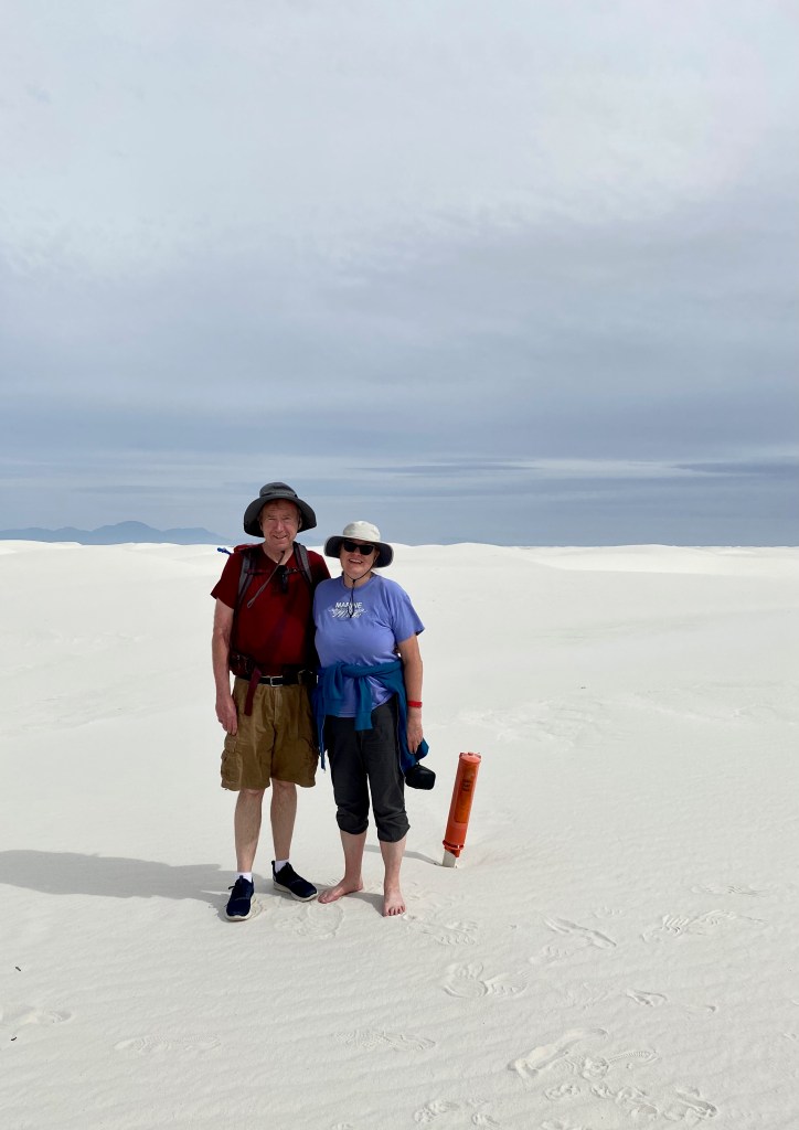
ALAMOGORDO, NM – Today we hiked through the gigantic 176,000-acre sandbox known as White Sands National Park. We walked for five miles over dunes mostly in our bare feet on the Alkali Flats Trail, the main excursion in the park.
It was an otherworldly experience to be surrounded by fine white sand in every direction, with the Sacramento Mountains in the distance. There is no normal trail out on the sands but instead red markers every few hundred feet to keep you on the path. The trail turns back where the sands reach the Alkali Flats, an ancient hard-packed seabed that the U.S. military uses as a missile range. (They actually close the park and nearby roads for a few hours each week when testing.)
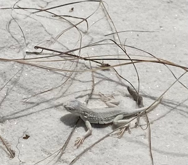
“Elizabeth of the White Sands.” Movie rights under negotiation!
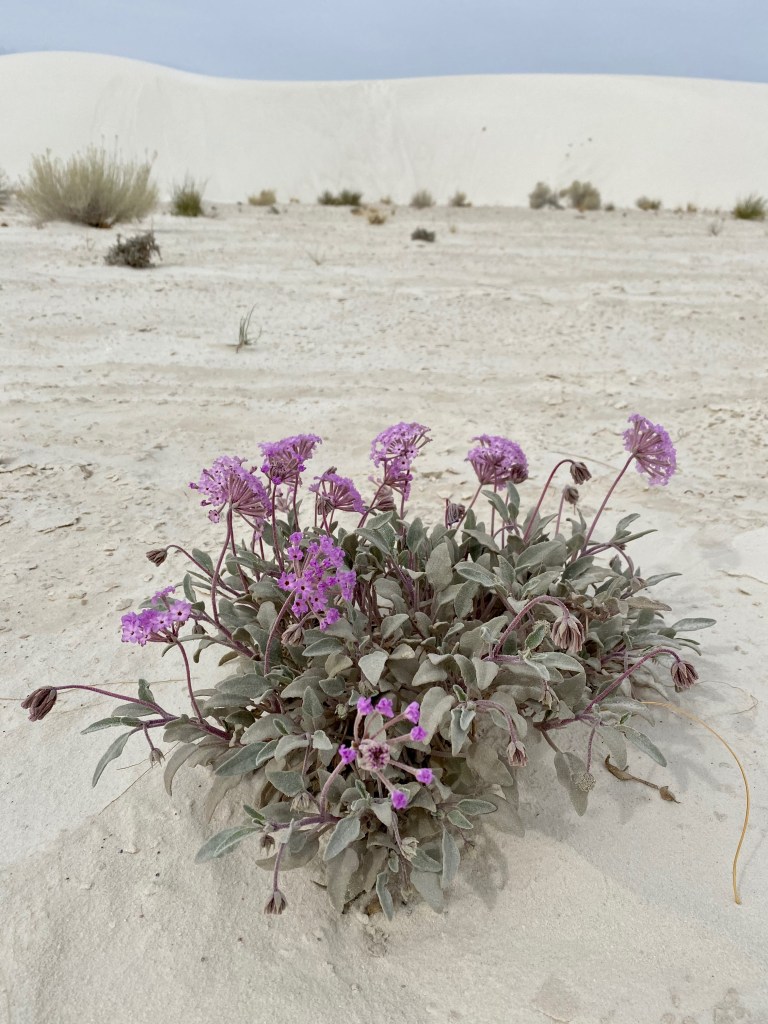
On our walk, we saw a beetle scurrying across the sand and a “bleached earless lizard,” which I understand is neither of those adjectives! We labored up the soft side of the sand dunes, but enjoyed sinking our feet in the cool sand on the downward slopes. Because the gypsum sand is white, it reflects the sunlight and stays cool. It’s also moist just beneath the surface because of the high water table, which tends to anchor the dunes and offer further delight for the feet of hikers.
If you hike this trail, our best advice is to go counter clockwise, which allows you to tackle the more challenging dunes when you are freshest. There is little elevation gain on the trail, but hikers still need to climb the dunes, which can reach 50 feet in height. We found that it’s easier to climb the windward side of a dune, where the sand is harder packed and the slope more gradual, which was more often the case on the return leg if you tackle the loop counter clockwise. Also take plenty of water—they recommend 2 liters per person—lather on the sunscreen, and wear a broad-brimmed sun hat. And if you can, visit in the non-summer months and start early in the day to avoid temperatures above 85 degrees F. It was about 70 degrees for us today with winds of 10 to 15 mph and we agreed we would not want it much warmer.
In August 2015 I read a news story about White Sands N.P. that has stuck with me to this day: A French couple touring the American west with their 9-year-old son had ventured out on the Alkali Flats Trail at mid-day with the temperature at 101 degrees and only two 20-ounce bottles of water. About a mile out, the mother felt ill and headed back toward the parking area, but she collapsed and died along the way. The father and son went about half a mile further before the father succumbed. Park staff found the son alive next to his dead father. The son was relatively well hydrated only because the parents had given him extra water, sacrificing themselves for his survival. Here’s a 2015 CNN story on the tragedy, and a New York Times follow up with further details. (The CNN story reports that heat-related deaths in national parks are rare; far more park visitors die from drownings, car crashes, and falls.)
***
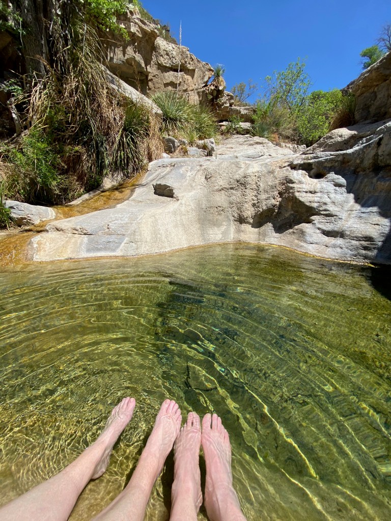
On Wednesday, we spent part of the day hiking in Oliver Lee State Park, located in Dog Canyon about 20 miles southeast of Alamogordo. The state park was recommended by a couple we met at another RV park and also by a National Geographic guidebook to state parks that we’ve brought along on our trip. The park was well worth the visit.
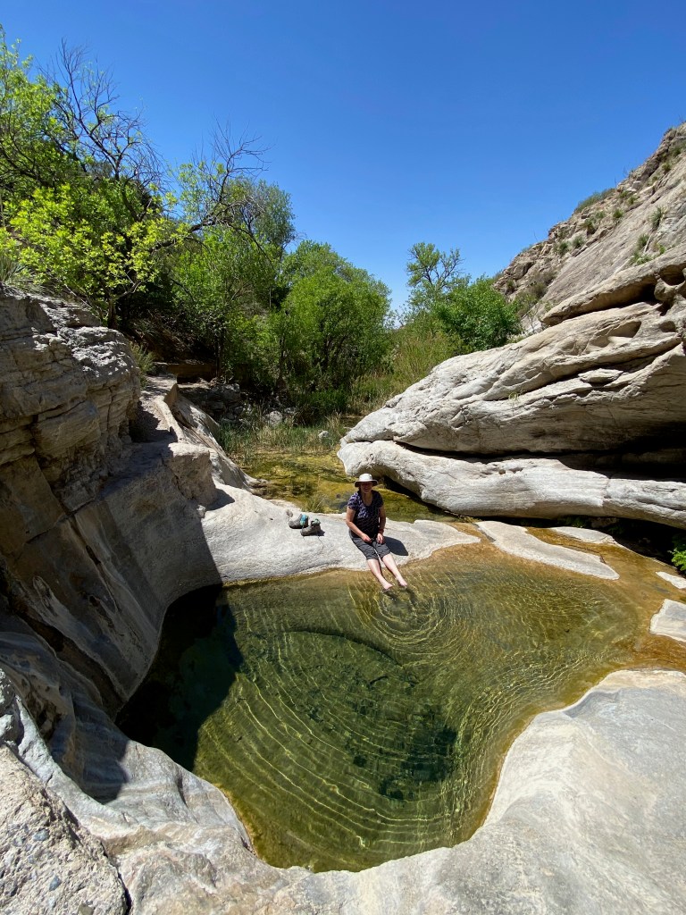
We started our excursion in the park with a 2.5-mile roundtrip hike up and along the side of Dog Canyon. Elizabeth continued her study of desert plants along the trail, and we both enjoyed the views back down the canyon to the valley floor. Our labors were rewarded back near the visitors center when we hiked a short way into the canyon to a spring-fed oasis. We enjoyed soaking our feet in a pool of clear, cool water, shaded by the surrounding cottonwood trees and other plants.
Dashboard:
Days on the road: 66;
Miles towing the RV: 3,044;
RV parks stayed at: 20;
National parks visited: 7.
The road ahead (Lord willing): Tucson, AZ, and Saguaro National Park
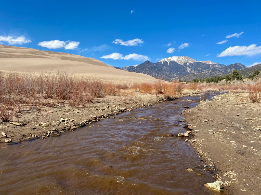
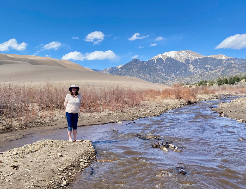
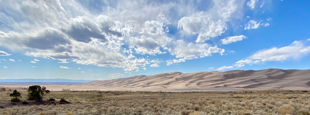
COLORADO SPRINGS, CO – On our last full day in Colorado Springs yesterday, we drove in the F-150 with Michael, Lizzy, and Max to the Great Sand Dunes N.P. about 170 miles south and west in the San Luis Valley.
The dunes have been a Griswold family favorite since our time in Colorado 30 years ago. In May 1994, I camped with Emily (6 at the time) and Michael (almost 3) to give Elizabeth a break while she looked after our newborn son Paul. We returned the next summer as a family before we moved away from Colorado to eventually settle in Northern Virginia.
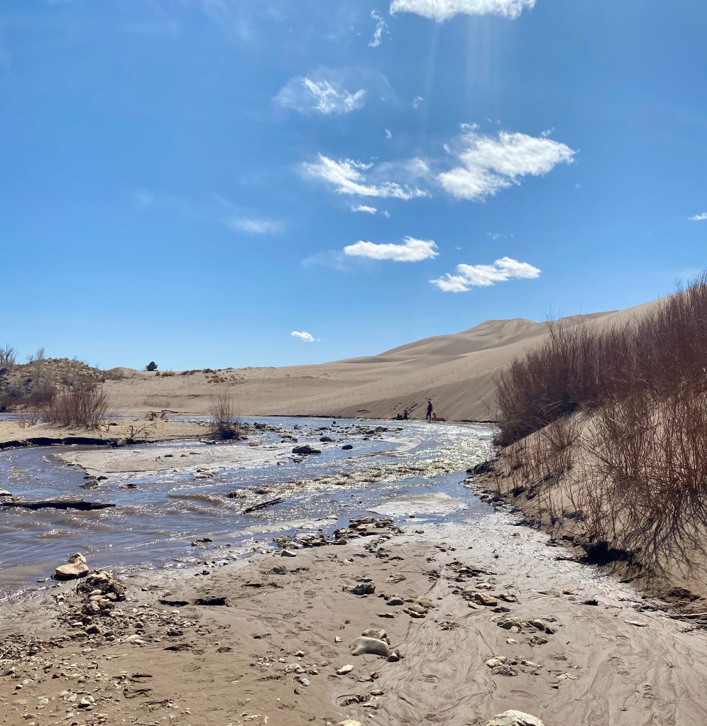
If you haven’t seen the dunes before, they’re an amazing sight: sand dunes piled as high as 700 feet above the valley floor, with Medano Creek running alongside the dunes in the spring and early summer, fed by snow melt from the Sangre de Cristo Mountains rising to the east and north.
On our visit yesterday, we were able to leave the crowds behind by driving a few miles up the 4-wheel-drive-only “Primitive Road” to the Sand Pit picnic area. We enjoyed a stretch of the creek and the dunes all to ourselves for about an hour before another family showed up.
If you visit the Great Sand Dunes, be sure to visit sometime between April and June when the creek is flowing. The water is refreshing, especially when the sand is starting to get hot. When the snow melt is at its peak later in the spring, gentle, regular “waves” will come down the creek.
While we were visiting Colorado, we left the RV at a Keystone dealer in Roswell for a few minor adjustments. After a 420-mile drive back to Roswell today, we plan to resume our RV adventure tomorrow with a drive to Alamogordo, NM.
Dashboard:
Days on the road: 63; Miles towing the RV: 2,924; RV parks stayed at: 19; National parks visited: 6.
Elizabeth and I spent almost the whole month of March traveling through Texas, arriving in Sulphur Springs on March 2 and departing the Guadalupe Mountains National Park for the last time on April 2, with stops in Waco, Austin, San Antonio, and Big Bend National Park along the way. It’s a great state in every way, from its geography to its economy and history.
One of the lasting impressions from our time in Texas is its immense size. From our entry into Texarkana to our exit into New Mexico a month later, we towed the RV 998 miles, plus a 180-mile side trip to the remote corner of Big Bend. That’s nearly 1,200 miles just to get through one state from east to west! (See the Google Map of our trek.)
Nothing captured the grandeur of Texas more for us than following US Highway 90 for 462 miles from San Antonio to Van Horn. The highway follows the path of a railway line that fueled the economy of the desert high plains a century ago. The road took us from the greenery of the San Antonio River to the scrub brush and dry river beds of the desert southwest, and to the mountain climates of Alpine, Fort Davis, and the Chisos and Guadalupe mountains.
Another impression from our time in Texas was the dynamism but also the disparity of its economy. Its big cities are thriving, with gleaming high rises, big universities, and suburban growth fueled by high tech and other 21st century industries. But we also saw boarded up store fronts and ramshackle housing in the smaller towns as we headed out onto the plains. This is not a criticism of Texas, since you can see the same in other parts of the country, but the contrast there seemed even starker.
Yet another lasting impression is the pride that Texans take in their history, including their time as an independent republic from 1836 to statehood in 1845. As Lyle Brunson pointed out to me, you see the Texas flag hanging in retail stores and lots of other places where you wouldn’t normally see a state flag elsewhere in the country. The electronic road signs in Austin said, “Slow down. You’re already in Texas!”
We spent a full afternoon with the Brunsons at the Alamo absorbing the history there. Texans are proud of what happened at the mission from February 23 to March 6, 1836, and with good reason. Fewer than 200 defenders held off a much larger Mexican army for those 13 days. All the men died, but not before by some counts killing an average of 10 Mexican soldiers each before the siege was broken. They bought enough time for Sam Houston to gather his troops and finally defeat Gen. Santa Anna at the decisive battle of San Jacinto on April 21, 1836.
For an accessible one-volume history of Texas, I highly recommend a book recommended to me by one of the staff at the Fabled Bookshop & Cafe in Waco: Lone Star: A History Of Texas And The Texans, by T. R. Fehrenbach (Da Capo Press, 2000). The author weaves a narrative that describes crucial events, the stock of immigrants who populated Texas, and how the vast landscape shaped the state’s culture and development.
I learned a lot about Stephen F. Austin, the statesman and visionary who brought the first 300 families—“The Old Three Hundred”– to settle in central Texas. As Fehrenbach writes, “In ten years, Austin located more than 1,500 American families, and these became the heart of Anglo-Texas. In a single decade, these people chopped more wood, cleared more land, broke more soil, raised more crops, had more children, and built more towns than the Spanish had in three hundred years.”
In the book and at the Alamo, I learned about William Travis, a military man and firebrand who died at the Alamo but not before becoming the Patrick Henry of Texas. At the end of a March 3, 1836, letter from the besieged mission appealing for reinforcements, Travis wrote, “God and Texas—Victory or Death!” Fehrenbach quotes another historian, Louis J. Wortham, who said of Travis’ letter, “It sealed forever the title of the Texans to the soil of Texas. The blood of Travis, of Bowie, of Bonham, of Crockett and the rest, consecrated the soil of Texas forever.”
During our month in Texas, I also came to appreciate the importance of geography in understanding the state. In crossing Texas, you cross a line that angles southwest roughly from Dallas, to just east of the Hill Country and down to Del Rio, a natural line that has shaped the state’s history and development. It’s where the greener, more well-watered forests and farmland of the east give way to the Balcones Escarpment and the high plans and mountains to the west.
West of the line, such industries as cotton farming were not possible, and thus the institution of slavery reached a natural barrier, checking its spread further west in the mid-19th century.
The high plains were also dominated by another barrier to development, the fearsome Comanche Indians. As Fehrenbach writes, “The Comanche hordes debouched on the Texas plains around the year 1725. They came like a thunderbolt; one historian compared them with the mounted hordes of Genghis Khan. Man, woman, and child, they were among the finest horsemen ever known.” In introducing the horse to the Indian tribes in Texas, the Spanish colonialists unwittingly created “the most fearsome light cavalry—the Plains Indian—the world had ever seen.”
Our month-long trek across Texas confirmed what Fehrenbach writes about the expansive and harsh West Texas landscape:
Over the whole land the sun burned, not the distant, friendly orb that filtered light through European forests, but a violent, brassy engine that browned the earth and made the hillsides shimmer with heat. …
If the American Manhattanite has almost forgotten he lives on soil, has shed his history, and is shaped more by social pressures than a sense of territory, the Texan can never, even in his cities, forget or be free of the brooding immensity of his land.
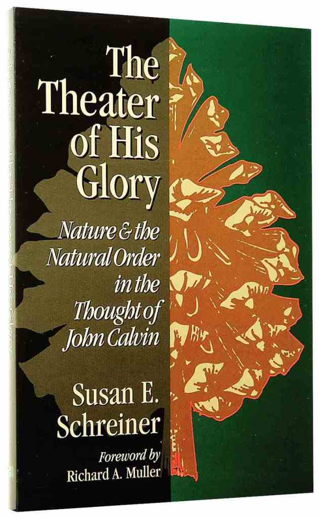
This book has been waiting patiently on my bookshelf for about 20 years, ever since a friend gave it to me as a present. The prospect of beholding new scenic wonders on this RV trip motivated me to finally read it, and I’m glad I did.
The key insight for me from Schreiner’s book is that God loves his creation, both the natural world and mankind, and for that reason he has not completely abandoned them to the forces of chaos and evil. This truth allows the Christian believer to more accurately see the hand of God in nature. As Schreiner writes,
Calvin insisted that the created world was not evil or alien to the believer. He stressed, therefore, not only the restraint of sin but also the remaining goodness and integrity of nature and society. Society was not, in Calvin’s view, the realm of darkness but was that arena in which the Christian pursued holiness. Calvin’s God did not reject his creation but continued to exercise providence over the “work of his hands” and to reveal his glory in this earthly “theater.” …
As the human soul is gradually restored to (and even surpasses) the original order characteristic of the image of God, so too the believer returns to that originally intended activity: namely, the contemplating of God’s revelation written in the book of nature and revealed in the visible splendor of the world.
Another useful insight from the book is that both nature and our own lives depend on the constant attention and benevolence of God. On p. 32, Schreiner quotes a vivid passage from Calvin on how precarious life on this earth really is and the multitude of ways a 16th century man could be struck down at any moment by an assortment of physical calamities. I’ve had more than one occasion on this RV trip to give thanks to God for watching over us during moments when things could have gone terribly wrong. We don’t appreciate that our lives are in God’s hands every moment of every day.
WHITES CITY, NM – This morning we wrapped up four nights in a modest RV park in far southern New Mexico, but our location allowed us to see the wonders of God’s creation from deep underground to high above the surrounding desert.
Looking down on the backside of El Capitan from Guadalupe Peak, Texas.
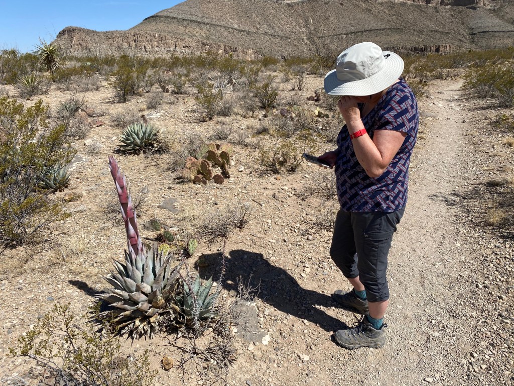
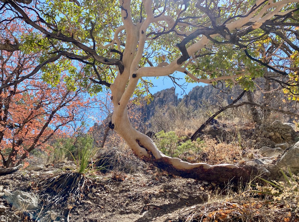
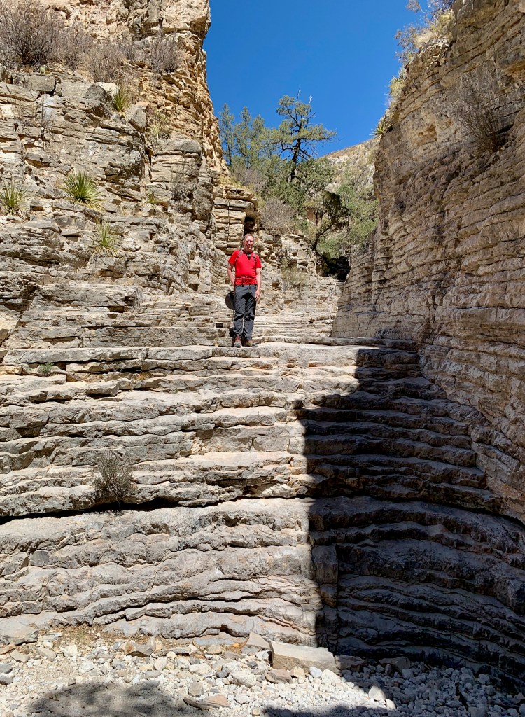
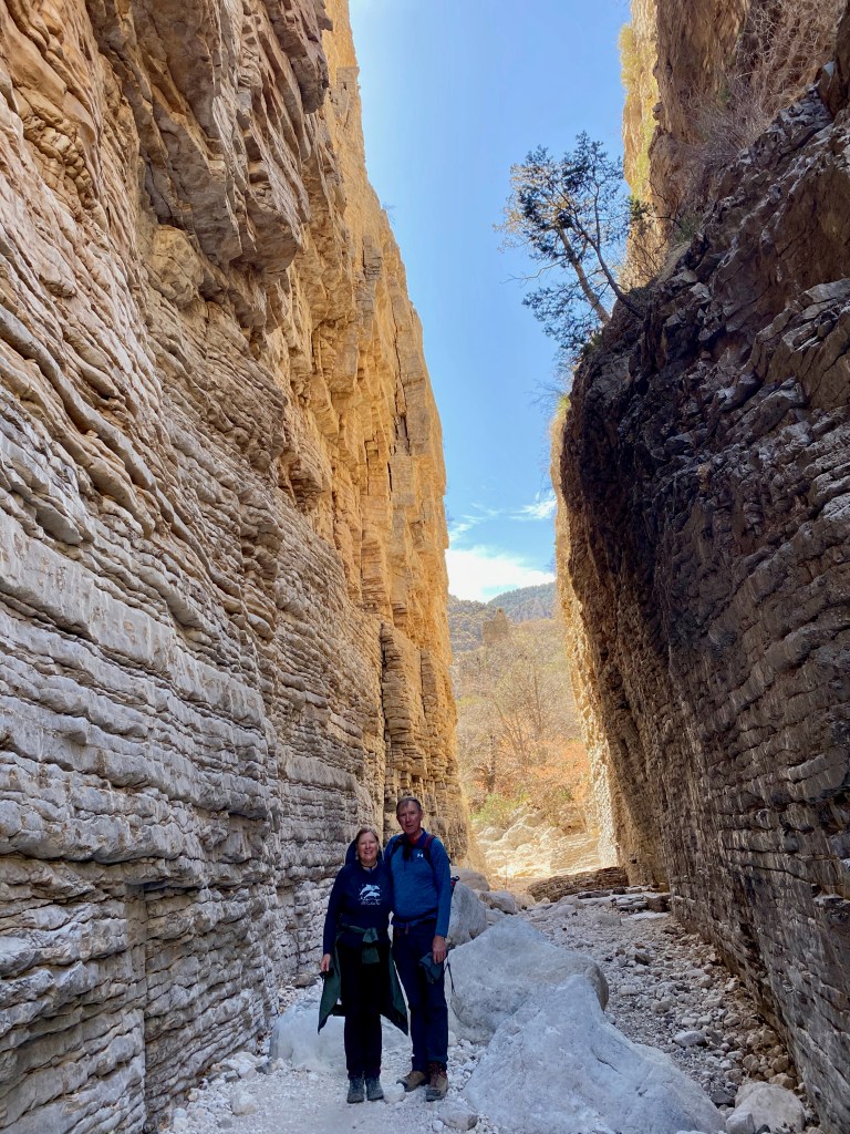
On Wednesday, our first full day here, Elizabeth and I hiked the Devil’s Hall Trail in Guadalupe Mountains National Park. The visitor center and trailhead were about a 30-minute drive back across the Texas border from the RV park.
The trail follows a dry stream bed, or wash, for about 1.8 miles to a short and narrow gorge that gives the trail its name. Along the way we looked up at the surrounding peaks, followed a side trail and then the wash, climbed a natural rock staircase, and noted the different kinds of trees and cactus. Our favorite was the Texas madrone tree, which has a smooth reddish bark, sinewy branches, and evergreen broadleaves. In the spring it blooms white flowers and in the fall it yields a red, berry-like fruit that birds like to eat. If I were living in this part of the country, I would plant a Texas madrone or two in the yard.
We saw several Texas madrones on the hike.
At the top of the natural stone staircase on the way to Devil’s Hall.
***
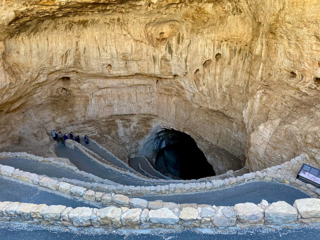
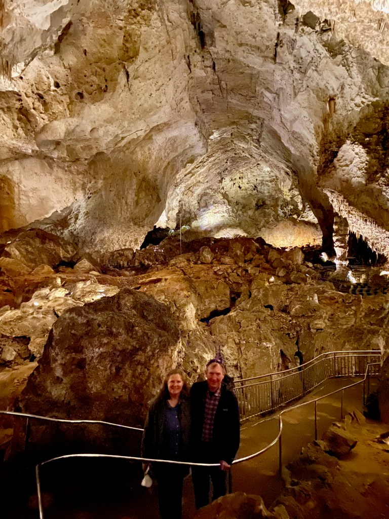
On Thursday we were joined by our dear brother in the Lord Daniel Lauer, who drove down from Roswell, NM, to join us for a tour of the Carlsbad Caverns. The vistors center was only 7 miles from our RV park. The entrance fee is $15 a person, but because of my lifetime senior national park pass, we were all able to enter at no extra charge.
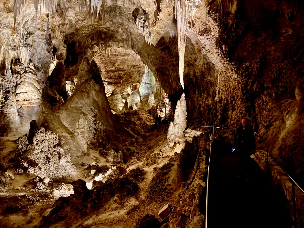
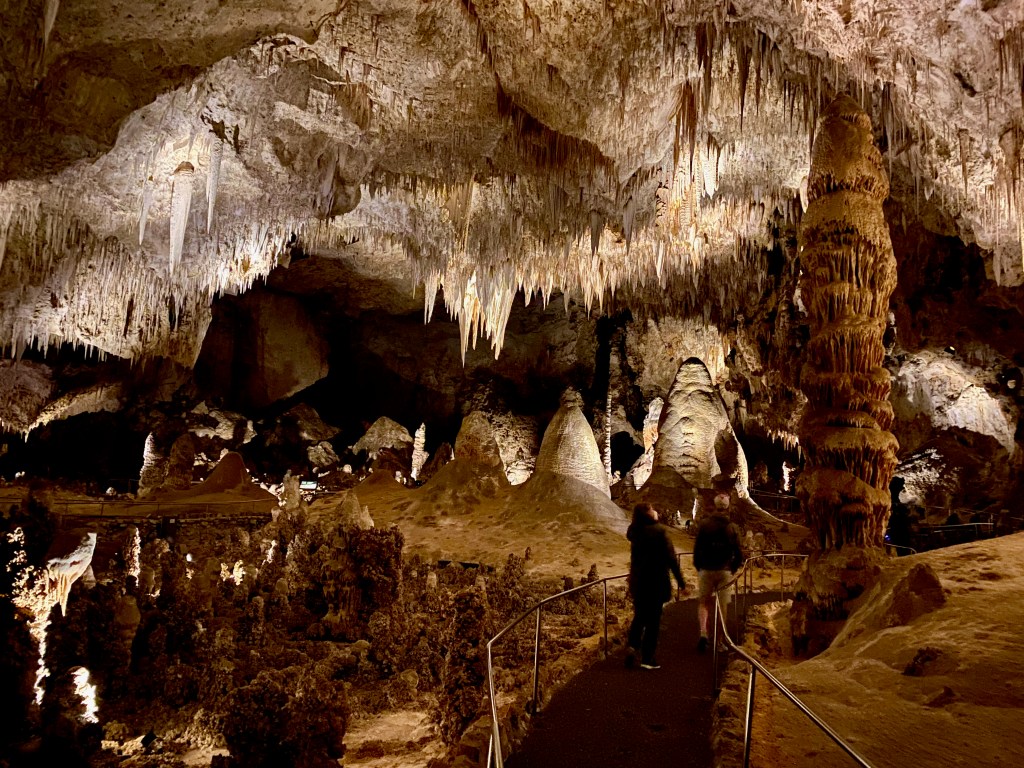
The caverns are awesome, comparable only to the Mammoth Caves in Kentucky as a natural wonder. We descended through the Natural Opening down winding switchbacks to the main rooms of the cavern 750 below the surface. Walking along about 2.5 miles of paved walkways, we saw rock formations that looked like lion’s tails, fairy villages, Star Wars creatures, and layered birthday cakes. The far point of the trail takes you to the Big Room, which is 255 feet high and large enough to cover six football fields. After more than two hours on our feet, we gladly rode the elevator back to the visitors center at the surface.
Carlsbad Caverns were discovered in 1898 by a teen-age cowboy named Jim White when he saw a black cloud of bats emerging at dusk from natural opening. Photos were a challenge without any natural light.
For those of you into bats (and as a warning for those who are not!) a colony of hundreds of thousands of Brazilian free-tailed bats live and breed about 200 feet into the cave from spring to October. The bats emerge en masse at dusk to feed on tons of insects and then return by dawn to sleep all day in the cave. The timing of our trip didn’t allow us to see any bats, which was a mild disappointment for me but not for Elizabeth.
***
On Friday, Daniel and I set out for Guadalupe Mountains N.P. to climb Guadalupe Peak, the highest point in Texas at 8,751 feet above sea level. It was a perfect day, sunny with temperatures in the 50s and mild breezes. The trail is steep, especially the opening round of switchbacks, but it’s well engineered, signed, and maintained. We covered the 4.1 miles up in about 2 hours, 10 minutes, enjoyed the 360 degree views and lunch from the top for half an hour, and made it back down in about 2 hours flat. I told Daniel, who’s less than half my age, that if he gets any fitter, he may not be content to hike with Mr. Griswold in the future!
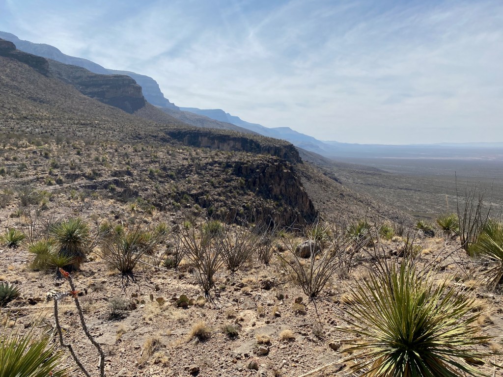
Like Big Bend N.P., Guadalupe Mountains N.P. is remote but worth the effort to visit. The geology of the Guadalupe Mountains is distinct from other areas of the Rocky Mountains because geologists say it lies on what was the rim of a large but shallow inland tropical sea 260 million years ago. Geologists say that the mountains are actually an exposed section of the horseshoe shaped Capital Reef that bends through western Texas and southern New Mexico. The reef would explain the large number of marine fossils found in the area.
***
On our drive this morning as we towed the trailer between Carlsbad and Roswell, NM, we observed a number of small oil rigs pumping up and down, a large refinery, and a number of oil-servicing companies. The same Permian Basin that fuels the energy industry in Midland and Odessa, Texas, also lies under this part of New Mexico. We also saw a number of pecan tree orchards, with thousands of bare trees perfectly aligned along shallow irrigation ditches. I had no idea that this part of the country was “an American hub of pecan production.”
Dashboard: Days on the road: 55; miles towing the RV: 2,824; RV parks stayed at: 18; national parks visited: 5.
The road ahead (Lord willing): Alamogordo, NM, and Tucson, AZ, with a side trip in just the truck to visit son Michael and family in Colorado Springs, CO.